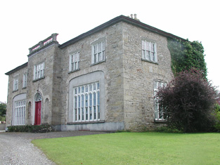
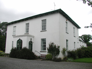
Honeymount
Houses within 10km of this house
Displaying 23 houses.
Houses within 10km of Honeymount
Displaying 23 houses.
| House name | Description | |
|---|---|---|
| Green Hills | The home of a branch of the Minchin family in the 18th and for part of the 19th centuries. The house was occupied by the Reverend William Minchin in the first half of the 19th century. It was valued at £34.15 shillings at the time of Griffith's Valuation and held in fee. The sale rental of 1851 describes the house as large and commodious and in good repair. Bought by a brother of one of the Reverend Minchin's son in laws Montague Blackett. This house no longer exists. | |
| Derrylahan House | This house was the home of the Mason family in the 19th century, occupied by James Mason in 1814 and by William Mason in the early 1850s. The buildings were valued at £10 and held from Peter D. La Touche. William Mason of Derrylahan owned 228 acres in the 1870s. A house and farm are still extant at the site. | |
| Longford | The Ordnance Survey Name Books refer to Robert Lloyd as the proprietor of Longford House in the 1840s and it was occupied by him and held from Thomas Prince Lloyd at the time of Griffith's Valuation when the house was valued at £16. A mansion house in the townland of Longford valued at £34+ was occupied by James Lloyd in 1906. A building is still located at this site. | |
| Mountfrisco | Mount-fresco was occupied by Thomas Lloyd in 1814 and by Horatio Lloyd in 1837 and in the early 1850s. The house was then valued at £10 and held in fee. This house is no longer extant. | |
| Loran Park | The seat of the Roe family in the 19th century, occupied by George Roe in 1837 and in the early 1850s, when the house was valued at £25.10 shillings and held from Henry Minchin. The residence of Ellen Robinson in the mid 1870s. A house and farm are still extant at the site. | |
| Whiteville | Leet records Mr Stephen Ryan as the resident of White-ville, Moneygall, in 1814. The Ordnance Survey Name Books refer to Whiteville as the residence of Robert White. Benjamin White was the occupier at the time of Griffith's Valuation. He held the property in fee and the buildings were valued at £13+. This house marked on the first edition Ordnance Survey map was replaced by a later house known as Knockanroger House and located slightly to the north of the original structure. A house is still extant at the site. | |
| Dangansallagh | Lewis records J. Lewis as resident at Dangan Lodge in 1837 and Griffith's Valuation records James Middleton holding the lodge valued at £10+ and 266 acres in fee. It is now a ruin. | |
| Sheehills House | Occupied by William H. Minchin at the time of Griffith's Valuation and held with 874 acres from the Earl of Portarlington. The buildings were valued at £15.10 shillings. The Reverend John George Birch occupied buildings valued at £19+ and 880 acres of untenanted land at Thesheehys in 1906. A building is still located at this site. | |
| Ash Park | Ash Park or Park was the home of the Butler family in the 18th and 19th centuries. Occupied by James Butler in 1814 and 1837 and by Captain James Butler at the time of Griffith's Valuation. The buildings were valued at £35+ and held in fee. This house no longer exists. | |
| Skehanagh | George Lloyd was living in a house valued at £16 at Skehanagh North in the mid 19th century.The Ordnance Survey Name Books note "Skehana" as the residence of George Richard Lloyd in 1840. In the 1870s Horatio M. Lloyd of Skehana, Templemore owned 182 acres in county Tipperary. Catherine Lloyd was resident in 1906. This house burnt down and the present building on the same site dates from the early 20th century. |

|
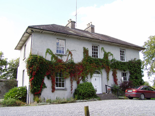
| Lisduff | The Smiths were resident at Lisduffe from the early 18th century when Jeremiah Lalor married the daughter of Samuel Smith of Lisduffe. From this couple descend the Lalors of Long Orchard. Samuel Smyth was the occupant of Lisduff in 1814 and William Smith in 1837. Griffith's Valuation records John Minchin as resident. The buildings were then valued at £33 and held from Admiral Darby. This house is still a residence. |
|
| New Grove | Leet and Lewis both record Westropp Smith as the occupier of New Grove, Roscrea, in 1814 and 1837. John Minchin was the occupier at the time of Griffith's Valuation. He held the property, valued at £19, from Henry B. Minchin. A building is still extant at this site. | |
| Montevideo House | A house marked on the first edition Ordnance Survey map and occupied by Francis Smallman in the mid 19th century, when the buildings were valued at £20 and held from the Earl of Portarlington. The National Inventory of Architectural Heritage names this house Beechmount. |
|
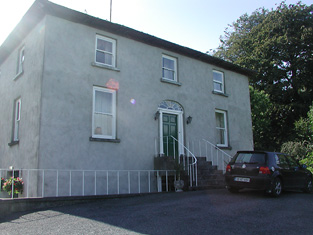
| Mount Dudley | A house close to the town of Roscrea and marked on the first edition Ordnance Survey map. In the mid 19th century occupied by Samuel Dudley, valued at £17 and held with 29 acres from the Earl of Portarlington. The home of Thomas Ely in the 1870s. This house is extant and occupied. |
|
| Inane | In 1786 Wilson mentions Inane as the seat of Rev. Curtis. Robert Curtis was the proprietor of Inane, Roscrea, in 1814 and P. Jackson was resident in 1837. By the time of Griffith's Valuation Frederick A. Jackson was the occupier, holding the property in fee. The buildings were valued at £50. There appear to be two houses at Inane, a nine bay house dating from the early 18th century and a 19th century house very closeby. The Jacksons were still resident in the 1870s and the representatives of Henry V. Jackson held the property in 1906. It is still extant. |
|
| Lloydsborough | In 1786 Wilson mentions that Lloydsborough was the seat of Mr. Carden. This house was the seat of the Lloyd family in the 19th century. In 1814 Henry Lloyd was resident and in 1837 John Lloyd was the occupant. Griffith's Valuation records John as holder of the property in fee and the buildings were valued at £44+. Lloydsborough was still in the possession of a branch of the Lloyd family in the early 20th century. Still extant and occupied, Lloydsborough was offered for sale in 2014. |

|
| Falleen | The home of the Hawkeshaw family in the 19th century, held from the Bowens of Bowens Court. Benjamin Hawkeshaw is recorded as the occupant in 1814 and in the early 1850s when the house was valued at £13.14 shillings. G. Riall was resident in 1837. The Ordnance Survey Name Books refer to Falleen as the seat of James Bennett in 1839. A house is still extant at the site. | |
| Knockane | Knockane was occupied by Mr William Cooke in 1814. In 1840 the Ordnance Survey Name Books describe it as " a commodious house the property of Mr. Hawkshaw". It was the residence of William Hodgens in the early 1850s, when the buildings were valued at £12.17 shillings and held from Robert Cole Bowen. A possibly later house is located at the site now. | |
| Aghsmear | This house is not marked on the first edition Ordnance Survey map. Griffith's Valuation records a house of £4.5 shillings valuation occupied by Dr Patrick Cleary and held from Joseph Griffith. Joseph Griffith lived at Aghsmear in the 1870s and he was still resident in 1906 when the mansion house was valued at £22+. |
|
| Killough (Templemore) | Cottage type house built 1880. In 1906 Richard J. Lloyd is recorded as the occupier of a mansion house valued at £27+ in the townland of Killough. |
|
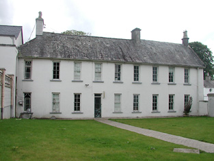
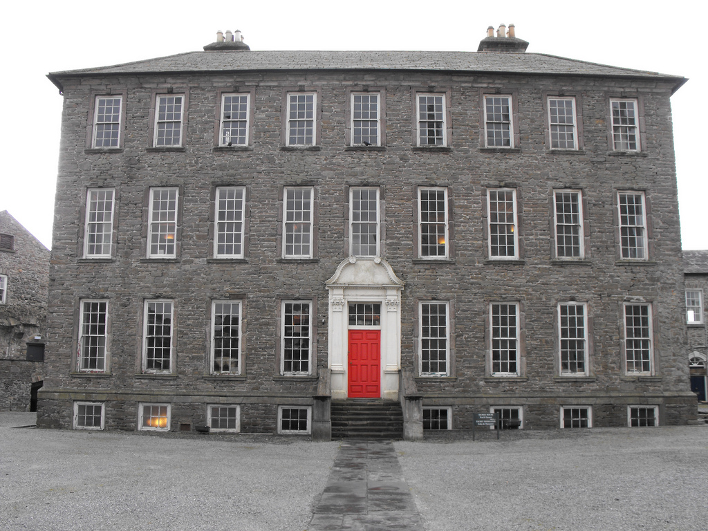
| Damer House | Located in the centre of Roscrea, this house was built by the Damer family in the early 18th century. Used as a barracks for much of the 19th century, it has also functioned as a school. Saved from demolition by the Old Roscrea Society and the Irish Georgian Society in the 1960s, it is now under the care of the Office of Public Works and the Roscrea Heritage Society. |
|
| Mill Grove House | In 1841, the Ordnance Survey Name Books describe Mill Grove House as " a good house with demesne and plantations, the residence of Mr. Kennedy". At the time of Griffith's Valuation, Edward Kennedy was leasing a substantial milling complex and a house at this location from the Stoney estate. The buildings had a value of £46+. It is labelled Millgrove House on the 25-inch map of the 1890s but is no longer extant. | |
| Butler's Lodge | In 1840 the Ordnance Survey Name Books refer to Butler's Lodge as "a gentleman's seat" in the townland of the same name. The house is labelled as Butler's Lodge on the 1st edition Ordnance Survey map but is not labelled on the 25-inch edition of the 1890s. At the time of Griffith's Valuation it was valued at over £5 and part of the estate of Edward Cambie. A modern house occupies the site now. |