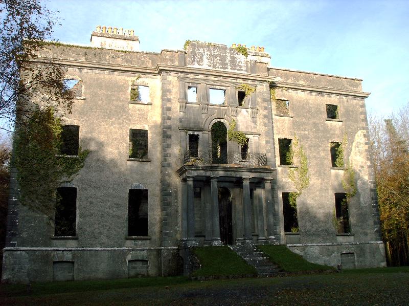
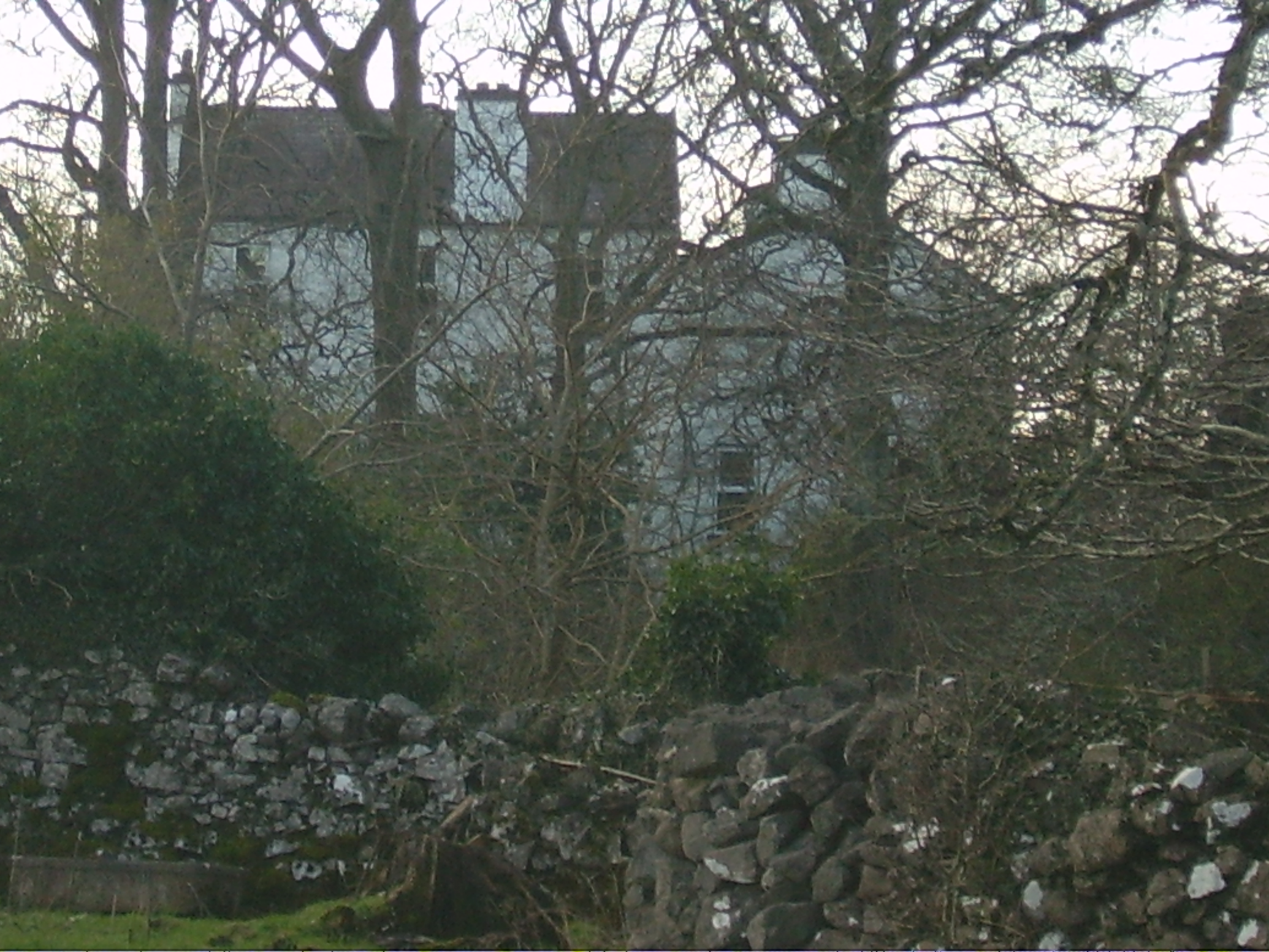
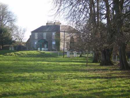
Creagh
Houses within 10km of this house
Displaying 26 houses.
Houses within 10km of Creagh
Displaying 26 houses.
| House name | Description | |
|---|---|---|
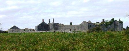
| Moore Hall | Built in 1795 and burnt down in 1923. The residence of George Henry Moore, MP, at the time of Griffith's Valuation, when it was valued at £45. Slater refers to it as the seat of George A. Moore in 1894. The ruin is now owned by Coillte Teoranta. |
|
| Levally | Home of the Fair family for a time in the 19th century. At the time of Griffith's Valuation it was leased by James Simpson from the Earl of Lucan's estate and valued at £5. It is described as a "Herd's House". It was unoccupied in the early years of this century and for sale in 2007. Demolished in September 2007. |
|
| Castlecarra | Granted to Sir Henry Lynch after the Restoration, it was the family's main home in county Mayo for much of the 18th century. In 1786 Wilson refers to Castle Carra as the seat of Mr. Lynch. The mansion house and offices at Castlecarra were described in 1844 by Samuel Nicholson as "now almost ruins". Castlecarra was leased to the Brownes of Castlecarra at this time and was part of their property for sale in 1852. The ruins of the original tower house are still extant but much of the surroundings are now covered by forestry. | |
| Garracloon | Wilson refers to Garracloon as the seat of Mr. Blake in 1786. In 1814 the house was occupied by the Reverend Cecil Crampton, rector of the parish of Cong. At the time of the first Ordnance Survey in 1838 Garracloon house was recorded as a ruin. At the time of Griffith's Valuation, it was held in fee by Joseph Blake and valued at £8. The house was later rebuilt, Ruane refers to the ruined Victorian Garracloon House. Sir William Wilde refers to Colonel Veitch at Garracloon. No longer extant but yard buildings remain. |
|
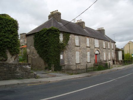
| Robe Villa | A town house on the River Robe, home of the Kenny family for 200 years, sold by them in the early 1980s to the Ballinrobe Rugby Club. |
|
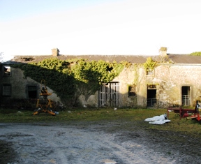
| Ballinrobe Castle | A Bourke castle, restored by James Cuffe in 1752 and sold to the War Office in 1821 for use as a military barracks though a barracks existed there in the 18th century as Wilson refers to the town having a barracks with two companies of foot in 1786. The barracks were valued at £75 at the time of Griffith's Valuation. It ceased to be a barracks in the 1920s but substantial ruins of the buildings remain. |
|
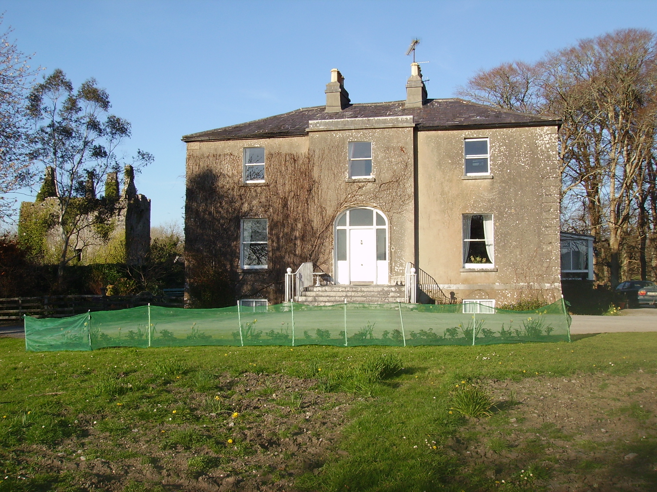
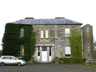
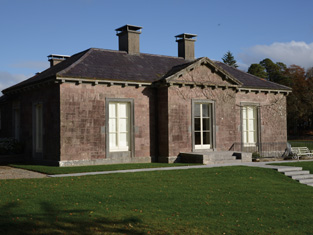
| Partry House | Bence-Jones describes the house, situated on the shore of Lough Carra, as Georgian with a Wyatt window above the porch. It is likely that it incorporates an earlier house built in the latter part of the 17th century. In 1786 Wilson mentions "Cloonlagheen" as the seat of Mr. Lynch. It was the seat of the Lynch/Blosse Lynch family for three centuries. At the time of Griffith's Valuation, it was held in fee by Henry Lynch Blosse and valued at £14. Owned briefly by David Shaw Smith in the 1990s, now the home of Lorraine O'Donoghue. |
|
| Portroyal | In 1786 Wilson refers to Port Royal as the seat of Mr. Gildea. At the time of Griffith's Valuation, the townland was in the possession of James and Anthony Knox Gildea and the house was valued at £2 10s. The house is not shown on the 25-inch Ordnance Survey map of the 1890s. | |
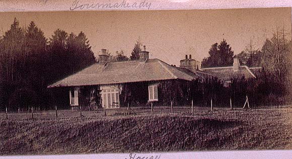
| Toormakeady Lodge | Robert Graham in 1836 refers to "Mr Plunket's cottage residence" while in 1837 Lewis describes it as a summer lodge of Dean Plunkets. Sold in 1876 to the Mitchell family of Bradford. Restored in the 1960s and used as a guest house. |
|
| Lough Mask House | This house was constructed in the early 1840s when Ormsby Elwood was agent to the Earl of Erne. Robert Fair was occupying the house, valued at £10, at the time of Griffith's Valuation and would appear to have taken over as agent to Lord Erne. In the autumn of 1880 Lough Mask House was the scene of the first boycotting incident when Charles Boycott was the agent for the estate. By the mid 1880s Bernard Daly had bought Boycott's lease of the house and farm and his descendants continue to live at Lough Mask. |
|
| Cloonee | A house built circa 1760, sometimes known as Lakeview. It was occupied in the late 1770s by a member of the Browne family and from the early 19th century by the Blakes. Thomas Walsh was the occupier at the time of Griffith's Valuation. He held the property from Colonel Charles Knox. Cloonee was the home of William Creagh Burke in the early 20th century. The "Connaught Telegraph" of 9 March 1935 reported the sudden death of William C. Burke of Lakeview in the Main Street of Ballinrobe when a fair was taking place. The property passed by marriage to the Ruttledge family of Bloomfield. see www.clooneehouse.com/ |
|
| Springvale | Springvale was noted by Lewis as the home of Henry Joseph Blake in 1837. At the time of Griffith's Valuation the house was leased by Henry Blake from Joseph H. Bath and was valued at £8. A substantial corn mill in the townland, valued at £25, was leased by Henry Blake to Patrick Tierney at the same time. The house was later the residence of the Mayne family. It is still extant and occupied. The mill building is also still visible. |
|
| Cloonnagashel | A house inhabited by the Gildea family from the mid 18th century and situated on the estate of the Earls of Lucan. Wilson refers to it as the seat of James Gildea in 1786. It was the home of James Simpson between 1855 and 1880 , valued at £25 at the time of Griffith's Valuation. Later occupied by the Egan family. It now functions as the club house for Ballinrobe Golf Club. |
|
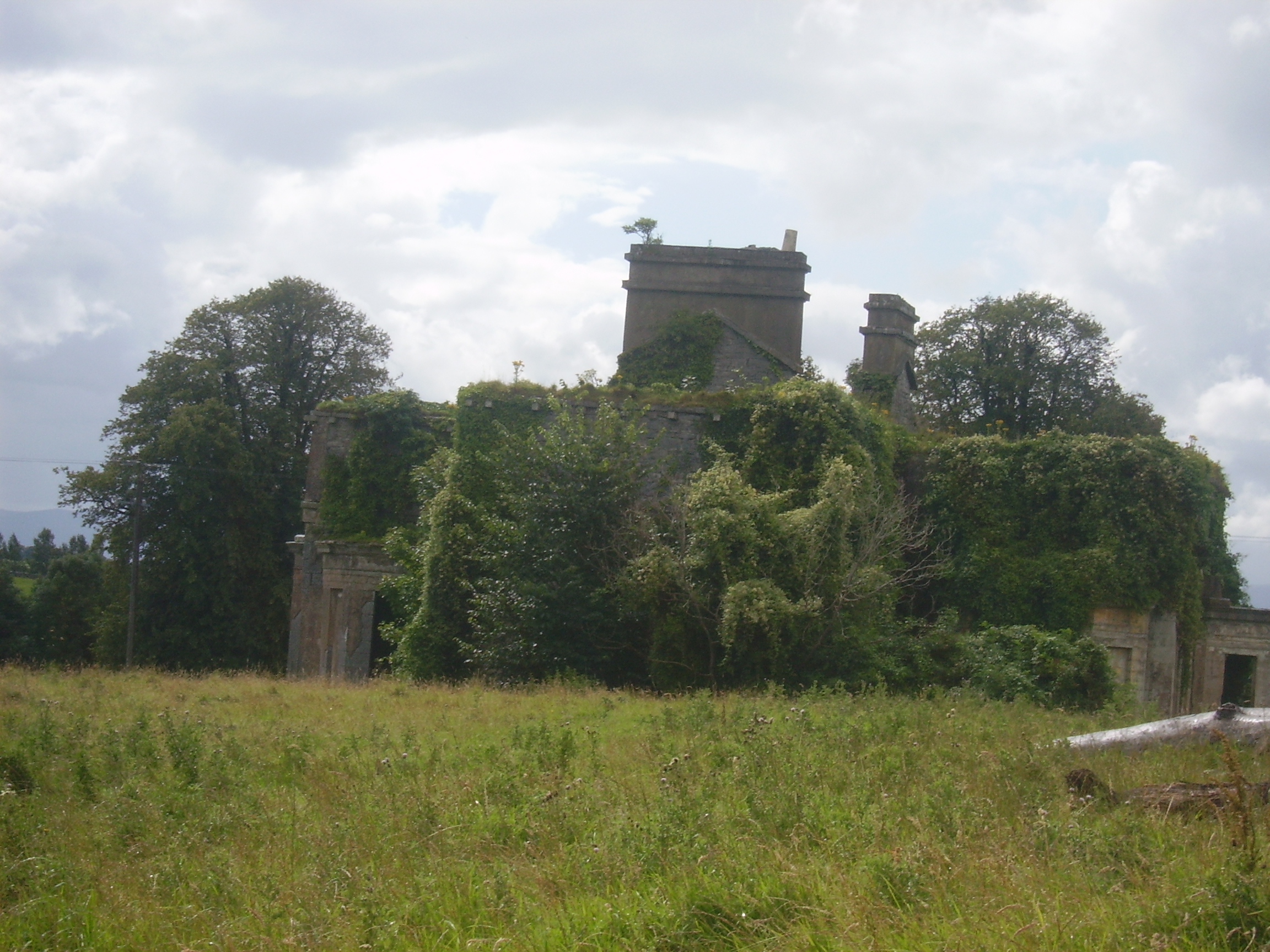
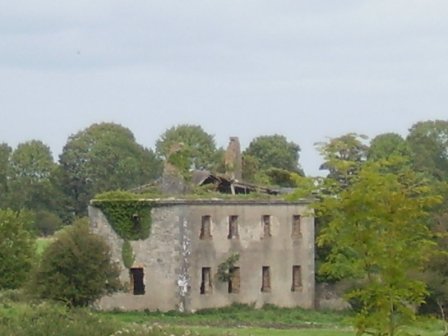
| Cranmore | Built in 1838 by Alexander Clendining Lambert on land he held on lease from Colonel Charles Knox. It reverted to the Knoxes after the Famine and was used as a dower house by Colonel Charles Howe Cuff Knox for his mother, a daughter of the 2nd Marquess of Sligo. The house was bought by the Daly family in the 1920s and sold to the McCartans in the late 1940s. They took off the roof in the 1950s and the house is now a ruin. |
|
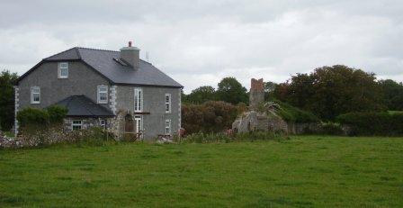
| Cuslough | Lewis describes this house as formerly a 'seat of Lord Tyrawley and now of R.Livesay'. At the time of Griffith's Valuation it was occupied by Richard Livesay, leasing from Colonel Charles Knox, when the house was valued at £12. It stood close to the ruins of Cuslough Castle. | |
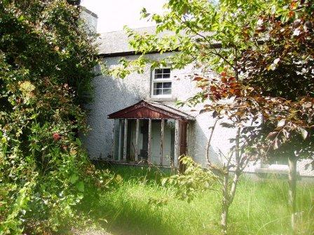
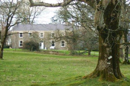
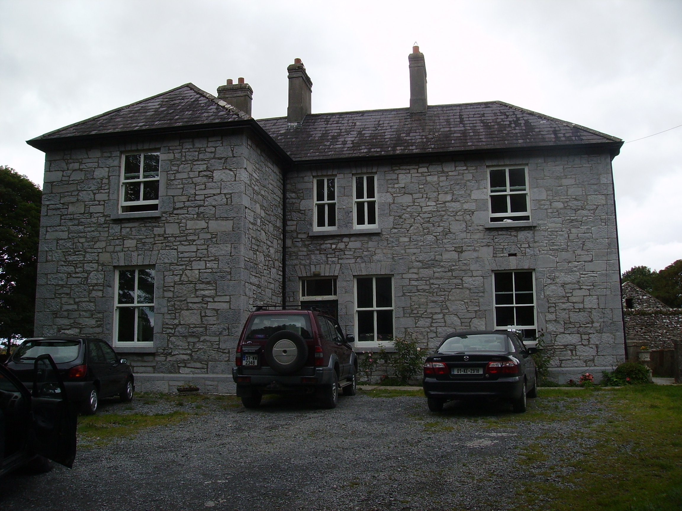
| Curramore House | Bence Jones dates this house as circa 1830. At the time of Griffith's Valuation it was occupied by Geoffrey Martyn and valued at £20. It was still in the possession of the Martyn family in the mid 1920s. Curramore is still extant and occupied. |
|
| Liskilleen | Built by Courtney Kenny in 1862. He was also the owner of the townland at the time of Griffith's Valuation when a herd's house existed there. It is still extant and occupied. |
|
| Togher | Originally a Lambert residence but occupied by George Ruttledge by 1837. It was held in fee by John Hood at the time of Griffith's Valuation when it was valued at £13.. It became the home of his fourth son, Charles Ralph Hood. This house is now completely demolished. | |
| Gallow's Hill | Occupied by James Simpson at the time of Griffith's Valuation when the buildings were valued at £20 and leased from the Earl of Lucan's estate. On the 1st edition Ordnance Survey map the name "Gallowshill" is attached to linear set of structures set out in small plots. This has disappeared by the 25-inch edition map of the 1890s and the substantial structure leased by Simpson is located some distance away. The site of this is now almost completely overgrown. | |
| The Neale | An early 18th century house, with a number of follies designed by Lord Charlemont. Wilson refers to it as "the superb and beautiful seat of Sir John Browne" in 1786. It was occupied by the Reverend James Cromie, brother-in-law of the 2nd Baron and his family, for most of the first half of the 19th century. The house was valued at £25 at the time of Griffith's Valuation. It was sold in the 1930s and most of the house is now demolished. |
|
| Brownstown | In 1786 Wilson refers to Brownstown as the seat of Mr. Browne. This house is shown on the 1st edition Ordnance Survey map but marked 'in ruins' on the later 25-inch edition. The townland was in the possession of George Browne at the time of Griffith's Valuation. The Irish Tourist Association file describes the house as a 3-storey T shaped plain residence, uninhabited for about 60 years. |
|
| Clooncormick | Home of the Gildea family in the 19th century and of the McCartan family in the late 20th century until it was destroyed by a fire. Francis Knox Gildea was leasing from James Knox Gildea at the time of Griffith's Valuation, when the property was valued at £45. No trace of the house remains but much of the stable yard is still extant. |
|
| Cornfield | Cornfield was the original Ruttledge home in the Hollymount area and continued to be lived in by family members until the 20th century, although it was replaced as the family's principal residence by Bloomfield. In 1786 Wilson refers to it as the seat of Mr. Ruttledge. In the mid 19th century it was the home of Thomas Ruttledge who married Jane Fair. He was leasing from Robert Ruttledge and the buildings were valued at £20. The existing dwelling is part of the original house, as are the ruins beside it. Local sources suggest that portions of the original house were demolished when the property was acquired by the Land Commission and some of the stone used to build houses in Hollymount village |
|
| Garriestown | This was a Walsh family home in the 19th century. At the time of Griffith's Valuation the house was leased by Thomas Walsh from Robert Rutledge when it was valued at £11. Garriestown is now a large farming enterprise and the house is still lived in. |
|
| Drimbawn | Built by Catherine Plunket and now owned by the Wilson family. At the time of Griffith's Valuation it was occupied by Catherine Plunkett leasing from the Lynch Blosse estate when the house was valued at almost £5. |
|
| Ellistron Castle | A Browne castle, a house is marked close by as the residence of the Brownes in the 1770s. In 1786 Wilson refers to Ellistron as the seat of Mr. Browne. However there is no house at this location on the 1838 Ordnance Survey map but an avenue is shown there. |