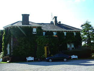
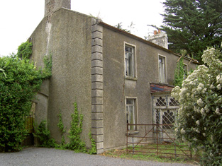
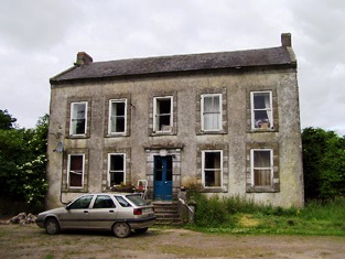
Killemly Lodge
Houses within 10km of this house
Displaying 55 houses.
Houses within 10km of Killemly Lodge
Displaying 55 houses.
| House name | Description | |
|---|---|---|
| Tubbrid | Laurence Walsh occupied a house valued at £11.10 shillings and held from Lord Waterpark in the mid 19th century. This house still functions as a farm house. |
|
| Monroe House | Charles Browne was occupying this house in the early 1850s. He held it from the Earl of Glengall and the buildings were valued at £10. A house and farm are still extant at the site. | |
| Caher Park | Bence Jones writes that this house was built by Lady Margaret Charteris in the early 1860s to the design of Lanyon, Lynn and Lanyon. Valued at £45 in 1906, the house burnt down in the 1960s after being sold following the death of Lieutenant Colonel R.B. Charteris in 1961. Also known as Cahir Lodge. |
|
| Caher House | A house lived in by the Butler family when they ceased to use Caher Castle as a residence. Wilson mentions the seat of Lord Caher in the town. Located in the town square of Caher it now functions as a hotel. Leet records Lord Cahir as resident at Cahir Castle in 1814 but by 1837 Lewis writes that Cahir House was the seat of the Earl of Glengall. He held this house in fee at the time of Griffith's Valuation when it was valued at £100. |

|
| Mill View | This house was the home of the Sargent family in the 19th century, inhabited by Henry Sargent in 1814 and at the time of Griffith's Valuation. It was held from the Earl of Glengall and valued at £30 in the early 1850s. This house is no longer extant. | |
| Garnavilla | A branch of the Nagle family lived at Garnavilla in the 18th century. They held it on a lease from Lord Caher. James Archer Butler was the occupant of this house in 1837 and in the early 1850s when the house was valued at £21 and held from the Earl of Glengall. A building is still extant at this location. | |
| Ballybrada | The residence of Joseph William Fennell in 1814 and 1837. In 1840 the Ordnance Survey Name Books describe "Ballybrado House" as "old and plain, the residence of William Pnnyfeather". Thomas Fennell held the house and offices and 206 acres including a Quakers' graveyard from William Pennefather at the time of Griffith's Valuation. The buildings were valued at £21. The original house as marked on the first Ordnance Survey map is not extant now. The National Inventory of Architectural Heritage website features Ballybrada House built 1879, possibly by the Denny family. Charles E. Denny was resident in 1906 when the buildings were valued at £141+. |
|
| Cottage (Caher) | The residence of George Fennell from 1814 until at least the mid 19th century, when it was valued at £22+ and held from Mrs Rachel Haughton. A building is still located at this site. | |
| Caherabbey House | Occupied by John Fennell in 1814 and by Richard Grubb in 1837. Montgomery records that Richard Grubb built a house at Cahirabbey circa 1833. Richard Grubb held the property in fee at the time of Griffith's Valuation when the buildings were valued at £70. He also had a flour mill closeby valued at £200. In 1894 Slater notes it as the seat of Rev. George Grubb. This house continues to be a family home. In 2013 it was offered for sale. |
|
| Caherabbey House Upper | Joshua Fennell occupied a house known as Caher-abbey-villa in 1814 and in the early 1850s Joshua Fennell (Joseph) was occupying a house in Caherabbey Upper, valued at £29 and held from Ponsonby Barker. | |
| Alta Villa | The home of a branch of the Going family for much of the 19th century. Charles Going was resident in 1814, William Going in 1837. The Ordnance Survey Name Books describe it as "of modern structure in good repair" in 1840. William Going was also the occupier at the time of Griffith's Valuation when the house was valued at £22+ and his flour mill at £66. The property was held from the representatives of Dunbar Barton. Alexander Going of Alta Villa owned 313 acres in county Tipperary in the 1870s. Sir T. Warren lived at Alta Villa, Cahir in the mid 20th century. Alta Villa is still extant and occupied. |
|
| Rochestown | Rochestown came into the possession of the Barton family through the marriage in 1798 of Dunbar Barton and Elizabeth Riall. In 1837 Lewis describes Rochestown as the seat [of their son] S. Barton. Samuel Barton was resident in the early 1850s holding the house valued at £37 from a member of the Beamish family. The National Inventory of Architectural Heritage records the remodelling of the house in 1867 by the Wise family, the design by Sir Thomas Newman Deane. The house was valued at £55 in 1906 and occupied by Francis H. Wise. Damaged by fire in 1918 and completely destroyed by fire in February 1923. |

|
| Keylong | In 1786 Wilson refers to this house as the seat of Mr. Butler. Key-long was the residence of Richard Butler in 1814 and in the early 1850s Richard Carew was the occupier, holding the house valued at £12 from Thomas Going. This house is still a family residence. |
|
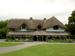
| Swiss Cottage | A thatched house built in a wooded area early in the 19th century and "probably designed by John Nash" (Bence Jones p.53). In the mid 19th century it was valued at £9 and held by the Earl of Glengall in fee. A lithograph of this building is included in the Glengall sale rental of November 1853 and the Burmester, Law and Sadlier sale rental of November 1857. Now in use as a heritage centre. |
|
| Loughlohery | In 1786 Wilson refers to "Loughlokery" as the seat of Mr. Dogherty. The residence of William Quin from at least 1814 and held by him in fee in the early 1850s when the house was valued at £33. The Quinns were still resident at Loughloher in the 1870s. A house is still extant at the site. | |
| Carrigataha | The home of W.J. Fennel in 1837 and in 1840. The Ordnance Survey Name Books describe it as "very pleasantly situated and in good repair". It was occupied by Thomas Fennell in the early 1850s. Thomas held the property from a member of the McCarthy family and the buildings were valued at £15. Buildings are still located at this site. | |
| Garryroan House | Robert Fennell occupied this house in 1814 and Joseph R. Fennell at the time of Griffith's Valuation, when the buildings were valued at £14 and held from Lord Waterpark. This was still a Fennell home in the 1870s and continues to be a family residence. In 2012 it was offered for sale. |

|
| Scart | The residence of Robert Croker in 1814 and of Henry Rice in 1837. The Ordnance Survey Name Books refer to it as his residence in 1840, "pleasantly situated on rising ground and in good repair". In the early 1850s Rice held the property from John Bagwell and the buildings were valued at £12+. Henry Rice may have been a son-in-law of Robert Croker. see http://members.iinet.net.au/~nickred/croker_research/The_Irish_CROKER.pdf A building is still located at this site. | |
| Millgrove House | Thomas Jackson occupied this house in 1814 and William Walpole in the 1850s. Walpole held the property from Lord Waterpark and the house, office and corn mill were valued at £38. This house has recently been renovated. |
|
| Tincurry House | Abraham Jackson was residing at Tincurry in 1814. The Ordnance Survey Name Books refer to Tincurry as the residence of Stephen Moore in 1840. The building appears to have been in use as a workhouse at the time of Griffith's Valuation. In 1906 Wiliam Jackson Pigott was resident at Tincurry in a house valued at £23+. The National Inventory of Architectural Heritage states that the present house was built in 1932 on the same site as the original house which was blown up by British Forces in 1921. |

|
| Coole | A house with a gatelodge marked on the first Ordnance Survey map and located just north of Knocklofty. Occupied by Thomas Morrissey in the mid 19th century, held from the Earl of Donoughmore and valued at £16+. A building is still extant at this location. | |
| Marlfield | Built by Colonel John Bagwell MP in the late 18th century in the Palladian style. It was the seat of the Bagwell family of Clonmel in the 19th and 20th centuries, held from the Moores of Barne and valued at almost £83 in the early 1850s. The central part of the house was burnt in 1923 and rebuilt in 1925 and is now in use as an apartment complex. |

|
| Woodrooff | The seat of the Perry family in the 18th and 19th centuries, Samuel Perry was resident in 1814 and William Perry in 1837 and at the time of Griffith's Valuation, when the buildings were valued at £66+. Samuel Perry was resident in 1906. Bence Jones writes that this house is now mostly demolished. | |
| Shanballyard | Shanballyard House is marked on the first Ordnance Survey map. In the mid 19th century John Scully held buildings valued at £16+ and 299 acres from James Scully. The National Inventory of Architectural Heritage records this house as "disused". |
|
| Barn | The seat of the Moore family in the 18th, 19th and 20th centuries. In 1786 Wilson refers to it as the seat of Thomas Moore In 1840 the Ordnance Survey Letter Books note that it had "a garden nursery and ornamental ground". It was held by Stephen Moore in fee in the mid 19th century and valued at £49+. Randal K. Moore was resident in 1906 and Mr and Mrs Murray Moore in the early 1940s when the house contained a very fine library and antique art collection. Barn is still extant. |

|
| Ardfinnan Castle | A building that has been added too and altered since the 15th century. Occupied by James Prendergast at the the time of Griffith's Valuation, held from the Ecclesiastical Commissioners and valued at £13. In 1894 Slater notes it as a residence of Mrs. Prendergast. Still in use as a residence. |

|
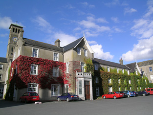
| Rockwell | Wilson refers to Rockwell as the seat of Andrew Roe in 1786. In 1814 and 1837 John Rowe/Roe was living at Rockwell. By the time of Griffith's Valuation John Bushe was the occupant, holding the property from the Court of Chancery. The buildings were valued at £40.16 shillings. John Bushe was the resident in May 1856 when the estate was advertised for sale. The buildings were altered and added too in 1865 after the arrival of the Holy Ghost Fathers who started a school. This school still operates as one of Ireland's well known boarding school. http://www.rockwellcollege.ie/missionstatement.html |
|
| Boytonrath | T. O'Meagher was the proprietor of Boytonrath in 1814. The Ordnance Survey Name Books refer to Richard Anderson as the occupant in 1840. In the early 1850s Henry Andrews was the occupier holding the property from the representatives of William Roe. The buildings were valued at £12+. A house and farm are still extant at the site. | |
| Belle Vue | Belle Vue house situated in Belle Vue Park in the townland of Boytonrath was occupied by Andrew Roe in 1814 and by George Roe in 1850. The buildings were valued at £9.15 shillings. The house has been altered over the years and is still the centre of a working farm. |
|
| Westgrove | Arthur Riall was residing at Westgrove in 1837 and in 1850 when the house was valued at £23+ and held from Robert Maunsell. This house is still in use as a residence. |
|
| Donegal | John O'Halloran occupied Donegal House in the mid 19th century which he held from Arthur Riall. The buildings were valued at £12.18 shillings. This house no longer exists but a farm complex is still located at the site. | |
| Loughkent | Nicholas Dogherty is recorded as the occupier of Loughkent House in 1814 and in 1850, when he held the house valued at £12.18 shillings from Arthur Riall. It is no longer extant. | |
| Garranlea | A Keating home from the 18th century, occupied by Leonard Keating in the first half of the 19th century. In 1800 Leonard Keating married Lucinda Scully of Kilfeacle. Their son, Robert, was Member of Parliament for county Waterford in the late 1840s. In 1850 he held the property from the Earl of Clonmel and the buildings were valued at £34+. This house no longer exists. | |
| Marlhill | Edward O'Meagher was the occupier of Marlhill in 1814. The Ordnance Survey Name Books mention Marlhill as the residence of J. O'Meaghar in 1840. Thadeus O'Meagher was the occupier in 1850. Thadeus held the house and 120 acres from Stephen O'Meagher and the buildings were valued at £22+. Buildings still exist at this site. | |
| Woodinstown | Woodinstown was the home of a branch of the Carew family in the 18th and 19th centuries. Robert Carew was resident in the first half of the 19th century, holding the property in fee at the time of Griffith's Valuation when the buildings were valued at £16. This house is no longer extant. | |
| Maginstown | A house valued at £13+ in the townland of Maginstown was occupied by James O'Donnell at the time of Griffith's Valuation and held from William Fennell. Buildings are still located at this site. | |
| Ballydrehid | In 1786 Wilson refers to Ballydrehid as a seat of Viscount Lismore, "pleasantly situated on rising ground". The home of Robert Keating in 1814 and of Robert Doherty in the early 1850s. Doherty held the property from Viscount Lismore and the house was valued at £17. This house is still extant and occupied. |

|
| Kilmoyler | A late 18th century house, the seat of the O'Meagher family, occupied by Dennis O'Meagher in 1814 and 1837 and by Stephen O'Meagher at the time of Griffith's Valuatiton. He held the property in fee and the buildings were valued at £40. In 1865 this property was advertised for sale by the Prestons. The rental records that the house was held on a lease dated 1860 from William O'Meagher to Standish Butler who was resident at the time. In 1786 Wilson had recorded "the castle and house at Kilmoyler, the ancient seat of Colonel Butler". Still extant and occupied. |

|
| Ballycarron | The Butlers are described as "of Ballycarron" from the early 18th century. Ballycarron was the residence of Thomas Butler in the 19th century, held from Michael Gavin in the 1850s when the buildings were valued at £36. ''Burke's Irish Family Records'' states that the proceeds of the sale of the Ballycarron estate and the house itself were bequeathed "to the Church". This building is now divided into residential apartments. | |
| Suirville | This house was the home of Peter Smithwick in the early 19th century. Suirville was held by Richard Butler from Michael Gavin at the time of Griffith's Valuation and the house, valued at £10, was occupied by Miss Alice O'Connor. The sale rental of 1873 shows William Roche as tenant, trustee for Mr Butler. The Irish Tourist Association Survey records Suirville as the birthplace of Sir William Butler in 1838. The house was a ruin in the early 1940s. | |
| Ballyslatteen | Richard Butler, a younger brother of Thomas Butler of Ballycarron, was resident at Ballyslatteen in 1837 and at the time of Griffith's Valuation. He held the property from the Honourable John Massey and the buildings were valued at £20. Included in the sale of the Earl of Portarlington's estates in June 1856. A building is still located at this site. | |
| Suir Castle House | Suir Castle was the home of a branch of the Massy family in the latter part of the 18th century. Two buildings are marked on the first edition Ordnance Survey map Suir Castle and Suir Castle House. The Inventory of National Architectural Heritage dates the house from circa 1820. Suir Castle [Grid Ref. S004 352] was occupied by Joseph Robbins in 1814 and in 1837. In the mid 19th century Suir Castle House was held by Francis Massey in fee and the buildings were valued at £21. The Massys were still resident in the 1870s. Occupied in the 20th century by Major Harold O'Malley. For sale in 2003. |

|
| Hymenstown | This house was the home of the Robbins family in the 18th and 19th centuries. Occupied by George Robbins in 1814 and by R. Scully in 1837. Michael Cleary was resident at the time of Griffith's Valuation holding the property from Nathaniel E. Robbins, when the buildings were valued at £20. Included in the sale of the Earl of Portarlington's estates in June 1856. John Graham was living at Hymenstown in the 1870s. This house is still extant. |
|
| Toureen | The first edition Ordnance Survey map marks Toureen House, later maps show a house located a short distance to the south west. Leet and Lewis records Denis O'Meagher as resident at Toureen. This may be the dairy house and offices recorded in Griffith's Valuation and valued at £3.5 shillings held by Stephen O'Meagher in fee. The 25-inch map of the 1890s indicates Tooreen House and a house and substantial farm are still extant at this site. | |
| Toureen Wood House | This house located on the northern fringe of Toureen wood was the home of Philip Maguire in the second half of the 19th century. The site of this house is located near a building marked on the first edition Ordnance Survey map as Maguire's Castle. The sale rental of 1875 refers to a new and comfortable dwelling house on the lands of Toureen, containing 2 good reception rooms, 7 bedrooms. a large kitchen and store room, dairy and pantries. The house was in the owner's possession. A house in the townland of Toureen valued at £7.5 shillings was held in fee by Philip Maguire in the mid 19th century. Lewis records a house known as Kilmoylermore, the residence of "the late Constantine Maguire, Esq." | |
| Ballinattin | In 1786 Wilson refers to "Ballattin" as the seat of Mr. Parsons. This house valued at £17+ in the mid 19th century was occupied by Thomas Cooney and held from William Moore. A farm exists at the site and the original house is not extant. | |
| Ballinattin House | Occupied by Denis Cooney at the time of Griffith's Valuation, valued at £13+ and held from Edward B. Vise. This house is still extant and occupied. | |
| Kilcoran Lodge | A house built in the second half of the 19th century, valued at £46.10 shillings in 1906, the property of Robert Murdock. | |
| Drangan | In the mid 19th century Daniel Heffernan held buildings valued at £15 from the Earl of Lismore at Drangan Beg. Drangan House is marked on both the first and 25-inch edition Ordnance Survey maps. A house and large farm are now located at the site. | |
| Cappagh (Clanwilliam) | In 1786 Wilson refers to Cappagh as the seat of Mr. Massey. At the time of Griffith's Valuation, this townland was the property of estate of Reverend John Massey Dawson. [Grid Reference is approximate]. | |
| Ballymorris | In 1786 Wilson refers to Ballymorris as the seat of Mr. Magher. By the time of Griffith's Valuation the townland was held by Stephen O'Meagher and the buildings were valued at £1. The house appears to be gone by the time the first Ordnance Survey map was published as it is not shown there. | |
| Cuckoo Hill | In 1786 Wilson referred to a house he called "Clover-Hill", three miles from Caher, "the seat of Mr. Ryall". He may have been referring to the townland named Cuckoohill which appears on the 1st edition Ordnance Map. A house is present in this townland which is labelled Cuckoo Hill House on the 25-inch Ordnance Survey map of the 1890s. At the time of Griffith's Valuation, this property was leased to Patrick Heffernan by Abraham Riall when it was valued at over £6. A house and farm still occupy the site. | |
| Rosemount (Caher) | In 1840 the Ordnance Survey Name Books refer to Rosemount as a house in good repair, the residence of Robert Franklin. He is also listed as the occupier at the time of Griffith's Valuation, leasing from the Barton estate when the buildings had a valuation of £10. Robert Franklin of Rosemount is listed in Slater's Directory of 1846. The house is no longer extant. | |
| Lissava House | In 1840 the Ordnance Survey Name Books refer to Lissava House as the residence of John Egan. He was recorded among the gentry of Caher in Slater's Directory 1846. He also the occupier in the early 1850s when he was leasing it from the Earl of Glengall's estate. The buildings were valued at £12. A house is still extant at the site. | |
| Hymenstown House | Hymenstown House is shown on the 25-inch Ordnance Survey map of the 1890s. The National Inventory of Architectural Heritage suggests it was built sometime in the 1860s. The house on the site at the time of Griffith's Valuation was owned by Nathaniel Robbins and valued at under £2. In 1901 it appears to have been the property of Alex Going but was vacant at the time. Hymenstown House is still extant and occupied. |
|