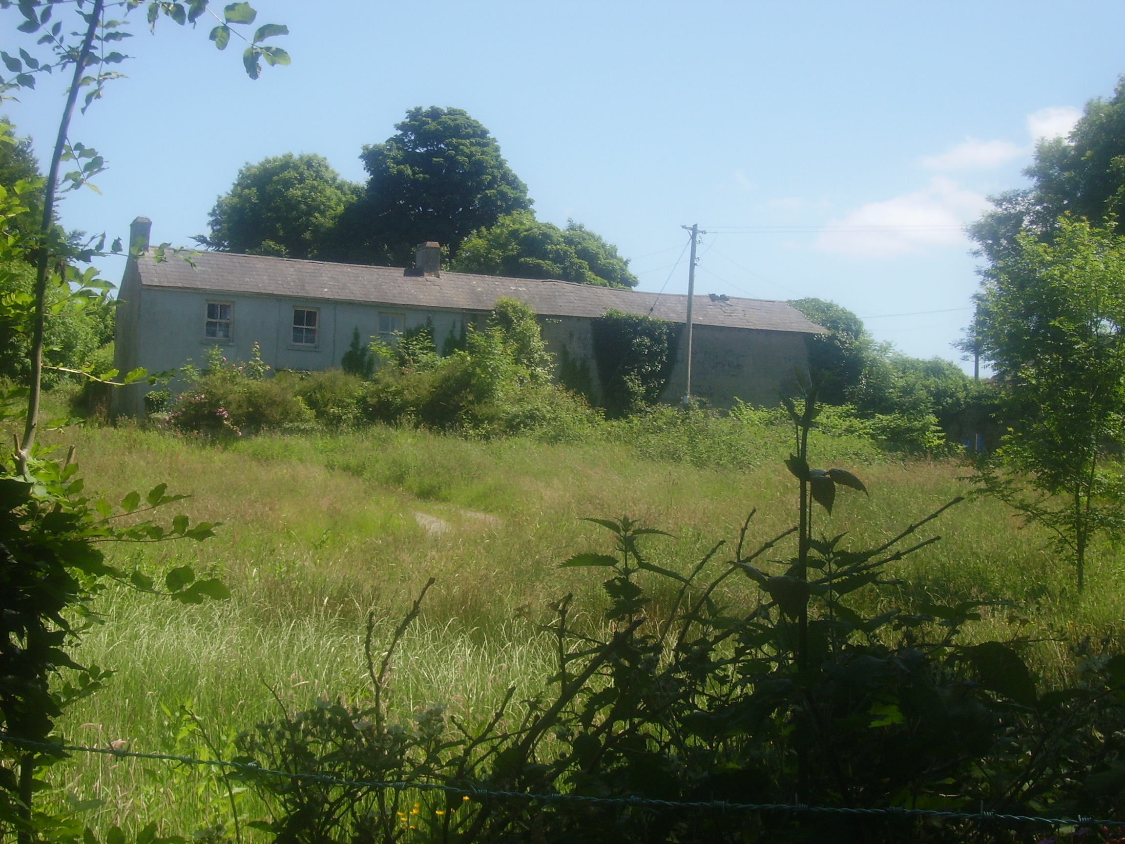
Woodfield
Houses within 10km of this house
Displaying 34 houses.
Houses within 10km of Woodfield
Displaying 34 houses.
| House name | Description | |
|---|---|---|
| Dangan | The main residence of the Creagh family in the 18th and 19th centuries, held by Cornelius Creagh in fee at the time of Griffith's Valuation when the house was valued at over £25.. Sold in the 1920s, the Irish Tourist Association Survey file records the house as dilapidated and going to ruin in the 1940s. Weir writes that the house was demolished in 1948. | |
| Castlecrine | Weir writes that this was an 18th century residence possibly incorporating the 16th century tower. Castlecrine was the home of a branch of the Butler family for most of the 18th and 19th centuries, valued at £45 at the time of Griffith's Valuation, it was demolished in the mid 20th century. |

|
| Castlelake | Home of the Gabbett family in the 19th century, occupied by Robert Gabbett in 1814 and by John Gabbett in 1837 and in the 1850s. They held the property from the Westropp family with whom they intermarried. Home of the Carroll family in the second half of the 20th century, still occupied. | |
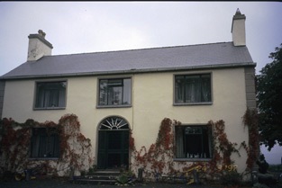
| Ieverstown | A house held by John A. Ievers in fee at the time of Griffith's Valuation when the building was valued at £11.10 shillings. Still inhabited it stands close to the road. | |
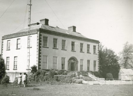
| Mount Ievers | A house built in the 1730s by Henry Ievers to the design of John Rothery. Wilson refers to it as the seat of Mr. J.A. Ievers in 1786. Occupied by Robert Ievers in 1814 and by W. Ivers in 1837. Eyre Ievers was resident at the time of Griffith's Valuation, holding the property from James Ievers. The Ievers family still live in the house. |

|
| Ballysheen | A house on the Vandeleur estate, occupied by the Walton family for most of the 19th century. Occupied by George Perry in 1814. Valued at £10 at the time of Griffith's Valuation it was renovated in the 20th century. Labelled as Walton Lodge on the 25-inch Ordnance Survey map of the 1890s. |
|
| Cappaghlodge | A property in the possession of the Spaight family from the early 18th century. The house named "Lodge" was the residence of Samuel Spaight in 1814. James Kelly held the property from the representatives of Edward Spaight Ferreter at the time of Griffith's Valuation, when the house was valued at £18. It was in the hands of the Court of Chancery at this time. In 1906 the house valued at £11 was in the possession of James Frost. Weir writes that the house is now demolished. | |
| Russell Villa | An early 19th century house built on the Dromoland estate, the home of the Russell family in the 19th and 20th centuries. The building is still extant. | |
| Kilkishen | An 18th century house that passed into the Studdert's possession throught a marriage with a Cusack of Kilkishen. The house was valued at £40 in the mid 19th century. Slater notes it as the residence of Maj. R.A. Studdert in 1894. It remained a Studdert home until sold to the Binghams in the 1920s. A house is still extant at the site. |
|
| Brook Lodge/Dangan Ville | Occupied by William O'Connell in 1814 and by Pierce O'Brien who held it from Pierce Creagh in the mid 19th century, when the house was valued at over £13. By the 1870s this house, which is labelled Brooke Lodge on the 25-inch map of the 1890s, was the residence of Nicholas Henry Martin. A house is still extant at this site. | |
| Craggaunowen Castle | 16th century tower house, "in ruins" at the time of the first Ordnance Survey. The castle, herd's house and 96 acres were in the possession of the Reverend William Ashworth in the mid 19th century, who held them from a Caswell. A mansion house valued at £13 was in the possession of Count James Considine in 1906. The castle was bought by John Hunt in the mid 1960s and was the first home of the Hunt Museum. | |
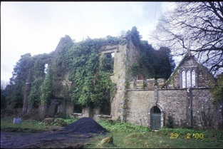
| Cullane House | A house built in the 1780s, also known as Lough O'Connell. It was the home of Thomas Steele and in 1821 passed to his nephew "Honest Tom" Steele, friend of Daniel O'Connell. In the late 1840s Cullane was inherited by Tom Steele's niece who had married Charles Studdert of Newmarket House. Their son Robert Wogan Studdert held the house valued at £25 in fee at the time of Griffith's Valuation. It remained in Studdert hands until 1954 and is now a ruin. | |
| Rathluby | By the end of the 18th century Rathluby was in the possession of the Bridgeman family. The buildings were valued at £5 at the time of Griffith's Valuation when Henry Bridgeman occupied the house which he held from Eliza Piercey and it continued to be a Bridgeman home until the end of the 19th century. The house is now a ruin. | |
| Belvoir | Belvoir was an early 19th century house on the same site as an earlier building. It was the home of the Wilson family, valued at £32 in the mid 19th century. The house was burnt in 1888 when leased by the Wilson Lynches to Lady Loftus. It was not rebuilt though recorded as the seat of Maj. Wilson Lynch in 1894. Members of the Wilson Lynch family continued to live in the remaining wing until the mid 20th century. It is now a ruin. |
|
| Glenwood | Weir records Poole Gabbett in residence in 1810, Basil Davoren occupied the house in 1837 and John Gabbett at the time of Griffith's Valuation. He held it from George Studdert and it was valued at £10. Alice Studdert married General Frederick Maunsell and they lived at Glenwood which passed to their son Robert Maunsell. This house was the scene of an ambush in which eight Black and Tans were killed in 1920. The house no longer exists. | |
| Glenomera | Glenomera was the seat of the Arthur family from the mid 17th century until the early 20th century. In 1786, Wilson refers to Ballyquin as "the fine seat of Mr. Arthur". It is labelled Ballyquin House on the 1st edtion Ordnance Survey map but as Glenomera on the later 25-inch edition. Lewis wrote in 1837 that Glenomera was "celebrated as a shooting station for grouse and pheasant". It was held in fee by Thomas Arthur at the time of Griffith's Valuation and valued at £35. The house is now demolished. | |
| Hurdleston/Hurdlestown | This was the seat of the Bentley family in the 18th and 19th centuries. The present house dates form 1871 and may well incorporate parts of the former house. The buildings were valued at £40 in 1906. Restored at the end of the 20th century. |

|
| Violet Hill | Home of James Going and his wife Jane Patterson from at least 1837. Occupied by their third son Wyndham Quin Going in the mid 19th century when the buildings were valued at £20. The house remained the property of the Going family until it was sold in 1924, now a ruin. | |
| Trough Cottage | Trough Cottage was occupied by William Walsh who held it from John Carroll at the time of Griffith's Valuation. It was valued at £16. Weir writes that this was the home of the Misses Bentley in the early 20th century. | |
| Trough House | Trough Castle in the townland of Trough is marked as "in ruins" on the first Ordnance Survey map 1842. Weir writes that Dr Elliott O'Donnell who inherited the county Clare property from Sir Charles O'Donnell in 1870 probably built Trough House in the townland of Roo West. Roo Cottage is marked on the first Ordnance Survey map. | |
| Mount Baylee | In 1837 the residence of H. Bayley. Occupied by Susannah Baylee at the time of Griffith's Valuation, who held it from Henry Thomas Baylee. The buildings were valued at £8. Weir writes that in the 20th century Miss Edie Baylee married the father of the architect Percy le Clerc. The house is still lived in. | |
| Sunville | Occupied by T. Studdert in 1837 and by Robert Hanley at the time of Grifftith's Valuation who held the property from Thomas Prosser. Also known as Sion Ville. A building is still extant at the site. | |
| Doon House | A seat of Sir Hugh Dillon Massy in the 1780s, leased to Richard Harte in 1814 and the Reverend W. Butler in 1837. Weir writes that the house was rebuilt by Richard Bentley in 1845. Griffith's Valuation records Richard Bentley as the occupier, he held it from Sir Hugh Dillon Massy. The buildings were valued at £18. The house belonged to the Whitehead family in the early 20th century and was later demolished. | |
| St Catherines | An O'Callaghan property from the 18th century, George O'Callaghan was residing at St Catherines in 1814 and D. Sampson in 1837. Burkes 1904 records George's brother Edward "of Coolready" and he was married to a Miss Sampson. At the time of Griffith's Valuation the house was unoccupied and Ralph Westropp was the immediate lessor. The buildings were valued at £24. Only the servants' quarters now remain and have been converted into a family home. |

|
| Fort Edward | Built post the first Ordnance Survey probably by a member of the Westropp family. Occupied by Dr Patrick Cullinan at the time of Griffith's Valuation who held it from the Reverend John Gleeson. The house is still inhabited and well maintained. |
|
| Ballinahinch | A branch of the Molony family appear to have occupied Ballinahinch for some time in the 18th century. Occupied by Cornelius O'Callaghan in 1814 and 1837 and by his son Charles George in the mid to late 19th century. It is recorded as his seat in 1894. By 1906 Ballynahinch mansion house valued at £45 was in the possession of the Gore family. Weir writes that owners left when the "Troubles" began early in the 20th century and the house was vandalised. It was later demolished. The yard buildings remain and are still in use. |
|
| Derrymore | The MacGraths had a 17th century home here which was incorporated into the servants' quarters when the Gores built their 18th century mansion. They continued to occupy the house until the early 20th century. The 17th century house and servants' quarters still stand but the rest of the house has been demolished. Some of the stone and stone features from Derrymore were taken to build a house near Drewsborough on the outskirts of Scarriff, Discovery Map 58, R637 836. | |
| Kilgory | The main residence of the O'Callaghan family in the 18th century situated on the shore of Kilgory Lough. In 1786 Wilson refers to it as the seat of Mr. Callaghan. Towards the end of the century the house became the residence of the O'Connells. Colman O'Loghlen married a sister of Daniel O'Connell of Kilgory before 1783. In 1814 Kilgory was the home of Daniel O'Connell and in 1837 Maurice O'Connell was the proprietor. It continued to belong to the O'Connells for the rest of the 19th century. Weir writes that most of the house was demolished in 1928. | |
| Bunavory | A house on the Molony estate, occupied by William Scanlan in the 1850s. The house is now divided into two residences. | |
| Cragg | Home of a branch of the Molony family from the 1730s to the early 20th century. The house is still extant and lived in. It was valued at over £14 in the mid 19th century when it was held by Anne Molony in fee. | |
| Fort Anne | An 18th century house that was in the possession of Robert Westropp, eldest son of Poole and Mary Westropp, by 1814. His son John, who married Maria Macnamara, was occuping the house in 1837 and their son Robert was resident in the mid 1850s. Robert Westropp held the property in fee and the buildings were valued at £25. This house passed into the possession of the O'Callaghan Westropp family. It no longer exists. | |
| Maryfort | An early 18th century house with late 19th century embellishments, home of the Westropps. By the early 19th century it was occupied by John O'Callaghan (died 1818) who seems to have moved there from Kilgory. Occupied by his grandson John O'Callaghan at the time of Griffith's Valuation, valued at £35 and held from George Westropp. In the 20th century it was the home of his son Colonel George O'Callaghan who assumed the additional name of Westropp. Weir writes that the house was demolished in 1967 by Colonel Conor J. O'Callaghan Westropp, the last member of the family to live there. |
|
| Annaly Lodge | A house built post 1850 as a shooting lodge for the White family. Sold in the late 1870s to the Phelps it later became the property of the Forestry Department. Back in private hands now it is still occupied. [Grid reference is approximate] | |
| Garruragh House | In 1786 Wilson refers to "Garuragh" as the seat of Mr. Harrison. At the time of Griffith's Valuation, the house was part of the O'Callaghan estate but leased to the Tulla Board of Guardians as an auxiliary workhouse when the buildings were valued at £48. It is labelled Garruragh House on both the 1st edition and 25-inch edition Ordnance Survey maps though much of the buildings have disappeared by the 1890s and only some ruins remain now. |