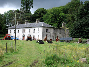
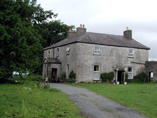
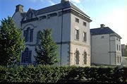
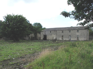
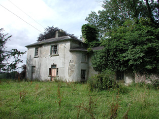
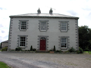
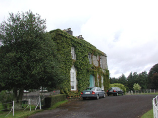
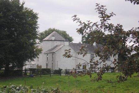
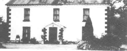
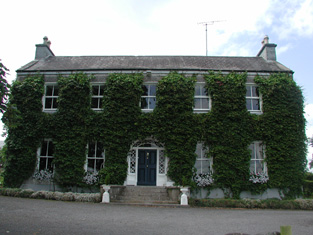
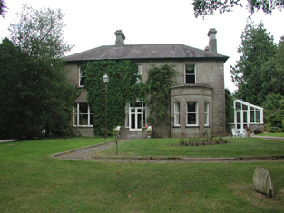
Caldragh
Houses within 15km of this house
Displaying 101 houses.
Houses within 15km of Caldragh
Displaying 101 houses.
| House name | Description | |
|---|---|---|
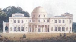
| Rockingham | Sir Robert King, Viscount Lorton, built Rockingham House around 1810 and the family moved there from King House in Boyle. At the time of Griffith's Valuation Rockingham was valued at £180. In 1903 Rockingham became the county residence of the Lord Lieutenant Lord Dudley. It was destroyed by fire in 1957 and subsequently demolished. Only some of the servants' tunnels as well as other estate buildings remain. The site is now occupied by Lough Key Forest Park. |
|
| Alderford | At the time of Griffith's Valuation Alderford was leased by the representatives of William F. McDermottroe to Catherine Thompson and was valued at £25. In 1814 it was the seat of Thomas McDermottroe. Lewis also records it as the seat of the latter in 1837. Alderford is famous for its associations with Turlough O'Carolan, the Irish harper, as he died there in 1738 and is buried nearby in Kilronan. This house, however, was built in the early 19th century. It was the seat of Thomas Charles McDermottroe in 1894. It is still extant but in a dilapidated condition. |
|
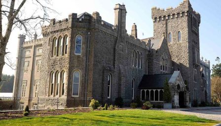
| Kilronan Castle/Castle Tennison | The house presently occupying this site was constructed in the later 19th replacing an earlier house which had been built c.1820. At the time of Griffith's Valuation the house had been valued at £70 and was occupied by Edward King Tenison. In 1814 it was the seat of Thomas Tennison and is recorded by Lewis as the seat of Col. Tenison. In 1894 Slater referred to it as a residence of the Earl of Kingston. The building is still extant and in 2006-7 was converted into a luxury hotel. For more information on Kilronan Castle see www.kilronancastle.ie. |
|
| Jamestown House or Jamestown Lodge | At the time of Griffith's Valuation Hugh O'Beirne was occupying a house at Jamestown, barony of Leitrm, valued at £40. Jamestown House was held by the O'Beirne family until the twentieth century though in 1894 Slater refers to it as the seat of Gilbert King, junior. In 1906 it was also valued at £40. It is still extant and occupied. |
|
| Mohill Castle | At the time of Griffith's Valuation John Kane was leasing a property valued at £20 from Sir M. Crofton in the town of Mohill. |
|
| Mount Campbell | Josias Rowley was leasing the property at Mount Campbell, valued at £35, to William A. Lawder at the time of Griffith's Valuation. Slater refers to it as the seat of William S. Lawder in 1894. In 1906 William Rowley owned the mansion at Mount Campbell valued at £40. The house is no longer extant. |
|
| Lismoyle | At the time of Griffith's Valuation Francis Waldron was the owner of a property valued at £12 at Lismoyle, barony of Leitrim. A house still exists at this site. | |
| Laheen | In the 1780s both Taylor and Skinner and Wilson recorded Laheen as a seat of the Peyton family. Lewis also records it as a Peyton residence. At the time of Griffith's Valuation it was being leased by Richard Peyton to Michael Fitzgerald and was valued at £15. The original Laheen house is not extant though a house and extensive farm buildings remain at the site. | |
| Derrycarne | At the time of Griffith's Valuation Derrycarne was the property of William Ormsby Gore and was valued at £30. Lewis records it as the seat of the Nisbett family in 1837. In 1906 it was in the possession of Lord Harlech (Ormsby Gore) and was valued at £33. The Ormsby Gore estate was eventually sold in 1924 and Derrycarne and about 80 acres were acquired by a Col. Kirkwood, a relative of the Kirkwood family of Woodbrook, county Roscommon. It changed hands again several times before being acquired by the Land Commission in 1952. The house was demolished shortly afterwards. | |
| Hatley Manor | This house was built c. 1830. At the time of Griffith's Valuation Charles St. George was leasing it to Diana Faris. It was later inherited by the Whyte family of Newtown Manor and is recorded by Slater as the seat of Charles C. Beresford Whyte in 1894. It is still extant and had been in use by the Bank of America. In April 2007 it was offered for sale. |
|
| Castlecarra (Leitrim) | This house was occupied by the Peyton family later in the 19th century. In 1814 it was the address of Mr. A. O'Beirne. In 1906, when it was the property of Mrs. William Peyton it was valued at £10. | |
| Keonbrook | In 1783 Taylor and Skinner record Kanebrook but not the name of the family whose residence it was. Keonbrook, the residence of the Keon family, was occupied by John F. Tottenham in 1856. In 1906 it is recorded as the property of Bridget Mollahan and was valued at £14. A modern house has been constructed in the demesne. | |
| Newbrook | At the time of Griffith's Valuation Michael Costello was leasing Newbrook, valued at £7 from the Keon family. Lewis records Newbrook as a residence of the Keon family in 1837. in 1814 Ferdinand Keon had his address at Newbrook, Carrick-on-Shannon. The sale notice of 1878 mentions the existence of Newbrook House which "with some expenditure might be made a most desirable residence for a gentleman's family". | |
| Loughscur | Loughscur was originally a seat of the Reynolds family but later passed into the ownership of the Peyton family through marriage. In 1894 Slater refers to it as the seat of James Reynolds Peyton. However, this may refer instead to the Peyton property at Laheen. | |
| Annadale | At the time of Griffith's Valuation, William Slack was leasing the house at Kiltubbrid from the Ecclesiastical Commissioners when it was valued at £11. Lewis also records it as the residence of the Slack family. According to the National Inventory of Architectural Heritage survey, Annadale House was built c.1760. It is still extant and occupied. |
|
| Driney | In 1906 the mansion house at Driney was valued at £31. At the time of Griffith's Valuation it was occupied by Rev. Walter C. Peyton and was valued at £10. In 1814 it was the residence of Walter Peyton and was also recorded as the seat of the Peyton family in 1837. It was also recorded as a seat of the Peyton family by Taylor and Skinner in 1783. There is no evidence of a house at this site now. |
|
| Aghacashel | According to the National Inventory of Architectural Heritage Aghacashel House was built c. 1800. At the time of Griffith's Valuation it was occupied by Charles Rolleston and was valued at £14. In 1837 Lewis records it as a Johnston residence. In 1814 it was the home of Joseph Johnston. By 1906 it was still valued at £14 and was the property of Thomas Guckian. It is still extant. |
|
| Port | Port is given as the address of Guy Cooper in 1814 while in 1856 the house at Port was occupied by George Latimer. | |
| Glasdrumman | The property at Glasdrumman in the parish of Fenagh, belonging to William Lewis, described as "in chancery" was leased to John Murphy in 1856 when it was valued at £8. It is still extant and occupied. |
|
| Blackrock | In 1906 the house at Blackrock was owned by John W.L. Birchall and was valued at £10. Arthur J.V.L.Burchall was occupying the house at the time of Griffith's Valuation when it was also valued at £10. There is still an occupied house at this site. | |
| Drumhierny Lodge | At the time of Griffith's Valuation William LaTouche was leasing this property, valued at £15, to Francis LaTouche. Originally built by David La Touche and lived in by successive generations of the family until the early years of the twentieth century. Sold in 1912 and now a ruin. | |
| Shannon Lodge | Alexander or Alick Faris leased property from the St. George estate in Carrick-on-Shannon. His wife Diana is recorded as the occupier of the house known as Shannon Lodge at the time of Griffith's Valuaiton, when it was valued at £30. Pyle states that after Alick Faris died Diana married a French aide of the St.George's, Victor de l'Herrault. She resided at Shannon Lodge for some time but after her second husband died she moved to Sligo and rented Shannon Lodge to her brother, James. She died in 1890. |
|
| Letterfine/Letterfyne | Letterfine was occupied by the representatives of Mary Anne McNamara in the mid 1850s. In 1814 it was the address of Tobias Peyton. Taylor and Skinner and Wilson both record it as a seat of the Reynolds family in the 1780s. It is labelled Letterfine House on the 1st edition Ordnance Survey Map but is not visible on the later 25-inch edition. In 1943 the Irish Tourist Association survey recorded no trace of the house. | |
| Bunnybeg House | Lewis records Bonnybeg as a seat of the Lawder family in 1837. At the time of Griffith's Valuation it was owned by William Lawder and was valued at £10. A modern house and farm exist at the site now. | |
| Lakeview (Mohill) | At the time of Griffith's Valuation William Slacke was leasing a property valued at £8 at Drumdart, barony of Leitrim, to William Lawder. | |
| Drumrahan | Lewis records Drumrahan as a seat of the O'Brien family in 1837. At the time of Griffith's Valuation it was being leased by John O'Brien to Phillip Taggart and was valued at £25. Entrance gates have been reconstructed but the original house is not extant. | |
| Drumcree Mill | Josias Rowley was leasing a mill and house valued at £13 in this townland to Alexander Acheson in the 1850s. | |
| Gort House | Margaret O'Brien was leasing a house valued at £15 in the townland of Gortnalamph from the Clements estate in the 1850s. Gort House is still extant and occupied. |
|
| Headfort/Headford | At the time of the first Ordnance Survey the property at Headford was described as belonging to "S. White, non resident, property going into decay". In the seventeenth and eighteenth centuries it was a seat of the Jones family. Wilson, perhaps incorrectly, refers to it as the seat of Mr. Johnston, in 1786. The house was immortalised by Anthony Trollope in his novel ''The McDermotts of Ballycloran''. The ITA survey of the 1940s recorded it as in ruins and it remains as an ivy-covered ruin today. It was pointed out for this survey as "the ruins of that auld Ballycloran Castle"! |
|
| Estersnow Glebe | At the time of Griffith's Valuation the Ecclesiastical Commissioners were leasing a house at Cavetown valued at £10 to Rev. Frederick Hamilton. It is described as "a good glebe house, the residence of the incumbrant of Estersnow" at the time of the 1st Ordnance Survey. It is still extant and occupied. | |
| Ardcarne House | At the time of Griffith's Valuation John Hackett was leasing Ardcarne House, valued at £25, from Viscount Lorton's estate. The house is still extant and used as a farmhouse. |
|
| Glencarne House | At the time of Griffith's Valuation Samuel Handy was leasing a house valued at £18 at Ardcarne, barony of Boyle, from Viscount Lorton's estate. Glencarne is now a guesthouse. |
|
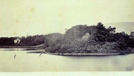
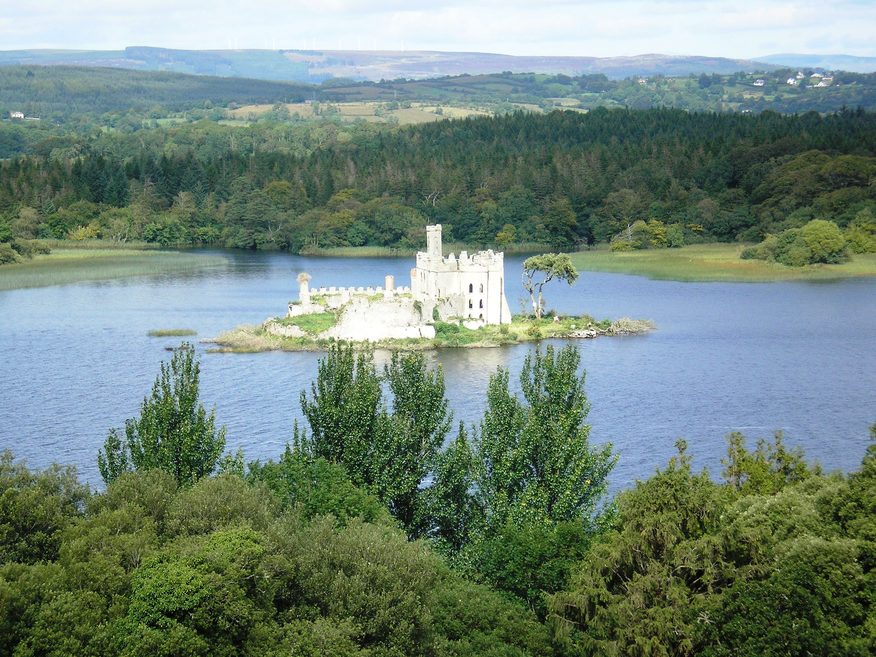
| Castle Island | Also known locally as the Rock of Lough Key, at the time of Griffith's Valuation Viscount Lorton's estate owned a house on Castle Island valued at £14. The original building on the island was a medieval stronghold of the McDermott family to which additions were made in the early 19th century. Renovation work was taking place on these buildings in 2007. |
|
| Ardcarn Glebe | At the time of Griffith's Valuation Viscount Lorton was leasing the Glebe House in Ardcarn parish to Rev. George Griffith when it was valued at £12. It is still extant and is part of a large farming enterprise. |
|
| Grevisk | At the time of Griffith's Valuation Thomas Phibbs Peyton was leasing a house at Grevisk, valued at £10, along with 100 acres, from Viscount Lorton's estate. The Census of 1749 recorded Grevisk as the home of John Nesbit. It is still extant. | |
| Knockvicar | At the time of Griffith's Valuation Charles J. Peyton was leasing a house at Knockvicar, parish of Ardcarn, valued at £15 to Edward Jones. Lewis records the house as the seat of C.J. Peyton in 1837. In 1814 it was the seat of Randal Peyton. | |
| Oakport | Oakport was the home of the Reverend William French, fourth son of John French of French Park, in the early 18th century. At the time of Griffith's Valuation, Oakport House, the property of Thomas William Goff, is recorded as "unoccupied". A house is still extant at the site. | |
| Mount Erris | At the time of Griffith's Valuation William Duckworth was leasing this house valued at £26 from Viscount Lorton's estate. There is still an inhabited house at this site. |
|
| Tangier | Caleb Robertson is recorded as occupying the house known at the time of the first Ordnance Survey. He is noted as the immediate lessor at the time of Griffith's Valuation though the house was unocciped and valued at £28. Tangier House was occupied by Harward O'Farrell, a doctor, in the second half of the 19th century. His third son, Sir George Plunkett O'Farrell, was granted arms in 1909. A house is still extant at the site. | |
| The Warren | Caleb Robertson is recorded as the lessor of a property in the townland of Warren or Drum at the time of Griffith's Valuation. It was valued at £25 and leased to a Captain Butler. A house at this site is labelled The Warren on the 25-inch map of the 1890s and a house still exists there. | |
| Moylurg House | In 1837 Lewis records Moylurg house as the seat of the Dick family. Rev. William Robertson was leasing a property valued at £25 to John Johnston, at Clogher, parish of Eastersnow, at the time of Griffith's Valuation. This appears to be Moylurg House which is still extant. Moylurg was the home of Major Henry Taaffe Ferrall in the 1870s. |
|
| Cavelawn | Guy Lloyd was leasing a house at Faus valued at £10 to James Acheson at the time of Griffith's Valuation. The house at this site is labelled Cavelawn on the 25-inch Ordnance Survey map of the 1890s. A house is still extant at the site. | |
| Havarine Cottage | Anna Maria Fry was leasing a house valued at £11 from Lord Lorton's estate at Tullyvohaun, barony of Boyle, at the time of Griffith's Valuation. At the time of the first Ordnance Survey Havarine Cottage, at Tullyvohaun, was described as a ''gentleman's seat', the residence of Mrs. Fry. | |
| King House | King House was built between 1720-1740 by Sir Henry King. In 1786 Wilson wrote "the Earl of Kingston has a very fine house at Boyle, situated near the ruoins of an ancient abbey". Following a fire in 1788 the King family vacated the house and moved to Rockingham on the shores of Lough Key. King House was used as a military barracks until the 1960s. It is now in the ownership of Roscommon County Council and is open to the public. |
|
| Lough Key House | At the time of Griffith's Valuation, Alicia Peyton was leasing a house valued at £13 at Ballykeevican, barony of Boyle, from Viscount Lorton's estate. This property is now Lough Key House guesthouse. |
|
| Carrickard House | At the time of Griffith's Valuation, Charles Peyton was leasing a house at Keeloges, valued at £25, from Lord Lorton's estate. |
|
| Riversdale House | John R. French was leasing a house valued at £25 at Kilateasheen from the Ecclesiastical Commissioners at the time of Griffith's Valuation. There is no substantial house marked on the 1st edition OS map. This house is still extant and known as Riversdale House. |
|
| Croghan | At the time of Griffith's Valuation, Guy Lloyd was the occupier of the house at Croghan, valued at £40. In 1749 the Census of Elphin shows that J. Lloyd, spinster, lived there. Wilson also notes it as a seat of the Lloyd family in 1786. Croghan House is no longer extant but an extensive range of outbuildings remains. |
|
| Killukin Glebe/Killukin House | At the time of Griffith's Valuation, Archdeacon Henry Irwin was occupying the Glebe House in the parish of Killukin, valued at £11. This property is labelled Killukin House on the 25-inch Ordnance survey map of the 1890s. A house is still extant at the site. | |
| Cloverhill | At the time of Griffith's Valuation, Thomas Cox was leasing a house from the Lloyd estate at Bunreagh, barony of Boyle, valued at £10 . This property is labelled Cloverhill on the 25-inch map of the 1890s. A house and substantial farn are still extant at the site. | |
| Danesfort (Roscommon) | At the time of Griffith's Valuation, William Roycroft was leasing the house at Danesfort, valued at £12, from Miss M. O'Connor. In 1814 it was recorded as the seat of Gilbert Roycroft. Lewis also describes "Deansfort" as the seat of the Roycroft family in 1837. Keenehan and others state that the Roycroft house was demolished c.1890 and another house constructed on the site by the Duignan family. | |
| Hermitage | Lewis records the Lloyd family occupying a second house called Hermitage also located in the townland of Croghan. Buildings still exist at the site. | |
| Knockranny | At the time of Griffith's Valuation Knockranny House was leased by Joseph Bennett Little from the Tenison estate and was valued at £25. Lewis recorded the house as the seat of the Dodwell family. Knockranny is still extant but derelict. |
|
| Greyfield | At the time of Griffith's Valuation, Greyfield, barony of Boyle, was leased by Robert O'Donnell from the O'Reilly estate. It was valued at £10. Lewis also records Greyfield as the seat of the O'Donnell family in 1837. The original house is no longer extant. | |
| Cloongownagh | Thomas and Andrew Kirkwood had houses in this locality in 1814. Thomas resided at Hermitage and Andrew at Lakeview. At the time of Griffith's Valuation Andrew Kirkwood was occupying a property at Cloongownagh, barony of Boyle, valued at £13. Keenehan and others state that Cloongownagh House was built in 1690. It was occupied by the Kirkwood family until 1939 when Col. Moore Kirkwood sold the house and 109 acres. The house is still extant and occupied and is now part of a farm. | |
| Woodbrook House | Keenehan and others state that Woodbrook House was built around 1780 by the Phibbs family although there may have been an earlier house on the site. The Kirkwood family purchased the property sometime in the early nineteenth century. At the time of Griffith's Valuation Sarah Mary Kirkwood was leasing a house at Usna, barony of Boyle, valued at £14, from Robert H. Brewster French. From the 1890s-1911 Woodbrook was a very successful racing stables run by Colonel Tom Kirkwood. Life in the house in the post-WWI era has been made famous by the memoir ''Woodbrook'' written by the Scottish author David Thomson, a tutor to the daughters of the family. In 1946 over 50 acres of the estate was sold to the local golf club while the Land Commission subsequently divided the remainder. Woodbrook House is still extant. | |
| Springfield House | At the time of Griffith's Valuation, John Keogh was leasing a house at Cultycuneen, barony of Boyle, valued at £13, to Joseph Backhouse. Keenahan and others state that this house was built by the Backhouse family in the 1790s. It remained in the family until the mid twentieth century. It is still extant and has been recently refurbished. | |
| Carrowreagh | Richard O'Farrell Caddell was leasing a "herd's" house valued at £8, together with over 350 acres, at Carrowreagh, barony of Boyle, to Thomas Boylan, at the time of Griffith's Valuation. A house and farm are still extant at the site. Patrick Fox was leasing a mill property from the Caddell estate in the same townland. Some stone buildings remain at the site though the mill was described as "in ruins" on the 25-inch Ordnance Survey map of the 1890s. | |
| Finnor House | At the time of Griffith's Valuation, Richard O'Farrell Caddell was leasing a house valued at £8, at Finnor, barony of Boyle, to Michael Barrett. It s labelled "Finnor House" on the 25-inch Ordnance Survey map of the 1890s and a house still exists at the site. | |
| Portobello | At the time of Griffith's Valuation, John Stafford was leasing a property at Portobello valued at £13 from Lord Lorton's estate. In 1814 it had been the residence of Thomas Stafford who Lewis also recorded as resident there in 1837. | |
| Ryefield | At the time of Griffith's Valuation Andrew Cummins was leasing a house at Ryefield valued at £17 to John Dowd. It was occupied by John Cummins, agent to Nicholas Cummins at the time of the first Ordnance Survey. | |
| Hughestown | The seat of the Mulloy family is described as Hughestown but at the time of Griffith's Valuation the buildings at this location are described as "offices" and have a low valuation. C.M. Mulloy was resident at "Husetown"in 1749. Wilson refers to Hughes-town as the seat of Mr. Molloy in 1786. In 1814 Hughestown was the seat of Mulloy McDermott. | |
| Ellesmere | Harloe Powell was leasing a house valued at £18 at Ardcarn, barony of Boyle, from Viscount Lorton's estate, at the time of Griffith's Valuation. This house is still extant and occupied. |
|
| Lyonstown | At the time of the first Ordnance Survey a large ruin, said to have been the residence of the Lyons family, was in the possession of the O'Donnell of Greyfield estate. | |
| Abbey View House | Morgan Crofton, agent to Lord Lorton, was residing here at the time of the first Ordnance Survey. At the time of Griffith's Valuation it was occupied by Caleb Robertson and valued at £34. A house is still extant at Abbey View. |
|
| Kilmore House | Built by the Reverend Edward King, Bishop of Elphin circa 1630. Home of a branch of the Lawder family in the 18th century until the murder of James Lawder in 1779. The Auchmuty family resided at Kilmore in the 19th century. The demesne was named Aghaward on the first Ordnance Survey map. A large farm is still extant at the site. | |
| Coote Hall | In the seventeenth and eighteenth centuries Coote Hall was owned by the Coote family. The 4th and 5th Baronets, both named Charles, lived there and it was one of the houses O'Carolan visited and for whom he composed tunes. It was bought by Maurice O'Conor in the 18th century and later again by the Barton family. There is still an extant house at the site. |
|
| Mount Allen House/Lough Allen Cottage | Lewis records "Lough Allen Cottage" as the seat of Hugh McTernan in 1837. At the time of Griffith's Valuation, this townland was leased by Richard H. Gorghes from Arthur O'Conor. It included a house valued at £7 10s. This building is labelled Mount Allen House on the 25-inch Ordnance Survey map of the 1890s. | |
| Ballycummin | A house valued at £8 when occupied by Roderick J. Hanley, who held it from Laurence Murray, at the time of Griffith's Valuation. Described by Lewis in 1837 as the former seat of the Earl of Roscommon and at that time occupied by Lieutenant Rodrick J. Hanly. | |
| Cartron (King) | The home of the Waldron family in the 18th and early 19th centuries. Occupied by Gilbert Hogg in 1837. Valued at £10 and occupied by John B. Hogg at the time of Griffith's Valuation who held the house from Sir Gilbert King. A substantial farm is still extant at the site. | |
| Cloonteem | Described in 1837 by Lewis as "a handsome and newly erected lodge of the Marquess of Westmeath". The house was valued at £14 in the 1850s and was held by Lord Greville in fee. The buildings have disappeared by the time the 25-inch Ordnance Survey map was published in the 1890s. | |
| Charlestown House | In 1786 Wilson refers to Charlestown as the "the fine seat of Mr. King, most delightfully situated on the Shannon". The first Ordnance Survey map marks both Charlestown House and Charlestown Old House closeby at M984 976. Valued at £46 at the time of Griffith's Valuation. In 1894 Charlestown was the residence of Sir Gilbert King. The house is no longer extant but extensive estate architecture survives. |

|
| Fortview | At the time of Griffith's Valuation occupied by Erasmus Lloyd who held it from William Lloyd. This house is labelled Fortview on the 25-inch edition map of the 1890s. A house is still extant at the site. | |
| Dangan | Dangan Castle was one of the main residences of the O'Beirne clan but was badly decayed by the early 17th century. Dangan House was built nearby and was occupied by the O'Beirne family from the 17th to the 19th centuries. They held Dangan from the King family. Father Martin Coen writes that Dangan House in the parish of Kilmore was the birthplace of George J. P. Browne, Bishop of Galway in the 1830s. Patrick O'Beirne was the occupant in 1814 and 1837. It was the residence of Mathew Hanly at the time of Griffith's Valuation when the house was valued at £8. Farm buildings exist at the site. |
|
| Ashfort House | The home of John Lawder in 1814. Occupied by Hubert K. Waldron in 1837. At the time of Griffith's Valuation occupied by John Hamilton and held from Thomas Goff. Farm buildings exist at the site now. There was a second smaller house known as Ashfort Vale in the same demesne grounds. It is no longer extant. | |
| Tully Lodge | Built circa 1820, occupied by J. W. Kelly in 1837 and by Christopher Lawder in the 1850s who held the property in fee. It was valued at £20. Occupied by Samuel Russell in 1906. Another house marked as Lakeview was in the demesne grounds at the time of the first Ordnance Survey. In 1837 W. McDonnell was residing in Lakeview [M987 921] |
|
| Sallyfield | A Hanly home from at least 1749 but by the 1850s held by George Lawder in fee. It was described at this time as a steward's house with offices and a lodge, valued at £3. It is labelled on both the 1st and 25-inch edition Ordnance Survey Maps as Sallyfield. It is no longer extant. A house named Cottage was also in the townland of Lavagh at N005 895 on both maps. | |
| Smith Hill | Smithhill was in the demesne of The Palace at Elphin. It was the residence of the Reverend Oliver Jones, grandfather of Oliver Goldsmith, in the early 18th century. It was the home of Robert Jones Lloyd in the late 18th and early 19th century and of the Reverend John Lloyd in 1837. The house was unoccupied at the time of Griffith's Valuation when it was valued at £8 and held by Robert Lynch. The Ordnance Survey Field Name Books record that Goldsmith's father was born at Ardnagowna [or possibly Oliver himself, see http://en.wikipedia.org/wiki/Smith_Hill_(house)]. |
|
| Flanker House | The Walsh estate, including Drumsna House, was advertised for sale in the Landed Estates' Court in 1861. The sale notice describes the dwelling house as "handsome and commodious" with a large walled garden. At the time of Griffith's Valuation Mary Anne Walsh was leasing the house, valued at £22 from Josias Rowley. The accompanying map indicates that it was called Flanker House. In the 1870s several members of the Keogh family, with an address at Flanker House, Drumsna, held property in county Roscommon. |

|
| Holywell | Holywell was built in the 1790s. In the early nineteenth century it was leased from the St. George estate by the Dockery family who in turn leased it to the Munns family, doctors in Carrick-on-Shannon. It was later the home of the Kiernan family and is now a country guesthouse. |
|
| Cavetown | In 1786 Wilson notes Cavetown as the seat of the Rev. Dean Mahon and the Reverend Arthur Mahon resided there in 1814. At the time of the first Ordnance Survey a ''gentleman's seat of two stories'' is noted in Cavetown. Guy Lloyd is recorded as the proprietor. This may be the property, valued at £5, leased from the Lloyd estate by Geo. Laird at the time of Griffith's Valuation. There are buildings still extant at this site. |
|
| Rushfield | At the time of the first Ordnance Survey Mr. A. Irwin is noted as the occupier of one of two ''gentlemen's seats' at Tullyvohaun, barony of Boyle. In 1814 it was the residence of John Irwin. This property was valued at £8 and was occupied by William Phibbs at the time of Griffith's Valuation. A substantial farm still exists at the site. | |
| Rockville | Home of the Lloyd family in the 18th and 19th centuries. Valued at £45 in the 1850s. Sold in 1917 to George Frayne of Ballaghderreen. Demolished in the second half of the 20th century. |

|
| Rush Hill | Home of the Devenish family in the 18th and 19th centuries, held from Sir Gilbert King. Funding received from the Heritage Council in 2005 for the restoration of this house. http://www.iol.ie/~oldbuilders/oldbuilders/rushhill/rushhill_01.htm. A detailed history and account of ongoing improvements to Rush Hill can be found at the blog www.irishaesthete.com tagged as Rush Hill. |
|
| Lissadorn | Lissadorn was a Crofton home from the mid 17th century. It became a Lloyd home in the 18th century following the marriage of Catherine Crofton and John Yeadon Lloyd in 1786. By 1814 Joseph Healy was living at Lisadurn. Burke's ''Landed Gentry of Ireland'' (1904) records the second son of Walter Balfe of Heathfield as John Balfe of Lissadorn. J. Balfe was residing at Lissadorn in 1837. At the time of Griffith's Valuation, Bernard Balfe held Lissadorn, valued at £20, from Viscount Lorton. It is no longer extant. On the first Ordnance Survey map (1838) the demesne included a smaller house named Ryefield. |
|
| Cloonahee | Residence of Gilbert Conry in 1814 and of John Conroy esq in 1822. According to a note with the sale rental of 1853 the house was accidently burnt and a good farm house built as a replacement. The home of John Heague in the mid 19th century. Occupied by Richard Hague and valued at £40 in 1906. |
|
| Cloonfad | Home of the Browne family in the 18th and 19th centuries. | |
| Beech Abbey | Originally a Begg residence, Beech Abbey in the mid 1850s was occupied by William Acheson, who was the main tenant of the Babington lands in the parish of Aughrim. The house was only valued at £2.10 shillings. It appears to have fallen into ruin by the 1890s. | |
| Cartown | In 1783 Taylor and Skinner recorded Cartown, close to the town of Carrick-on-Shannon, as a seat of the Cunningham family and Wilson, writing in 1786, also refers to it as the seat of Mr. Cunningham. At the time of Griffith's Valuation George Church was in possession of a property in this townland, valued at £12, described as "unfinished". The house shown on the 25-inch Ordnance Survey map of the 1890s is substantially larger than the 18th century house. The house now at this site has had commercial premises attached to it but is still extant. |
|
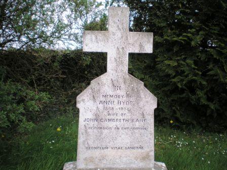
| Drumkilla or Mohill Glebe | At the time of Griffith's Valuation Rev. Arthur Hyde was leasing the Glebe at Drumkilla, valued at £22, from the Ecclesiastical Commissioners. | |
| Drumliffen Glebe | At the time of Griffith's Valuation Rev. Wm. Percy was leasing a property valued at £12 at Drumliffen Glebe, barony of Leitrim, from the Ecclesiastical Commissioners. The property is still extant and part of a farm. | |
| Hartley | At the time of Griffith's Valuations Charles St. George was leasing a house valued at £10 at Hartley, barony of Leitrim, to Robert Burns. It is unclear if this house has survived due to dense forestry and building of modern mansions. | |
| Glebe Mohill | At the time of Griffith's Valuation, Rev. Arthur Hyde was leasing the glebe house at Drumkilla, barony of Mohill from the Ecclesiastical Commissioners. It was then valued at £22. | |
| Holly Park (Leitrim) | In 1786 Wilson refers to a house close to Leitrim village as the seat of William Houghton. He may be referring to the house named on the 1st edition Ordnance Survey map as Holly Park. At the time of Griffith's Valuation Francis La Touche was leasing this property, valued at £4, at Tullylannan, to Edgar Macklin. Extensive redevelopment has taken place in this area | |
| Lisnanuran | Occupied by Robert Burns at the time of Griffith's Valuation and held from Arthur F. Lloyd. | |
| Lowfield | A Lawder home in the 18th and early 19th centuries. Occupied by John B. Hogg at the time of Griffith's Valuation who held it from Sir John Gilbert. The house was valued at £2. It is not visible on the 25-inch map of the 1890s. | |
| Clogher | Built post 1838, home of William Parks at the time of Griffith's Valuation and valued at £7. Thomas H. Parke was born at Clogher in 1857. He became a surgeon in the British Army and was with Stanley in Africa. Clogher was purchased by the Collins family from the Parkes in 1910. | |
| Drum Lodge | One of the many surviving gatelodges on the Rockingham Demesne. |
|
| Belmont | At the time of Griffith's Valuation Mary Anne Walsh was leasing a property valued at £17 to Hugh Byrne at Drumsna, barony of Leitrim. In June 1883 Gerald F. Walsh offered for sale the property in Drumsna known as Belmont. Modern housing now occupies the site. | |
| Gallowshill | A house built for the St George family at the end of the eighteenth century but used as a hospital for the Carrick-on-Shannon area until the 1940s. |
|
| Cloontykilla Castle | This building was constructed after the publication of the first Ordnance Survey Map. It appears to have functioned as a shooting/fishing lodge for the King estate. It is now a ruin. |
|