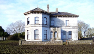
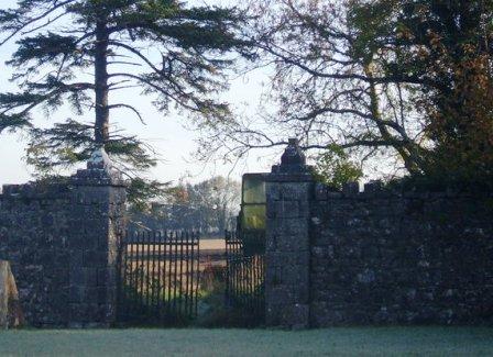
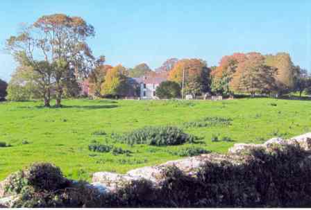
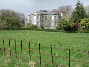
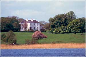
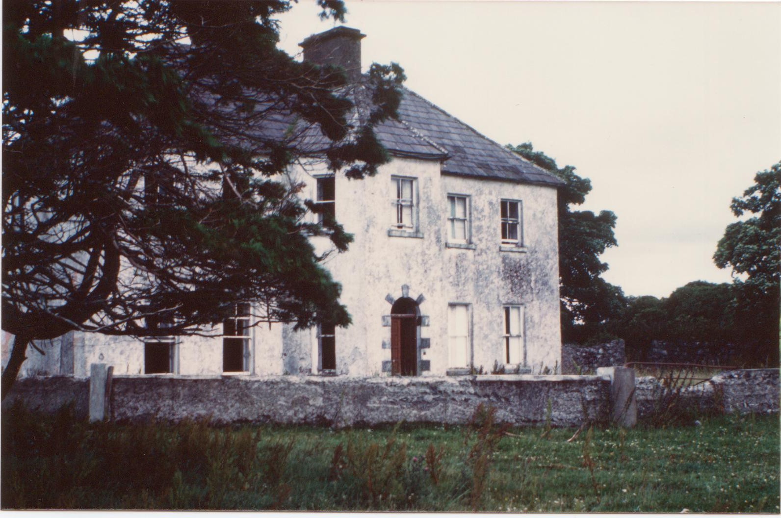
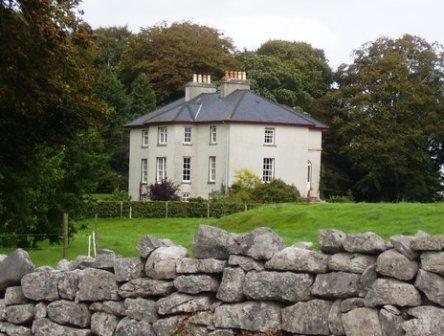
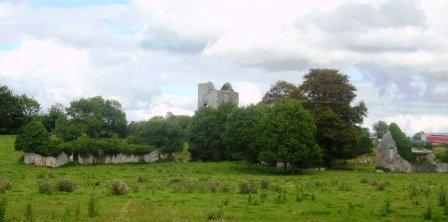
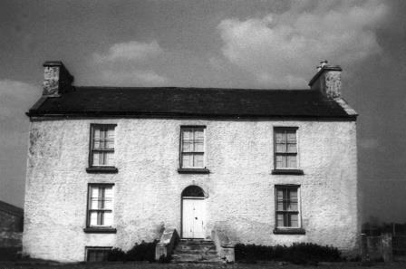
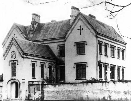
Kilroe
Houses within 10km of this house
Displaying 27 houses.
Houses within 10km of Kilroe
Displaying 27 houses.
| House name | Description | |
|---|---|---|
| Moyne Lodge | Moyne Lodge was occupied by the Golding family in the early part of the 19th century and by Martin Kirwan Blake before the sale in 1852. The house is no longer extant but some stone walls are still evident with the old castle to the right. |
|
| Ross Lodge | Occupied by Anthony Blake in the second decade of the 19th century and by Walter John Blake in the 1830s. It was leased by Walter Blake from Anthony Blake at the time of Griffith's Valuation, when it was valued at almost £9. Named as Ross Lodge on the first edition Ordnance Survey Map the house seems to gone by the time of the 25-inch map in the 1890s. This may be the property referred to by Wilson in 1786 as "The Lodge, beautiful seat"of a Mr. Shaw. | |
| Ower | In 1786, Wilson refers to "Aur" as the seat of Mr. Burke. The Ordnance Survey Name Books record John Burke as the owner in the 1830s. At the time of Griffith's Valuation, Joseph Burke held this property in fee when it was valued at £13. It was leased to Colonel Beddington in the 1920s and is now a ruin. |
|
| Winterfield House | Described in the 1830s as a neat 2 storied house, the home of Captain Butler. It was held in fee by John Butler at the time of Griffith's Valuation, when it was valued at £15. It is no longer extant. | |
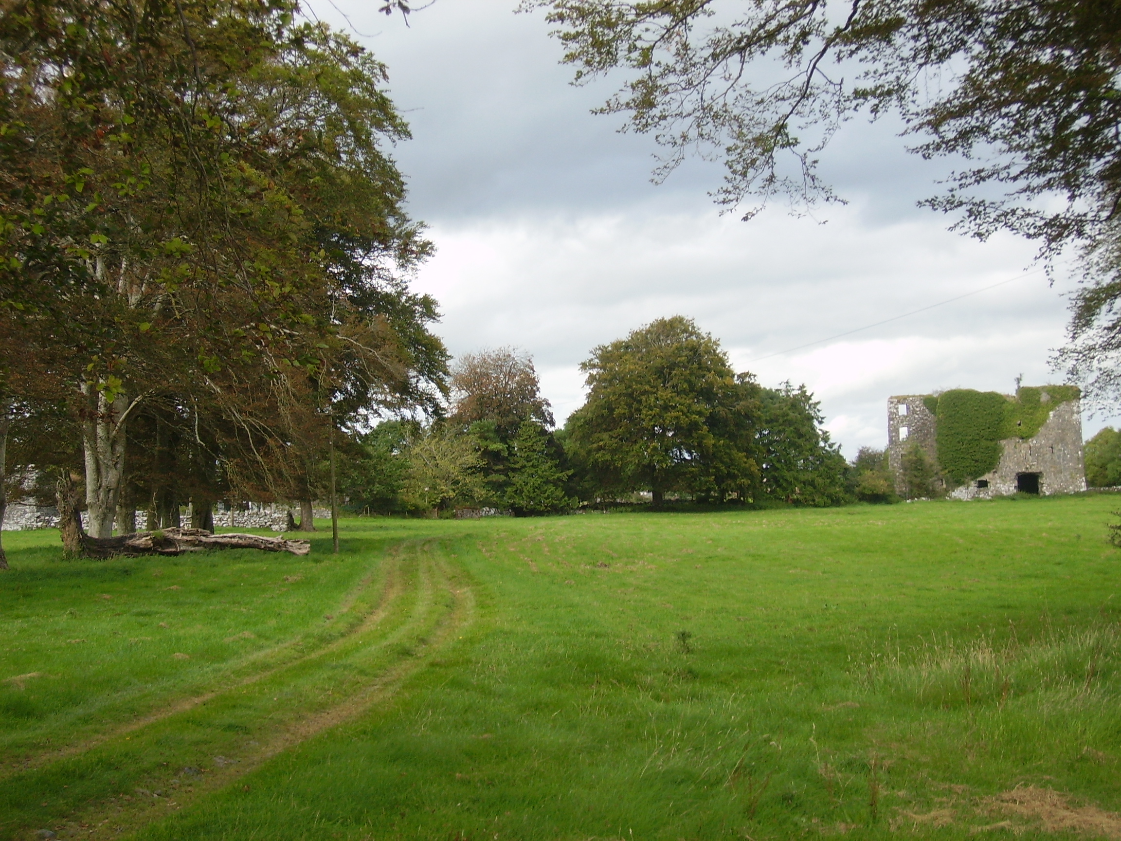
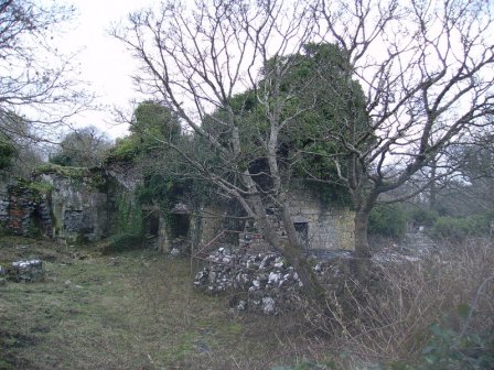
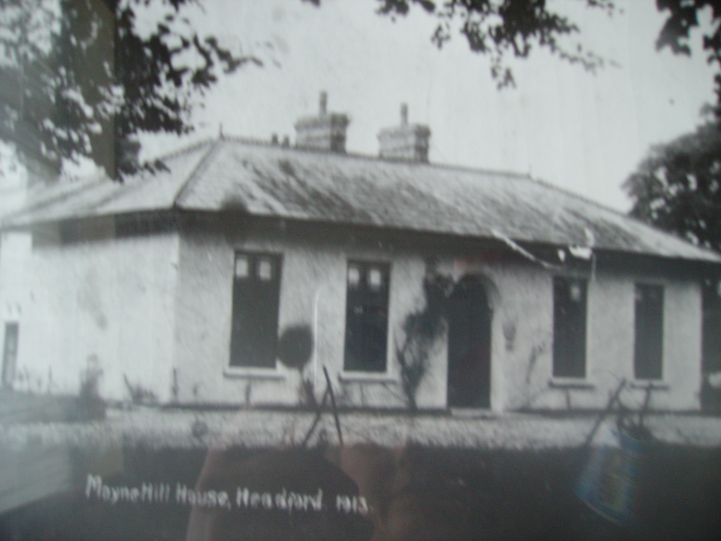
| Moyne Hill | Hughes writes that a Captain Carter bought Moyne Hill in 1852 from Charles Blake of Merlin Park. By 1906 James McDonnell was occupying the house. Soon afterwards it became the home of Thomas McDonagh of Headford Castle and his descendants still live there. The original house was knocked down circa 1950 and replaced by a modern bungalow. The original entrance gates and farm buildings are extant. |
|
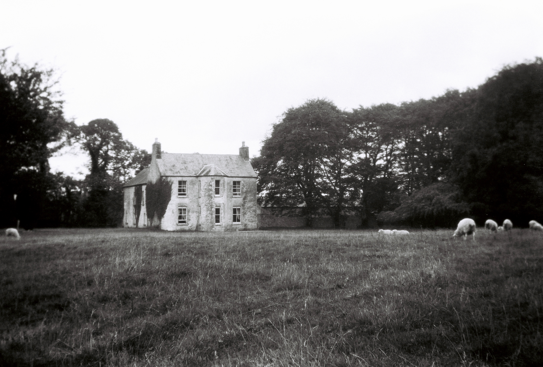
| Thomastown | At the time of Griffith's Valuation, Thomastown House, barony of Clare, was occupied by James Clarke and valued at over £10. The National Inventory of Architectural Heritage indicates that this is a two-phase house, the original part dating from the early eighteenth century. It is still extant and occupied. |
|
| Mossfort | A house labelled Caherakeeny is shown here on the First ediiton Ordnance Survey map. It was valued at £12 and occupied by John Kilkelly at the time of Griffith's Valuation. The present house was constructed in the late nineteenth century and is labelled Mossfort on the 25-inch Ordnance Survey map of the 1890s. |
|
| Castlehacket | Castlehacket takes its name from the Hackett family who owned the land in the 14th century. An early 18th century house was built by the Kirwan family and lived in by their descendants until 1985. Wilson mentions it as the seat of John Kirwan in 1786. It was held in fee by Denis Kirwan at the time of Griffith's Valuation when it was valued at £40. Referred to as the seat of Bernard Percy Broderick by Slater in 1894. The original house of 3 storeys was burnt in 1923 and rebuilt at the end of the 1920s as a 2 storey house. The house has had a number of owners in the past 20 years. |
|
| Cahermorris | Occupied by Cecil Crampton in the mid 19th century. Two generations of Cramptons were rectors of Headford in the 18th century. A house still exists at the site as well as a fine entrance gateway. |
|
| Dennistown House | Built post 1838, occupied by Hugh Craven at the time of Griffith's Valuation and a centre for the Agricultural Institute in the late 20th century. | |
| Dalysfort | At the time of Griffith's Valuation the townland of Cahernaheeny belonged to James Maitland Kirwan, a member of the Kirwan of Dalgan family. It was leased by John Fitzgerald who was occupying Dalysfort House, then valued at £5. A house still occupies the site. | |
| Cregg Castle | Built in the mid 17th century, the home of the Kirwans until the early 19th century. In 1786 Wilson mentions that it was the last castle to be built in county Galway and that it had lately been remodelled by Mr. Kirwan. Later occupied by a branch of the Blake family. It was held in fee by Francis Blake at the time of Griffith's Valuation, when it was valued at £40. Slater notes it as the residence of Mrs. Blake in 1894. Sold by the Blakes in 1947 to the Johnstons, who made alterations and restored it. Bought by the Murrays in the early 1970s, who ran it as a guest house. Sold again in 2006. |
|
| Baunmore | Held in fee by Richard Kirwan at the time of Griffith's Valuation when it was valued at £7. The house was extended and enlarged towards the end of the nineteenth century. It as well as yard buildings, gates and walls still remain. |
|
| Waterdale | This was originally a Staunton property which passed by marriage to the Lamberts. In 1786 Wilson refers to it as the seat of Mr. Staunton. The OS Name Books record it as the property of James Blake in the 1830s. Sold to Lord Clanmorris briefly in the 1850s and repurchased by James Staunton Lambert, Waterdale was leased to John Wilson Lynch 1857-1870 and to James Delahunt 1870-1883. It was taken over by the Land Commission in 1903 and demolished. |

|
| Carrowbeg House | A former Bodkin house, the home of the Lynch family in the second half of the 19th century and early part of the 20th century. It was held in fee by Dominick Lynch at the time of Griffith's Valuation when it was valued at £8. It is still extant and in use. |
|
| Clydagh | Built in the early 1820s close to the shore of Lough Corrib, a residence of the Lynch Stauntons until the early 20th century and still occupied. IN 1894 Slater noted it as a seat of B. O'Neill Power. |
|
| Lisdonagh | An O'Flaherty home, built in the late 18th century, sold to the O'Mahonys in the late 19th century and passed by marriage to the Palmers. Now functions as a guest house run by John and Finola Cook. http://www.irelands-blue-book.ie/lisdonagh.htm |
|
| Caherhugh | Occupied by John Lynch in 1814, by Mrs Martin in the 1830s and by Michael Cullinane at the time of Griffith's Valuation. The home of Mark Killilea (Member of the European Parliament) in the 1970s. The house no longer exists but a walled garden is still extant. |
|
| Mirehill | Home of Thomas Redington in 1814, Stepney St George in the 1820s and occupied by Michael Kelly in the 1850s, when it was valued at £4 and by Stephen R. Roche in 1906. It is no longer extant. | |
| Annaghdown | A house at this site on the First Edition Ordnance map is labelled Annaghdown House. The current house was built in 1868 by the Blake family It is still occupied and well maintained. |
|
| Ballinduff Lodge | A Skerrett home in the 18th and 19th centuries. It is labelled Ballinduff Lodge on the Ordnance Survey maps though the 25-inch edition of the 1890s notes that it was in ruins by then. At the time of Griffith's Valuation John Skerrett held the lands in fee when the house was only valued at £2. The old castle stands close by the house ruins. |
|
| Newgarden | The home of Edward Burton, Rector of Annaghdown and Vicar General of Tuam in the latter part of the 18th century. Occupied by Mrs Smith in 1814, in the 1830s by Roderick O'Connor and in the 1850s by Richard Jennings. In the Ordnance Survey Name Books it is decribed as a pretty lodge, the residence of the proprietor Lieutenant Daniel Smith. A modern house and some old farm buildings are still visible at the site. |
|
| Headford Castle | Richard J. Mansergh St George built Headford Castle in the early 19th century. In 1836 Robert Graham referred to an Elizabethan house 'just built', the architect was George Papworth. At the time of Griffith's Valuation it was held in fee by Richard M. St. George and valued at almost £46. Slater noted it as the seat of Thomas McDonagh in 1894. It burnt down in 1906. |
|
| Ballynalacka Lodge | In the sale rental of 1852 there is reference to the erection of a shooting lodge at Ballynalacka by the 'late proprietor' and a building named Ballynalacka Lodge appears in this townland on the 1st edition Ordnance Survey Map. It is labelled as "in ruins" on the 25-inch Ordnance Survey map of the 1890s. | |
| Woodpark | Described in the sale rental of 1879 as "a good house, with stables, a walled garden, walled orchard and a park around the house which stands on an elevated site affording a fine view of lake scenery". Peter Newell was occupying the house, then valued at £4, at the time of Griffith's Valuation. It is now a ruin. |
|
| Carrownacroagh | Home of William Skerrett in the 1830s. By the time of Griffith's Valuation, the townland was in the possession of Dominick O'Flaherty but there was no house with a valuation greater than £2. |
|
| Lodge (Headford) | In 1786 Wilson refers to Lodge as the seat of Mr. Shaw. A well laid out demesne, on which there is a small building, is depicted on the 1st edition Ordnance Survey map. The townland was in the possession of the St. George estate at the time of Griffith's Valuation but the only house was valued at 15s. |