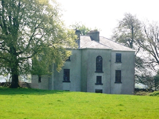
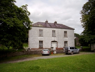
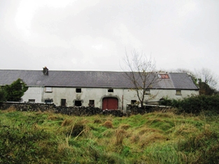
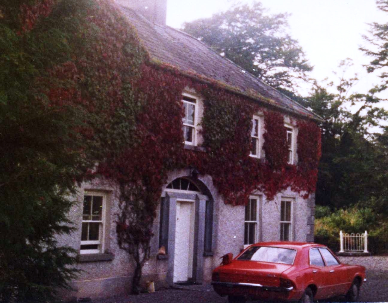
Dartfield
Houses within 10km of this house
Displaying 42 houses.
Houses within 10km of Dartfield
Displaying 42 houses.
| House name | Description | |
|---|---|---|
| Masonbrook | Masonbrook was originally the seat of the Mason family but was later bought by the Smyth estate. At the time of Griffith's Valuation it was occupied by James Smyth and was valued at £60. It is recorded in the Valuation and the 1906 report on Untenanted Demesnes as located in the townland of Moanmore East but is shown in the townland of Masonbrook on the 1st edition OS Map of 1842. In 1906 it was valued at £60. It is not shown on the 25-inch edition Ordnance Survey map and is no longer extant. |

|
| Benmore | In 1778 this was a Daly property and in 1786, Wilson also refers to it as the seat of Mr. Daly. In 1824 Mr. O'Connor was listed as a non-resident proprietor in county Galway. The OS Name Books record the proprietor of Benmore as Hugh O'Connor with a Mr. Dowdall acting as his agent in the 1830s. In 1855 Valentine O'Connor Blake was leasing 584 acres and buildings valued at £8 in the townland of Benmore, parish of Grange, barony of Loughrea, to Denis Deely. The original house does not appear to be extant. | |
| Lynchfort House | Martin J. Lynch was occupying this house at the time of Griffith's Valuation when it was valued at £10. Lynchfort House is still extant and in good condition though it is not clear if it is continuously occupied. |
|
| Abbeyville | At the time of Griffith's Valuation this property was held in fee by Thomas H. Pilkington and valued at £7. It is still extant. |
|
| Glenville | The Earl of Clancarty was leasing a house valued at £12 in Cahercrea East to Margaret Daly in 1855. This house is still extant and now known as Glenville. In the adjoining townland of Ballycoony Clancarty was leasing a house valued at £4 as well as 118 acres to John Hardy. |
|
| Woodmount House (Loughrea) | The 1st edition OS map indicates Woodmount House at Knockadikeen, barony of Loughrea. At the time of Griffith's Valuation James Smyth was leasing this townland from the Clanricarde estate. The property included a herds' and labourers' houses valued at £2. | |
| Ballybroder | In 1814 Ballybroder was the seat of Henry Burke. Ballybroder was recorded as the property of Mr. Burke in the 1830s. In 1855 Patrick Burke was leasing the house at Ballybroder from Peter Dolphin. In 1906 Eleanor M. Burke is recorded as the owner when the house was valued at £10. The house at Ballybroder is still extant and in reasonable repair but unoccupied. |
|
| Danesfort (Loughrea) | On the first edition Ordnance Survey map this house is labelled Lisduff House but on the 25-inch edition of the 1890s it has become known as Danesfort. In the mid 19th century it belonged to a branch of the Dolphin family of Turoe. By the early 20th century Danesfort was inherited through marriage by the Tighes of The Heath, near Ballinrobe, county Mayo and in 1906 was the property of Robert Dolphin Tighe when it was valued at almost £16. It is no longer extant. |
|
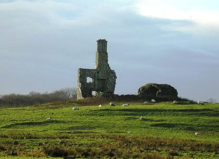
| Wallscourt | Wallscourt House is described as "in ruins" on the 1st edition 6" OS map. Very little now remains of it except for one chimney. |
|
| Tooloobaun House | At the time of Griffith's Valuation, Henry Hudson was leasing this house, then valued at almost £4, from John R. Hudson/Hodson. It is not shown on the later 25-inch Ordnance Survey map of the 1890s. | |
| Rathville | At the time of Griffith's Valuation, John Blake was the holder of a property at Carrowreagh, barony of Athenry, valued at £10. Rathville House is still extant and occupied. In 2013 it was offered for sale. |
|
| Streamstown House(Tynagh) | Michael McDermott was the occupier of Streamstown House at the time of Griffith's Valuation when it was valued at £12. In 1783 Taylor and Skinner recorded a house at Ballindrimney as the seat of the Lambert family. The house is still standing but derelict. |

|
| Dalystown/Dalyston | Built for the Daly family in the mid-18th century it later became the seat of Charles O'Farrell. In 1906 it was valued at £50. It was stripped of its fittings in the early 1960s and is now a ruin. Crossbaun burial ground (M664116), located nearby, contains the mausoleum of Denis and Charlotte Bowes Daly. |
|
| Carrowkeel | James U. Burke was leasing the house at Carrowkeel from Charles Farrell at the time of Griffith's Valuation when it was valued at £9. In the 1830s the Ordnance Survey Name Books mention "a good dwelling and ornamental grounds" in the townland of Carrowkeel. It is still extant and occupied. |
|
| The Cottage | At the time of Griffith's Valuation, Patrick Trumple was leasing this house, in the townland of Cloonmain, parish of Killoran, from the Clonbrock estate. It is still extant and occupied. |
|
| Ballydugan | In 1786 Wilson refers to Ballydugan as the seat of William Burke. Rev. Michael Burke was the owner of Ballydugan at the time of Griffith's Valuation, when it was valued at £24. In 1906 Michael H. Burke owned the mansion house at Ballydoogan then valued at almost £27. It was burnt in 1922 but rebuilt, with modifications, in 1929. Much of the family and estate archives were destroyed in the fire of 1922. Ballydugan is still extant and occupied. |
|
| Rafarn House | At the time of Griffith's Valuation, Rafarn House was leased from the Clanricarde estate by Thomas Tully and was valued at £17 and was accompanied by over 400 acres. In 1814 it was recorded as the residence of Joseph Tully. It is still extant. |

|
| Cooleeney/Coolinny/Cooleeny | At the time of Griffith's Valuation this property was occupied by James Daly and was valued at £15. When offered for sale in February 1863 the house was occupied by Eleanor M. Lynch. In 1906 it was in the possession of John J. Smyth of Masonbrook and was valued at £20. Cooleeney is still extant and occupied. | |
| Brooklawn | Labelled Brooklawn House on both the First and 25-inch editions of the Ordnance Survey map though the buildings are slightly apart. In 1837 this house was the residence of a branch of the Blake family. At the time of Griffith's Valuation the house was leased to Michael McDermott by Thomas J. Blakely [sic]. It is no longer extant. | |
| Hollyhill | At the time of Griffith's Valuation Hollyhill house was the residence of Arthur Daly. Lewis recorded it as the seat of P. Kelly. In 1814 it was occupied by D. Shaughnessy. Michael J. Daly, owner of over 700 acres, was resident there in the 1870s. In 1906 it was owned by Denis B. Daly when it was valued at £9. It is still extant and occupied. | |
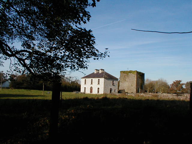
| Ballydonnellan Castle | At the time of Griffith's Valuation, Ballydonnellan Castle was occupied by John D. Mahon and was valued at £62. It was still extant in the 1890s but is described as "in ruins" on the 1933 edition of 6" map. These ruins are still visible. |
|
| Eastwell | In 1837 Lewis records Eastwell as the seat of C. Usher. At the time of Griffith's Valuation it was occupied by Christopher Usher and the buildings were valued at £79. By 1906 it was in the ownership of William A. Usher and was valued at £81. This house is no longer extant but extensive remains of stables, demesne and walled garden survive. |
|
| Rathglass | In 1814 Rathglass House was the residence of Bernard Rochford. In November 1850 Mark Lynch was occupying the house. At the time of Griffith's Valuation it was occupied by James M. Bourchier. It is still extant. |
|
| Killagh | Lands at Killaghmore and Clonecallin amounting to 635 acres were granted to Edmond Donnellan in 1684. Wilson refers to it as the seat of Mr. Donnellan in 1786. Stephen Donnellan was occupying the property at Killagh, valued at £33, at the time of Griffith's Valuation. In 1906 it was in the possession of Stephen J.R. Donnellan. It is no longer extant. |

|
| Grousehill House | Patrick Murphy was leasing 66 acres and buildings valued at over £1 from the Earl of Huntingdon's estate at Killeenadeema West, barony of Loughrea, at the time of Griffith's Valuation. This includes the property described as Grousehill House, in the same townland, on the 1st edition OS map. The house is not recorded on the later 25-inch map. A modern building exists at the site. | |
| Burkeville | Burkeville was offered for sale in the Encumbered estates court in July 1852. At the time, Maurice Bennett was the tenant of this "fine commodious dwelling house". At the time of Griffith's Valuation it was held by Nicholas Coolaghan and valued at almost £10. It was still in the possession of Nicholas Coolaghan in 1906. A house still exists at the site. | |
| Oatfield | Oatfield House, owned by John Longworth , was vacant at the time of Griffith's Valuation. Earlier, in 1837, Lewis had recorded it as the seat of Major Lynch even though this house had been in the possession of the Longworth family since at least 1814. The Ordnance Survey Field name books also record it as the residence of Major Lynch. In 1783 Taylor & Skinner and in 1786,Wilson, both recorded Oatfield as a property of the Brabazon family. By 1906 it was the property of Edward Longworth. The original house is not extant at the site now. |
|
| Ashbrook | In June 1854 William Kelly was recorded as the owner of the property at Ashbrook, formerly Bouilagh, parish of Killaan, barony of Kilconnell. At the time of Griffith's Valuation the house at Ashbrook, valued at £20, was the residence of Charles B. Lynch. It is no longer extant. | |
| Woodberry House (Kilconnell) | William Hemsworth was occupying this property, valued at £10, at the time of Griffith's Valuation when he was leasing it from Seymour Harrison. In 1894 Slater states that it was in the possession of Patrick J. Davy and he is also listed as the owner in 1906. . Earlier, in 1814, Leet noted it as the seat of Peter Daly. It is still extant and occupied. |
|
| Caraunbeg | Obadiah Holland was leasing a house valued at £8 and over 240 acres at Caraunbeg, parish of Killimordaly, barony of Kilconnell, from Lord Ashtown at the time of Griffith's Valuation. It is no longer extant. | |
| Caraunmore/Anneville | Rev. Joseph Seymour was leasing a house valued at £9 together with over 350 acres at Caraunmore, parish of Killimordaly, from the Ashtown estate at the time of Griffith's Valuation. This is possibly the house which Lewis records as Anneville, the seat of Rev. J. Seymore, in 1837. It is now a ruin. | |
| Lime Hill | Patrick Egan was leasing property valued at £13 including a mill and over 100 acres, at Limehill, barony of Leitrim, county Galway, at the time of Griffith's Valuation. This was part of the Clancarty estate. The house is labelled Limehill House on the 25-inch Ordnance Survey map of the 1890s. It is still extant. |
|
| Cartron (Duniry) | In 1906 Lawrence Egan owned a property valued at £5 at Cartron, barony of Leitrim, county Galway. Patrick Egan had held almost 200 acres here at the time of Griffith's Valuation but the buildings valuation at that time was less than £1. A house still occupies the site. | |
| Ballyargadaun | In 1906 Charles O'Farrell was the owner of a house valued at £4 at Ballyargadaun, barony of Leitrim, county Galway. This may be the gatelodge at the entrance to the Dalystown demesne or may be buildings associated with the plant nursery in the same townland. {Grid Reference is for gate lodge] | |
| Kylebrack | In 1906 Lord Clonbrock's estate held a property valued at £3 at Kylebrack West, barony of Leitrim, county Galway as well as over 100 acres of untenanted land. At the time of Griffith's Valuation, the townland was leased to tenants and this property appears to have been occupied by Michael Coleman. | |
| Abberanville | Abberanville House is descibed as "in ruins" on the 1st edition OS map. The townland, containing 24 acres, was part of John B. Daly's estate and was leased to John Blake when the buildings were valued at £15s. The ruins of a hemp factory were located nearby. There are no buildings at the site now. | |
| Curheen House | Sometimes known as Coorheen House. In 1786 Wilson refers to Curheen as the seat of Mr. Loftus. At the time of Griffith's Valuation, this was a small property occupied by Andrew Egan, leasing from the Clancarty estate and valued at £1 5s. Extended and enlarged sometime after this, by the 1890s it had become Curheen House, resided in by the Aitken family, agents for the Clancarty estate. Later the residence of the RC Bishop of Clonfert. |
|
| Newgrove House | In 1786 Wilson refers to Newgrove as the seat of Mr. Blake. At the time of Griffith's Valuation, the property is described as a care-takers house, and leased to John H. Blake by the Wallscourt estate. It is labelled Newgrove House on the 1st edition Ordnance Survey map but is described as "in ruins" on the later 25-inch map of the 1890s. | |
| Summerhill House (Loughrea) | In 1786 Wilson writes that Summerhill House, on the outskirts of Loughrea, was the seat of Mr. Persse. By the time of Griffith's Valuation in the 1850s, the property was occupied by Henry Dolpin, leasing from the Clanricarde estate, when it was valued at almost £8. Parts of the building have disappeared by the 1890s and the site is now part of a school. | |
| Mount Pleasant (Loughrea) | In 1786 Wilson writes that Mount Pleasant was the seat of Mr. Daly. At the time of Griffith's Valuation, the townland was in the possession of the Clanricarde estate but the only building with substantial valuation was the militia barracks. The house is no longer extant though the area is still known as Mountpleasant. |
|
| Cottage (Loughrea) | In 1786 Wilson refers to Cottage as the seat of Mr. Varo [?]. At the time of Griffith's Valuation, the property was leased by Bryan Rynn from the Clanricarde estate and valued at £4. The original house is no longer extant. | |
| Fortlands House (Loughrea) | In 1786 Wilson refers to a charter-school at Loughrea and this premises is labelled on the 1st edition Ordnance Survey map. However, by the time of Griffith's Valuation, it appears to have reverted to use as a house, leased by John Smyth from the Clanricarde estate and valued at £11. The house at this location is labelled Fortlands House on the 25-inch Ordnance survey map of the 1890s. A house is still extant at the site. |