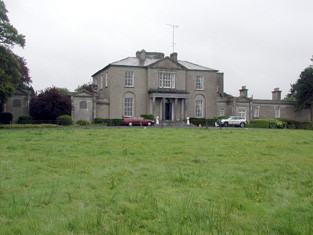
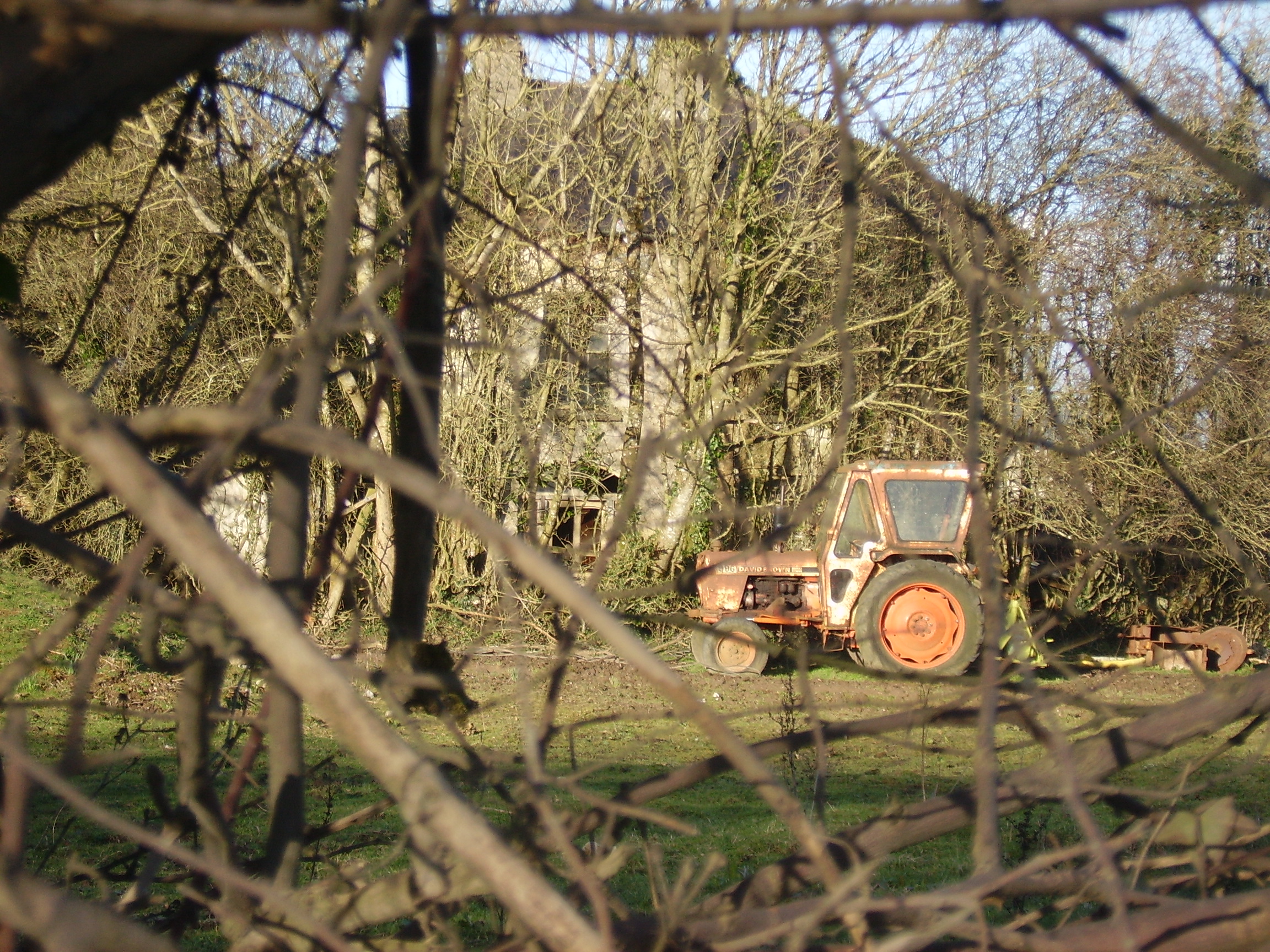
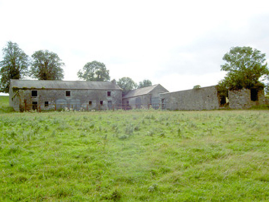
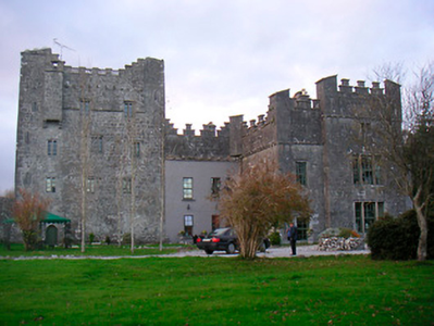
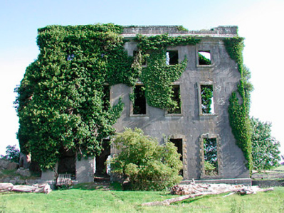
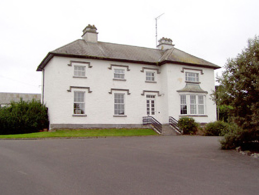
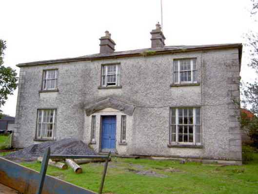
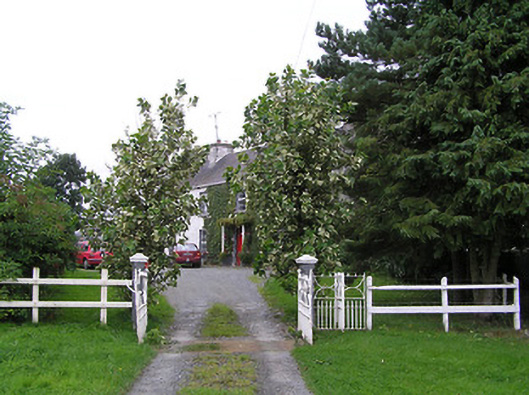
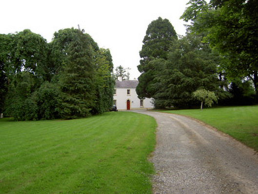
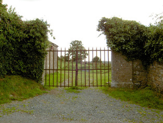
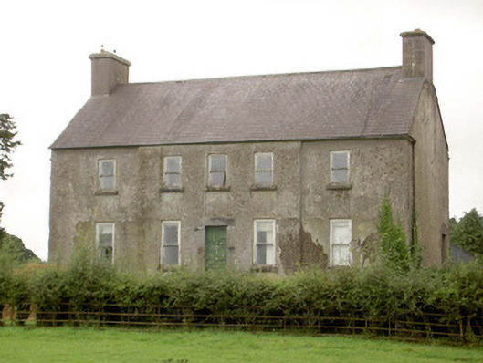
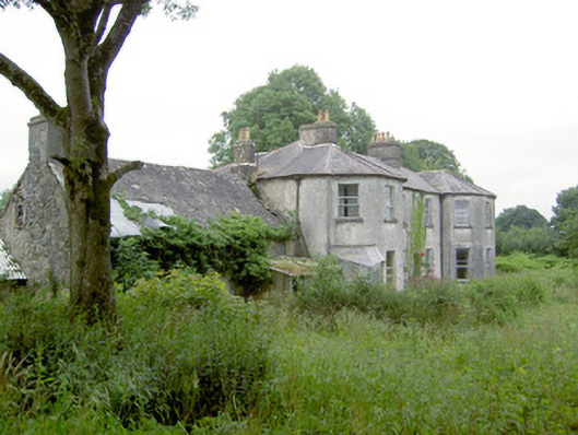
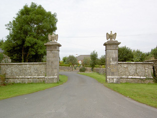
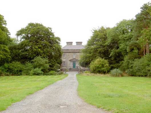
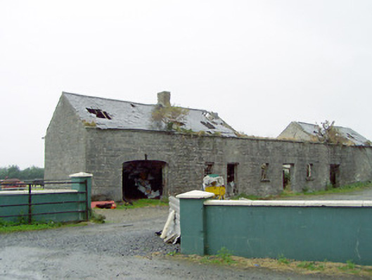
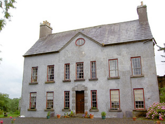
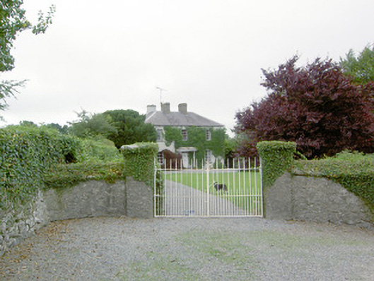
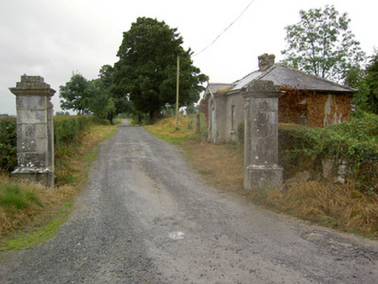
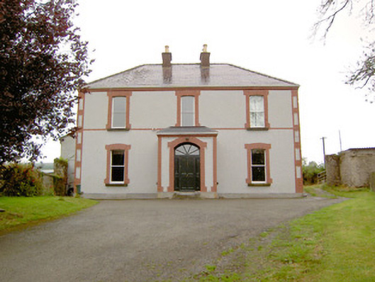
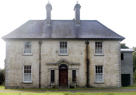
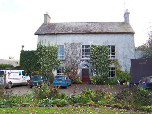
Newtown Parochial House
Houses within 15km of this house
Displaying 83 houses.
Houses within 15km of Newtown Parochial House
Displaying 83 houses.
| House name | Description | |
|---|---|---|
| Mote Park | The home of the Crofton family from the 17th century, valued at £140 in 1906. ''Saunders Newsletter'' dated 17 May 1865 refers to a fire at Mote Park which badly burnt the house. The house was demolished in the 1960s. Roscommon Golf Club occupies part of the original Mote Park demesne. |

|
| Carrowroe Park | The home of the Goff family in the 19th century. Described by Lewis as a substantial and handsome mansion of limestone with a Doric portico, the residence of R. Goff. In the 1850s occupied by the Reverend William Battersby, who held the property from the Earl of Essex. Reverend Battersby was married to Mary Maud Caulfield, a daughter of John Caulfield, Archdeacon of Kilmore. The house was valued at £65. By the 1870s the residence of John Burke and the seat of Lt-Col. Michael A. Burke in 1894. Still extant and offered for sale in 2008 (Irish Times, 5 June 2008). |
|
| Mountplunkett | Built in 1806 by George Plunkett and home of the Plunkett family until the mid 19th century when it became the property of Patrick Grehan. Described in the Crotty sale rental of 1851 as a 'superb mansion' repaired by Mr Crotty at a cost of upwards of £2,000. Grehan held the house, valued at £30, in fee, at the time of Griffith's Valuation. Samuel Richard Prosser lived in Mount Plunkett in the 1860s. The entrance gates are still in use but only walls remain of the house and outbuildings. Robert Adamson was apparently living at Mount Plunkett in the 1870s. |
|
| Ballymurray House | The Crofton family are originally recorded as 'of Ballymurray'. Ballymurray is the next townland east of Mote Demesne. A house at Ballymurray was occupied by Captain E. W. Kelly in 1837 and by Edmund Kelly in the 1850s, who held the house, valued at £9, from the representatives of James Daly. William Curtis was residing in Ballymurray in the 1870s. The property is labelled "Balymurray House" on the 25-inch Ordnance Survey map of the 1890s. It is no longer extant. | |
| Churchboro | Occupied by Edward Kelly in 1814, E. Kelly in 1837 and by Patrick Grehan at the time of Griffith's Valuation. The house is no longer extant. |

|
| Scregg | A Kelly home built in 1767, occupied by J.E. Kelly in 1837 and Eliza Kelly in the 1850s. In the sale rental of 1856 the house is described as a respectable mansion, 3 stories high with basement and attic stories and a view of the Shannon River. Occupied in 1906 by the representatives of Henry Potts. The house is extant but no longer lived in. It is currently (2009) being restored with support from the Irish Georgian Society, see http://www.igs.ie/Programmes/Conservation-Grants/Scregg-House.aspx |
|
| Moyvannan Castle | 16th century tower house with late 19th century extension. In the sale rental of the Domvile estate 1865 it is described as a handsome and commodious residence. In 1986 Moyvannan was restored by Don Panoz, Chairman of the Elan Corporation. |
|
| New Park | A Lyster home from the early 18th century, inherited by the Smyths of Barbaville through marriage. Held in fee and valued at £38 at the time of Griffith's Valuation. The home of Marcus Anthony Levinge in 1906. The house remained in Levinge hands until about the 1940s when the roof was removed. In the early 1970s the house was restored as a hotel by Paddy Kenny. |

|
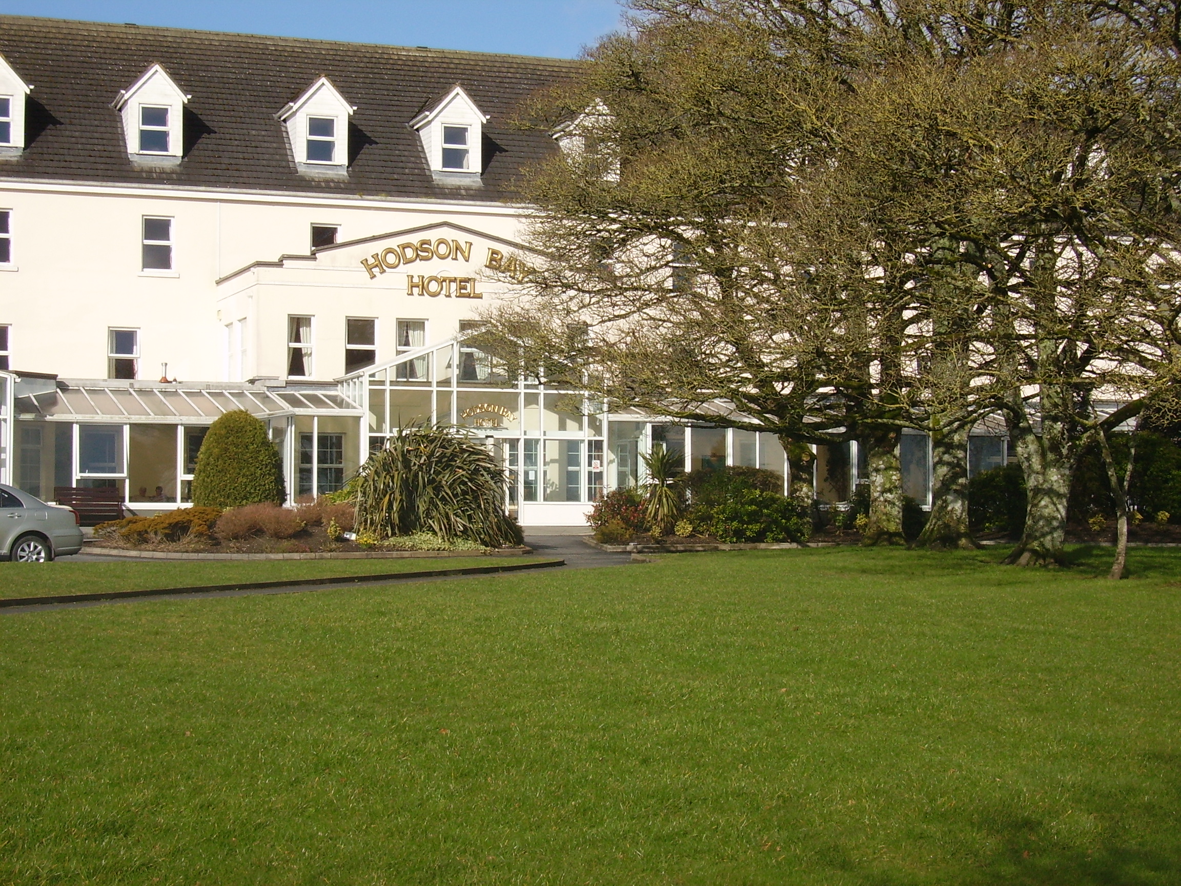
| Hodson Bay | The home of the Hodson family on the shore of Lough Ree. At the time of Griffith's Valuation occuppied by Leonard Hodson junior and Samuel Hodson, who held from the Court of Chancery. Now greatly expanded and functions as a hotel. |
|
| Kiltoom | Crofton Kelly bought or acquired the Kiltoom property where he built a house in the mid 18th century. Occupied by Thomas H. Strevens who held a number of townlands from Sarah Kelly at the time of Griffith's Valuation and left to him at her death. Kiltoom remained a Strevans home until the 1970s, now a derelict building. |
|
| Rockhill | Occupied by John Burne in 1814 and described as a tolerably good farmhouse at the time of the first Ordnance Survey. Occupied by E. Hodson in 1837 and by Thomas Wilson who held it from James Wilson in the 1850s. Thomas Wilson was still resident in the 1870s. |
|
| Sandfield House | Wilson notes this house as the seat of Mr. Sandys in 1786. The residence of Robert Sandes in 1814 and occupied by Bernard Reilly and valued at £3.10s at the time of Griffith's Valuation. A house is still extant at this location. | |
| Kellybrook | Wilson records this house as a Kelly residence in 1786. The seat of Denis Kelly in the 1830s and of Jane Kelly in the 1850s who held the property from Esther Dillon and the representatives of Maria Boswell. The house was valued at £3. Still occupied by a family named Kelly. |
|
| Carrownure House | In the mid 1850s valued at £20 and owned by Richard Bond in fee, who advertised it for sale in 1856. Described as a modern edifice on the shore of Lough Ree. The sale rental includes a lithograph. Bought by Bernard William Bagot in 1858 from Edward John Irwin. Sold by the Bagots to Samuel Auchmuty in 1903. Owned by the Auchmutys in the 20th century and known as Carnure House. |

|
| Galeybeg | Occupied by Mr Bart Purdue in 1814 and in the 1830s described as a gent's seat belonging to Mr Bond with a neat demesne attached. The sale rental of 1856 states that it was built by the Reverend James Bond. In the 1850s held by Richard Bond in fee from the Court of Chancery and described as a herd's house with office. The home of Benjamin Greene in 1906. Occupied until the late 20th century, now derelict. |
|
| Gort | A home of the O'Kellys in the mid 18th century. Occupied by "Doyle esquire" in 1778 and 1786 and by Simon J. Dowell in 1814. The house is labelled Gort on the 1st edition Ordnance Survey map but is not named on the 25-inch edition of the 1890s. The townland was in the possession of Elizabeth Dowell at the time of Griffith's Valuation when she was leasing a house valued at £4 10s to Michael Kelly. Some ruins exist at the site now. | |
| Johns Port | The residence of Maurice Hodson in 1814 and at the time of Griffith's Valuation held by John Hodson in fee. It is no longer extant. | |
| Johns Port House | At the time of Griffith's Valuation owned by Alexander Gunning in fee and valued at £10. Labelled Johnsport House on the 1st edition Ordnance Survey map and as St. John's House on the later 25-inch edition of the 1890s. It is still extant and offers guest accommodation. See www.stjohnshouse.biz. |

|
| Beechwood | A residence of the Hughes family in the 18th century. The sale rental of 1859 states that Beechwood was for many years the residence of the late Mr Ferrall. Daniel Ferrall of Beechwood was issued with a game licence in 1822. Occupied by Daniel Irwin in the 1850s when the house was valued at £40, by the Tolers in the 1880s and by Clare M. Nolan in 1906. Norton states that the Irwin brothers were nephews of Daniel Ferrall. Beechwood is no longer extant. |
|
| Ardmullan | Built post 1838 and described as a steward's house at the time of Griffith's Valuation when it was occupied by Thomas Pim junior who held it in fee. A mansion valued at £23 was still in the possession of Thomas Pim in 1906. The house no longer exists but some of the yard buildings remain. |
|
| Kilmore | Originally a Shaen property which passed by marriage to the Carters. A house and 4 acres were leased by Sir Arthur Shaen to William Hartly on 3 Aug 1706 (see sale rental 1855). In 1749, 1778 and 1786 it was occupied by the Waller family. The house was a ruin by the 1830s. | |
| Lisbride | Occupied by John B. Purdon in 1814 and in 1822 by Arthur Browne. Patrick Duignan was resident at the time of Griffith's Valuation, when the house was valued at £12. A house still exists at the site. | |
| Kilteeven House | Still occupied by the Mapothers in 1906, when the house was valued at £20. Some ruined buildings remain at this site. |
|
| Carrowmore | Carrowmore was occupied by John Davis at the time of Griffith's Valuation, when it was valued at £8 and leased from the Gunning estate. It is labelled Carrowmore House on the 25-inch Ordnance Survey map of the 1890s. A house still exists at the site. | |
| Ballagh | In 1814 James O'Connor was residing at Ballagh. Described as a good dwelling house at the time of the first Ordnance Survey. Occupied by Denis O'Conor in the 1850s, held from Theobald Dillon and valued at £6. In 1906 James D. O'Connor occupied Ballagh, valued at £17. It is no longer extant. | |
| Grove | This house, near Roscommon town, is named Bob's Grove on the Taylor and Skinner map, the residence of Ormsby esquire. Wilson also refers to it as the seat of Mr. Ormsby in 1786. Occupied by Christopher Davies in 1814. The house is labelled Grove on the1st and 25-inch edition Ordnance Survey maps. | |
| Ballagh | The residence of John Kelly in 1814. At the time of Griffith's Valuation, there is no house with a substantial valuation in the townland, which was the property of "Bernard Kelly, a minor, in chancery". | |
| Bawn House (Longford) | In 1837 Lewis described Bawn House as the property of Mr. Fox but the seat of Arthur Griffith. The Ordnance Survey Name Books note the occupant as Mr. Babington in the mid-1830s. John Daly was leasing the house from John S. Kirwan’s estate at the time of Griffiths Valuation in the early 1850s when it was valued at almost £19. In 1906 it was the property of Henry B. Armstrong and valued at £13. There is a ruin at the site. | |
| Mount Jessop | In 1837 Lewis referred to Mount Jessop as the seat of F. Jessop. At the time of Griffiths Valuation in the early 1850s it was leased by the representatives of Thomas Conroy to Henry Crawford, when it was valued at almost £19. This is the same valuation assigned to it by the original Valuation Office books in 1839 when the occupier was John Jessop. The National Built Heritage Service suggests it was demolished c.1980. A substantial stable block and other estate architecture survives. |
|
| Ladywell | Although much of the demesne of Harmony Hall is shown in the townland of Bunown on the first edition OS map, the house Ladywell was not built at this time. An elegant Italianate country house, six-bay two-storey over (partial) basement country house on L-shaped plan, built about 1845 to a design by Sandham Symes (1808-1894), for the Mahon Family (boi). In the mid-19th century Ross Mahon was the occupant holding the building valued at £37 in fee. Members of the Metge, Crofton, Williams and Flannery have all been occupants of this house. It has extensive views over Killinure Lough to the south. |
|
| The Lodge | The Lodge on Hare island was a hunting/fishing lodge built c 1814 for William Handcock, 1st Lord Castlemaine of Moydrum to designs by Sir Richard Morrison (1767 - 1849), having a veranda supported on cast-iron pillars to the entrance front (boi). In 1837 Lewis describes it as a ‘Beautiful cottage’ belonging to Lord Castlemaine. On Hare Island he engaged in fishing, shooting and boating on Lough Ree and hosted many social events on the island during the first half of the nineteenth century. In 1906 the buildings on Hare Island were valued at £18, occupied by Lord Castlemaine who held 110 acres of untenanted land there. It is now derelict. |
|
| Lough Ree Lodge | This lodge located on the eastern shore of Lough Ree, named on the first edition OS map, is a four-bay two-storey house, built c.1815, by a branch of the Handcock-Temple family of Waterstown House. It was the home of a Gustavus H. Temple, in 1837 and at the time of Griffith’s Valuation, when it was valued at £21. Later the home of the Daniels and Fagan families and still occupied. |
|
| St Marks | St Marks named on first edition OS map and on the 25 inch map, is now a ruin. It was the home of the Potts family, occupied by John Potts in 1814 and 1837 and by William Potts at the time of Griffith’s Valuation, when the building was valued at £16.10. O’Brien writes that in the 1860s the house came into the possession of the Magan family. The house was twice destroyed by fire . On the second occasion it was not rebuilt and the stables were converted into a residence. | |
| Killinure House | Killinure House located close to the eastern shore of Lough Ree is an early 19th century house originally constructed by a branch of the Murray Family. Occupied by Alexander Murray in 1814 and by Major General Murray in 1837. It was later the home of the Maunsell Family in the mid-to-late nineteenth-century. Members of the Brereton and Metge families were residents in the 20th century. It was later the home of the Reid family who opened it as a hotel. The Glasson Lakehouse hotel resort is located there now. |

|
| Portlick Castle | Portlick Three-bay four-storey late medieval tower house, built c.1500 by the Dillon family, with later seven-bay two-storey extension added to the southwest, c.1800, and a two-bay two-storey castellated block added to the southwest corner of this extension, c.1865 (boi). In 1696 granted to Thomas Keightly, a member of King William's privy council in Ireland who sold it to William Palmer of Dublin. About 1703 bought by the Smyth Family, who remained in ownership of Portlick Castle into the twentieth century. Valued at £26 and held by Robert Smyth in fee at the time of Griffith’s Valuation. A fire in 1861 damaged much of the building. Sold by a descendant of the Smyth family in 1955, the castle has been restored in recent times and has been used as a wedding venue. The Westmeath Independent reported the castle’s purchase by a family from California in January 2021. |
|
| Auburn | Auburn - Detached five-bay two-storey over raised basement house, built or rebuilt in the early 19th century (boi) This house takes its name from the Goldsmith Poem ‘The Deserted Village’, which was apparently inspired by the countryside surrounding this property where Goldsmith grew up as a boy. Auburn House was reputedly remodeled in the early nineteenth-century by John Hogan, whose father, a solicitor, acquired the property and estate from the Naper Family (of Loughcrew, Oldcastle, Co. Meath) in settlement of legal costs. J Hogan was the occupant in 1837. It was later sold to William Henry Daniel c.1848 and later to G.A.G. Adamson in 1864. In 1906 the buildings were valued at £34 and Charles G Adamson was the occupier. The Adamson family continued to reside at Auburn until about 1980. The house is now a ruin. |
|
| Cloonturk | At the time of Griffiths Valuation in the early 1850s, James Shaw was leasing this property for Richard Greville’s estate, when it was valued at £13 and included a mill. It is no longer extant | |
| Harmony Hall | O’Brien writes that Harmony hall was built in 1788 by Colonel William Caulfield, a member of a branch of the Caulfield family, Earls of Charlemont. In 1842, Colonel John Caulfield sold the house to Arthur Dunn Chaigneau and purchased Bloomfield House, Mullingar. Griffith’s Valuation records Chaigneau as the occupant and that the house was valued at £50. The National Inventory of Architectural Heritage states that the house was built by the Handcock Temple family. Occupied by Edward Molony Gleeson of the Athlone Woollen Mills in the 1880s. Occupied by the Fox, Wilson and Fitzsimons families in the 20th century. |
|
| Lackan Lodge | O’Brien writes of Walter Dillon living at Lackan in 1796. Lackan Lodge, valued at £14, was occupied by William Thomson in the mid-19th century. He held the property from the Dillons minors. A new building has been erected on this site. |
|
| Waterstown House | This Palladian style country house on rectangular plan, constructed c.1745 was designed by the German architect Richard Castle (1695-1751) for Gustavus Handcock and his wife Elizabeth Temple. It has important historical connections with the Temple-Handcock family, who were originally granted the lands around Waterstown as payment for services to the Crown during the Cromwellian Wars (boi). Robert Handcock Temple was resident in 1814 and 1837. Valued at £47 in the mid-19th century it was occupied by Robert Holmes. The buildings had increased in value to £61.15 in 1906. It remained within the Temple-Handcock family until mid-1923 when they sold the estate to the Land Commission. In 1928 the pedimented doorcase at Waterstown was removed and re-erected at Lissglassick House (Longford) and the house became a ruin in the 1930s. |
|
| Rathcline House | St. George Johnston was leasing this property from Colonel Henry White’s estate at the time of Griffiths Valuation in the early 1850s when it was valued at almost £38. Earlier, in 1837, Lewis referred to it as the seat of L. White. The National Built Heritage Service suggests the current house was built c.1820 though there is evidence to suggest there was an earlier house, also owned by the White family, at the site in the 1770s. Rathcline House served as a convent for the Sisters of Mercy in the mid-20th. It is still extant. |
|
| Danesfort (Moydow) | Reverend Francis Gregg was leasing this property from the Cooke estate at the time of Griffiths Valuation when it was valued at almost £21. In 1777 Taylor and Skinner had recorded the house at "Cranny" as the property of the West family. The house is labelled Danesfort on the 25-inch Ordnance Survey map of the early 20th century. It is still extant but derelict. |
|
| Gorteenboy | James Egan was leasing this property, which included a mill, from William Wilson’s estate at the time of Griffiths Valuation in the 1850s, when it was valued at £20. It is not shown on subsequent Ordnance Survey maps. | |
| Cordivin | At the time of Griffiths Valuation, Reverend Robert Moffett was leasing this property to James Ganley, when it was valued at £14 and included a mill. It is shown on the 1st edition Ordnance Survey map but does not appear on subsequent editions. | |
| Cloonta | Nicholas McGaver held this property in fee at the time of Griffiths Valuation in the 1850s, when it was valued at almost £12. The Ordnance Survey Name Books describe the property as a 'good farmhouse with trees and plantations' in the 1830s. The 1906 Untenanted Demesnes survey record a valuation of almost £12 when it was owned by Patrick McGaver. It is now ruinous. | |
| Middleton House | Michael Quinn held Middlton in fee at the time of Griffiths Valuation in the early 1850s, when it was valued at almost £13. In 1837 Lewis referred to Middleton as the seat of H. Montfort while in 1814 Leet notes it as the residence of W.B. Montfort. It is still extant. |
|
| Castlerea (Longford) | At the time of Griffiths Valuation in the early 1850s, John Bole was leasing Castlerea from the Kirwan estate, when it was valued at £15. In 1837 Lewis had noted Castlerea as the residence of Mrs. Bole. The Ordnance Survey Name Books suggest that the townland was the property of the Jessop estate in the 1830s. The 1906 Untenanted Demesnes report notes it as the property of Charles Webb with a valuation of £15. It is still extant. |
|
| Park Place | At the time of Griffiths Valuation in the 1850s, Ambrose Bole was leasing Park Place from the Jessop estate, when it was valued at over £27. The National Built Heritage Service dates the remaining walled garden evidence to the late 18th century and suggests that Park Place was the residence of the Moffat family. The Ordnance Survey Name Books of the 1830s note that the demesne was “cultivated by Mr. Robinson, the County Treasurer”. This is likely to be John Robinson, who, according to the Valuation Office Books, was the occupier in 1839, when the house was valued at £16. Family history sources suggest Ambrose Bole was a land agent, who managed the estates of the King-Harman and Shuldham families during the second half of the 19th century. Park Place was demolished in the 20th century but some estate architecture remains. |
|
| Newpark House (Rathcline) | Luke Bushe Fox held a property in fee here at the time of Griffiths Valuation in the early 1850s, with a valuation of almost £3. The original property in Newpark townland is labelled Newpark House on the 6” OS map. It appears to have become ruinous later. By the end of the 19th century Cordara House had been constructed at a different site in the same townland. It has since been demolished though some estate buildings remain at the site. In 1837 Lewis had recorded Newpark House as the seat of a Captain W.J. Davys. | |
| Rhynmount (Rinnmount) | Reverend G. Moore was leasing this property from George J. Mitchell at the time of Griffiths Valuation, when it was valued at £10. It is labelled Rinn Mount on the 1st edition Ordnance Survey map but as Rhynmount on the later 25-inch edition. A modern house exists at this site now. | |
| Glenmore (Moydow) | Noble Armstrong was leasing this property from the King Harman estate at the time of Griffiths Valuation, when it was valued at almost £12. Both Lewis in 1837 and Leet in 1814 referred to it as the seat of Newcomen Armstrong. It is extant but disused. |
|
| Moydow Glebe | In 1837 Lewis noted Moydow Glebe as the residence of Reverend Armstrong. At the time of Griffiths Valuation in the 1850s it was held in fee by Reverend William C. Armstrong when it was valued at over £20. The house is extant but disused. |
|
| Mosstown (Ballymahon) | At the time of Griffiths Valuation, in the 1850s, this property was leased by Arthur Kingston from the King-Harman estate. The property was valued at £30 with a mill valued at £50. Lewis referred to Mosstown as the seat of Arthur Kingston in 1837. Mosstown has been demolished but the ruins of the mill and some estate architecture remains. |
|
| Cormaglava House | William Lewis was leasing this property from William Montfort [Bond] at the time of Griffiths Valuation in the 1850s when it was valued at £12. The Ordnance Survey Name Books note that the townland was the property of Lady Rosse in the 1830s. A house is still extant at this site. | |
| Barnacor Mill | John Costello was leasing this property from Luke White’s estate at the time of Griffiths Valuation, when it was valued at £28. Some buildings still remain at the site. | |
| Knappoge House | Robert Wallace was listing this property from Colonel Henry White’s estate at the time of Griffiths Valuation in the early 1850s, when it was valued at over £10. A house is extant at the site but may not be original. | |
| Ledwithstown House | In 1837 Lewis referred to Ledwithstown House as the seat of W. Ledwith. Leet's Directory referred to it as the residence of Richard Dillon in 1814. By the time of Griffiths Valuation in the 1850s, it was held in fee by Edward Ledwith and valued at £15. The National Built Heritage Service suggests it was built c.1745 and was possibly designed by Richard Castle. It is still extant. In the 20th century it had become derelict but has been refurbished |
|
| Lislea House (Ballymahon) | Lislea House was leased by Elizabeth Bickerstaff from the Smyth estate at the time of Griffiths Valuation in the early 1850s, when it was valued at £12. In 1837 Lewis noted it as the seat of J.C. Bickerstaff. It is still extant. Datestones on the estate buildings suggest two phases of development at the site, in the 1820s and the 1860s. Elizabeth Bickerstaff was the owner of over 350 acres in County Longford in the 1870s |
|
| Ballyorney House | Ballyorney House is labelled on the 25-inch Ordnance Survey map of the early 20th century. At the time of Griffiths Valuation in the early 1850s, the house at this site was leased by John Boswell from Thomas Dennehy’s estate and was valued at £4. The National Built Heritage Service suggests the house at the site now was built in the 1880s. It is extant but derelict. |
|
| Cordara House | By the end of the 19th century Cordara House had been constructed at a different site in Newpark townland. It has since been demolished though some estate buildings remain at the site. |
|
| Ballymulvey House | John Shuldham was the owner of an extensive milling complex, valued at £35, at Ballymulvey at the time of Grffiths Valuation in the early 1850s. In 1837 Lewis had also referred to Ballymulvey as a seat of the Shuldham family. The property is labelled Ballymulvey House on the 1st edition OS map but “in ruins” on the 25” edition of the early 20th century when the woollen factory is located nearby. Some ruins of this complex remain at the site. | |
| Antely Cottage | A property labelled Antely Cottage is visible on the 25-inch OS map of the early 20th century. At the time of Griffiths Valuation, in the early 1850s, Robert de Ricci, MD, was leasing lands in this area from the Shuldham estate. The National Built Heritage Service suggests that Antely Cottage evolved from an earlier, possibly 1760s structure on the site. It is still extant and occupied. |
|
| Moygh House | John Shuldham held this property in fee at the time of Griffiths Valuation, when it was valued at £35. In 1837 Lewis referred to Moigh as the seat of M. Shuldham. It is labelled Moygh House on all OS editions. It is still extant. |
|
| Toneen | Captain Geoffrey Power was leasing this property from the Slator estate at the time of Griffiths Valuation in the early 1850s, when it was valued at over £13. In 1837 Lewis referred to “Towend” as the seat of “Jeffrey Keating Power”. The extant house at Toneen dates from the later 19th century. |
|
| Creevaghmore (Ballymahon) | Edwin Moore Sandys was leasing Creevaghmore House to William Hogan at the time of Griffiths Valuation in the early 1850s, when it was valued at £20. In 1837 Lewis referred to “Creevagh” as the seat of R. Sandys. Leet refers to 'Creevagh' as the seat of John Fetherston in 1814. Creevaghmore is still extant. The National Built Heritage Service suggests it was built in the mid 18th century. |
|
| Lisglassock House | At the time of Griffiths Valuation in the early 1850s, Grace Robinson held this property in fee when it was valued at almost £25. In 1837 Lewis referred to it as the seat of J.R. Robinson. The National Built Heritage Service suggests this house was built c.1810 and that it was associated with the Robinson family throughout the 18th and 19th centuries. In 1906 it owned by John Robinson. It is still extant. In recent years it has been sympathetically renovated and offers guest accommodation. |
|
| Corrabola House | Hugh Morrow was leasing this property from the Jessop estate at the time of Griffiths Valuation in the 1850s, when it was valued at £28. Lyons records the sale of the house and estate in the Landed Estates Court in 1861. The schedule notes that it had been built by Morrow about 20 years previously and provides a good description of the house and demesne. The interest was purchased by the Jessop estate. The sale notice includes a lithograph of the house. A painting of this house, attributed to Arthur Morrow, is held in a New Zealand collection, where members of the Morrow family emigrated to in the 1860s. This house later features as the address of Thomas Alder Cusack, a Dublin solicitor who managed the Jessop estate. |
|
| Doory Hall | Doory Hall was the residence of F.T. Jessop at the time of Griffiths Valuation in the 1850s, when it was valued at £50. The National Built Heritage Service suggests that the current ruined property dates from the 1820s but that it replaced an earlier dwelling at the site. In 1906 it was owned by Louisa Jessop and still valued at £50. The remains of a large number of ancillary estate buildings area also visible at the site. |
|
| Torboy House | Phillip McCutcheon was leasing Torboy from Colonel Palliser’s estate from at least the early 1840s, as shown in the Valuation Office House books. At the time of Griffiths Valuation in the early 1850s the house was valued at over £12. The Landed Estates Court sale notice of 1862 indicates Philip McCutcheon had renewed his lease on this property in 1848. Torboy House is still extant and occupied. |
|
| Monascallaghan House | This property was described as a herd’s house belonging to the Palliser estate at the time of Griffiths Valuation in the early 1850s, when it was valued at £2 5s. The Ordnance Survey Name Books noted that the townland was part of the Jessop estate. In 1906 it was the property of Dr. J. McCutcheon and valued at almost £3. A house is still extant at the site. | |
| Laurel Lodge (Ballymahon) | At the time of Griffith’s Valuation in the 1850s, the property at this site was described as a herd’s house with a value of £4. It was occupied by Edward Phillips, leasing from the King Harman estate. A larger house was later erected on the site and is still extant. |
|
| Laurel Lodge (Shrule) | Thomas Hussey was occupying this property at the time of Griffiths Valuation in the 1850s, when it was valued at just over £10. In 1838 the original Valuation Office books noted the occupant as Edward Nugent. The Ordnance Survey name books of the mid 1830s state that the townland was part of the Ledwith estate. The house is not named on the 1st edition OS map but is labelled Laurel Lodge on the 25” map of the early 20th century. It is now a ruin. | |
| Clooncallow House | Clooncallow House was occupied by Thomas Bredin at the time of Griffiths Valuation in the 1850s when it was valued at £12. He was also noted by the valuers as the occupier in 1840, though his name was spelt 'Braydon' at the time. Thomas Bradon is also recorded as a landholder in Clooncallow in the Tithe Applotment records in 1829. It is still extant and occupied. |
|
| Newcastle House (Ballymahon) | The extensive property at Newcastle was originally the seat of the Harman family, which came into the King family through marriage. In 1837 Lewis referred to it as the seat of the Dowager Countess of Ross. At the time of Griffiths Valuation in the 1850s it was the seat of Laurence King-Harman and was valued at £90. In 1906 it was owned by Col. W.H. King-Harman. It remained in the family until the twentieth century when it was sold to an order of religious sisters. In the later 20th century and again more recently it has functioned as a hotel. A Center Parcs resort is now located in an area of the former demesne. |
|
| Cartron House (Ballymahon) | At the time of Griffiths Valuation in the 1850s, Thomas Wright was leasing this property from the King Harman estate when it was valued at £10. In 1837 it was noted by Lewis as the seat of J. Wright. It is still extant. |
|
| Rathmore House (Ballymahon) | Robert C. Barbar was occupying this property, then valued at over £12, at the time of Griffiths Valuation. Lewis had also noted it as his seat in 1837. It was leased from the King Harman estate. This property was labelled Rathmore House on the 1st edition Ordnance Survey map but a later house (Grid Reference N150546) carries this label on the 25-inch edition of the early twentieth century. The latter is still extant. |
|
| Castlecore/Castlecor House (Ballymahon) | The National Built Heritage Service suggests that the original building at Castlecore was built as a hunting lodge in the mid 18th century by a member of the Harman family from Newcastle House. It underwent several changes and additions during the 19th century. Between the 1830s and the 1850s it was in the hands of Thomas Hussey and at the time of Griffiths Valuation, it was valued at £10. Hussey advertised it for sale in the Encumbered Estates Court in 1855, when it was described as 'of a peculiarly convenient construction, built about 50 years at a cost of £4000'. The 'Freeman's Journal' reported that it was sold for over £6000. By the 1870s it was the seat of John Bond. In 1906 Castlecore was owned by Emily C. Clarke and valued at £44 10s. It is named as Castlecor House on the 1st edition Ordnance Survey map but as Castlecore House on the later 25-inch edition. It is still extant. |
|
| Drumnacor House | At the time of Griffiths Valuation in the 1850s, John Bond held this property in fee when it was valued at £15. In 1837 Lewis had recorded Drumnacor as the residence of W. Sandys. In 1906 it was owned by John Bond’s representatives. The site is now occupied by a farmyard. | |
| Grillagh House | Edward Trelford was leasing a house and associated mill from Henry Montford Bond at Grillagh, in the parish of Killashee at the time of Griffiths Valuation, when it was valued at £10. The property is labelled Grillagh House on the 25-inch Ordnance Survey map of the early 20th century. The mill buildings, though derelict, are still extant. |
|
| Littletown House [Lodge] | William Magill was leasing this property from Joseph Manly at the time of Griffiths Valuation in the early 1850s when it was valued at almost £14. On the 1st edition Ordnance Survey map it appears to be located within the townland of Doonis but on the 25-inch edition of the early 20th century it seems to be within the townland of Cartroncroy. The house is labelled Littletown Lodge on the 1st edition map but as Littletown House on the 25-inch edition. It survived into the twentieth century but is no longer extant. In 1837 Lewis referred to Littleton Lodge as the seat of W. Lennox Napier. Another Littletown House is shown on the 1st edition Ordnance Survey map in the adjacent townland of Littletown [N096519] but this is described as 'in ruins' on the later map. William Magill of Littleton, Ballymahon was recorded as the owner of over 350 acres in County Longford in the 1870s. | |
| Annaville House | Francis Longworth was leasing this property from William Dawson at the time of Griffiths Valuation in the early 1850s, when it was valued at almost £14 and included a mill. On the 25-inch Ordnance Survey map of the early 20th century it is labelled Annaville House. A house is still extant at the site. | |
| Noughaval House (Ballymahon) | William Dawson was leasing this property from the King-Harman estate at the time of Griffiths Valuation in the early 1850s when it was valued at £13. Lewis also referred to it as his seat in 1837. The National Inventory of Architectural Heritage suggests it was built in 1760. O'Brien notes that there is a family tradition that the roof had to be replaced in the nineteenth century having been damaged during ''the Night of the Big Wind'' in 1839. Noughaval is still extant and occupied. |
|
| Lissaquill House | In 1837 Lewis referred to Lissaquill House as the seat of Harding Fetherstone. At the time of Griffiths Valuation in 1854 this property was occupied by John Hogan, leasing from O'Brien Dillons, when it was valued at £9. The Valuation Office Books of 1841 noted the house here as having a valuation of £10 and occupied by Harding Fetherstone. A house and farm are still extant at this location. |