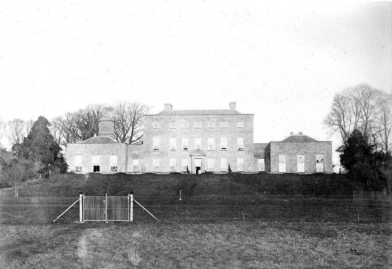
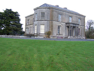
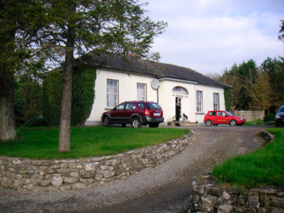
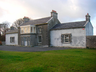
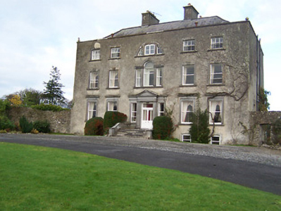
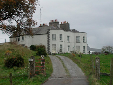
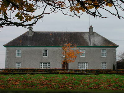
Glenown/Clonown
Houses within 15km of this house
Displaying 90 houses.
Houses within 15km of Glenown/Clonown
Displaying 90 houses.
| House name | Description | |
|---|---|---|
| Ballintober (Kilcumreragh) | Ballintober House is named on both the first edition OS map and the early 20th century 25 inch map, but no longer appears to be extant. In 1837 William Fetherstonhaugh was resident and in the mid-19th century it was the home of James Fetherston Haugh, held from Dorothea Horton and valued at £20. In the 1870s James Fetherstonhaugh of Ballintober owned 39 acres in county Westmeath. Ballintober was still in Fetherston Haugh occupation in 1901 but unoccupied by 1911. This was a branch of the Mosstown and Bracklyn Fetherstonhaugh family. | |
| Rosemount House/Oldcourt | Rose Mount House is also known as Old Court, both names appear on the OS maps. The village nearby is known as Rosemount. Described by buildings of Ireland as a well-balanced structure originally built by the Geoghegan Family in the late eighteenth-century, probably replacing an earlier house. Leet records John Pim occupying a house named Rosemount near Moate in 1814 and Lewis records Lady Nagle as the occupant in 1837. O’Brien writes that it was inherited by the Nugent family of Ballinacor through marriage. At the time of Griffith’s Valuation it was occupied by John J Nugent who held it from the representatives of Sir Richard Nagle. It was valued at £21.10. Still extant and occupied. |
|
| Coolatore | This house was not built at the time of the first edition OS survey. It was constructed about 1866 and was the home of members of the Upton family. In 1906 it was valued at £56, occupied by Henry N S Upton who held it with over 400 acres of untenanted land. According to the discover Ireland website it now provides self-catering accommodation. |

|
| Grouse Lodge | Grouse Lodge is named on both the first 6 inch and 25 inch OS maps. Described as a three-bay two-storey over basement country house with attic level, built c.1810 (boi), now in use as a residential recording studio. Grouse Lodge was built by a branch of the Fetherstonhaugh Family of Ardagh, County Longford and was occupied by Theodore Fetherston in 1814 and by William Fetherstonhaugh at the time of Griffith’s Valuation. The building valued at £24 was held from Edward Fetherstonhaugh, who was the occupant in 1837. It is still a family home. |

|
| Ballinderry | Detached four-bay two-storey country house, built about 1870, replacing an earlier house built by Sarah Kelly. The stable block appears to be 18th century. The estate was bought in 1840 by solicitor Edmond Kelly of Rookwood House, Co Roscommon, who also owned Kiltoom House, Athlone. At the time of Griffith’s Valuation (publ. 1854) Sarah Kelly was the occupant of the house valued at £19. She held it in fee. It was inherited by her nephew Robert Bailey whose descendants lived at Ballinderry until the mid-20th century when it was bought by the Land Commission. The house is extant. |
|
| Moate View | Moate View is situated on the outskirts of the town of Moate and predates much of the town. It is a detached five-bay two-storey house, built 1762, verified by a cut stone date stone inscribed ‘James Clibborn built this house anno domini 1762’. O’Brien writes that James Clibborn was the son of Joshua Clibborn and his wife Sarah Lecky. His second son William Cooper Clibborn inherited the house and was the occupant at the time of Griffith’s Valuation (publ. 1854) holding the building valued at £32 from Thomas H Mulock MP. It is still the home of Clibborn family members. |
|
| Bellanalack | Bellanalack is marked on the first edition OS map and the later 25 inch map but a much smaller building is now located on the site. The house was occupied by Christopher Adamson in 1837 and at the time of Griffith’s Valuation (publ. 1854). He held the property valued at £13 from Lord Castlemaine. | |
| Mount Temple House | Mount Temple House is marked on the first edition OS map, south of Holy Trinity Church and named on the 25 inch map. Leet records Richard Telford as resident at Mount Temple. At the time of Griffith’s Valuation (publ. 1854) Sarah Russell held the house and 182 acres from the Hon R T H Temple, the buildings were valued at £12. This house now provides accommodation for guests. See lodging-world.com/ei/hotels/mount-temple-house-in-moate-91944640. |
|
| Moate Castle | A complex structure, of at least three periods of construction, which dominates the centre of the town. It is a two-bay three-storey former fortified house/tower house, built 1550, having a three-bay three-storey wing to the west end, built c.1720 and a two-storey bowed extension to the east end, built c.1760, acquired by Captain John Clibborn in 1659 (boi). In 1814 Thomas C Clibborn occupied Moate-castle and in 1837 Moate Castle was the seat of Cuthbert J Clibborn. At the time of Griffith’s Valuation (publ. 1854) Gilbert Nugent was resident holding the property valued at £23 from the representatives of Cuthbert J Clibborn. Moate Castle has remained a private residence and was for sale in 2023. |
|
| Farnagh | Buildings are marked at this site on the first edition OS map and the house is named on the 25 inch map. It was built in the early 19th century and a Mr Benjamin Wynne was resident in 1814. The house was extended about 1850 according to the National Built Heritage Service. This house was the residence of R. Adamson in 1837 (Lewis) and of Hannah Wynne who held it from Edward Digges La Touche, valued at £14.5 at the time of Griffith’s Valuation (publ. 1854). Edward Wakefield, a ‘gentleman farmer’ and his family were resident in the early 20th century. This house remains a family home. |
|
| Moyvoughly | Moyvoughly named Moyvoughly Lodge on the first edition OS map and Moyvoughly House on the 25 inch map. O’Brien writes that this was originally Arabin land purchased towards the end of the 18th century by the Grogans. This house was constructed by 1837 as C Arabin was resident, who was probably leasing it from the Grogans. By the time of Griffith’s Valuation (publ. 1854) John Ennis had acquired the house and lands as he is recorded as holding the property in fee . O’Brien writes that he rented the house to William Dargan, the railway entrepreneur, who was building the Mullingar to Dublin railway line and that the land was used to graze and accommodate the horses used in this work. In the mid-1850s Moyvougly was leased to Thomas Maher who eventually purchased the estate. Bought by the Fallon family in the 20th century, the house is now demolished but some outbuildings and stables survive. |
|
| Umma or Emoe House | Umma or Emoe House is named on the first edition OS map. It was a Magan home from at least the early 18th century. Thomas Magan was resident in 1814. O’Brien writes that Francis Magan was the last family member to reside at Emoe. It was recorded as his seat in 1837. He died in 1841. At the time of Griffith’s Valuation (publ. 1854) James Hill Shaw held the house valued at £15 from George A Boyd. Another building with the same name is marked on the 25 inch map to the south east of the original house and is still extant (N198 453). This second house was built in 1900 (O’Brien) by the Shaw family. James Shaw of Ballymahon purchased the lands in 1875. Occupied by the Skelly family in the 20th century. | |
| Ballysallagh House | Ballysallagh house is not marked on first edition OS map. It is a three-bay two-storey late-Georgian-style farm house, built about 1850. At the time of Griffith’s Valuation (publ. 1854) it was occupied by Christina McCormick, who held the house valued at £11 from William Longworth. It is still in use as a residence. |
|
| Kill House | Kill house marked on first edition OS map and the 25 inch map is located a short distance west of Sonna. At the time of Griffith’s Valuation (publ. 1854) it was valued at £17, occupied by Maria McCormick and held from George Thompson. It appears to be still extant with courtyard outbuildings. | |
| Knocknacreeve House | A building is marked at this site on the first edition OS map and a building of a different shape named Knocknacreeve House on 25 inch map. Richard Ham occupied this house valued at £14 which he held from Robert Smith, at the time of Griffith’s Valuation (publ. 1854). It is now the centre of a farm complex of buildings. | |
| Sonna | Set in a substantial demesne as shown of the first edition OS map, the building is slightly altered in shape from this map to the 25 inch map. The house was a three-storey, seven-bay mid-18th century Palladian style mansion. It was the home of the Tuite family and remained as such until it was burnt in 1921. Described in 1837 by Lewis - ‘Sonna for upwards of six centuries, the seat of the Tuite family, is at present the residence of Hugh Morgan Tuite… the house is a light and elegant building, in a well planted demesne’. O’Brien gives a detailed account of the family. The estate consisting of 638 acres was sold to the Land Commission in 1928. See https://www.tuites1.com/424198848.html |
|
| Glencara House | This building is named Corr House on the first edition OS map but was later known as Glencarry or Glencara House. It was built for the Kelly family in the 1820s with later additions, c.1840. Glencarry was the residence of a J H Kelly in 1837 and of Robert Hume Kelly at the time of Griffith’s Valuation (publ. 1854) when the house was valued at £40 and held in fee. It remained in the possession of the Kelly family until Colonel Arthur Bellingham bought the house in the late 1930s. |
|
| Dalystown | Dalystown is marked on the first edition OS map and named on the 25 inch map. It is a detached three-bay two-storey house, built in the early 19th century. Valued at £12 at the time of Griffith’s Valuation (publ. 1854), occupied by Lewis Meares and held from John Rotton. |
|
| Hallstown House | Hallstown or Halston House is named on the first edition OS map. This house was built c.1760 and altered and extended c.1820 by Sir Richard Morrison for the Boyd Gamble family (O’Brien). It is a two-storey, three-bay house and was the home of a H. Boyd Gamble in 1837. At the time of Griffith’s Valuation (publ. 1854) Frederick Gambell held it from Captain H Boyd Gambell, when it was valued at £28. Various other occupants followed and the house and lands were sold to the Hon Kieran Guinness in 1980. |
|
| Washford House | Washford House is a five-bay single-storey house, built c.1845, with a shallow projecting porch to the centre. Valued at £20 and held by Captain H Boyd Gamble in fee at the time of Griffith’s Valuation (publ. 1854). |
|
| Darlington Lodge | Darlington Lodge, named on the first edition OS map, occupied by A McDonnell in 1837 and by John Malone and held from Captain H Boyd Gamble at the time of Griffith’s Valuation (publ. 1854) when valued at £18. O’Brien writes that it was possibly built as a dower house for Hallstown/Halston. The home of the Kenny family in recent times. | |
| Toberville House | Toberville House is named on the first edition OS map. At the time of Griffith’s Valuation (publ. 1854) it was occupied by Thomas Murtagh, valued at £12 and held from Captain H Boyd Gamble. A building is still located at this site. | |
| Jamestown House | Jamestown House was not built at the time of the first edition OS map. Situated on the main Mullingar to Athlone road the house, three-bay two-storey over basement house, was occupied by James Brabazon at the time of Griffith’s Valuation (publ. 1854) when the building was valued at £12 and held from Walter McK Bond. |
|
| Redmondstown | Redmondstown is named on the first edition OS map and 25 inch map. The National Built Heritage Service records that the main entrance was erected about 1800. In 1814 John Tisdall is recorded as resident. At the time of Griffith’s Valuation (publ. 1854) it was occupied by Frederick Hart who held the house valued at £10 from Jerome Tisdall. The house is now demolished. | |
| Jamestown Court | Jamestown Court is located to the north west of Castle Geoghegan. It is a three-bay two-storey over basement country house with six-bay single-storey over basement wings to either side (boi). It was originally built in 1740, the date is inscribed on a window opening but was substantially altered at a later date which may be why Lewis records it in 1837 as a ‘spacious and handsome castellated mansion of modern erection’. This house was the home of the Nagle family and the property was originally in the ownership of the McGeoghegan family who were direct ancestors of the Nagles. From the late 18th century Jamestown Court was the home of Sir Richard Nagle, Baronet. He also had connections with Donore Castle, near Horseleap, which he ‘restored’ in 1809. Jamestown Court was later the seat of Sir Richard Neagle (Nagle) Geoghegan 2nd Bt in 1846 (Slater’s Directory). Following his death in 1850 it was inherited by his sister Frances Mary who was married to John Grace of Mantua House, Co Roscommon. At the time of Griffith’s Valuation (publ. 1854) the house was valued at £13, occupied by John Lynam who held the property from John Ennis with 156 acres. The rest of the townland was held by John Grace. In 1901 and 1911 occupied by Lt Colonel Gilbert Lavillan Nugent and family. For sale in 2012 and bought in 2013. |
|
| Charleville/Lunestown House | This building was named Charleville House on the first edition OS map and Lunestown House on the 25 inch map. A late 18th century five-bay two-storey over basement country house, built 1790 (keystone) and altered c. 1830 and c.1890. Charles Kelly built the house and its first name was derived from his Christian name. He was the occupant in 1814. In 1837 Lewis recorded Charleville as the seat of C Kelly and in the mid-19th century John Hubert Kelly held the house valued at £22 from William H Magan MP. Martin Charles Kelly JP and his wife Emily were resident in 1901 and 1911. |
|
| Togherstown | Togherstown House, named The Lodge on the first edition OS map with a small demesne. This is a three-bay two-storey over basement house, built before 1837 possibly incorporating the remains of an earlier house c.1700 built by Thomas Magan, High Sheriff of Co Westmeath. By 1837 Togherstown House was in the occupation of William Thomas Dillon (d. 1870). It was valued at £22 at the time of Griffith’s Valuation (publ. 1854), William T Dillon holding it from William H Magan MP. William Thomas Dillon was the son of Thomas Dillon of Lung, county Mayo and was married to Teresa daughter of Edmund Count Nugent of Ballinacor, county Westmeath. Margaret Treddin, widow and caretaker, and her family were resident in 1901 and 1911 holding the property from Julia Dillon of Dublin. The house was restored in the 21st century. |
|
| Barrettstown | Barrettstown House was not built at the time of the first edition OS map (c. 1837). It is located just south of the railway line. At the time of Griffith’s Valuation (publ. 1854) it was valued at £22 and occupied by Thomas Murray who held the property from John Savage Nugent. Still occupied by the Murray family in 1911, this house is extant. |
|
| Dysart House | Dysart House was in ruins at the time the first edition OS map was compiled in the 1830s The Nugent family were resident here in the 18th century. Nugent of Desert is recorded on the Taylor and Skinner maps of the late 1770s. Lavallin Nugent born in 1722 died unmarried and the property was inherited by his brother John. When he died in 1812 it passed to his nephew Andrew Savage of Portaferry, Co Down who took the additional name of Nugent. Andrew Savage Nugent never lived at Dysart and it became a ruin. | |
| Lilliput | Andrew Savage Nugent was occupying Lilliput in 1814. Lilliput and Dysart House, also owned by Andrew Savage Nugent, were recorded as uninhabited and in ruins by Lewis in 1837. Griffith’s Valuation records Lilliput as an unoccupied house in the townland of Nure or Lilliput, parish of Dysart, valued at £7.10. The immediate lessor was George A Boyd. Lilliput is also mentioned in the 1906 list when valued at £12.5 and occupied by the representative of Captain R H Boyd Rochfort. O’Brien describes the house as a late 18th century two-storey three-bay building, situated on the shore of Lough Ennell, ‘recently restored’. | |
| Ballinacor | Ballinacor is named on the first edition OS map. This two-storey, five-bay house was erected c 1740 and was the home of the Nugent family who were resident here from the 17th century until the mid-19th century. Referenced on the Taylor and Skinner maps of the late 1770s and occupied by Edward Nugent in 1814. In 1852 James Nugent, Count Nugent, sold the Ballinacor estate to the Halls. The sale rental describes the house as ‘large and commodious and in perfect habitable order’. At the time of Griffith’s Valuation (publ. 1854) Charles Hall held the house valued at £23 in fee. In 1906, Major George C Hall was recorded as the occupant. Bought by the Finnerty family in the early 20th century, the house is now demolished but the main entrance gates remain. |
|
| Killare House | Killare House is named on the first edition OS map, it is now a green field site as O'Brien notes it is long demolished. Valued at £12 at the time of Griffith’s Valuation (publ. 1854) it was occupied by Robert Matthews and held from Reverend Dean Pakenham. | |
| Mosstown | Mosstown House named on both the first edition OS map and the 25 inch map. O’Brien writes that Mosstown was originally a property belonging to the Judge family and was sold to Cuthbert Fetherstonhaugh in 1790 and he was recorded as occupant in 1814. In 1837 it was recorded as ‘the principal seat’ of the parish ‘the handsome residence of Theobald Fetherston H.’ It remained a Fethetstonhaugh property until sold to William Dargan in the Encumbered Estates Court in 1851 (O’Brien). At the time of Griffith’s Valuation (publ. 1854) it was valued at £40 and occupied by Thomas Smith who held it from William Dargan. Later this house was occupied by members of the Fosberry and Adamson families. In 1906 George A G Adamson was the occupant. The house was destroyed by fire in 1938 and is now a green field site. | |
| Irishtown | Irishtown is named on the first edition OS map and the 25 inch map. In the late 1770s it was the home of Johnston. The Banon/Bannons lived here in the 19th century. Lewis records J Banon as resident in 1837 and Christopher J Bannon was the occupant at the time of Griffith’s Valuation (publ. 1854). He held the house valued at £15 from William H Magan. The Banons were still living at Irishtown at the time of the 1901 and 1911 censuses. The house was demolished in the 1960s but outbuildings remain. | |
| Mount Dalton | Mount Dalton, named on the first edition OS map but on the 25 inch map (c 1914) as Loughazon Hall. It is a six-bay two-storey over basement country house, built 1784, on a rectangular plan. Erected by Count Richard D'Alton (d. 1790) on his return to Ireland following a distinguished career in the Austrian Service but subsequently vacated by him when he took up the post of Governor of the Austrian Netherlands (Lewis 1837 II, 491-2). Lewis describes the house as standing 'on the banks of a fine sheet of water ... formerly the seat of the ancient family of D'Alton ... the house which is now the residence of O W C Begg was built in 1784 by Count Richard D'Alton'. Valued at £16, it was unoccupied at the time of Griffith’s Valuation (publ. 1854) and the immediate lessor was Thomas Babington. Historic connections with the D'Alton family including Count Oliver D'Alton (d. 1799); Ignatius Dillon Begg (d. 1813) and Countess Elizabeth Begg (née D'Alton) (d. 1832); Oliver William Costello Dillon Begg (d. 1848) [of] Mount Dalton Rathconrath (Lewis 1837 xi); and the Brabazon family. Mount Dalton is the home of the Brabazon Gibson family. | |
| Rathcastle | An early 19th century three-bay two-storey over a basement house, named on the first edition OS map. Rathcaslin was the residence of Thomas Banon, in 1837. By the time of Griffith’s Valuation (publ. 1854) George Murdoch occupied the house valued at £23 from John Devenish Meares. Home of William Brabazon in 1901. It was still in the possession of the Meares in 1906 and is still extant. |
|
| Mearescourt | Named on the first edition OS map, this five-bay three-storey over basement Palladian country house was built about 1760, possibly incorporating the remains of earlier buildings, including a Medieval tower house. John Meares died in 1790 leaving his estate to his nephew, William Devenish. In 1814 William Devenish Meares was resident and in 1837 it was the seat of J Devenish Meares, as it was at the time of Griffith’s Valuation (publ. 1854) when the house was valued at £35. It remained a Meares home until the 1930s. In use as a guesthouse in the early 21st century. |
|
| Oldtown | Oldtown is named on the first edition OS map and the 25 inch map. A two-storey, three-bay house built by the Banon family. Occupied by J Banon in 1837 and at the time of Griffith’s Valuation (publ. 1854) by Thomas Bannon who held the property valued at £13 from James Fallon. Oldtown was for sale in the Encumbered Estates Court in 1851. The house, described as a comfortable two-story house, fit for the residence of a gentleman, was occupied by Anne, Frances and Maria Banon, (Sale Rental 19 Dec 1851) and was bought by James Fallon, a wine and spirit merchant of Dublin. James Fallon of Oldtown is recorded among the 1876 landowners of the county. The Fallon family were still resident at the beginning of the 20th century. | |
| Ballinlaban | Buildings are marked at this site on the first edition OS map, now an extensive farming complex. At the time of Griffith’s Valuation (publ. 1854) a house valued at £18 was occupied by William Colgan who held the property from the representatives of Sir Richard Nagle. | |
| Streamstown House | Streamstown House, just north of the Mullingar to Athlone greenway and marked on the first edition OS map, is a five-bay two-storey over basement country house, built c.1820 (boi). The interest of John Thomas Barlow, assignee of James Nugent, in the mansion house and lands of Streamstown were for sale in the Encumbered Estates Court on 12 February 1852. The property was held under a lease for lives for ever, the last renewal in 1846 was from William Palmer to John Thomas Barlow. At the time of Griffith’s Valuation (publ. 1854) Streamstown was the residence of Captain James H Dickson, valued at £20 and held from William Palmer. By 1906 Anne Somers was in occupation. |
|
| Temple House | Temple House, Templemacateer, is located on an old abbey site and very close to the border with County Offaly, it is named on the first edition OS map. This three-bay two-storey house was built in the mid-18th century and altered c.1840 (boi). It was originally the home of the Handy family. Dennis Kelly was the occupant in 1814. Marcus Kelly was resident in 1837 and at the time of Griffith’s Valuation (publ. 1854) when the house was valued at £12 and held from the representatives of Samuel B Handy. It was the home of John Mark Kelly, a farmer, magistrate and land commissioner and his wife in 1901. Now in use as a guesthouse run by the Fagan family, see https://templemacateer.booking.site/en | |
| Ballyhast House | Ballyhast House is named on the first edition OS map and the 25 inch map. At the time of Griffith’s Valuation (publ. 1854) it was valued at £12, occupied by Rose Colgan and held from Alicia O’Connor Malone (in Chancery). Eugene Charles Dennis Colgan, farmer, was resident in 1901 and also in 1911 when his wife and family are recorded in the census. There is a building still at the site, the centre of a stud farm. | |
| Middleton Park | Middleton House is marked on the first edition OS map (1838), with extensive gardens to the south east. The present house is a six-bay two-storey over basement country house, built c.1850, in an Italianate style to designs by George Papworth (1781-1855) for George Augustus Boyd. He was resident at the time of Griffith’s Valuation (publ. 1854) when the building was valued at £100. It replaced an earlier smaller-scale house on the site, the property of James M Berry, who was resident in 1814 while W Hudson was the occupant in 1837 holding it from Berry. The present house remained in the Boyd-Rochfort family until 1958 and has had a number of owners since then, one of whom Barney Curly sold it through conducting a raffle. It has since been a hotel and was on the market again in 2023. |
|
| Rockfield | Rockfield is named on the first edition OS map, this three-bay two-storey house was built c.1785. For sale in 1853 when the 'mansion house' was not in full repair. Mark Colgan was the tenant. It was held on a lease from Nicholas and Francis Evans. At the time of Griffith’s Valuation (publ. 1854) it was occupied by Marcus Colgan and held from John Elliott. It was valued at £13. Joseph Clavin, farmer and his family were the occupants in the early 20th century. This house is till part of a farm complex. |
|
| Cornaher | Cornaher House, named on the first edition OS map, is a two-storey seven-bay country house, built in the early 19th century by the Rev John Vignoles, of Hugenot decent. He married a member of the Lowe family who previously owned the property. It was the home of the Rev. Charles Vignoles in 1814 and 1837, who was rector of the nearby Newtown Church of Ireland church. His sons Thomas and Samuel were in residence at the time of Griffith’s Valuation (publ. 1854) when the house was valued at £32. The Rev Charles Vignoles died at Cornaher in 1877. It was occupied by William George Lowe and family in 1901 and by the Davis family in 1911. Since then it has had a number of owners, been in use as an organic farm and Bed and Breakfast and was for sale in 2022. |
|
| New Forest | New Forest is a five-bay three-storey over basement country house, built in the 1770s by the Evans family and acquired by Henry Daniel before the end of the century. In 1837 New Forest was the home of a H. Daniel described by Lewis as ‘one of the most complete and gentlemanly residences in the county of Westmeath’. In 1843 Henry was succeeded by his son Robert Daniel who Griffith’s Valuation (publ. 1854) records was the occupant holding the house valued at £55 from Francis Evans. When the Evans estates in counties Mayo, Monaghan and Westmeath were for sale in the Landed Estates Court in November 1871, Newforest was described as forming 'one of the most complete and gentlemanly residences in the county of Westmeath'. (LEC rental 14 November 1871). O’Brien writes that the Daniels bequeathed the estate to the Catholic Church in the 20th century. It was sold in 1948 to Lt-General Sir Charles Gairdner, who was later appointed Governor of Western Australia (1951–1963) and then Governor of Tasmania (1963-68). Its extensive mature landscaped grounds are now in use as a golf course and the house is a hotel see https://newforest.ie/ | |
| Knock House | Knock house is marked on the first edition OS map and named on 25 inch. It is a three-bay two-storey house with a return, built about 1815 and still extant. At the time of Griffith’s Valuation (publ. 1854) the house was occupied by John Robinson who held it from Sir William Leeson. It was valued at £10. |
|
| Ballynagore House | This house was not built at the time of the first edition OS map (1838). It is a four-bay two-storey over basement house built in an Italianate style about 1852 for John Perry to designs by John Skipton Mulvany (1813-1870). The Perry Family were a prominent milling family in Ballynagore, having bought out the milling interests of the Mulock family in 1838, and owned the large mill to the southwest of the village and other extensive buildings in the locality at the time of Griffith’s Valuation (publ. 1854). The Perrys held their milling interests from the Very Rev Charles Vignoles. At this time the house was valued at £35 and was the residence of John Marshall. Now functions as a Bed and Breakfast. |
|
| Carrick | Carrick House located near the eastern shore of Lough Ennell, named on the first edition OS map, this is an eight-bay two-storey house, built c.1740. It is recorded on the Taylor and Skinner maps of the late 1770s and was the home of the Fetherstonhaugh family. It was the residence of William Fetherstonhaugh (died 1851) in 1837 and held by his son, another William, in fee at the time of Griffith’s Valuation (publ. 1854) when the house was valued at £29. He married Alicia daughter of Thomas Berry and they had a son Francis Berry Fetherstonhaugh who married Elizabeth Hornidge of Calverstown. Their descendants were still living at Carrick in the 1920s. |
|
| Calverstown | Named on the first edition OS map, Calverstown House is a three-bay two-storey over basement house, built about 1800. Originally a Rochfort home it was occupied by Charles Rochfort in 1814. Calverstown House was the home of J. Hornidge in 1837. At the time of Griffith’s Valuation (publ. 1854) it was valued at £10, occupied by George Hornidge and held from Pilkington. Hornidge family members continued to live here until the mid-20th century. |
|
| Dalystown | Dalystown, marked on the first edition OS map and named on the 25 inch map, a three-bay two-storey house, built about 1810. It was the home of Charles Pilkington in 1837 and at the time of Griffith’s Valuation (publ. 1854). Valued at £11 the house was held from James W Berry with 189 acres. |
|
| Dalystown House | Dalystown House, marked on the first edition OS map and named on the 25 inch map. According to the Griffith’s Valuation map this was the house valued at £9 occupied by Samuel Cantrell who held it and 218 acres from James M Berry. This house was demolished. | |
| Guilford House | This land was originally the property of the North family who were connected to the Earls of Guilford. A five-bay two-storey house over a raised basement, built in the late 18th century, possibly by the Reynolds family, but was leased to the Usher family by the end of the century. Occupied by Christopher Coffie/Coffey junior in 1814 and by F. Usher in 1837. At the time of Griffith’s Valuation (publ. 1854) Christopher Swift held the house valued at £12 from Francis Usher. O’Brien writes that the Reynolds family still own Guilford House. |
|
| Newcastle | A five-bay two-storey castellated country house, built or rebuilt in the mid-19th century by the Coffey family who bought the property from the Norths in the 1780s. It is now derelict. The National Built Heritage Service states that the remains of an earlier house built by the North family, c.1740, and a tower house built c.1640 can be seen to the rear (west). The Taylor and Skinner maps record Newcastle as the property of the Norths. In 1814 and 1837 Newcastle was the home of Christopher Coffey. At the time of Griffith’s Valuation (publ. 1854) Richard Coffey was resident, when the house valued at £30 was held from Charles B Marley. The house would appear to have been unoccupied at the beginning of the 20th century. |
|
| Templeoran House | Templeoran House, named on the first edition OS map, this was a two-storey, five-bay late 18th century house which O’Brien states has been an ivy covered ruin for many years. In 1837 Mrs Johnson was resident and at the time of Griffith’s Valuation (publ. 1854) the house was the home of Edward Fetherstonhaugh, valued at £8.10 and held from George A Boyd. | |
| Lynn House | Lynn House, situated close to the shore of Lough Ennell, is named on the 25 inch map at this location. A house, offices, gatelodge and lodge were all held by Richard Swift MD in fee at the time of Griffith’s Valuation (publ. 1854), when they were valued at £12. A building remains on this site. | |
| La Mancha | La Mancha is situated facing Lough Ennell and named on the first edition OS map. This house was occupied by William Wynne in 1814 and was the property of Richard Swift in 1837, who held it in fee and valued at £18 at the time of Griffith’s Valuation (publ. 1854). This house is still extant. |
|
| Bloomfield | Bloomfield is named on the first edition OS map, situated close to the shore of Lough Ennell, it is now a hotel and leisure centre. O’Brien writes that the house was a long low two-storey nine-bay building now greatly altered. It was most likely built by the widow of the 2nd Earl of Belvedere after her marriage to Abraham Boyd in 1815. In 1837 Lewis records the Countess of Belvedere as the proprietor. Purchased [or leased] by Col John Caulfield of Benown/Harmony Hall in 1842 from George A Boyd who had inherited it from his mother. At the time of Griffith’s Valuation (publ. 1854) Col Caulfeild was the occupant holding the house valued at £40 from George A Boyd. Purchased by Charles B Marlay later in the 19th century. Functioned as a military hospital and convent in the 20th century until it became a hotel in the 1980s. | |
| Belvidere/Belvedere | Belvidere is situated close to the shore of Lough Ennell with a ruined castle to the north west. It is a five-bay two-storey over basement former country house or fishing lodge built in the mid-18th century to designs by Richard Castle for Robert Rochfort, who became 1st Earl of Belvedere in 1757. Not long afterwards Rochfort made Belvedere his main home in preference to Gaulstown. Belvedere later passed on to the Marlay Family and then to Lt Col Howard-Bury. This house is very much associated with the Jealous wall, a sham folly, built to the south about 1760 to block out the view of Rochfort or Tudenham, the home of the 1st Earl’s brother George. Following the death of the 2nd Earl of Belvedere in 1814 Belvedere was inherited by his sister Jane, Countess of Lanesborough and descended to her great grandson Charles Brinsley Marlay. It was valued at £37 at the time of Griffith’s Valuation (publ. 1854) when he was resident. It’s valuation had increased to £47 by 1906. Following his death in 1912 he left Belvedere to his cousin, leader of the 1921 Mount Everest expedition Col Charles Howard Bury. When he died in 1963 he left Belvedere to a friend Rex Beaumont who sold the house in 1981 to Westmeath County Council who have restored the house and demesne in recent times. The house and gardens are open to the public and have become a major visitor attraction. |
|
| Tudenham Park/Rochfort | Rochfort later known as Tudenham Park was a seven-bay three-storey over basement country house, built in the early 1740s for George Rochfort, a brother of Robert Rochfort of Belvedere House 1st Earl. Like Belvedere it was designed by Richard Castle but was a much larger edifice. In 1837 Lewis describes Col Rochfort seat as ‘one of the finest mansions in the county’. The house was sold about this time to Sir Francis Hopkins Bt. He was resident at the time of Griffith’s Valuation (publ. 1854) when the house was valued at £90. Following his death in 1860 the property passed to his sister Anna Maria Tottenham who changed its name to Tudenham. It remained in Tottenham ownership into the 20th century, Charles Loftus Tottenham being the occupant in 1906, holding it with 440 acres of untenanted land. Deroofed in the 1950s it is now a fine ruin. |
|
| Tallyho | Tallyho is a five-bay two-storey country house, built in the late 18th century by Thomas Gerard or possibly the Hon R Rochfort as Taylor and Skinner’s map of the late 1770s indicates he was resident there. Thomas Gerrard was resident in 1814 and it was the residence of Mrs. Gerard in 1837. Valued at £15 it was occupied by Michael Hevey who held it in fee. Agnes Duthie, a dairy teacher, lived here in 1901 and George Orr, a land steward and family in 1911 holding the property from J B Marley. This house is now the centre of a stud farm. |
|
| Charlestown House | Charlestown House, Balnamona, is named on both the first six inch and 25 inch maps. It was the home of Tennison Lyons in 1814. Hill J M Walsh was resident here at the time of Griffith’s Valuation (publ. 1854) when the house was valued at £15 and held from John C Lyons. There is a building still on the site, part of Charlestown stud. | |
| Bellmount House | Bellmount House, Curristown, is named on both the first six inch and 25 inch OS maps. It is a five-bay two-storey house, built about 1820. Although built on part of the Lyons of Ladestown estate, Bellmount House was in the possession of the Reilly family for most of the 19th century. The two families were related. In 1814 John Lyons is recorded as the occupier and in 1837 W Reilly. At the time of Griffith’s Valuation (publ. 1854) William Haig was resident holding the house valued at £36 from the representatives of Anthony A Reilly. Home of Arthur and Alice Trevor Booth in 1911. In the mid-20th century O’Brien records that Bellmount was in the ownership of the Gainsford-St Lawrence family of Howth Castle, Dublin. |
|
| Lakefield/Keoltown House | This house is named Lakefield on the first edition OS map and Keoltown House on the 25 inch map. Near the northern shore of Lough Ennell this five-bay two-storey over basement house was built about 1800 and substantially altered about 1885, with the construction of a new entrance block to the front of the existing house, (boi). This house was a L’Estrange home in the early 19th century. John L’Estrange was resident in 1814. By the time of Griffith’s Valuation (publ. 1854) John Swift was the occupier holding the house valued at £14 from John Charles Lyons. The L’Estrange and Swift families were related. John Swift of Keoltown owned 454 acres in the 1870s. The Swifts were still living at Keoltown at the time of the 1901 and 1911 censuses. The buildings were valued at £29.5 in 1906 and held with 457 acres of untenanted land. This house was for sale in 2020. |
|
| Ladestown | Ladestown House, sometimes known as Ladytown or Ladystown, home of the Lyons family, was in existence when the Taylor and Skinner maps were compiled at the end of the 1770s but was rebuilt about 1823 as a five-bay two-storey over basement house. From 1814 to the 1850s, the author John Charles Lyons is recorded as the occupier. At the time of Griffith’s Valuation (publ. 1854) he held the property in fee and the house was valued at £44. The Lyons family continued to live at Ladestown in the early years of the 20th century. The house is now demolished but outbuildings survive which are home to a riding school. |
|
| Strokestown (Mullingar) | Stokestown, located beside the railway line and marked but not named on either the first six inch of 25 inch OS maps. At the time of Griffith’s Valuation (publ. 1854) the house was valued at £14, occupied by John McKeown and held from Lord Vaux. In September 1862 John McKeon was selling Stokestown and 145 acres in the Landed Estates Court, held under a lease from Lord Vaux, dated 6 August 1853. William Mullen, shepherd, and his family were living in a first class house in Stokestown in 1901, held from W H Middleton. A building remains on this site. | |
| Greenpark House | Greenpark House, previously known as Tuitestown, located south west of Mullingar, now a green field site. Members of the Hudson/Hodson family lived here as recorded on the Taylor and Skinner maps of the late 1770s when the property was known as Tuitestown and in Leet’s directory of 1814 when Hartley Hudson was resident at Greenpark. By the time of Griffith’s Valuation (publ. 1854) Elizabeth Connolly was occupying the house, valued at £28 and held from Sir George Hodson. |
|
| Ballard | Ballard House, named on the first edition OS map as Lauree, but on the 25 inch as Ballard, located to the south west of Kilbeggan. It is a five-bay two-storey over basement house, built or rebuilt about 1830 (boi). In 1814 W Battersby was resident and in 1837 R Bolger. By the time of Griffith’s Valuation (publ. 1854) Sylvester Lalor occupied the house valued at £10 from Dr Richard P O’Reilly. The Lalor family still live at Ballard where they run an organic farm. |
|
| Bracca Castle/Coolalough House | Coolalough House, also known as Bracca Castle, close to the village of Horseleap is named on both the first six inch and 25 inch OS maps as Coolalough. The first edition six inch map shows a castle in the townland. The estate was granted to the Handy Family in the mid-seventeenth century. Coolalough House was later a base for the Methodists in the area. Wesley records in his letters in 1785 that the Handy Family had recently built a new property at Coolalough, apparently (re)named Bracca Castle (boi). Samuel W Handy was occupying Bracca Castle in 1814 and Samuel Handy is listed as the owner of Bracca Castle in 1837. By the time of Griffith’s Valuation (publ. 1854) Joseph Hackett was occupying the house, valued at £10 and held from the representatives of Samuel W Handy. Home of Katherina Lett, a married lady, and two servants in 1911. This house is no longer extant, a green field site. |
|
| Moycashel | Located on a side road south west of Kilbeggan, Moycashel was the home of the Holmes family from the mid-19th century. It is not marked on the first edition OS map. At the time of Griffith’s Valuation (publ. 1854) Robert Holmes held the house valued at £16.10 in fee. It appears to have been occupied by William Serviss and family in 1901. A building remains on this site. |
|
| Rostalla | Rostalla, marked but not named on the first edition OS map, named on the 25 inch map. In 1837 Rostalla was the home of Dr Naghtan. At the time of Griffith’s Valuation (publ. 1854) this house, valued at £18 was occupied by the Rt Hon H Parnell, who held it in fee. In 1901 George Graham, a farmer, and his family were resident. This house is no longer extant, as a large business complex is on the site. | |
| Bellmount/Belmont | Bellmount or Belmont, Hallsfarm, is named on both the first edition six inch OS and the 25 inch maps. O’Brien describes it as a three-bay, two-storey house over a basement erected about 1825 by the Maguire family. In 1837 Barnard Maguire was resident. Ellen Maguire occupied the house at the time of Griffith’s Valuation (publ. 1854) when it was valued at £11.10 and held from Col William Hall. The censuses of 1901 and 1911 record Eugene Gannon, a 26 year old farmer, born in Argentina, as resident in a first class house while in 1911 Joseph Delaney, herdsman and family were in occupation. This house is still a family home. |
|
| Meeldrum | Meeldrum is a three-bay three-storey house, possibly built by Malachy Tracy. The third storey may have been added in the 1880s. A Mr M Tracy was resident in 1814. Malachy’s daughter Catherine married Thomas Clarke in 1798 (O’Brien). Lewis records Mrs Clarke as resident in 1837. Mrs James Clarke occupied the house at the time of Griffith’s Valuation (publ. 1854) when it was valued at £14 and held in fee. Mrs Maria Clarke lived here in the 1870s. The house appears to be unoccupied in 1901 but held by Thomas Clarke. In 1906 Martin and James Larkin were in residence and they are recorded in the 1911 census as the occupiers the house with their niece. The house remains a family home. |
|
| Forgney House | Thomas Lennon was occupying Forgney House at the time of Griffiths Valuation in the 1850s, when it was valued at £12 and leased from the King Harman estate. It is possible that this is the same property which the valuers recorded as occupied by William Atkinson in 1840 and then valued at over £13. The house is not visible on the 25” map of the early twentieth century and the area is now covered by forestry. Elsewhere in the same townland, a house is labelled Forgney Old House (N205545) on the 1st edition Ordnance Survey map but does not appear on later maps. | |
| Gortmore [Longfield] House (Ballymahon) | Arthur H. Griffith was leasing this property from the King-Harman estate at the time of Griffiths Valuation in the early 1850s, when it was valued at almost £41. The house shown on the 1st edition Ordnance survey map is labelled Longfield House. The expanded range of buildings at the site, shown on the 25-inch map of the early 20th century, is labelled Gortmore House. O'Brien writes that Arthur Hill Griffith built this house c.1840 but that the Griffith family moved to Australia in 1871. He also notes that the previous house, known as Longfield, had been occupied by members of the Langstaff family. In 1837 Lewis referred to Longfield as the seat of J. Langstaff. Gortmore is no longer extant. | |
| Ardnagragh | Alicia Nugent was leasing this property, which included a mill, from the Digby estate at the time of Griffiths Valuation in the early 1850s, when it was valued at £23. The National Inventory of Architectural Heritage indicates that the house is still in use though the mill has been demolished. | |
| Ballincurra House (Rathconrath) | Benjamin Digby held this property in fee at the time of Griffiths Valuation in the early 1850s when it was valued at £23. The original Valuation Office books had valued the property at £25 in 1850, It had a similar valuation in 1906 when it was owned by William Benjamin Digby. It survived into the 20th century but is now a ruin. | |
| Drumraney | This property is described as “in chancery” at the time of Griffiths Valuation, though it was being leased by John Carney from the estate of Alicia O’Connor Malone. It was valued at £14. It is labelled as Drumraney House on the 1st edition Ordnance Survey map of 1838 but as “Constabulary barracks” on later edition maps. It is not extant now. | |
| Shinglis House | The 1906 Survey of Untenanted Demesnes indicates John Malone as the owner of a property at Shinglis, valued at almost £32. The 1st edition Ordnance Survey map shows the ruins of Shinglis Court adjacent to this site but the 25-inch map labels Shinglis House a short distance to the north-east. O'Brien provides a detailed account of the evolution of the houses at this site, notably those occupied by the Malone family. He notes that Shinglis was demolished in the 1970s. | |
| Newgrove [Badgersbridge House] (Ballymahon) | This property was held in fee by Dillon Kelly at the time of Griffiths Valuation, when it was valued at over £10. It is labelled Newgrove or Badgersbridge House on the 1st edition Ordnance Survey map but does not appear on subsequent maps. The Valuation Office books show that the house had been valued at £15 in 1840. | |
| Dorrington House | At the time of Griffiths Valuation St. George Gray held this property in fee when it was valued at £32. It is labelled Dorrington House on all editions of the Ordnance Survey maps. In 1906 it was the property of Wellington Gray and valued at £44. O'Brien writes that the house was demolished during the twentieth century and a newer house constructed at the site but extensive estate architecture survives. |
|
| Walderstown Lodge | William Potts was leasing this property from the Gray estate at the time of Griffiths Valuation in the early 1850s, when it was valued at £12. O'Brien writes that it was possibly built by the Dorrington Hackett family of nearby Dorrington House. It was acquired by the Gray family by inheritance and became a dower house. It is still extant. |
|
| Kilcornan Lodge (Ballymahon) | Thomas Murray was leasing this property from Charles Edward Grogan at the time of Griffiths Valuation in the early 1850s, when it was valued at almost £14. In 1814 Leet referred to Kilcornan as the residence of Patrick McDermott. O'Brien details the various occupiers from 1785, the year from which he asserts the house dates. It is still extant. | |
| Moyvore | Peter Odlum was leasing this property from the Grogan estate at the time of Griffiths Valuation, when it was valued at £12. | |
| Beech Lawn (Ballymahon) | George Meares was leasing this property from the Grogan estate at the time of Griffiths Valuation, when it was valued at almost £17. A house is still extant at this site. | |
| Belmore Place | At the time of Griffiths Valuation in the early 1850s this property was held in fee by Robert W. Lowry, when it was valued at £16. It is labelled Belmore Place on all editions of the Ordnance Survey maps. O'Brien writes that the original house at this site had been occupied by Netterville Blake, who sold the property to Lowry in 1832. The National Inventory of Architectural Heritage suggests the surviving farm complex was built c.1850. The house was demolished in the 20th century. |
|
| Ballymore Parochial House | Thomas Coffey was leasing this property to Reverend Thomas Guinan at the time of Griffiths Valuation when it was valued at £12. A smaller house appears at this location on the 1st edition map of 1838 but a house labelled “Parochial House” is shown on the early 20th century 25-inch edition. Buildings still extant at site but may not be original. | |
| Baltacken House | Abraham Coates was leasing this property from Nathaniel McElthwaite at the time of Griffiths Valuation when it was valued at £12. It was described as a caretaker’s house with offices. It is labelled Baltacken House on all editions of the Ordnance Survey map and is still extant and in use. | |
| Lissanode House | O'Brien writes that this house was occupied by the Russell family, probably from the early part of the eighteenth century. At the time of Griffiths Valuation, in 1854, it was occupied by Frederick W. Russell, leasing from the Boyd estate, when it had a valuation of £7. It was replaced by a more substantial house in the late nineteenth century following a fire. It is still extant. | |
| Jones Lake | A house south of the railway line and a short distance west of Moate in the mid-19th century. O'Brien writes that it was built by the Jones family in the mid-18th century as a two storey, three bay building. Leet records William Gustavus Jones as resident in 1814. Occupied by John Sills at the time of Griffith's Valuation (publ. 1854) and held from Patrick Dillon Irwin with about 50 acres, when it was valued at £13. |
|