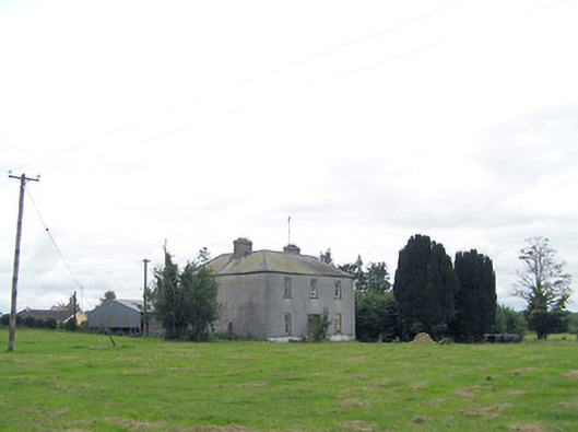
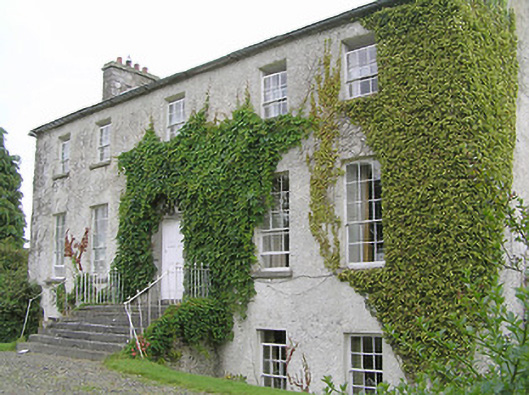
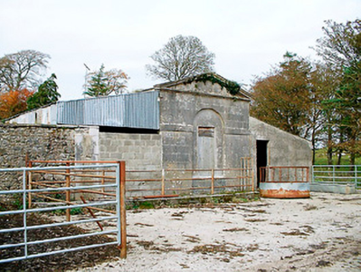
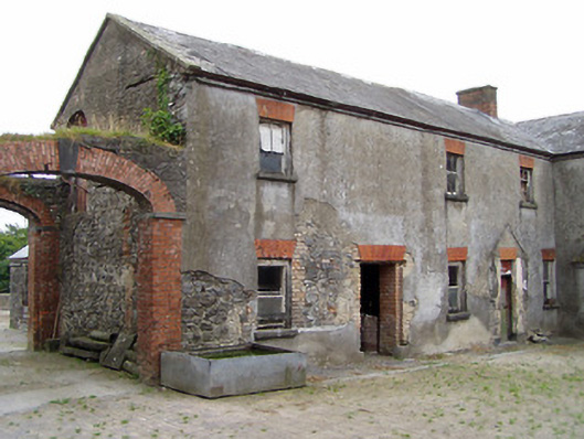
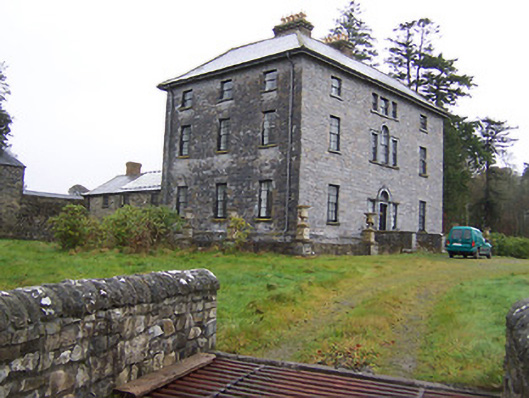
Rockfield/Cromlyn
Houses within 5km of this house
Displaying 11 houses.
Houses within 5km of Rockfield/Cromlyn
Displaying 11 houses.
| House name | Description | |
|---|---|---|
| Manor Mill House | William Cox was leasing this property from the Tuite estate at the time of Griffiths Valuation in the 1850s, when it was valued at £23 and included a mill. It is not labelled on the 1st edition six-inch Ordnance Survey map but appears as Manor Mill on the later 25-inch edition. It is no longer extant. | |
| Lissanure House | Lissanure House is labelled on the 25-inch Ordnance Survey map of the early 20th century. At the time of Griffiths Valuation in the early 1850s, the property at this site was occupied by William Green, leasing from the Tuite estate, when it was valued at £4. The National Built Heritage Service suggests that the current building replaced the earlier house in the 1850s. It is still extant but not used. |
|
| Clonwhelan | Richard White held this property in fee at the time of Griffiths Valuation when it was valued at £15. In 1814 Leet referred to it as the residence of Miss Godley. James Bond was the occupier at the time of the initial valuation in 1839 when it was valued at £12. It is still extant |
|
| Baronstown | Baronstown was a large mansion in an extensive demesne on the western shore of Lough Iron, as shown on the first OS map, with many features such as a temple, summer house etc. Described by the National Built Heritage Service as an important late eighteenth-century Palladian villa with two storey wings, it was associated with the Malone Family/Lord Sunderlin. Taylor and Skinner noted it as a Malone property in 1777. Lord Sunderlin was resident in 1814. Following the death of Richard Malone in 1837 his sister Alicia who had married Henry O’Connor of Mount Pleasant, King’s County (Offaly) succeeded to the Baronstown and Shinglis estates. O’Brien writes that the building was burnt twice and rebuilt. The first time in 1889 and the second time in 1903 when it was replaced by a large Tudor villa to designs by James Franklin Fuller. In 1906 it was valued at £70 and was occupied by Colonel John R Malone who held it with 943 acres of untenanted land. Demolished by the Land Commission in the 1920s, it is now a greenfield site. |
|
| Oran Vale | Located directly north of Ballynacarrigy, Oran Vale is named on the first edition OS map and was occupied by J Irwin in 1837. Valued at £15 it was unoccupied at the time of Griffith’s Valuation (publ. 1854) while the immediate lessor was Thomas William West who held the property from Alicia O’Connor Malone. The house is not named on the 25 inch map and is now a ruin. | |
| Ardglass House | This house was rebuilt in the style of an Italianate Villa post Griffith’s Valuation, possibly incorporating the fabric of an earlier house on the same site. The original Ardglass House was the home of a Major A. P. Bond in 1837. Valued at £13.15 at the time of Griffith’s Valuation (publ. 1854), it was occupied by the representatives of A P Bond who held it in fee. The present house was in the ownership of William Perry Bond JP, in the 1880s. The house has had various owners in the 20th century and was for sale in 2017, see https://www.businesspost.ie/article/high-class-at-ardglass-co-westmeath/ | |
| Newpark Lodge | Newpark Lodge named on both the first edition OS map and the 25 inch map. Occupied by James Auchmuty JP in 1837 and at the time of Griffith’s Valuation (publ. 1854) when he held the house valued at £10 from the representative of A P Boyd. Now a modern building located at the site situated on the main road from Mullingar to Edgeworthstown. Newpark Lodge was for sale in 2021. | |
| Foxhall (Ballymahon) | Richard M. Fox held this property in fee at the time of Griffiths Valuation in the 1850s, when it was valued at £40. The original valuation also noted it as his property in 1839 with a valuation of £39. In 1906 it was owned by the representatives of R.E. Fox. The Ordnance Survey Name Books mention that the demesne contained 38 acres of woodland in the mid-1830s. Leet referred to it as the residence of Richard Fox in 1814. The National Built Heritage Service suggests that the house at Foxhall was demolished in 1946. Estate architecture, including the stables, survives |
|
| New Port (Ballymahon) | At the time of Griffiths Valuation in the early 1850s, Patrick Ross was leasing this property from the Fox estate, when it was valued at almost £9. In 1814 Leet referred to it as the residence of J, Molloy. The Ordnance Survey Name Books mention it as a gentleman's residence belonging to Mr. Fox. The house is labelled New Port on the 1st edition Ordnance Survey map but does not appear on subsequent maps and is no longer extant. | |
| Newtown House [Newtown Lodge] | Robert Hagerty was leasing this property from the Fox estate at the time of Griffiths Valuation in the early 1850s. The house at the site is labelled Newtown Lodge on the 1st edition Ordnance Survey map. The Ordnance Survey Name Books referred to this as a 'farm house' in the 1830s. A different house at the site is named as Newtown House on the later editions, the name by which it is still known. The National Built Heritage Service suggests the original house was built c.1810. It is extant and well-maintained. |
![Photo of Newtown House [Newtown Lodge]](https://landedestates.ie/storage/img/orig/3406.png)
|
| Newpass | Griffiths Valuation notes the owners of Newpass as Elizabeth Westby and the representatives of Sir. G. Fetherson. Elizabeth Westby was the wife of William Westby and the daughter of George B. Whitney of Newpass. The house was unoccupied in the early 1850s and valued at £35. The National Inventory of Architectural Heritage suggests it was built c.1775 by the Whitney family, probably on the site of an earlier house. Taylor and Skinner noted it as a Whitney property in 1777. O'Brien states that Colonel Whitney first purchased the Newpass estate in 1670. In 1906 it was owned by Major E. Henry Fetherston Whitney and valued at £43. It is still extant. The estate also owned property in the nearby village of Rathowen. |
|