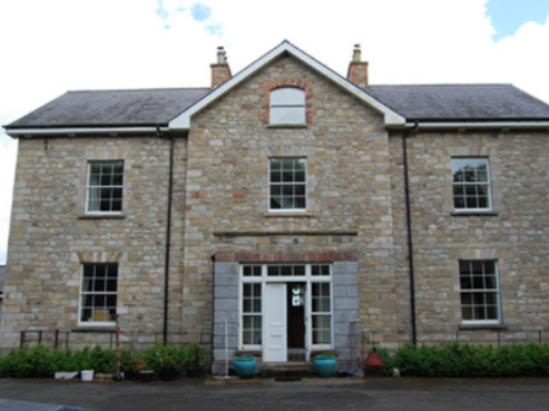
Corstruce House
Houses within 15km of this house
Displaying 62 houses.
Houses within 15km of Corstruce House
Displaying 62 houses.
| House name | Description | |
|---|---|---|
| Kilbracken | William Murray Hickson was leasing the house at Kilbracken, barony of Carrigallen, from Elizabeth Armstrong at the time of Griffith's Valuation when it was valued at £20. In 1814 a house at Kilbracken was recorded as the residence of Mr. Armstrong but it has been estimated that the present Kilbracken House was built around 1825. It is not named on the first edition Ordnance Survey map though there are buildings marked on the site. A poster in Leitrim County Library indicates that it was the property of Thomas S.Jones in 1905 when it was offered for sale. The house is still extant and undergoing restoration. |
|
| Cloghlough | At the time of Griffith's Valuation, William O'Brien was leasing a property valued at £8 at Cloghlough, barony of Carrigallen, from the estate of John King, which was in Chancery. Substantial farm buildings exist at this site. | |
| Faulties | At the time of Griffith's Valuation Francis Nesbitt was leasing a property valued at £11 from Catherine Warren at Faulties, barony of Mohill. Buildings still exist at the site. | |
| Drumkeen | In 1814 ‘Dromkeen’ was the home of Robert Sanderson. Bence Jones writes that this was an early 19th century two storey house. The Ordnance Field Name Book states that it Kilbee resided 'in the old family mansion of Drumkeen house’. It was held in fee, valued at £30 and occupied by Colonel Alexander Saunderson in the mid-19th century. In 1901, it was occupied by Arthur Trench, in 1906 by Lucas Clements when its rateable valuation had risen to £55 and in 1911 by Agnes Jane Clements and her daughter. Bought by the Loreto nuns in 1930, the building has since been altered. |

|
| Fortland | Leet records Fort-land, Mount Nugent, as the home of the Reverend H. Maxwell in 1814. Lewis records W. Gosling as the occupant of Fortland in 1837. The first edition Ordnance Survey map (publ. 1837) shows Fortland to have been a substantial property with laid out gardens and plantations and a demesne of over 300 acres. It was the home of the Hon Somerset Maxwell at the time of Griffith’s Valuation. He held the property in fee and the buildings were valued at £27. By 1906 this valuation had increased to £52.10.0. and the house was the home of Mrs Maxwell. The house is demolished and the site now a green field. | |
| Arley Cottage | A graphic of Arley Cottage ‘belonging to Colonel Barry’ in the National Library is dated circa 1820s, see http://catalogue.nli.ie/Record/vtls000550550. The Farnham Papers also refer to Arley Cottage in 1822. Lewis records Arley as the property of Lord Farnham and it was occupied by the Hon Somerset Maxwell in the mid-1840s and by the Hon Richard Maxwell in the mid-1850s when it had a rateable valuation of £20. The Hon. Henry Maxwell was the occupier in 1906. This building is no longer extant. | |
| Lakeview (Garrison) | A house on the Farnham estate, named on the first edition Ordnance Survey map (publ. 1837), valued at £11.10.0. in the mid-19th century when occupied by Edward Soren and held from David Kellett. | |
| Cullies House | Cullies House had a rateable valuation of £35 at the time of Griffith’s Valuation and was occupied by Nathaniel Montgomery and held from Edward K. Tenison. The entrance gates, lodge and outbuildings have become part of the St Patrick’s College complex. This house was demolished circa 1980 (National Inventory of Architectural Heritage]. |
|
| Moynehall House | Moynehall was originally the home of the Moores. In 1847 Moynehall, the house and 12 acres, was been offered for lease by the Court of Chancery in the matter of Catherine Bell, a minor and heiress in law of Robert Bell, a lunatic, dated 15 February 1847 (Anglo-Celt). Griffith’s Valuation records the house as vacant and the Reverend Anthony Adams as the immediate lessor. Moynehall, the property of the Reverend Anthony Adams, was advertised for sale in the Encumbered Estates Court on 28 May 1857. In 1876, Moynehall belonged to John Fay. It is still extant. | |
| Annagh House | Annagh, situated close to Annagh Lough, was the home of Robert Baker in 1814. Occupied and held in fee by Captain John O’Reilly in the mid-19th century, the house is now demolished. | |
| The Cottage | This house is located close to Lough Sheelin and on the roadside. In the mid-19th century it was valued at £12, occupied by James Sneyd and held from Andrew Booth Bell. In 1906, the townland of Bellsgrove was in the occupation of Matthew William Webb and The Cottage had a rateable valuation of £7. It appears to be still extant. | |
| Kilnahard House | Described by the National Inventory of Architectural Heritage as a castellated country house built circa 1820. Kilnahard is situated on the shore of Lough Sheelin. In the mid-19th century it was occupied by Tuite Dalton, who held the property from Andrew Bell. The buildings had a rateable valuation of £18. This house is still a residence. | |
| Crover House | This house is located on the shore of Lough Sheelin and in the mid-19th century was valued at £21.5.0. for rates. It was occupied by Thomas Cummins and held from Lord Farnham’s son, the Hon Somerset Mawell. By 1876 Robert John Cuming was resident at Crover. He owned 1,118 acres in the county. In 1901 Julia Cuming, a widow, and her daughter Kate were still resident. This house became a hotel in 1957. http://www.croverhousehotel.ie/History | |
| Woodlawn | A two storey house, close to the shore of Lough Sheelin, built about 1800 and still occupied. It was vacant at the time of Griffith’s Valuation but held by William Mahaffey from the Hon S. Maxwell and valued at £16.10.0. |

|
| Hollywell | Located on the Farnham estate and known as Tara Cottage on the first edition Ordnance Survey map (publ. 1837) and as Hollywell on the 25 inch map. An engraving in the National Library appears to be this house Hollywell Cottage and dates it to at least 1820, see https://catalogue.nli.ie/Record/vtls000152344. Occupied by the Reverend Henry Cottingham at the time of Griffith’s Valuation. Valued for rates at £14 the house was held from Mark Woods. The Reverend H. Cottingham held a townland in each of the parishes of Annagh and Urney at the time of Griffith’s Valuation. His representatives owned 381 acres in 1876. A building reduced in size continues to occupy this site. | |
| Summerville (Cavan) | Another house located on the west shore of Lough Sheelin. In 1814 James H. Cottingham was the proprietor of Summerville, Mount Nugent. The house was unoccupied at the time of Griffith’s Valuation but in the possession of William Webb. It was valued at £15.10.0. for rates. It was much reduced in size by the time the 25 inch map was compiled. A building still occupies the site. | |
| Rock House (Cavan) | Marked on the first edition Ordnance Survey map (publ. 1837). In the 1850s, this house was occupied by the Reverend Matthew Webb and held from George Wilton. It had a rateable valuation of £21. It is now the centre of a farming complex. | |
| Ballyhaise | Ballyhaise built for Colonel Brockhill Newburgh, design attributed to Richard Castle but more likely Sir Edward Lovett Pearce, early 18th century. About 1800 sold to Williamm Humphrys who added two storey wings to the building. Lewis describes the house in 1837 as ‘a spacious mansion, with an elevated front curiously ornamented with arches’. It was the seat of William Humphrys. In the 1850s the buildings had a rateable valuation of £110. Since 1905, Ballyhaise has been an agricultural college. |
|
| Clonervy | In 1814, Clonervy was the home of Richard Blackwood. Located on the estate of Earl Annesley it was vacant at the time of Griffith’s Valuation when its rateable valuation was recorded as £30. George Graham occupied Clonervy in the 1860s and in 1880 it was the residence of the subsheriff John Maxwell James Townley. The Irish Builder records plans for general repairs to Clonervy House for Patrick Lyons in 1912. A smaller building still occupies this site. | |
| Kilmainham - The Cottage/Heath Lodge | Lewis refers to Kilmainham as the residence of A. Bell and the house is named as The Cottage on the first edition 6 inch Ordnance Survey map (publ. 1837). By the time of Griffith’s Valuation about 20 years later, Henry Montford was the occupier, holding the property from William Humphrys of Ballyhaise. The building would appear to have been extended by this time as its rateable valuation was £15. The house is named Heath Lodge on the 25 inch map. James Hartley and family were resident at Heath Lodge in 1901 while Hector John Atkinson and his wife Sybil were the occupants in 1911 holding the property from the representatives of James Harley. A building of similar shape still exists at this site. | |
| Kill | Ambrose Leet records Kill, Mount Nugent, as the residence of George Lenauze. Kill House, located on the estate of the Bishop of Kilmore, is named on the first edition 6 inch Ordnance Survey map (publ. 1837). At this time there were laid out gardens and extensive plantations within the demesne grounds. The buildings at Kill House are reduced in size on the later 25 inch map. In the 1850s Garrett Keogh was the occupier holding the property valued at £5 from John Orpen. This house is no longer extant. | |
| Drumroragh Lodge | In 1814, Thomas Goslin was recorded by Leet as the occupant of Dromroa, Mount Nugent. Named on the first edition 6 inch Ordnance Survey map (publ. 1837) Drumroragh Lodge was quite a substantial building. It was the home of Charles Carr Morton and his wife Charlotte Tatlow. The demesne and mansion house of Drumrora were advertised for sale on 21 June 1855 and appears to have been purchased by a relative of the Mortons’ John Tatlow. Griffith’s Valuation in the 1850s describes Drumroragh as a herd’s house with a rateable valuation of £12. It was occupied by John T. Tatlow, who held it in fee. Later maps show a smaller house slightly to the east of the original building, which was demolished. The house is extant but does not appear to be occupied. | |
| Lake View House (Drumlane) | Home of Richard J. ‘Hynes’ (Hinds) at the time of Griffith’s Valuation, Lake View House was held in fee and had a rateable valuation of £10. It was built after the first Ordnance Survey of the 1830s and before the primary valuation survey. Henry Hinds in 1901 and Mrs Charlotte E. Hinds in 1911 held a vacant house in Deramfield. Lake View House is presently occupied. |
|
| Aubawn | Described by Mulligan as a ‘medium-size Late Georgian villa’. In 1814 Henry Lenauze was resident at Aubawn, Killeshanadra and Lewis records Aughabawn as the home of the Reverend J. Vernon. The Upton Papers (RIA) contain the will of M. Story of Aubawn, 1817. By the mid-1850s Richard Fox was the owner and occupier of Aubawn, with a rateable valuation of £21. In 1876 the address of George De La Poer Beresford, owner of 570 acres in the county, was Auburn, Killeshandra. Douglas G. Adams occupied the house in 1901, holding it from Beresford while a land steward William Gordon and his family were resident in 1911. This house has been renovated and modernised. |
|
| Croaghan House | A small house named on the first edition six inch Ordnance Survey map (publ. 1837). The building was later extended and in the mid-1850s was occupied by the Reverend Allan, who held it from Richard Carson. It was valued at £11. David Hamill Crawford, land agent, and family were resident in the early 20th century, this building appears to be still extant. | |
| Drummully House | In the mid-19th century a house valued at £10 was owned and occupied by Catherine Dickson in Drumully East. By the early 20th century a substantial house named Drom Mullac is shown on the 25 inch map when the Lough family were resident. There are references to Albert Hutton of Drummully House, Killashandra in 1876; Mrs Louisa Frances Hickson, widow of William Murray Hickson in 1884 and Thomas Lough MP of Drummully in 1898. This house became a convent and was demolished in 2012. | |
| Riverview/Cloggy House | River View was situated on the bank of the River Erne. It was obviously associated with linen making in the early 19th century as beetling and bleaching mills are both marked near the house on the first edition six inch Ordnance Survey map (publ. 1837). A corn mill is also shown nearby. The Faris family were resident in Cloggy from at least 1832 when Alexander Faris is mentioned in the Tithe Applotment Books. In the mid-19th century William Faris was resident holding the buildings valued at £15 from Cosby Thomas Nesbitt. Alexander Faris/Ferris, a farmer and his family were living in Cloggy at the beginning of the 20th century. This house has been modernised and still retains a fine range of outbuildings. | |
| Drumgoon | The houses known as Drumgoon, Lahard, Gartinadress and Lakeville are in close proximity to one another and all at one time were homes of the Young family. Drumgoon is located just east of Lahard. In the mid-19th century it was the residence of James Robinson, who held it from Robert Hutton when it had a rateable valuation of £6.10.0. This house is still extant. | |
| Laurel Bank/Holly Bank | This house, originally known as Laurel Bank, is named on the first edition six inch Ordnance Survey map (publ. 1837). It is shown in a demesne which included an old bleach mill and a corn mill and kiln. It is believed to have been built by a mill owner in the 18th century. Griffith’s Valuation records William Norton as the occupant holding the property valued at £8.10.0. from the Earl of Gosford. The house is called Holly Bank on the 25 inch map. Altered and added to in the 20th century it continues to be a residence. | |
| Gartinadress House | In 1814, Charles Veaitch was the resident at Gortin-ardrass. This house is named on the first edition six inch Ordnance Survey map (publ. 1837). Although having advertised Gartinardress for sale in 1850 William Young was the owner and occupier at the time of Griffith’s Valuation when the property was valued at £15 for rates. By the early 20th century the Armstrong family were occupying Gartinardress, although in 1906 William A. K. Young is recorded as occupier of 228 acres of untenanted land and the mansion house. This house is no longer extant and the site is part of a forestry area. A house known as Lakeville was also located in the townland of Gartinardress. Leases in the National Library record Lakeville as the home of Richard Young in the 1820s. It was described as ‘in ruins’ on the 25 inch map. | |
| Lahard | Lahard was the home of the Young family in the 18th and 19th centuries. It is named on the first edition six inch Ordnance Survey map (publ. 1837) which shows a flower garden to the south of the house. Occupied by Cosby Young in 1814 and by John Lough in the 1850s, who held the property from the representatives of Cosby Young. The buildings were valued at £10. Inherited by one of Cosby Young’s daughters, Mrs Mackarness. The railway line was erected to the south west of this house. It is no longer extant. | |
| Tully House (Killashandra) | Richard Young of Tully 1808, see GO MS. Richard Young and his wife Bridget Nugent Reynolds later lived at Fort Lodge, on the outskirts of Cavan town. In 1814, Mr R.Y. Reynolds was resident at Tully, Crossdoney. Major Randal Stafford of Tully House, Crossdoney, is listed as a subscriber to Lewis ‘Topographical Dictionary’ (1837). In the 1850s this house was occupied by William Magee who held it from the representatives of Hugh Walsh. The Douglas family were resident at the beginning of the 20th century. | |
| Rockfield (Killashandra) | The National Inventory of Architectural Heritage dates this house to circa 1720. The Irish Genealogist Vol II refers to the will of F. Young of Rockfield, 1777. Situated close to Rockfield Lough it was a Berry home in the first half of the 19th century. Thomas Berry was resident in 1814 and in 1851 (Thom’s Directory). Rockfield was advertised for sale in the Encumbered Estates Court in November 1851. A few years later Griffith’s Valuation records Robert O’Brien as the occupant of Rockfield holding it from Oliver Sproul. It was valued at £17. The house is still extant but no longer in use. |
|
| Bruce Hall | Thomas Hinds of Prussia Street, Dublin and previously of Bruce Hall, county Cavan, died in 1794. Henry B. Wilson was resident at Bruice-hall, Arva, in 1814. Bruce Hall was the home of John Warren in the mid-19th century. John Warren married Isabella, daughter of Captain James Blakely of Lake View, county Cavan, in 1856 (Anglo-Celt, 28 August 1856). He held Bruce Hall from Robert Burrowes and it was valued at £10 for rates. | |
| Castle Hamilton | In the mid-18th century Castle Hamilton came into the possession of the Southwell family through marriage with a Hamilton co-heiress. It remained in Southwell ownership until about the 1840s. Both Leet and Lewis record members of the Southwell family as resident. Lewis describes the house as ‘a spacious mansion surrounded by an extensive and highly embellished demesne’ adjoining the town of Killeshandra. The buildings were valued at £50 in the mid-19th century, by which time James Hamilton was owner and occupier. The Hamiltons were still resident at the time of the censuses of 1901 and 1911. The house was accidentally destroyed by fire in 1911 but a fine farm yard survives. |

|
| Portaliff House | Portaliff House was located on the Castle Hamilton estate, north of Mill Lough and a little south of Killashandra. In the mid-19th century it was occupied by Captain F.H.B. Philips when it was valued at £12 for rates. Portaliff House is listed as a protected structure. | |
| Bellville | The Fleming family were known to be at Bellville from the early 18th century. The house is named on the first edition six inch Ordnance Survey map (publ. 1837) and located facing two forts in a sizable demesne. Belville was the home of A. Fleming in 1814 and of Captain A. Fleming in the 1830s. By the 1850s, the occupant was Jane Kenny who held the property valued at £7 from Major General Fleming. At the beginning of the 20th century Bellville was the home of the Meikle family, originally from Scotland. It is still extant. | |
| Lismore Lodge | Built as the agent’s house in the Nesbitts’ Lismore Castle demesne close to the village of Crossdoney. Lismore Lodge is named on the first edition six inch Ordnance Survey map (publ. 1837). It was the home of William Tatlow in the mid-19th century, when the buildings were valued at £20. Occupied by the family of Thomas Cosby Burrowes at the beginning of the 20th century. His mother Mary Anne Burrowes had succeeded to the Lismore estate in 1886 following the death of her brother Alexander Nesbitt. Under boundary changes at the end of the 19th century the location of the Lodge was changed to the townland of Lismore Demesne and it was valued at £32 for rates in 1906. In the mid-20th century it was a Lucas-Clements home. This house is extant but unoccupied. |
|
| Drumcarban | Bence Jones describes Drumcarban as a late 18th century house of 3 storeys and 3 bays. It was the home of the Bell Booth family in the 19th century. George Thomas Bell Booth was resident in the 1830s and 1840s until he was murdered in 1845. Robert Booth Bell was the owner and occupant at the time of Griffith’s Valuation. This house was occupied by Annie Sheridan in 1901, in 1906 by Michael Sheridan when it had a rateable valuation of £22.5.0. and is still extant. | |
| Bingfield | A house built in the mid-18th century by the Venerable Joseph Story, Archdeacon of Kilmore. Occupied by Joseph Story in the mid-19th century, when the buildings were valued at £40. The property was held from Anthony O’Reilly. The Story family were still resident in 1901. Bingfield was sold by Arthur Patrick Story [sometime in mid-20th century, Irish Family Records (1976)]. Many of his siblings went to live in New Zealand. This house is still a fine residence. |

|
| Castle Cosby | Castle Cosby was situated close to a small lough of the same name. A number of other country houses were located in close proximity, such as Lismore. J. Whitethorne was resident at Castle Cosby in the 1830s and 1840s. By the mid-1850s Andrew Smith was the occupant holding the property from John E. Vernon. It was valued at £16. In 1876, Philip Smith of Castlecosby owned 77 acres in co Cavan. He married Delia Mary daughter of Corney Banahan of Renny, Co Roscommon and had a number of sons who became doctors. His third son Frederick Paul married in 1905 Isabella Ann daughter of Edward Smith of Bellamont Forest. Castlecosby was mainly known as Kevit Castle under Smith ownership. The house is now demolished but a gate lodge is still extant. |
|
| Lismore Castle | An early 18th century house, possibly designed by Sir Edward Lovett Pearce (Bence Jones). Named on the first edition six inch Ordnance Survey map (publ. 1837), it was valued at £12 for rates in the mid-1850s. It was a Nesbitt family home until the 1880s when inherited by the Burrowes family and passed from them by marriage to the Lucas Clements in the 1920s. However the house was marked as ‘in ruins’ on the 25 inch map. Bence Jones records that it was later demolished and that the Lucas-Clements resided in the agent’s house nearby Lismore Lodge. | |
| Rockville (Crossdoney) | Named on the first edition six inch Ordnance Survey map (publ. 1837), Rockville was located on the Nesbitt estate to the north east of Lismore Castle, on the outskirts of Crossdoney. In the 1830s it was the home of John C. Tatlow and in the 1850s of Samuel Moore, when the buildings were valued at £20 for rates. Occupied by Dr John Stirling Greer and his wife in 1901 and held from Thomas Cosby Burrowes. Another medical family named Hallowes was resident in 1911. Apparently still extant and occupied. | |
| Ricehill House | Rice Hill was built in the mid-18th century. It was the home of the Bredin family in the first half of the 19th century. It is named on the first edition six inch Ordnance Survey map (publ. 1837). Described by Mulligan as a ‘classic Georgian gentleman’s farmhouse in a small demesne.’ Occupied by Patrick Finnegan and held from the representatives of Sophia Wright in the 1850s, when the buildings were valued at £3.10.0. It was still the home of the Finnegan family at the beginning of the 20th century and continues to be a residence. |
|
| Drumheel House | A house named on the first edition six inch Ordnance Survey map (publ. 1837) with extensive outbuildings and occupied by R. Bell. Griffith’s Valuation records William Smith as owner and occupier in the 1850s, when the buildings were valued at £23.10.0. A building of different shape now occupies this site. | |
| Kilmore Palace | A house built in the 1830s for Bishop George de la Poer Beresford, designed by William Farrell and resembling Rathkeeny. It replaced an earlier palace on a different site. Its rateable valuation was £100 in the 1850s, the Bishop of Kilmore being owner and occupier. This house continued to be the home of the Bishops of Kilmore until the early 21st century. It is now in private hands and currently for sale (2022), see https://theirishaesthete.com/tag/kilmore/ |

|
| Lisnamandra | Lisnamandra was a Sneyd family home in the 18th century. Frances Arabella Sneyd of Lisnamandra married Archdeacon Joseph Story (died 1767) of nearby Bingfield. One of their daughters Sophia married Robert Burrowes of Stradone House. Their grandson, James Edward Burrowes, was the occupant of Lisnamandra in the 1850s. He held the property valued at £20.10.0. from Earl Annesley. However previous to J.E. Burrowes’ occupation Lisnamandra had been the residence of Mrs Elliott in 1814 and of George Burdett L’Estrange in the 1830s. Hugh Hamilton Moore and his wife lived in Lisnamandra in the early 20th century. He was a barrister and Clerk of the Crown and Peace for county Cavan. | |
| Danesfort | The present house replaced that marked on the first edition six inch Ordnance Survey map (publ. 1837). Danesfort was the home of the Dean of Kilmore and is situated a short distance from Kilmore Cathedral. Mulligan refers to a Deanery House on the site in 1739. Dean Magenis was resident in 1814 and Lord Fitzgerald and Vesey, Dean of Kilmore, in the 1850s. The buildings were valued at £24 for rates. The building is still in use as the home of an ecclesiastic. |
|
| Countenan House | Countenan House on the shore of Countenan Lough is named on the first edition six inch Ordnance Survey map (publ. 1837). It was occupied by Thomas Hartley in the 1850s and held from Robert Burrowes. The rateable valuation was £10.10.0. Home of the Hawe family at the beginning of the 20th century, this house is apparently still attached to a farming enterprise. | |
| Stradone | According to Burke’s Irish Family Records the Burrowes family were resident at Stradone from at least the mid-18th century. The architect J.B. Keane designed the 19th century house for Major Thomas Burrowes in 1828. His son Robert Burrowes was the owner and occupant in the 1850s when the rateable valuation was recorded as £67.10.0. The Burrowes were still in possession of Stradone in the early 20th century until it was burnt in June 1921. The stables and a gate lodge survive. |
|
| Lake View (Scrabby) | Lake View in the townland of Bernyhill (212 acres) was the home of the McManus family. In the mid-19th century Eugene McManus held the property, valued at £11.10.0. in fee. He owned the townland of Bernyhnill in 1876. Eugene Mc Manus, aged 39, was resident at Lake View in 1901 and in 1911. A house surrounded by farm building is still extant at this site. | |
| Brookvale | Sometime in the early 18th century Alexander Brooke, second son of William Brooke who purchased Drumavanagh from the Saundersons in 1685 (Burke’s), settled at Drumavanagh with his wife Catherine a daughter of Richard Young of Drumgoon. The present house known as Brookvale, was built in 1845 by William Hague, a successful building contractor. It was located on the outskirts of Cavan town near the train station. By the mid-19th century the Reverend Andrew Hogg was resident holding the buildings valued at £24 from William Hague, junior. This house is still a fine residence. It was advertised for sale in 2000 for £500,000 (Irish Times, 8 June 2000). | |
| Arnmore | A building located at this site as marked on the first edition six inch Ordnance Survey map (publ. 1837) was expanded before Griffith’s Valuation. The buildings were in the mid-19th century valued at £38.10.0. and the house, known as Arnmore, was occupied by William A. Moore and held from Earl Annesley. William Armitage Moore of Arnmore was an executor to the will of his nephew, the 4th Earl Annesley, who died in 1874. In 1906, this property was in the possession of Lord Farnham. Today it is the club house of the County Cavan Golf Club. | |
| Earlsvale | A house built circa 1840s on the estate of Earl Annesley and occupied by Captain Francis Meik at the time of Griffith’s Valuation, when the buildings were valued at £18. This may have been the residence of the agent of Earl Annesley. | |
| St Swithin’s Cottage/Drumbar House | St Swithin’s Cottage is named on the first edition six inch Ordnance Survey map (publ. 1837). It was located in the demesne surrounding Farnham House and was later extended by the addition of another block. Abraham Brush, who was the estate agent, lived here in the mid-19th century, when the buildings were valued at £20. By the early 20th century the building was known as Drumbar House. It continues to be a residence. | |
| Farnham Castle | The seat of the Maxwell family, Earls of Farnham, built about the turn of the 18th century for John Maxwell, son of the Bishop of Kilmore, who had purchased the estate from the Waldrons. A library and other alterations designed by James Wyatt were added in the 1780s. In the early 19th century Francis Johnston was employed by the 2nd Earl to rebuild the house. The buildings were valued at £120 in the mid-19th century. The house was remodelled again in the 1960s when dry rot was found to be prevalent and much of the 18th building was demolished. The house remained in the possession of the Maxwell family until the early 21st century. It is now a country house hotel. https://www.farnhamestate.ie/ | |
| Ford Lodge | Located on the Farnham estate just outside Cavan town and close to St Patrick’s Cathedral, Fort Lodge is named on the first edition six inch Ordnance Survey map (publ. 1837). R. Young Reynolds of Fort Lodge, Cavan, was a subscriber to Lewis ‘Topographical Dictionary’. It was occupied by Theophilus Thompson in the mid-19th century and valued at £27 for rates. Home of William Henry Halpin, a solicitor, in the 1930s. | |
| Lisdaran | In the mid-19th century John Moore held a house valued at £12 in the townland of Lisdaran from Lord Farnham. The Moore family were still resident in the early 20th century. | |
| Foxfield House | In 1814, Andrew Bell was resident at Foxfield (N435 888). In the 1850s John George Parr lived at Foxfield House, a residence on the other side of the road from the original Foxfield, which he held in fee. It was valued at £8 for rates. This house continues to be occupied. | |
| Cornadrung Cottage | In 1906 the report on Untenanted Demesnes notes a property at Cornadrung in the possession of Edward Fitzgerald and valued at over £10. This house is labelled Cornadrung Cottage on all editions of the Ordnance Survey map. It appears to have begun as a small property, possibly a hunting lodge on the shores of Lough Gowna which was enlarged in the latter part of the 19th century. In the 1870s Cornadrung was recorded as the address of Mrs. Sarah Hughes. Family history sources suggest it was later owned by the Cole family. The site is now occupied by a modern house. | |
| Derrycassan House | John Dopping held this property in fee at the time of Griffiths Valuation in the early 1850s, when it was valued at £36. Burke suggests it had been a D’Arcy property until the marriage of Alice D’Arcy to Anthony Dopping in the 18th century. It was in the ownership of Capt. J.D.L. Hepenstal and valued at £50 in 1906. Derrycassan House was acquired by the Forestry Service. The house was demolished and some of the stone used in the construction of St. Columba’s RC church not far away. Other estate architecture remains and there are woodland walks in the estate. | |
| Woodville (Granard) | Richard Lambert held this property in fee at the time of Griffiths Valuation, when it was valued at £16. In 1839 the Valuation Office books also note Lambert as the occupier of the property which was then valued at £12. The house survived into the twentieth century but is no longer extant. |