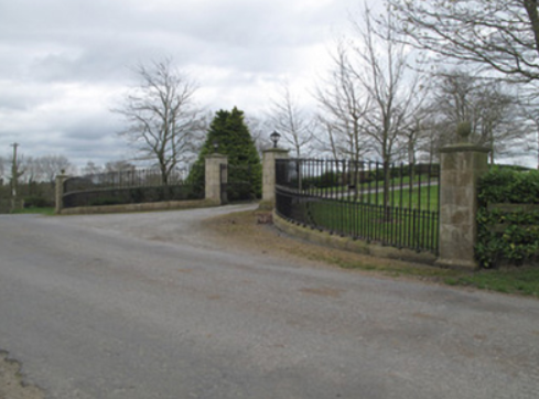
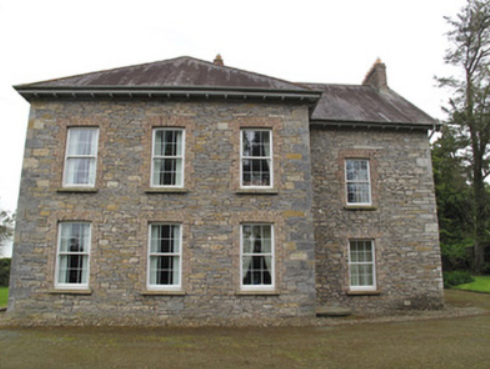
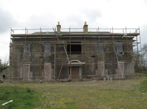
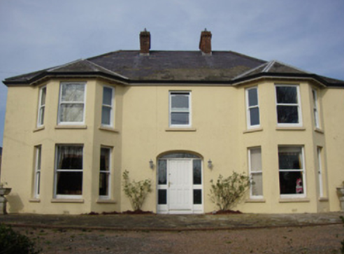
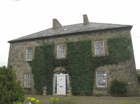
Kiltybegs
Houses within 10km of this house
Displaying 24 houses.
Houses within 10km of Kiltybegs
Displaying 24 houses.
| House name | Description | |
|---|---|---|
| Bessmount Park | The original house ‘Bessmont’, sometimes spelt Bessmount, dates from the early 1800s and is marked and named on the 1st edition 6 inch Ordnance Survey map (1836) with a walled garden to the south. It was the home of a branch of the Montgomery family and was inherited through marriage by the Nixons. In the 1830s it was the residence of A. Nixon Montgomery. In 1840 it was acquired by John Hatchell, High Sheriff of Monaghan in 1843 and his daughter held the house in fee circa 1860. The buildings were valued at £46. The house was elaborately re-modelled in an ornate style possibly to the design of an unknown architect in the late 1860s for the owner William Henderson and became known as Bessmount Park. William Henderson was married to John Hatchell’s daughter Frances Maria Isabella. Mrs Henderson, described as a widow, was living in the house in 1901 and a retired doctor Edward Taylor in 1911. This house continues to be a fine residence. |

|
| Poplar Vale | Home of the Richardson family in the 18th and 19th centuries, Lewis records Major E. Richardson as proprietor. The house is named on the 1st edition 6 inch Ordnance Survey map (1836) surrounded by parkland and an extensive walled garden. The buildings were valued at £30 circa 1860 when John Richardson was the occupier holding the property from Robert Ellis. Edward John Richardson was resident in the early 20th century. In the 1940s St Patrick’s Agricultural College was established at Poplar Vale. | |
| Castleshane | Castleshane was the home of the Lucas family from the mid-17th century. The original house was described by Lewis as ‘an ancient mansion in a highly enriched and tastefully embellished demesne’. In 1836 it was replaced by a Elizabethan or Jacobean style house built for the Right Honourable Edward Lucas. It was valued at £160 in the mid-19th century and in 1906 when surrounded by 359 acres of untenanted land. Occupied by the Honourable Kathleen Vereker in 1901 and by servants in 1911, this house was burnt on 15 February 1920. Tarquin Blake has documented the remains in his second volume of Abandoned Houses. | |
| Anketell Grove/Trough Lodge | Bence Jones writes that the Anketells have built three houses in this area but on different sites. The first house was constructed in the mid-17th century. The second one was built by Oliver Anketell and demolished in 1781. The third house was built in the 1780s and was remodelled in the mid-19th century. Andrew Crawford appears to have lived here in 1807 and James Mervyn B[unbury] Richardson between 1812 and 1827 (see Richardson Papers 1197 in the National Archives). On the 1st Ordnance Survey 6 inch map (1836) it is marked as Trough Lodge. It later became known as Anketell Grove. The Ordnance Survey Field Name Book describes Trough Lodge as ‘a very handsome house and has good office houses’. At the time of Griffith’s Valuation the buildings were valued at £50 and were held by Matthew J. Anketell in fee. In 1901, Samuel Griffen, land steward, and family were the occupants. Patrick McKenna bought Anketell Grove and 130 acres in 1928. |

|
| Dungillick House | Dungillick House, the home of a branch of the Anketell family from at least the mid-18th century, is named on the 1st edition 6 inch Ordnance Survey Map (1836). The Ordnance Survey Field Name Book records the house as thatched. In the mid-19th century Matthew J. Anketell was recorded as the occupant. He held the property from Lord Cremorne. The buildings were valued at £20. Occupied by the Burgess family at the beginning of the 20th century. Dungillick was bought by the Land Commission in 1932 and the house was purchased by James McKenna in 1935. This house remains a family residence. |

|
| Mount Anketell/Spring Mount | Located on the Anketell estate and marked on the 1st edition 6 inch Ordnance Survey Map (1836), this house was the residence of George Olpherts and valued at £10 circa 1860. The house appears to have been unoccupied at the time of the censuses in 1901 and 1911 but was in the possession of the Moutray family of Fort Singleton. The 25 inch map (surveyed in 1908) records the name of this house as Spring Mount. It is no longer extant. | |
| Fort Johnston | The Johnstons were in possession of Stramore from about the mid-18th century and Fort Johnston appears to have been in existence from then. This long house is named on the 1st edition 6 inch Ordnance Survey map (1836). The Ordnance Survey Field Name Book describes Lieutenant Johnson’s house as ‘a pretty good house (cottage built)’ called Fort Johnson. On the 25 inch map (surveyed 1908) it appears as a square block so it may have been altered. In the mid-19th century it was the home of Henry G. Johnston held by him in fee. Burke’s ‘Landed Gentry of Ireland’ (1904) records Fort Johston as the family seat but their residence was in Bandon, county Cork |
|
| Liscarney House | The home of the Ross family for at least a century and a half. David Ross of Liscarney is mentioned in a deed of 1816. Major Ross is recorded in Liscarney in the Tithe Applotment Book and also by Lewis in the 1830s. In Griffith’s Valuation (circa 1860) James Ross (1819-1893) is mentioned as the occupier holding the property in fee. The buildings were valued at £32. Members of the Ross family continued to reside here well into the 20th century as The Irish Law Times and Solicitors Journal of 1955 records the death of Sharman Crawford Ross, solicitor and estate agent, of Liscarney. |
|
| Fort Singleton | The 1st edition 6 inch Ordnance Survey Map (1836) names this house and shows its laid out gardens. The house was the home of the Singleton family, dating from about the mid-18th century. Lewis writes that the home of T. Singleton was ‘situated in a well wooded demesne of 200 acres’ while the Ordnance Survey Field Name Book refers to the ‘neat dwelling house and good office houses’ and that the demesne ‘contains a great deal of fine ash, elm and beech’. The buildings were valued at £60 in Griffith’s Valuation and Whitney Moutray was the occupant, holding from Thomas C. Singleton. Henry Abercrombie, land steward, and his wife were resident in 1901. In more recent times this building has undergone renovation. |
|
| Faulkland Castle | Shirley refers to the confinement of John Leslie, Dean of Dromore, by Robert Maxwell, Sheriff of Monaghan, in his house at Falkland/Faulkland in 1707. The Maxwells occupied Faulkland Castle until 1780. By the time of Griffith’s Valuation it was valued at £1.6 shillings and was held by James Jackson Senior from the trustees of John Maxwell. The 25 inch map (surveyed 1908) shows the castle ‘in ruins’. | |
| Coolmain House | The National Inventory of Architectural Heritage dates this house to circa 1790. It belonged to a family called Graham in the 18th century according to a story recorded in the Schools Collection under Coolmain House. It was named on the 1st edition 6 inch Ordnance Survey Map (1836). In the 19th century this property belonged to the Brooke family of Dromavana, county Cavan. Burke’s Landed Gentry of Ireland 1904 records William Brooke of Dromavana, Dublin and Coolmaine House. He was born in 1769 and married Angel daughter of Captain Edward Perry and niece and heiress of Colonel Richard Graham. John Goudy of Coolmain House is listed in Lewis’ ‘Topographical Dictionary’ published 1837 for the parish of Tehallan but his name is spelt Gondy in the list of subscribers. John Goudy is recorded in Griffith’s Valuation as resident holding the property from the Reverend Edward P. Brooke and others. James Gondy Lewers of Coolmain House died in November 1885 (The Northern Standard, 7 November 1885). This house was occupied by James H. Pollock in 1911 and is still a residence. | |
| Greenmount | Marked on the 1st edition 6 inch Ordnance Survey map (1836) this house was described as a thatched 2 storey house with an orchard and nursery. The grounds were planted all-round the house. It was extended after Griffith’s Valuation and was the home of the agents for the Castleshane estate. At the beginning of the 20th century it was occupied by William Martin, land agent. In the 1920s Martin purchased Greenmount and following the death of his sister in 1949 it was sold to Albert Noble. |
|
| Lough Emy | Lough Emy house on the Leslie estate was built in the mid-19th century. At the time of Griffith’s Valuation it was occupied by William V. Ryan and valued at £20. It retained this valuation in 1906. The 25 inch map (surveyed 1908) shows the house at the end of a long tree lined avenue with Emy corn mill close to the entrance. It was the home of the Kavanagh/Cavanagh family in the early decades of the 20th century. This house is completely demolished, the site is now a green area. | |
| Portinaghy House | Buildings are located at this site on the 1st edition 6 inch Ordnance Survey map (1836). In the mid-19th century the house was valued at £18 and inhabited by Mary Campbell, who held the property from Charles P. Leslie. In 1876, the representatives of Mrs Mary Campbell, Portinaghy, owned 211 acres in county Monaghan. Home of the Edwards family in the 20th century. |
|
| Hollow House | Marked on the 1st edition 6 inch Ordnance Survey map (1836), this house was extended and by the mid-19th century was valued at £12. It was occupied by James Cargill and was situated on the Leslie estate. In 1901, Samuel Cargill, a miller and farmer, was resident with his family. |
|
| Broomfield Cottage | This house was located on the Leslie estate and dates from about the mid-19th century. At the time of Griffith’s Valuation it was occupied by George Scott and its buildings were valued at £12. Home of the McKenna family at the beginning of the 20th century. |
|
| Leek House | An early 19th century house on the Leslie estate, marked on the 1st edition 6 inch Ordnance Survey map (1836). Occupied by William Cochran at the time of Griffith’s Valuation and with a rateable valuation of £20. Occupied by Samuel Barbour and family at the beginning of the 20th century. |
|
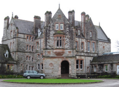
| Castle Leslie | The area around Glaslough was part of the MacMahon territory granted to Sir Thomas Ridgeway in 1608, who built a castle on his newly acquired lands. In 1665, Glaslough was bought from the Ridgeway trustees by Bishop Leslie and the castle became the home of the Leslie family. By the 1830s, Castle Leslie ‘situated about 6 chains to the north of the town of Glasslough’ was described as ‘a poor building and in a dilapidated state’. The present house, a Victorian edifice, sometimes known as Glaslough House, is described in the National Inventory of Architectural Heritage as ‘undoubtedly the finest country house in County Monaghan’. It was built for John Leslie in the 1870s to the design of Sir Charles Lanyon and William Henry Lynn. Located close to the site of the original Castle Leslie which it would appear from Shirley’s ‘History of the County of Monaghan’ was still extant in 1877 (page 147, includes drawing) but was demolished soon afterwards. In the mid-19th century the building was valued at £55 and held by Charles P. Leslie in fee. A caretaker’s house and farm buildings valued at £60 were located in the townland of Kiltybegs to the north east. By 1906, the rateable valuation of this mansion was £300. It was occupied by a butler and other servants in 1901 and by Sir John Leslie in 1911. Castle Leslie now functions as a hotel run by Sammy Leslie, see https://www.castleleslie.com/ |
|
| Annagola | This house, situated very close to the border with county Armagh, is marked on the 1st edition 6 inch Ordnance Survey map (1836) and named on the 25 inch map (surveyed 1908). The building had been extended. William George Irwin lived at Annagola in the 1840s. In the mid-19th century the buildings were valued at £35 and held by Maria Irwin from the trustees of Dr Sterne’s charities. Occupied by Robert Quinn, gardener, and his family at the beginning of the 20th century. |
|
| Annareagh House | Built in the mid-19th century, valued at £16 and held by William Martin from the trustees of Dr Sterne Charities. Named on the 25 inch map (surveyed 1908) as Annarea House with a square block of outbuildings behind the house. | |
| Blackwater Vale | This house is marked on the 1st edition 6 inch Ordnance Survey map (1836) and located just outside the town of Monaghan. The building was expanded in the mid-19th century. Griffith’s Valuation records the buildings valued at £13 when the house was occupied by Thomas E. Wright who held the property from William and Charles Crofton. At the beginning of the 20th century Blackwater Vale was occupied by Foster Dunwoody, a solicitor. Still extant and occupied. |
|
| Dromore House | Dromore House is named on the 1st edition 6 inch Ordnance Survey map (1836) with a circular drive to the front and a walled garden to the rear. It was the home of C. Hawkshaw in the 1830s. Located on the Hatchell estate it was occupied by James Wade at the time of Griffith’s Valuation and valued at £14. The home of the Smyth family in the early 20th century, this house is no longer in existence. | |
| Sallymount | Sallymount facing a plantation is named on the 1st edition 6 inch Ordnance Survey map (1836). In the 1830s it was the home of T. Robinson. At the time of Griffith’s Valuation the buildings were valued at £8 and John Woods was the occupant, holding the property from John Maxwell, whose estate was at that time being administered by the Court of Chancery. Home of the Assistant County Surveyor James Smith in 1911. He held the house from John McMahon. A building is still located at this site. | |
| Woodview | Situated on the Lucas estate, this house was not built at the time of Griffith’s Valuation (circa 1860) as there is no house in the townland of more than £2.10.0. valuation. The National Inventory of Architectural Heritage records that it is believed to have been built as a house for the agent to the Castleshane estate. |