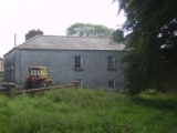
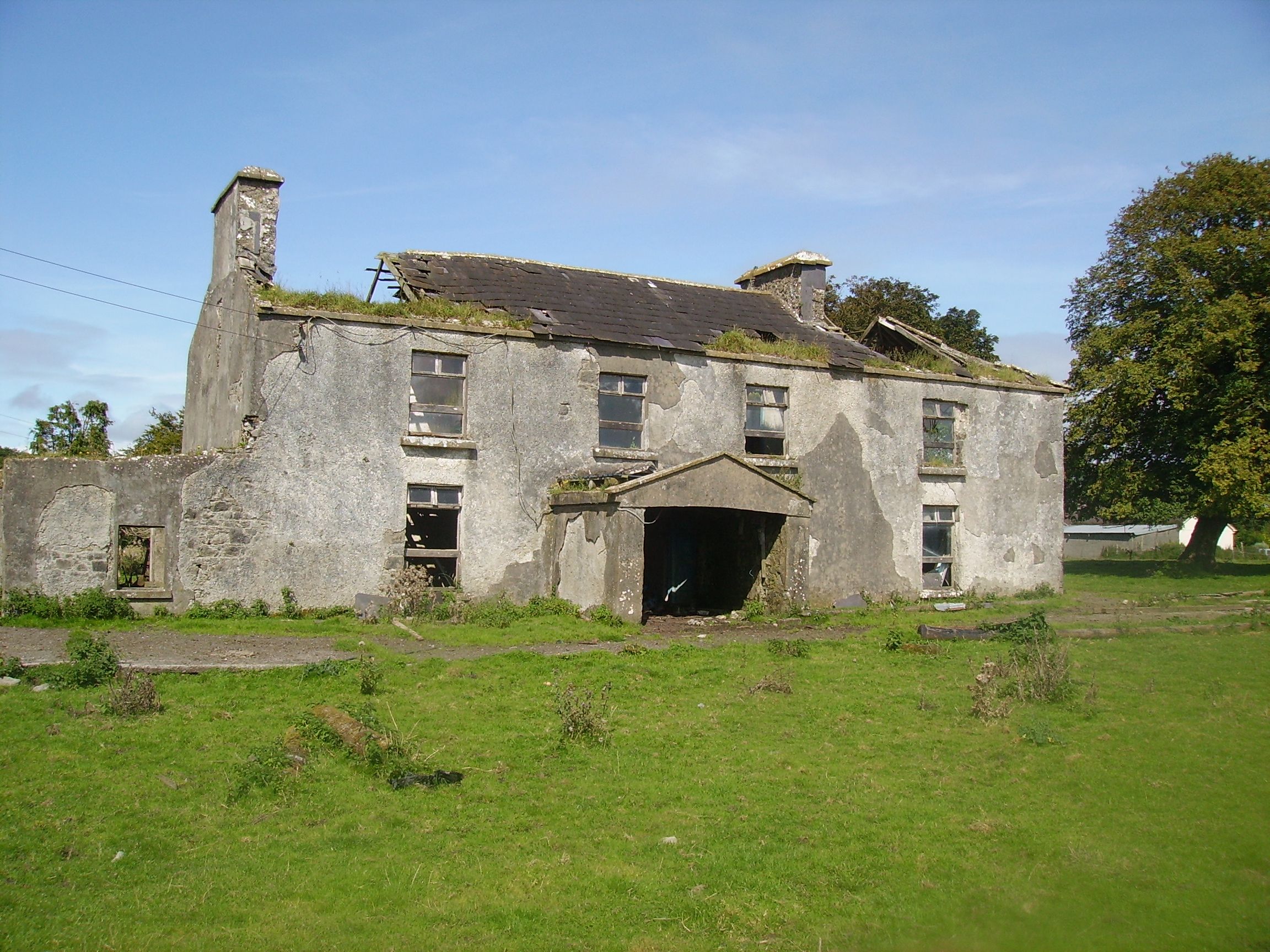
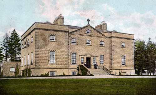
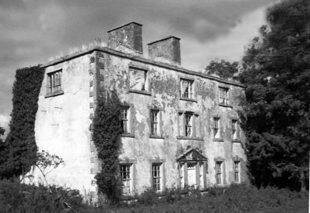
Castlemagarret
Houses within 10km of this house
Displaying 38 houses.
Houses within 10km of Castlemagarret
Displaying 38 houses.
| House name | Description | |
|---|---|---|
| Ballinvilla | The home of the Crean family in the 19th century. Ballinvilla was held in fee by Austin F. Crean at the time of Griffith's Valuation when it was valued at £7. This house no longer exists. | |
| Purrauns | Home of a branch of the Bell family of county Mayo and occupied by the Lynches in the mid 19th century. At the time of Griffith's Valuation it was occupied by Patrick King leasing from James Lynch when the buildings were valued at £5. Buildings are still extant at the site. |
|
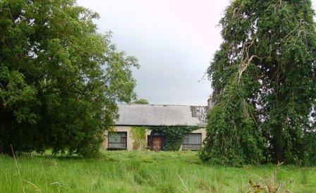
| Hollybrook | In 1786, Wilson refers to Boullybeg as the seat of Mr. Crean. This house was the home of the Creans and Crean Lynches. At the time of Griffith's Valuation the house was occupied by Ephraim and George Anderson, leasing from Patrick C. Lynch, when it was valued at £25. It is now a ruin. |
|
| Kilrush | A house in the village of Hollymount, leased by Christopher Bowen from Reverend Christopher Bowen's estate at the time of Griffith's Valuation, when it was valued at £25. Only a few walls remain now. |
|
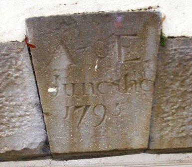
| Annefield | Built by Anthony Elwood in 1795, the property passed to the Blakes of Windfield, county Galway, in the mid 19th century. It was occupied by Charles Cromie in the 1830s and at the time of Griffith's Valuation by Emerson Dawson. It was sold to the Brannick family early in the 20th century and was bought by a Mr Fleishche in the 1980s, who restored the derelict house. The house was for sale in 2007. |
|
| Mount Jennings | Home of the Jenings family in the 18th and 19th centuries. Mount Jennings was held in fee by Benjamin Jenings at the time of Griffith's Valuation when the house was valued at £20. It was the childhood home of the ballad singer, Delia Murphy. Her parents still resided in the house in the 1940s. The roof was taken off the house in the 1970s and it is now demolished. | |
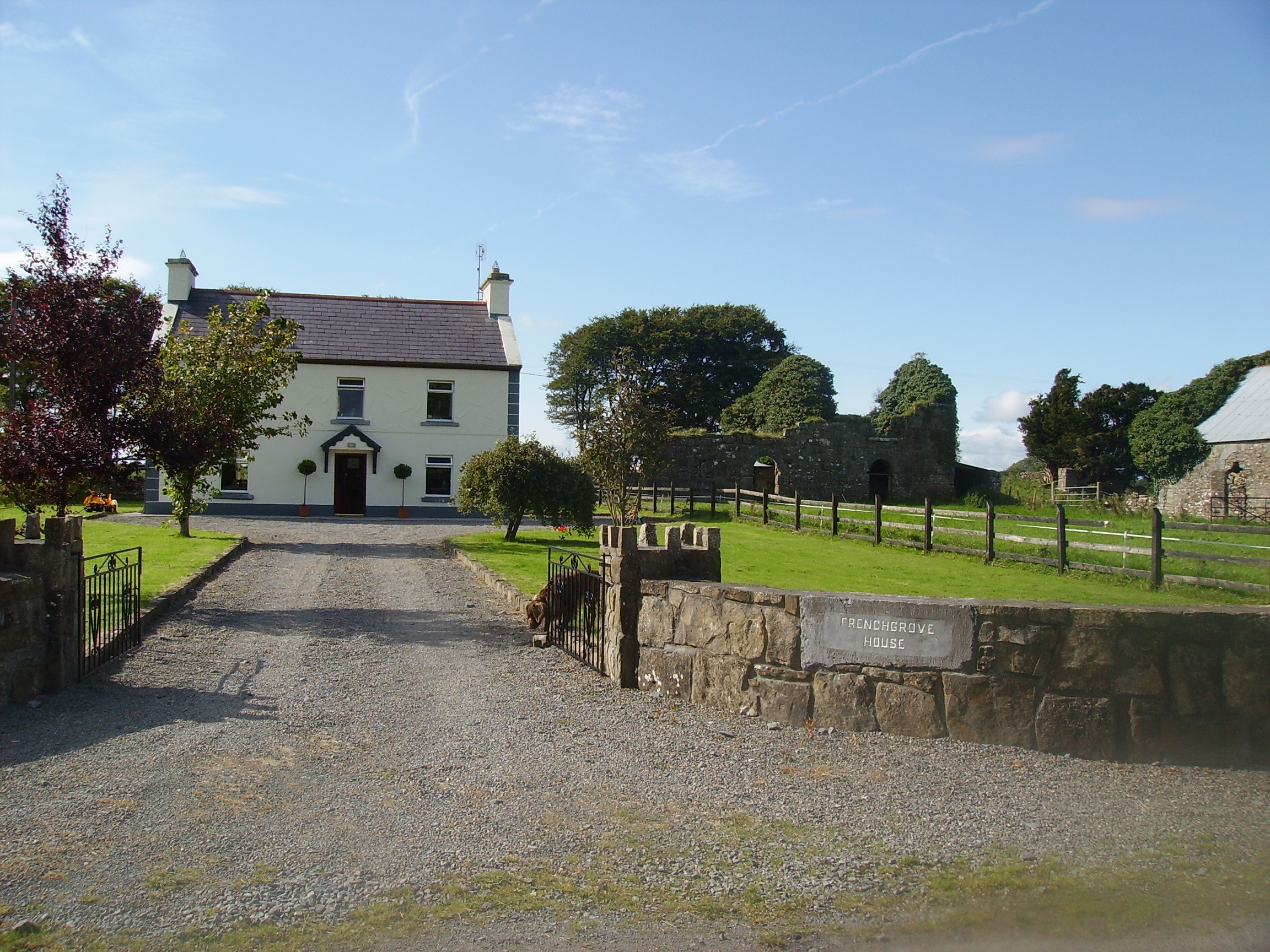
| Frenchgrove | A house marked as 'in ruins' on the 1915 edition of the 6 inch Ordnance Survey map. The Irish Tourist Association file describes Frenchgrove as the residence of the Blakes, later of the Frenches and finally of a man named Eager, a Dublin banker. No house of more than £3 valuation was recorded in Griffith's Valuation for the townland of Frenchgrove. A modern house now occupies the site with the remaining evidence of the old building. |
|
| Kilrush House | Built as an agricultural school in the 1830s, it was not a success and swiftly closed. The property was rented in the 1850s from the Lindseys by Francis Laurie, a farmer from Scotland. He died in 1865 and James Simpson took over the lease. Charles Bingham Jenings and his wife, formerly of Mount Jenings, lived at Kilrush for the first three years of the 20th century. The building is now a ruin. |
|
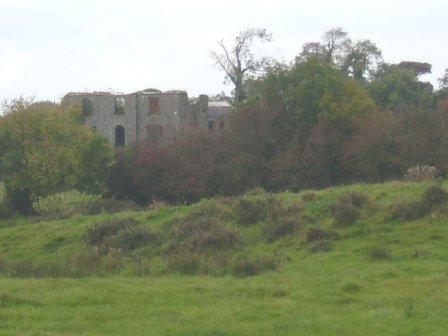
| Hollymount | A very early 18th century house built by Archbishop John Vesey of Tuam, altered in the 19th century. In 1786 Wilson refers to it as the seat of Mr. Lindsay. It was held in fee by Thomas S. Lindsay at the time of Griffith's Valuation when it was valued at £61. The home of the Lindsey Fitzpatricks until 1922 and of Mr J Loftus in the 1940s, now a ruin. |
|
| Ballyheeragh St Leger | This house was held in fee by Dominick Kearns at the time of Griffith's Valuation, when it was valued at £10. Bought by the Tierney family in the early 20th century and still occupied by them. |
|
| Farmhill/Carradoyne | In 1786, Wilson refers to Farmhill as the seat of Mr. Vesey. Dean Arbuthnot, who lived in the house in 1814, was rector of the parishes of Crossboyne and Kilcolman and a brother of Sir Robert Arbuthnot. The Gonne Bells were recorded as resident in Lewis and the Ordnance Survey Name Books. The house appears to have been known as Farmhill during the Vesey/Arbuthnot/Gonne Bell ownership and thereafter as Carradoyne House. It was occupied by Thomas Elwood in 1845 and by Lady Lynch Blosse at the time of Griffith’s Valuation. By the 1860s it was the home of the Sheffields. It was occupied by Katherine Tynan and her husband, Henry Albert Hinckson, during World War I. Carradoyne House is still extant and occupied. |

|
| Bushfield | The original house, now a ruin, was sometimes known as Creaghduff. Creaghduff was occupied by Burke esq in the 1770s. Thomas Ruttledge of Bloomfield made his will at Bushfield in 1797 and died there in 1805. Bushfield was the home of Arthur Knox and his wife Barbara, nee Lambert. Their daughter, Elizabeth, married Annesley Knox of Rappa Castle. Barbara married Charles White as her second husband and sublet the house to Robert Fair, son of Robert Fair of Fortville. It was valued at £15 the time of Griffith's Valuation. Robert Fair of Bushfield had an only daughter, Jane, who married Thomas Ruttledge of Bloomfield and their second son took the surname Ruttledge Fair. A new house was built in the 1920s and is the home of the Delaney family. Extensive remains of the original Bushfield farmyard survive at the site. |
|
| Castlevilla | A Ruttledge family home in the 19th century, still extant and lived in. At the time of Griffith's Valuation it was leased by James Rutledge from Lady de Clifford's estate and valued at £18. |
|
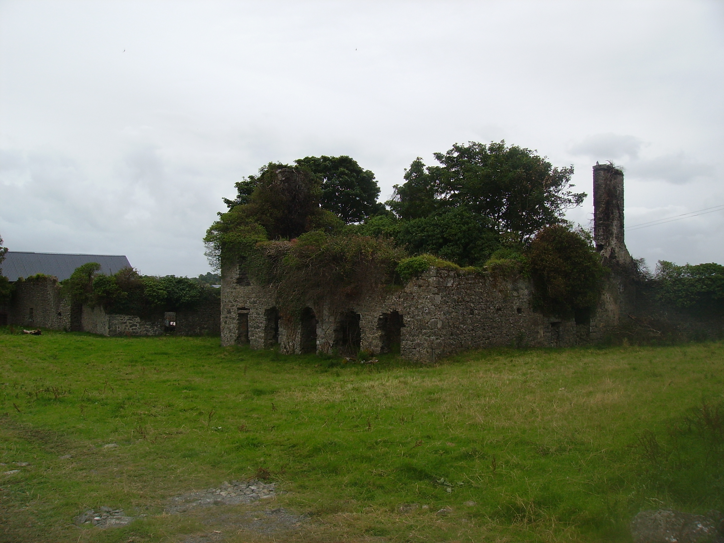
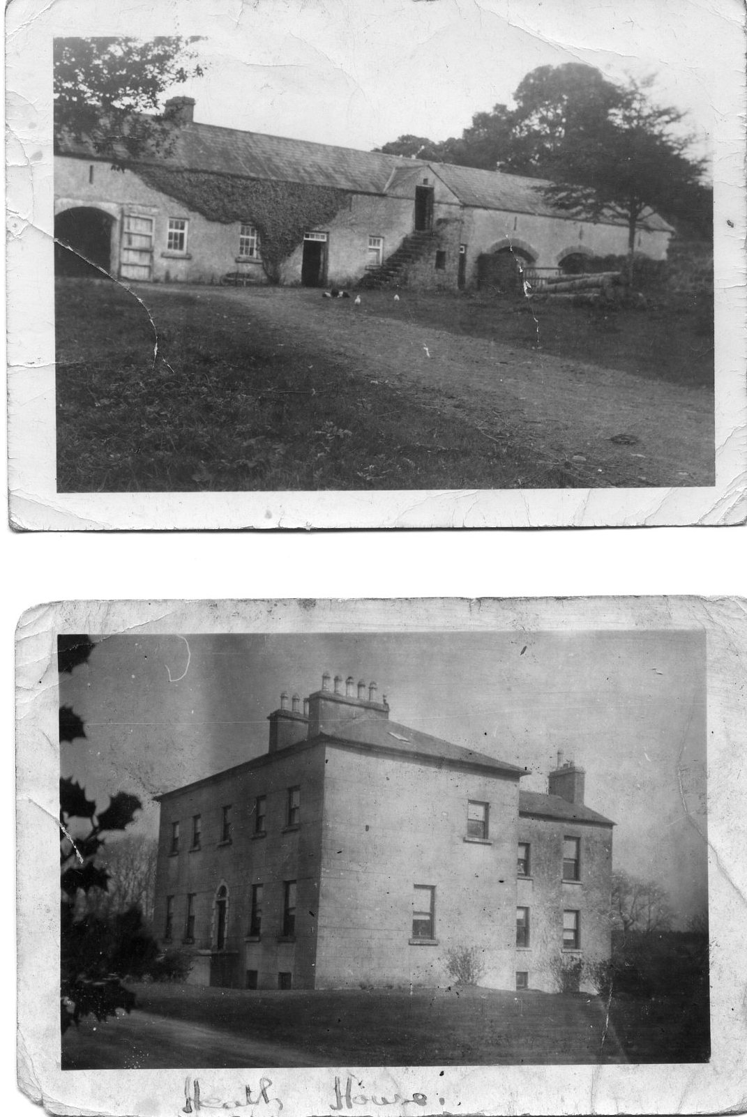
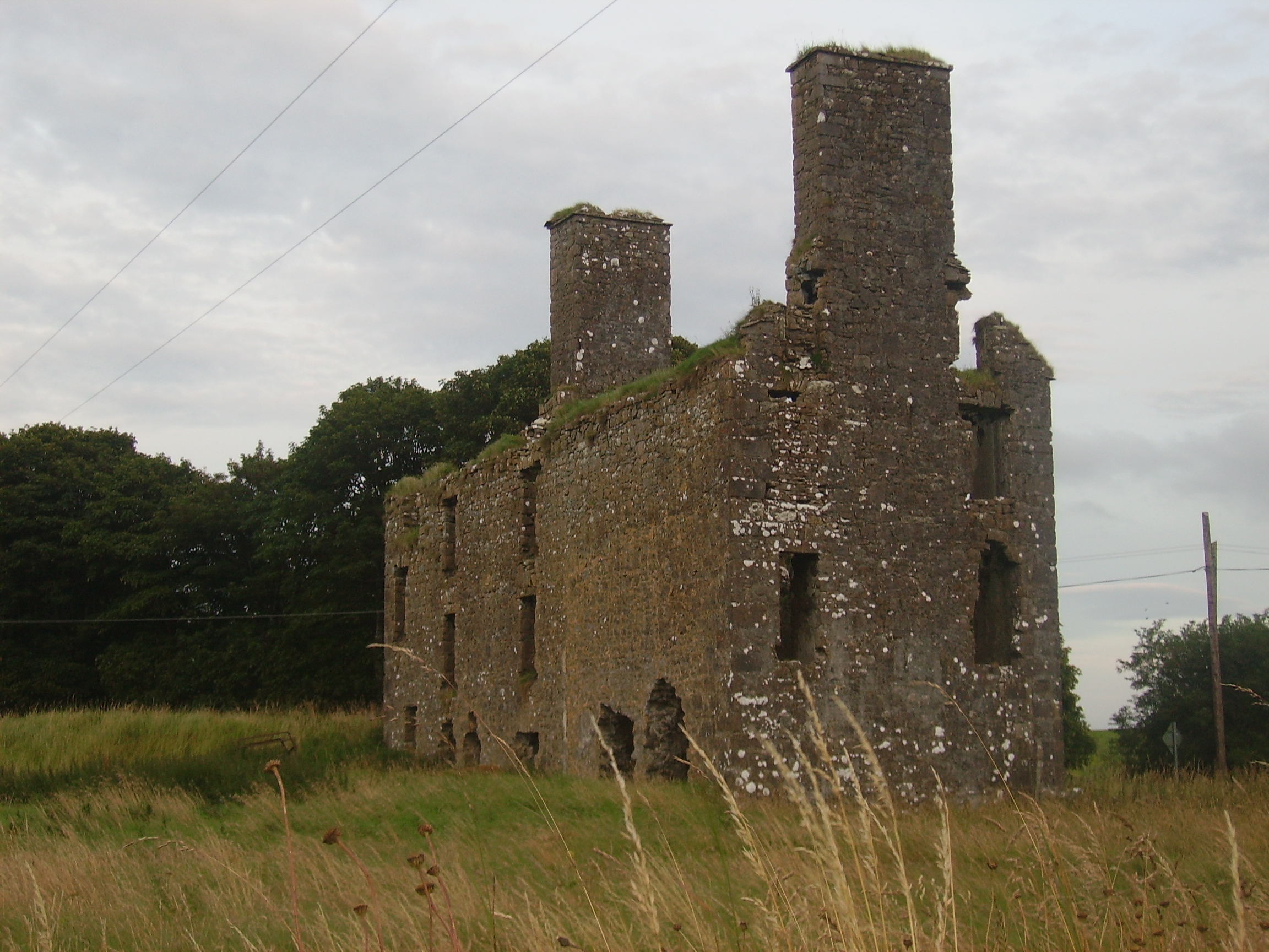
| The Heath | At the time of Griffith's Valuation, it was the property of Henry Blake and valued at £10. Described in 1863, when sold by the Blakes to the Tighes, as a substantial dwelling house with two reception rooms and six bedrooms, all in good repair. It is now a ruin. |
|
| Doonmacreena | In 1786 Wilson notes "Dunmacrene" as the seat of Mr. Blake. The sales rental of 1851 states that the old house at Doonmacreena was the residence of Mr Blake's ancestor 'now in ruins'. |
|
| Streamstown | William Coghlan was living at Streamstown, near Claremorris, in 1814. In the 1830s the townland is noted as belonging to Mr. Gonne Bell of Farmhill, Claremorris. By the time of Griffith's Valuation there is no house with a significant valuation in the townland. | |
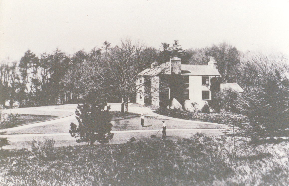
| Claremount | Built in the 18th century, this house was the home of George Browne, third son of the 1st Earl of Altamont, in the 1760s. His daughter and heiress married Dominick Browne of Castlemagarret and ownership of Claremount appears to have passed to the Castlemagarret Brownes. The Kirwans and Denis Browne of Westport lived in the house in the late 18th and early 19th centuries. It was bought by Murray McGregor Blacker from Lord Oranmore and Browne in 1858 for £4,250. Blacker owned the house until 1874. In 1877 the house and about 313 acres were sold to the local parish priest by Thomas D. Maguire for the purpose of establishing a Convent of Mercy. The nuns ran a girls' secondary school in the house. In October 1906 just over 300 acres of Claremount was vested in the Congested Districts' Board. |
|
| Woodstock | There is no substanial house marked on the first Ordnance Survey map for the townland of Woodstock. | |
| Cloonboy House | The home of John Coghlan at the time of Griffith's Valuation, held from the Lynch Blosse estate when the house was valued at £10. It is still extant. | |
| Cappagh | Cappagh was occupied by James Tighe at the time of Griffith's Valuation when the house, valued at £4, is described as a herd's house. It was built some time before the publication of the 1st edition Ordnance Survey map of 1838 and is still extant and well-maintained. |
|
| Millbrook House | There is a lithograph of this house attached to the sales rental of Lord Oranmore and Browne's estate in 1854. The sale rental states that the late tenant [Lawrence Glynn] recently expended a large sum in building a residence on this lot. This later building is labelled Millbrook House on the 25-inch Ordnance Survey map of the 1890s. It is no longer extant. | |
| Coarsefield | The Grays were in possession of Coarsefield by the late 1830s. The present house was probably built by the Tighe family who bought Coarsefield from the Grays and sold it to the Stephens family in the early 20th century. |
|
| Brookhill | Brookhill was situated on church land held by the Gonnes, who leased the house to the Kirwans in the late 1770s. Occupied by the Lambert family from the 1790s to the 1940s when it was sold to Gerald Maguire, a solicitor in Claremorris. Now the home of the Noone family. |
|
| Ballygowan Cottage | A Prendergast home in the 19th century, now in an advanced state of disrepair. The property was held in fee by Richard Prendergast at the time of Griffith's Valuation when it was valued at almost £10. |
|
| Carrowneden | Jon Treston was leasing this house, valued at £4, from the O'Farrell estate at the time of Griffith's Valuation. A house is still extant at the site. | |
| Dalgin | In 1786 Wilson refers to "Dalygan" as the seat of Mr. Birmingham. It was held in fee by Michael Bermingham at the time of Griffith's Valuation when it was valued at £17. Inhabited by the Birminghams and later the Kirwans until 1954, subsequently demolished. Out buildings still remain at the site beside a modern bungalow, the home of Mr John Curran. |
|
| Lehinch | A house marked on the Taylor and Skinner's map but not on the first Ordnance Survey map. In 1786 Wilson refers to it as the seat of Valentine Blake. The walls of the garden still remain and this was the venue for the Hollymount Show at one time. |
|
| Coolcon Castle | Originally a Burke castle and later a residence of the Blakes in county Mayo, very little of this castle now remains. | |
| Castlegar | Occupied by Ignatius Kelly in 1814, by William T. Kelly at the time of Griffith's Valuation and by Edward Dale in 1906. In the 20th century it became a boys' secondary school. There is a lithograph of the house in the sale rental for Castlemagarret in the Public Record Office of Northern Ireland. | |
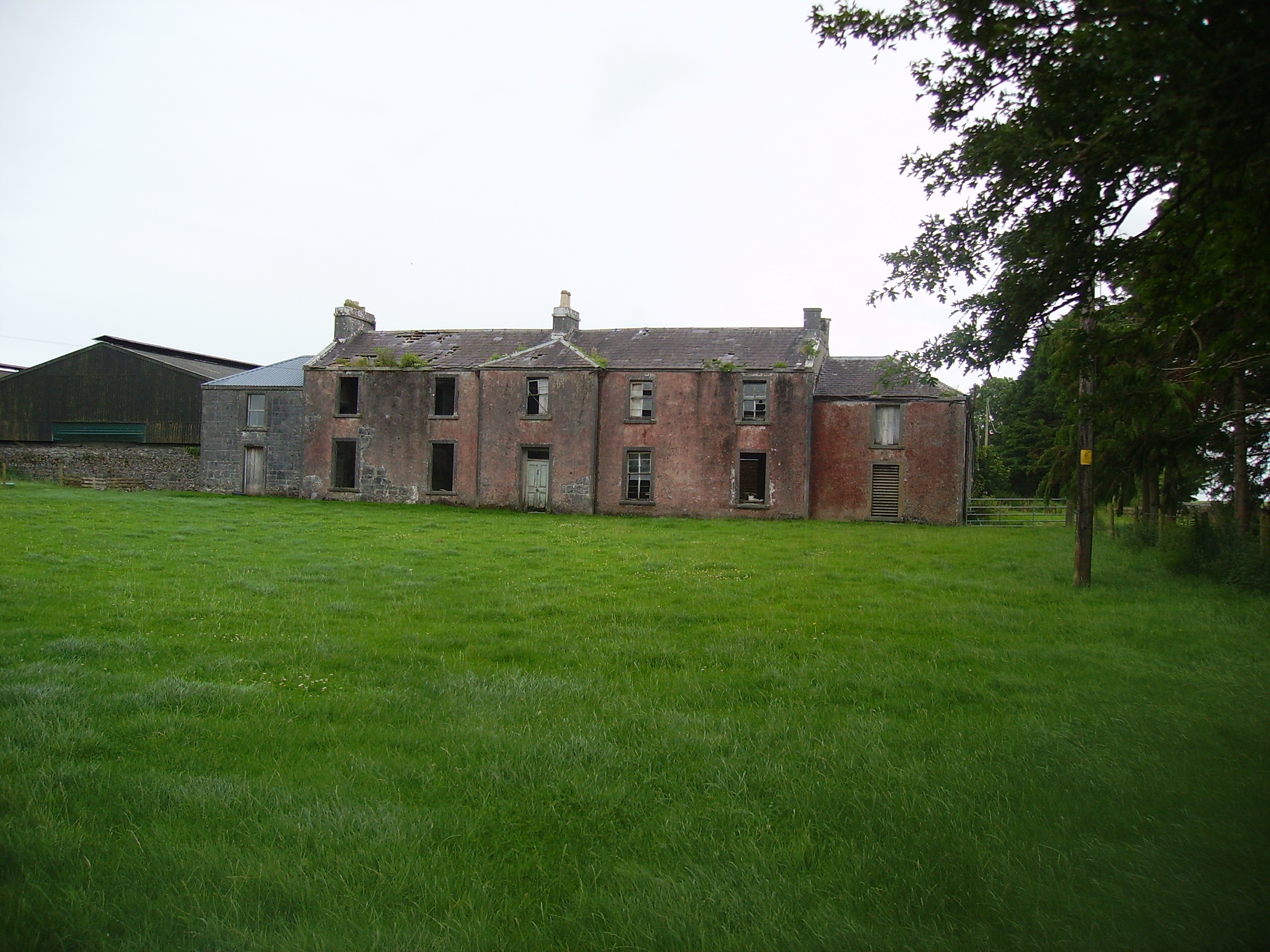
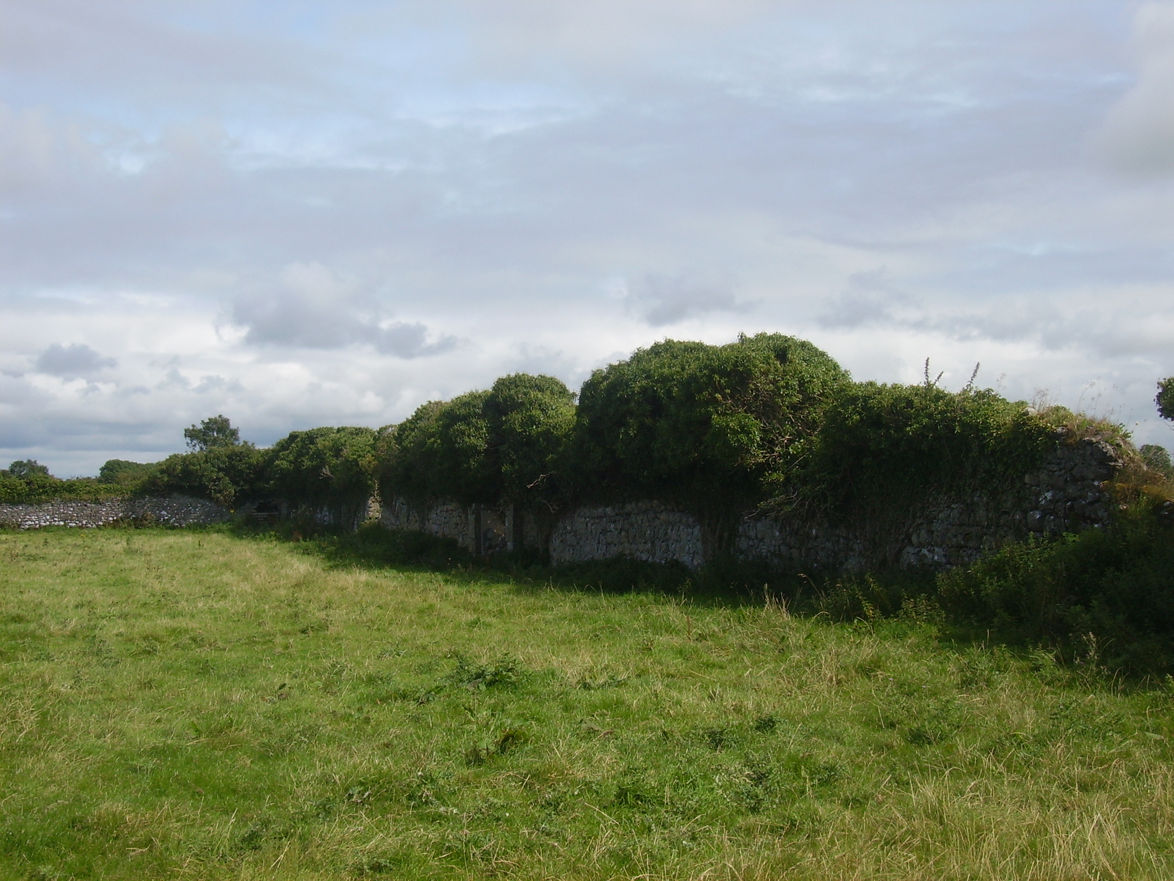
| Millbrook | Millbrook House was held in fee by John Bermingham at the time of Griffith's Valuation when the house was valued at £11 and the nearby mill (M412635) at £12. Both buildings are now in ruins. |
|
| Belmont | Home of the Blakes in the late 18th century and first half of the 19th century. Wilson refers to it as the seat of John Blake in 1786. Recorded as a steward's house at the time of Griffith's Valuation when it was held by James D. Meldon from the Bishop of Tuam. The original house is now a ruin. |
|
| Oldtown | A single storey house until the early 20th century when a second storey was added to part of the house. Occupied by the Bourkes from the 18th century until the 1920s and then by the Curran family. Restored by the present owner in the late 1990s. |
|
| Cuillaun | Part of the Oranmore and Browne estate in the mid 19th century, occupied by Frenches, Brownes and by Edward Rush at the time of Griffith's Valuation, when the house was valued at £7. Now the home of the Donnellys. |
|
| Oory/Coarsefield | It is probable that the townland of Coarsefield was part of Oory in the 18th century and that Oory was divided into two townlands at the time of the first Ordnance Survey. The remains of an old house are still visible at Coarsefield, close to the present house, and it is believed that this was Oory House, home of the Bourkes and later owned by the Nettervilles. In 1814 "Course-field" belonged to James Netterville. The sales rental of the Gray estate of Coarsefield in 1861 refers to one wall remaining of the old Netterville house. |
|
| Rockfort | Valued at £4 in the mid 19th century when it was occupied by Thomas Bourke who held from David Ruttledge. The Westport Estate Papers contain two 17th century maps of Levallyroe in the possession of Gerald Dillon and held from the Blakes. The Malones also had an interest in Levallyroe and Boleyboy. | |
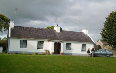
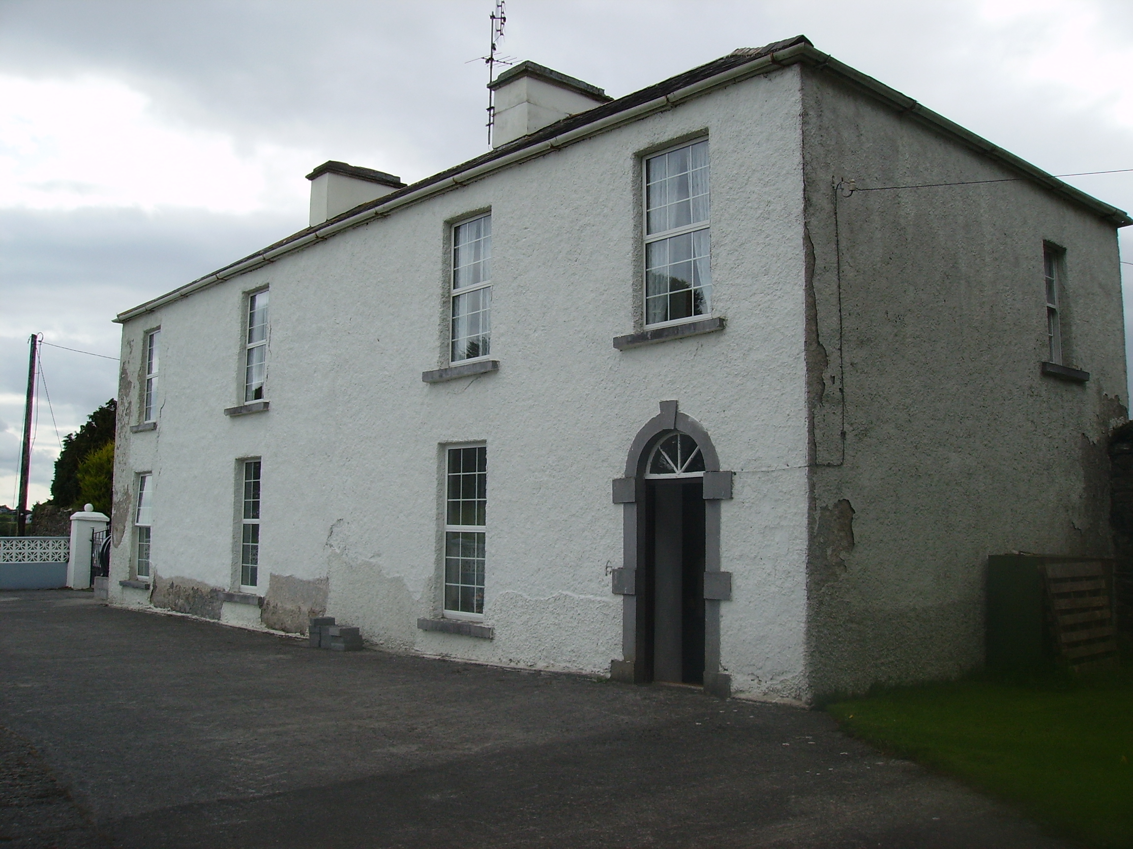
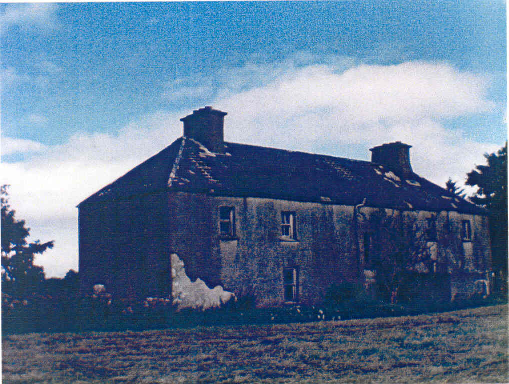
| Gardenfield House [Kilcommon] | Another Bowen home, occupied by William Bowen in 1814. The townland was in the possession of Henry Martin Blake at the time of Griffith's Valuation. It is labelled Gardenfield House on the 25-inch edition Ordnance Survey map of the 1890s. Still a family home, renovated in the early 21st century. |
![Photo of Gardenfield House [Kilcommon]](https://landedestates.ie/storage/img/orig/731.jpg)
|
| Rockfield | Marked on the first edition Ordnance Survey map, this house was occupied by Henry French at the time of Griffith's Valution and was described as a herd's house. It was valued at £4 and was located on the estate of Lord Oranmore and Browne. Now derelict it was last occupied by the Dillon family. |
|
| Cloontreston | The notice advertising the sale of Michael Francis Treston's property at Cloontooa, barony of Clanmorris states that "the dwelling house with the offices, garden and demesne, known as Cloontreston, is in fair order and condition, suitable as a residence for a gentleman". At the time of Griffith's Valuation the townland was owned by John Treston who also held a herd's house there. The house is labelled Cloontreston on twentieth century maps. Buildings are still extant at the site. |