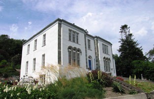
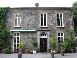
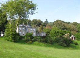
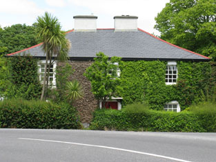
Ballynagornagh House
Houses within 5km of this house
Displaying 29 houses.
Houses within 5km of Ballynagornagh House
Displaying 29 houses.
| House name | Description | |
|---|---|---|
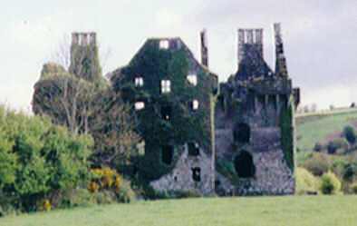
| Coppinger's Court | Built by Sir Walter Coppinger in the early seventeenth century and partially destroyed in the 1641 Rebellion. Described by Bence-Jones as an impressive semi-fortified house. By the mid nineteenth century it had fallen into ruin and is not mentioned in Griffith's Valuation, when the lessor of the surrounding land was Lady Carbery's estate. |
|
| Kilfinnan Castle | Occupied by John O'Brien, leasing from John de Burgh , at the time of Griffith's Valuation, when it was valued at £15. Noted in Lewis in 1837 as the residence of J. Ranclud. John French was occupying the house and demesne at Kilfinnin, barony of East Carbery, when it was offered for sale in the Encumbered Estates Court in May 1851. It is still extant and occupied. |

|
| Drombeg House | Drombeg was being leased by Catherine Jones from Lady Carbery's estate at the time of Griffith's Valuation, when it was valued at over £20. The sale notice of April 1852 includes a small lithograph of the house. In 1837 Lewis referred to Drombeg as the seat of Rev.Jonas Travers Jones. Leet refers to it in 1814 as the residence of John Baldwin. The house is still extant and occuped. See the Clonakilty Museum material at www.allaboutireland.ie |
|
| Lakeview (Kilfaughnabeg) | Leased by Martha Raclaud from the Baldwin estate in 1851 when it was valued at £8. It is labelled Lake View on both the First and 25-inch Ordnance survey maps. A house is still extant at this site. | |
| Shorecliffe House | Occupied by the Rev. William Baldwin at the time of Griffith's Valuation, when it was valued at £11. It is named Prospect House on the 1st-edition Ordnance Survey map but as Shorecliffe House on the 25-inchmap of the 1890s. It is still known by this name. It was offered for sale in 2015. |
|
| Glandore Castle | John deBurgh was leasing this property from James Redmond Barry in 1851 when it was valued at £12 10s. Noted by Lewis as the seat of P. Morris in 1837. In the 1940s the Irish Tourist Association Survey referred to it as the residence of Mr. T. McCarthy. It is still extant, having seen several renovations in its long history. |
|
| West View (Glandore) | Leased by Francis Allen from Lords Longford and deVesci at the time of Griffith's Valuation, when it was valued at £21. The National Inventory of Architectural Heritage contends that Stone Hall is the earliest house of this group of three and that they were constructed by members of the Allen family. This house is labelled as West View on both the First and 25-inch edition Ordnance Survey maps. It is still extant and occupied. |

|
| West View | At the time of Griffith's Valuation, West View was being leased from Lords Longford and deVesci by Francis Allen, when it was valued at £21. Lewis refers to West View as the seat of Maj. E. Allen in 1837. It is still extant and occupied and now known as Seamark. |
|
| Chateau Marie or East View | Held by Francis Allen but unoccupied in 1851 when it was valued at £30. Lewis refers to it as the seat of F. Allen in 1837. It is labelled Chateau Marie on the First Edition Ordnance Survey Map but as East View on the later 25-inch edition of the 1890s. Now a country house used for private functions. |
|
| Stone Hall | John Allen was leasing this property to Phillip Somerville in 1851 when it was valued at £26. Noted by Lewis as the seat of Maj. J. Allen in 1837. The house is still extant and occupied. |
|
| Glandore Lodge | Leased by Richard Adams from the Barry estate at the time of Griffith's Valuation, when it was valued at £14. Lewis refers to it as the seat of R. Adams in 1837. Though a building appears to exist at the site it is not named on the 25-inch Ordnance Survey map of the 1890s. A hotel is marked at the site. | |
| Glandore House | Leased by James R. Barry to Hon. Cecil Lawless in 1851 when it was valued at £26. . Noted by Lewis as the residence of J. R. Barry in 1837.The Irish Tourist Association survey of the 1940s noted that it had formerly been the residence of Isaac Morgan Reeves and later of Judge Coughlan but that it was vacant at that time. Still extant and offered for sale in 2010. |
|
| Glandore Cottage | Leased by John Allen and others from the Barry estate in 1851 when it was valued at £10. Noted by Lewis as the residence of J.F. Townsend in 1837. James R. Barry also owned an unoccupied hotel at this location in 1851. Glandore Cottage is still extant. | |
| Millfield House (Ross) | This house, with a mill valued at £40, was leased by William Limerick to Henry Morrow in 1851, when the house was valued at £12 5s. Lewis notes Millfield as the seat of Lieut. Lloyd, RN, in 1837 while it is noted by Leet as the residence of Roger Sweeny in 1814. The mill is labelled Ross Mill on the 25-inch map of the 1890s. There is still an extant house at the site as well as the remains of some mill buildings. | |
| Cahermore House | In 1851 Thomas Hungerford was leasing Cahermore House from the Bishop of Cork's estate,when it was valued at £32. It was owned by Henry Hungerford in 1906 and valued at over £44. Taylor and Skinner's map of 1783 as well as Wilson in 1786 also mention Cahermore as a Hungerford residence. In 1944 the Irish Tourist Association Survey noted that Cahermore had been burnt during the War of Independence and was then derelict. Donnelly indicates that it was burnt in June 1921. It is no longer extant. | |
| Burgatia House | Leased by Robert Starkey from the estate of the Bishop of Cork at the time of Griffith's Valuation when it was valued at £12. Donnelly indicates that this house was occupied by Thomas Kingston when it was burnt in February 1921 during the War of Independence. It is no longer extant. | |
| Easton House | In 1851 Jane Smyth was leasing this property from the Bishop of Cork's estate when it was valued at £13 15s. | |
| Milleen | Rev.William Jennings was leasing this property from the Hungerford estate at the time of Griffith's Valuation, when it was valued at £19 15s. In 1944 the Irish Tourist Association Survey lists Milleen among the houses in the area which had been burnt during the War of Independence and were then derelict. It is no longer extant. | |
| Creggane House | Creggane House was in the possession of John [Lichfield] at the time of Griffith's Valuation when it was valued at almost £9. It was leased to Robert Starkey at the time. A more substantial house is shown on the later 25-inch map of the 1890s. In 1885 Walford described Francis Evans Bennett as of "Creggane". A house is still extant at the site. | |
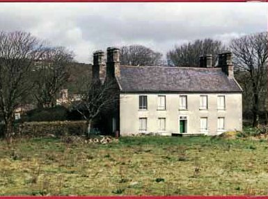
| Derry House (Ross) | Family records indicate the original house at Derry was bought by Bryan Townsend, son of Richard, the Cromwellian officer, in the 1680s. This house was a short distance from the current house which was built by Reverend Horatio Townsend in the early years of the nineteenth century and was held in fee by Reverend Chambre Townsend in 1851 when it was valued at £44. Earlier, in 1786, Wilson referred to Derry as a Townsend seat. It was substantially damaged when it was burnt in April 1921 during the War of Independence. . At the time it was the residence of Alexander Sullivan, a well-known barrister. In 1944 the Irish Tourist Association Survey noted that it was still derelict following the 1921 burning. The centre portion of the house and a substantial farm still exist at the site. |

|
| Roury House | Occupied by William Bleazby at the time of Griffith's Valuation on lease from the Townsend estate and valued at £12 5s. In 1885 Walford refers to the seat of William J. Bleazby as Bleazby Hall. A house still exists at this site. | |
| Castle Downeen | James Courcey was leasing Castle Downeen from Rev. John Smyth in 1851 when it was valued at £23 10s. Lewis refers to the house as the seat of R. Smith in 1837. Shown as a Smith residence on Taylor and Skinner's 1783 map. In 1944 the Irish Tourist Association Survey refers to "Duneen" as "now a farmer's dwelling". It is now a ruin. | |
| Ross Abbey House (Rosscarbery) | Rev. John Hamilton was leasing this property from Elizabeth Jago at the time of Griffith's Valuation, when it was valued at £12. This house no longer exists. | |
| Cashel House (Kilmacabea) | William Wolfe was leasing this property, then valued at £12, from Miss Wheeler, at the time of Griffith's Valuation. Local records suggest the family were associated with this house since the eighteenth century. The original house is no longer extant and a modern house exists at the site now. | |
| Cloonkeen House (Kilmacabea) | Leased by Sarah Dorman to Florence McCarthy in 1851 when the house was valued at £9. A house still exists at the site. | |
| Connonagh House | John Morris was leasing this property to Barbara Jago in 1852 when it was valued at almost £8. There is still an extant house at the site. |
|
| Westwood/Benduff Cottage | Catherine French held this property from William Morris at the time of Griffith's Valuation. On the 25-inch Ordnance Survey map of the 1890s it is labelled Westwood. In 1906 it was owned by Michael French and valued at £13 10s. There is still an extant house at the site. | |
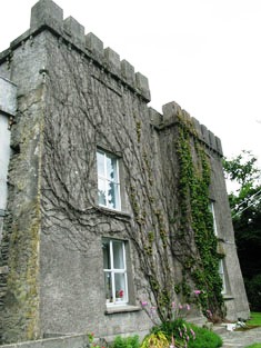
| Castle Salem | This property had formerly belonged to the McCarthys but was acquired by William Morris and re-named Castle Salem. In 1786 Wilson refers to it as the seat of the Morris family but by the publication of the first Ordnance Survey Map it is labelled "Benduff Castle or Castle Salem, in ruins". This property, developed over several centuries, is still extant and occupied. |
|
| Cellmount House | Wilson, writing in 1786, refers to "Selmount House" as a seat of Mr. Morris, three miles from Ross Carbery. This property is labelled "Cellmount House, in ruins" on the 1st edition Ordnance Survey map and there is no trace of it on later maps. |