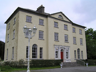
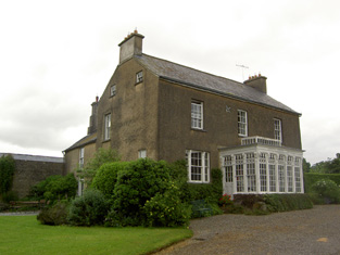
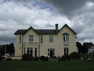
Heathview
Houses within 10km of this house
Displaying 49 houses.
Houses within 10km of Heathview
Displaying 49 houses.
| House name | Description | |
|---|---|---|
| Ballinunty House | William Going occupied this house and held it in fee in the mid 19th century when it was valued at £24.10 shillings. In 1894 Slater notes it as the seat of Miss A.J. Going. This house no longer exists. | |
| Lickfinn | Fergus Langley occupied Lickfinn in 1814 and John Langley held the house valued at £12 and 273 acres in fee at the time of Griffith's Valuation. This house was later known as Knockanure. In 1906 held by the representatives of John Langley. | |
| Poyntstown | A home of a branch of the Cooke family in the 18th century. In 1786 Wilson refers to "Point's-town" as the seat of William Cooke. He was also the proprietor in 1814. In 1837 Lewis records Poyntstown as the property of Phanuel Cooke "in ruins". The house is marked as in ruins on the first Ordnance Survey map. Fennell Cooke held this townland at the time of Griffith's Valuation. | |
| Helen Park | Oliver Latham was residing at Helen Park in 1814 and in the mid 19th century Reverend Martin Laffan, Parish Priest of Killenaule, was the occupant. He held the property from Patrick Waldron and the buildings were valued at £22.15 shillings. Helen Park is listed as one of the residences of Lawrence Waldron in the 1870s. Still extant and occupied. |
|
| Cleragh House | William Power was living at Cleragh, Killenaule in 1814 and Charles Blackmore was resident in the mid 19th century. Blackmore held the house valued at £13 from Patrick Waldron with 257 acres. This house is still in use as a country residence. |
|
| Noan | Originally the home of the Taylor family, Wilson refers to Noan as the seat of Godrey Taylor in 1786. It was occupied by Natt. Taylor in 1814 and recorded by Lewis as the seat of the Taylor family. In 1840 the Ordnance Survey Name Books refer to Mary Phelps as the proprietor of Noan House. By the mid 19th century it was occupied by the representatives of John Bagwell and held in fee. The buildings were valued at almost £30. The sale rental of 1853 records James Chadwick as tenant on a seven year lease. A lithograph of the house is included. Occupied by Dr Armitage in the 1870s who owned over 2,000 acres in the county. It is still extant and occupied. |
|
| Knockanglass | This house was the home of James Riall in the early 1850, who held the property from K.Pennefather. The buildings were valued at £18.15 shillings. The National Inventory of Architectural Heritage states that this house was associated with the Langley family and was sold to the O'Dwyers in 1912. It was occupied by Adelaide Langley in 1906. It still functions as a residence. |
|
| Moglass House | Moglass valued at £11 was held by John Riall from George Riall at the time of Griffith's Valuation. It is described as "in ruins" on the 25-inch Ordnance Survey map of the 1890s. | |
| Lanespark | The home of the Lane family from the 18th century,Wilson refers to it as the seat of Hamilton Lane in 1786. Held by John Lane in 1814 and by his representatives in the early 1850s, when the house was valued at £26. The sale rental of 1858 describes the farm offices as extensive and that a powerful steam engine had been erected. Lanespark House is still extant. | |
| Roan | Dennis Duan was resident here in 1814 and Robert Purcell in 1814. He held the property valued at £18.15 shillings from Matthew Jacob. This house had later associations with the Bianconi family and is still a family home. |
|
| Silverfort | Silverfort was the home of a branch of the Scully family throughout the 19th century. Jeremiah Scully was resident in 1814, in 1837 and in the early 1850s when he held the house valued at £18.10 shillings from George Carlton. Jerome J. Scully was tenant in November 1857 and still resident in the mid 1870s. This house is still in use as a country home. |
|
| Ballinree | Ballinree House was valued at £16+ in 1850 and was occupied by the Reverend William Kirwan and held from Smyth Barry. Arthur H.S. Barry was the occupier in 1906. | |
| Ballysheehan | Occupied by the Lethams from at least the 1770s and noted by Wilson as their residence in 1786. William Latham is recorded as resident in 1814 and Thomas Brinly in 1850 when the buildings were valued at £28+ and held from Smyth Barry. This house still exists, the centre of a stud. | |
| Ballytarsna | John Max occupied this house which he held from the Bunbury estate in 1850. The buildings were valued at £16.12 shillings. In 1906 James Grene was resident. Recently renovated this house is still well maintained and occupied. |
|
| Dually | William Scully, fourth son of Roger Scully of Kilfeacle and Dualla, county Tipperary, was living at Dually in the late 18th century. John Scully was resident at Dually in 1837. In 1811 John had married Catherine Moore sister of the poet Thomas Moore. Roger Scully was the occupier in the early 1850s. He held the property from Oliver Latham and the buildings were valued at £24.14 shillings. This house is now run as a Bed and Breakfast guesthouse by the Power family. http://www.duallahouse.com/ |
|
| New Park | A mid 18th century house built by the Pennefather family and occupied by them until sold to the Davies family after the Famine (Bence Jones). In the mid 19th century the house was valued at almost £49 and held in fee by Captain M. Pennefather. It was advertised for sale by the Pennefathers in June 1852 and bought by the Davies who sold it to the McCans in 1864. Joseph McCann was resident in 1906. Now known as Ballyowen House and still in use as a country house. |
|
| Rathclogh Cottage | A small residence when marked on the first Ordnance Survey map. Occupied by Charles Minchin in 1850, valued at £13+ and held from John Millett. | |
| Lismortagh | Matthew N. Sankey was residing at Lismortagh in 1814 and John Millett in 1850. Millet held the property from the representatives of William Burgess and the buildings were valued at £17.15 shillings. This 18th century house is still a fine residence. |
|
| Mortlestown Castle | Captain James G. Jacob was the occupant of Mortlestown Castle in 1814. By the time of Griffith's Valuation Thomas P. Lloyd was resident holding the property from Robert Jacob. The house was valued at £29. Buildings are still located at this site. | |
| Gaile | Gaile was the home of the Phillips family in the 19th century, occupied by S. Phillips in 1837 and by Richard Phillips in 1850. It was held from Benjamin Bunbury with 749 acres and was valued at £37+. The Phillips continued to reside at Gaile until at least the mid 20th century. This house was vacant in the early 21st century. |
|
| Regaile | In 1840 the Ordnance Survey Name Books record Rev. Mr. Joice as the occupant of Regeale. The Reverend Robert Armstrong occupied the house at the time of Griffith's Valuation holding it from Richard Phillips. The buildings were valued at £20.18 shillings.A house is still extant at Regaile. | |
| Grallagh Castle | In 1840 the Ordnance Survey Name Books refer to Mr. Hodgins as resident at Grallagh House. Southery Mansergh occupied the house,valued at £14+ in the mid 19th century. He held this property from O'Connor Hinchy. It is labelled Grallagh House on the 1st Edition Ordnance Survey map but as Grallagh Castle on the 25-inch map of the 1890s. It is no longer extant. | |
| Graiguenoe | In 1837 Lewis refers to C. Clarke "who has recently erected a spacious and elegant mansion on his estate". In 1850 this mansion was valued at £44.12 shillings and it was held in fee by Charles Clarke. Slater noted it as the seat of James Neville Clarke in 1894 and the Clarkes were still resident at Granguenoe Park in the early 20th century. The house was burnt in 1923. The site is now occupied by a stud farm. | |
| Killough | A 16th century tower house with a number of additions, Lewis records Killough Castle as the "occasional residence" of the Honourable Mrs Plunkett. In 1850 the Honourable Bowes Daly occupied the castle valued at £22.14 shillings which he held in fee. |
|
| Beechmount | John Godfrey was the occupant of Beechmount, Fethard, in 1814 but by 1837 T. G. [Thomas Godfrey] Phillips was resident. He held the property from the Massys and in the early 1850s the buildings were valued at £18.12 shillings. The representatives of Samuel Phillips were still resident here in the 1870s. The house is still a residence. |
|
| Clonbrogan | An early 18th century house built by Solomon Watson, the residence of M. Watson in 1814. By the time of Griffith's Valuation John Murphy was the occupier holding the house from Jeremiah Scully. It was valued at £5.14 shillings. This house is still a residence. |
|
| St Kevinsfort | St Kevinsfort was occupied by William Massey [William Creagh Massy?] at the time of Griffith's Valuation. The buildings were valued at £15.17 shillings and held from Usher Beere. In 1840 the Ordnance Survey Name Books refer to the house as the property of Mr. Massy. |
|
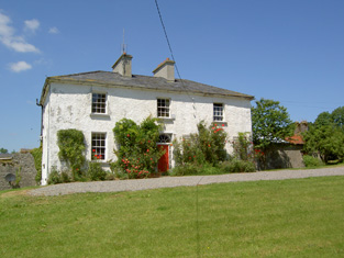
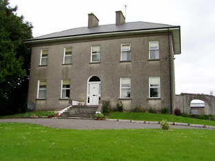
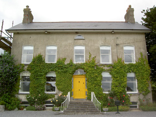
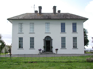
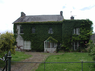
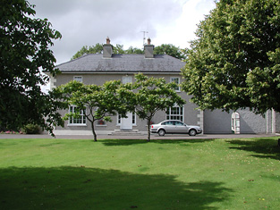
| Liskeveen [Fannyville] | Originally known as Fanny Ville and marked on the first Ordnance Survey map as such. The Ordnance Survey Name Books refer to it as the residence of Richard Beere in 1840. This house was extended sometime in the mid 19th century and was valued at £30+ when occupied by Samuel M. Going and held by him in fee at the time of Griffith's Valuation. It is still extant. |
![Photo of Liskeveen [Fannyville]](https://landedestates.ie/storage/img/orig/2015.jpg)
|
| Newhill | A property belonging to the Going family in the late 18th and 19th centuries. Newhill was the home of James Going in 1814 and of John Thomas Going, son of Samuel Murray Going, in the mid 19th century. The buildings were valued at £18.12 shillings at this time and held from Christopher Donville. Newhill passed to John Thomas Going's sister Mary Braddell who was resident in 1906. | |
| Riversdale | A house occupied by Patrick Hyland at the time of Griffith's Valuation, held from Usher Beere and valued at £15+. | |
| Parkstown | The Lamphiers were resident at Parkstown from at least the 1770s. In 1786 Wilson refers to Parkes-town as the seat of "Mr. Lanphier". Henry Langley lived at Parkstown in 1814 and John P. Lamphier was resident in 1837 and in the early 1850s. Lamphier held the property from the Court of Chancery and the buildings were valued at £23+. John P. Lanphier was the occupant at the time of sale in 1852. This building is still a fine residence. |
|
| Cabragh Castle | The home of James Fogarty in 1814. In 1840 the Ordnance Survey Name Books refer to P. Fogarty as the proprietor of "Cabra House". Denis Leahy was the occupier in the mid 19th century when the castle was valued at £16+ and held from the Court of Chancery. | |
| Turtulla | A member of the Blunden family was living at "Turkla" close to Thurles in the 1770s. William Nicholson was living at Turtola in 1814. Lewis writes in 1837 that it was the property of Valentine Maher but that John B. O'Brien was resident. A flour mill was located on the property. In 1840 the Ordnance Survey Name Books record a Mr. Lister in charge of the mill. They refer to Valentine Maher as the proprietor. By the time of Griffith's Valuation Nicholas Maher was the occupier. He held the property from the Court of Chancery and the buildings were valued at £50+. Nicholas had succeeded his cousin Valentine in 1844 and died without heirs in 1871. Turtulla then became the home of the Barry family from county Limerick. It was unoccupied from 1927 to 1944 when it was purchased by the Thurles golf club and has been their club house since then. see http://www.thurlesgolfclub.com/cluboverview.html |
|
| Maxfort House | Maxfort was the home of John Max in 1814 and of William Max in 1837 and at the time of Griffith's Valuation. It was held from Viscount Hawarden and valued at £15.18 shillings. A house is still extant at the site. | |
| Laurel Lodge | In the mid 19th century Vernon Lamphiere occupied a house in the townland of Moycarky held from William Max and valued at £13.5 shillings. A house is still extant at the site. | |
| Archerstown | The home of a branch of the Langley family, occupied at the time of Griffith's Valuation by Henry Langley and held from the Reverend Robert Lockwood. The buildings were valued at £25+. The Langley family continued to live here until the 1970s. |
|
| Rathmanna | Thomas Ryan of Rathmanna died in 1835 and is buried in the graveyard of St Mary's Church, Thurles. Rathmanna house was occupied by Thomas Ryan in the mid 19th century and held from Messrs Waller and Doherty on a lease dated 1791 James Doherty to Thomas Ryan. It was valued at £22.17 shillings. In 1865 it was advertised for sale with about 340 acres belonging to Thomas Ryan. Rathmanna a substanial and spacious house was in the possession of Michael Cahill in 1873. A building is still located at this site. | |
| Littleton Lodge | Littleton Lodge was the residence of Thomas Ellard in 1814. In 1840 the Ordnance Survey Name Books record it as "the name of a castle, the residence of a gentleman". Charles Wilkinson as the occupier then and in the early 1850s. Wilkinson held the house valued at £17.12 shillings from Mrs Ellard. This house is still a family home. |
|
| Ballydavid | The residence of Marcus C. Russell in 1814 and of John Russell at the time of Griffith's Valuation, when it was valued at £26.15 shillings and held from Edward H. Byrne. The sale rental of 1854 includes a lithograph of this house. It was bought by Richard Power and his descendants continued to live in the house until 1950. The house was demolished in 1963. | |
| Ardfort House | The National Inventory of Architectural Heritage dates this house from approximately 1875. It was the home of the O'Brien family of Thurles and is still extant. |
|
| Synone | A house built in the second half of the 19th century, still extant and lived in. |
|
| Springhill | Occupied by Dr Samuel Hemphill and held by Samuel Hemphill Esq in fee at the time of Griffith's Valuation when the house was valued at £5.15 shillings. |
|
| Beakstown House | Major Ledwell was resident at Beakstown in 1837 and the Ordnance Survey Name Books also mention it as his residence in 1840. At the time of Griffith's Valuation one house at Beakstown appears to be in use as an auxiliary poorhouse, held by the Reverend George Peacock from the Court of Chancery and valued at £22+. Another property seems to be labelled Abbey View on the 1st Edition Ordnance Survey map but as Beakstown Cottage on the 25-inch map of the 1890s. The OS Name Books refer to this house as the residence of Mr. Mullvany, proprietor of Beakstown Flour Mills nearby. The name Beakstown Cottage had previously belonged to another property in Beakstown which is still extant [S087559]. The original Beakstown House does not appear to be extant. | |
| Ballymurreen | In 1786 Wilson refers to "Ballymoreen, with the ruins of castle and church" as the seat of Mr. Baker. This townland was described as "in chancery" at the time of Griffith's Valuation. | |
| Shanbally House (Moycarkey) | In 1786 Wilson refers to Shanbally as the seat of Colonel Slaughter. In1840 the Ordnance Survey Name Books note that "Shanbally Old Castle" was the name given to a house in the parish of Moycarkey. By the time of Griffith's Valuation the townland is part of the estate of Miss Emma Stannix. A house is still extant at this site, now part of a large farm. | |
| Coolquill Castle | In 1786 Wilson refers to Coolquill as the seat of Mr. Gahan. The property is labelled "Coolquill Castle" on the 1st edition Ordnance Survey map and indicates that it was built on to a tower house. Coolquill was held in fee by Colonel Palliser in the mid 19th century. He was married to Anne Glenstanes. The castle was valued at £5. The castle ruin and other buildings are still extant at the site. | |
| Holycross House | In 1840 the Ordnance Survey Name Books refer to Holycross House as a gentleman's residence. At the time of Griffith's Valuation, it was owned by Rev. Garret Wall but was unoccupied. The house was valued at almost £24. A house still stands at this site which now appears to be in use as a presbytery. |
|
| Abbeyfield / Gortnagowth | In 1840 the Ordnance Survey Name Books refer to Abbeyfield House as the residence of William Jones. At the time of Griffith's Valuation, Jeremiah O'Brien was leasing this property from the Wall estate when it was valued at £15+ and included a mill. It is labelled Abbeyfield on the 1st edition Ordnance Survey map but as Gortnagowth on the 25-inch map of the 1890s. It is still extant. | |
| Woodhouse (Middlethird) | In 1841 the Ordnance Survey Name Books refer to Woodhouse, a gentleman's house, the proprietor being Basil Bryan. By the time of Griffith's Valuation, a property at Woodhouse was occupied by Timothy Connolly, who was leasing it from Richard Price. It was valued at £10+. Woodhouse is labelled "in ruins" on the 25-inch edition Ordnance Survey Map of the 1890s. |