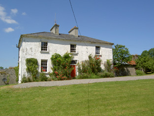
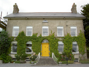
Peppardstown
Houses within 5km of this house
Displaying 10 houses.
Houses within 5km of Peppardstown
Displaying 10 houses.
| House name | Description | |
|---|---|---|
| Knockanglass | This house was the home of James Riall in the early 1850, who held the property from K.Pennefather. The buildings were valued at £18.15 shillings. The National Inventory of Architectural Heritage states that this house was associated with the Langley family and was sold to the O'Dwyers in 1912. It was occupied by Adelaide Langley in 1906. It still functions as a residence. |
|
| Moglass House | Moglass valued at £11 was held by John Riall from George Riall at the time of Griffith's Valuation. It is described as "in ruins" on the 25-inch Ordnance Survey map of the 1890s. | |
| Lismortagh | Matthew N. Sankey was residing at Lismortagh in 1814 and John Millett in 1850. Millet held the property from the representatives of William Burgess and the buildings were valued at £17.15 shillings. This 18th century house is still a fine residence. |
|
| Mortlestown Castle | Captain James G. Jacob was the occupant of Mortlestown Castle in 1814. By the time of Griffith's Valuation Thomas P. Lloyd was resident holding the property from Robert Jacob. The house was valued at £29. Buildings are still located at this site. | |
| Coolmore | The seat of the Sankey family in the 18th and 19th centuries, Coolmore was recorded by Wilson as the seat of Mr. Sankey in 1786. It was occupied by John Butler in 1814, by Matthew Villiers Sankey in 1837 and by Jacob Sankey in 1850. He held the property in fee and the buildings were valued at £37.15 shillings. In the second half of the 20th century Coolmore became a world famous stud for the breeding of race horses. The stud was set up in the late 1960s by Tim Vigors and continued by Vincent O'Brien, Robert Sangster and John Magnier. |
|
| Rocklow | Taylor and Skinner records Rocklowe as the residence of Lowe Esq in the 1770s. Rocklow was the home of Benjamin Frend and his wife, Eliza Gough, in the first half of the 19th century. Benjamin was resident there from at least 1814 to the 1850s. Griffith's Valuation records that it was held from Hugh Barton and was valued at £37+ in the early 1850s. This house later belonged to the Massys and is still in use as a residence. In 2022 it was offered for sale. |
|
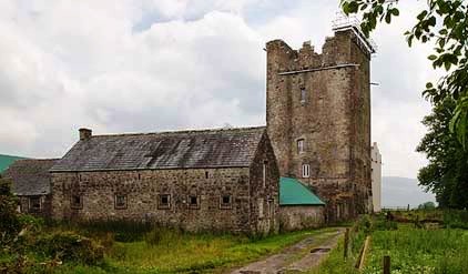
| St Johnstown | St Johnstown originally belonged to Matthew Jacob, whose only daughter and heir married Richard Pennefather of New Park in 1782. Wilson refers to it as the seat of Mr. Jacob in 1786 but their second son Matthew J. Pennefather was resident at St Johnstown in 1814. In 1837 Lewis records St Johnstown Castle as "consisting of a high square tower in good preservation, [it] is the property of James Millet Esq who has a modern house in its immediate vicinity". The buildings were valued at £31+ in the early 1850s, James Millet was still the occupier holding the property from Stephen C. Moore. | |
| Knockkelly | In the mid 19th century Richard Crane held a house valued at £12+ from William Barton in the townland of Knockkelly. This appears to be the house marked as Knockkelly house on the first edition Ordnance Survey map. | |
| Ballinard Castle | In 1894 Slater refers to Ballinard Castle as the residence of William Tennant. At the time of Griffith's Valuation, John Lindsay owned land in the townland of Friarsgrange, parish of Coolmundry, in which Ballinard Castle is situated. It appears that, in the nineteenth century, a house was built adjoining the original tower house as, in 1840, the Ordnance Survey Name Books refer to Ballinard Castle, a gentleman's seat in the townland of Friarsgrange. Information in the Woodstock Museum, Ontario, Canada, indicates that the building was owned by the Lindsay family until 1926. The building is still extant. |
|
| Brookhill House | In 1786 Wilson refers to Brookhill as the seat of Mr. Lowe. The 1st edition Ordnance Survey map shows Brookhill house, "in ruins", in Farranshea townland, parish of Peppardstown. An old manor house, also in ruins, is shown as well. The Ordnance Survey Name Books, in 1840, describe the site as "two large houses, one having its eastern end and the other, its eastern side, joining the ruins of the Old Manor House". At the time of Griffiths' Valuation, the townland was in the possession of the Hackett estate and the houses are described as "in ruins". The ruins are not shown on the later 25-inch map of the 1890s. |