Ballynatray House
Houses within 10km of this house
Displaying 61 houses.
Houses within 10km of Ballynatray House
Displaying 61 houses.
| House name | Description | |
|---|---|---|
| Breeda House | Roger G. Davis held a house in fee, valued at £17, in this townland at the time of Griffith's Valuation. Breeda House is labelled on the 25-inch Ordnance Survey map of the 1890s. A house is still extant at the site. | |
| Ballyglassin House | James Butler held this house valued at £17 from his father-in-law, Roger Green Davis, at the time of Griffith's Valuation. There is still an extant house at the site. | |
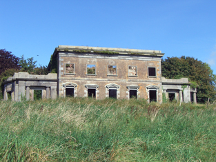
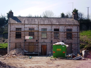
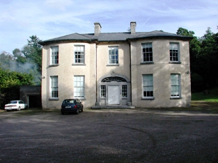
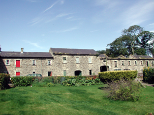
| Dromdihy | The building of this house was completed in 1833 for Roger Green Davis. He is recorded as the occupier in the early 1850s holding the house valued at £45 from Sir Arthur De Capell Brooke. The sale rental of 1863 gives a detailed description of this house - "Drumdiah House consists of a centre and two wings, ornamented with Doric columns and with a portico at the eastern end, by the hall is entered, and off which are hot, cold, vapour and shower baths. The first floor comprises five sitting-rooms; on the second floor are four best bedrooms, with dressing-rooms and water-closet......". In the 1940s the Irish Tourist Association Survey reported that the house had been "destroyed in the Troubles". It is now a ruin. |
|
| Gortnagappul | This area is marked as the farmyard of Aghadoe House on the first Ordnance Survey map. At the time of Griffith's Valuation a house and offices valued at £28 were held by Roger G. Davis from Richard Uniacke Bailey. A large farm complex exists at the site now. | |
| Aghadoe House (Killeagh) | Lewis writes in 1837 that “The present house is about to be replaced by a castellated mansion”. The earlier house is referred to by Wilson in 1786 as the seat of Simon Dring. Aghadoe wasccupied by Thomas M. Green at the time of Griffith's Valuation. The house, valued at £27, was held by him from Sir Arthur De Capell Brooke. The house is no longer extant. | |
| Mount Uniacke | A home of the Uniacke family in the 18th and 19th centuries, occupied by three generations of persons named Norman Uniacke in the 19th century. Earlier, in 1786, Wilson refers to it as the seat of James Uniacke. In the mid 19th century it was held by Norman Uniacke in fee and the house was valued at £30. The Irish Tourist Association Survey of the 1940s reported that it had been burnt in 1921 and it is no longer extant. | |
| Cornaveigh | A house in this townland was occupied by George Bowles in the mid 19th century, valued at £17 and held from his father, Spotswood Bowles. The original building is no longer extant. | |
| Park | Located on the Ponsonby estate The Park was occupied by John Hudson junior in 1814 and by Robert Hudson in the early 1850s when the house was valued at £10. The Hudsons may have been agents to the Ponsonbys. The address of Charles W. Talbot Ponsonby is given as Park House, Youghal in the 1870s. | |
| Burges House | This house, valued at £14, was occupied by William Hall at the time of Griffith's Valuation and held from Lord Ponsonby. | |
| Inchiquin House | In the early 1850s Henry Hall occupied this house valued at £15 located on the Ponsonby estate. | |
| Knockmonalea House | A house valued at £14, the home of John Hudson at the time of Griffith's Valuation and held from Lord Ponsonby. | |
| Brooklodge | This house situated in the 6 acre townland of Brooklodge was the residence of Henry Marsden and his wife in the first part of the 19th century. By the time of Griffith's Valuation the Reverend Pierse Drew was resident. He was rector of Youghal and a member of the family of Drew of Mocollop Castle, county Waterford. The Reverend Drew held the property from John Pollock and it was valued at £40. | |
| Mary Ville | Mary Ville is marked on the first Ordnance Survey map. In the early 1850s the house was occupied by John Hurley who held it from Colonel George Teulon. It was valued at £10. A house is still extant at the site. | |
| Glenally | A house valued at £15 and held with 6 acres by James Wallis from Mary Allen at the time of Griffith's Valuation. This house is named Glenally on the first Ordnance Survey map. | |
| Clashadonagh [Frogmore] | James Barry held an unoccupied house in the townland of Glanaradotia valued at £20 at the time of Griffith's Valuation. It is labelled Clashadonagh on the 1st edition Ordnance Survey map but as Frogmore House on the 25-inch map of the 1890s. It is now a ruin. | |
| Mistletoe Castle | Marked as Eustace's Castle on the first Ordnance Survey map and apparently straddling the boundary between Cooperalley and Greencloyne, this house was the residence of John Conroy Browne in the second half of the 19th century. At the time of Griffith's Valuation the buildings were valued at £25 and held from William Fitzgerald. J.C. Browne of Mistletoe Castle owned 16 acres in county Cork in the 1870s. The house is stated to have been built in the 1770s as a summer residence for the Villiers-Stuart [Stuart] family. |
|
| Windford | A home of the Hudson family occupied by John Hudson in 1814 and by Robert Hudson in the early 1850s. Though there are buildings at the site the original house does not seem to be extant. | |
| Heathfield Towers | Captain Cotter was resident at Heathfield in 1837. This house was unoccupied at the time of Griffith's Valuation, when it was valued at £8.10 shillings. The immediate lessors were the representatives of Walter Maguire and Mary Giles. It was later the home of the Reverend Pierse Drew who was in residence in the 1870s. |
|
| Muckridge House | The Hobson family were resident at Muckridge from at least the mid 1770s. Wilson, writing in 1786, refers to it as the seat of Mr. Hobson. In 1814 Richard Fitzgerald is recorded as resident at Muckridge and in 1837 William Fitzgerald. At the time of Griffith's Valuation Samuel Le Hunte Hobson held the property in fee and the buildings were valued at £37. Still extant, well maintained and for sale at the beginning of 2010. |
|
| Seafield | The home of Mr John Hudson in 1814 and of Thomas Seward in the early 1850s. Seward held the property from Lord Stuart de Decies and it was valued at £24. The National Inventory of Architectural Heritage suggests it was built in the latter decades of the 18th century. It has recently been under renovation. |
|
| Summerfield | John Hall held a house valued at £15 and 175 acres in fee at Summerfield in the early 1850s. No house of this size is marked on the first Ordnance Survey Map for this townland. Grid Reference is approximate. | |
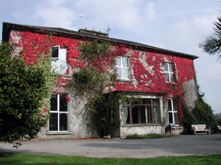
| Myrtle Grove | Myrtle Grove, a Tudor manor house, associated with Sir Walter Raleigh and the sixteenth-century poet, Edmund Spencer At the beginning of the 17th century it was sold to Richard Boyle, 1st Earl of Cork, and later became the property of the Hayman family, who owned it in the 18th and early 19th centuries. In 1837 Lewis writes that it was inhabited by Colonel Faunt. Later occupants include Joseph Wakefield Pim, Sir John Pope Hennessy and the Arbuthnot family. Now in private hands this house is open to the public on certain days in the year. |
|
| Ballyre | This house was occupied by Crofton Uniacke at the time of Griffith's Valuation when it was valued at £29.15 shillings and held from Mountifort Longfield. Earlier, in 1786, Wilson refers to it as the seat of Crofton Uniacke. The home of Robert M. Bayly in the 1870s. It is still extant. |
|
| Monaloo | This house was built post Griffith's Valuation. In the 1870s Charles Nason of Monaloo House, Tallow, owned 797 acres in county Cork. It is still extant. |
|
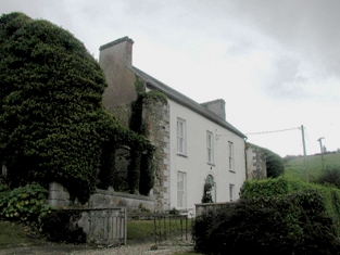
| D'Loughtane | The Ronayne family were resident at D'Loughtane for many centuries. It was lost to the family in the 17th century but recovered through marriage with a Bluett. In the eighteenth century Smith refers to it as "the pleasant seat of Mr. Ronayne". The original house was destroyed by fire and a new one built in the early 19th century. At the time of Griffith's Valuation, it was held in fe by Robert P. Ronayne and valued at £26. The sale rental of June 1851 states that it was erected at a cost of £3,500. Knight writes that it was sold in the Encumbered Estates Court in 1856 to Mr Samuel Allen who sold it later to John Pedder Furlong of Fermoy. Furlong sold the property to the Land Commission in 1910. The house has had a number of occupiers since then and is now owned by the Smiddy family. |
|
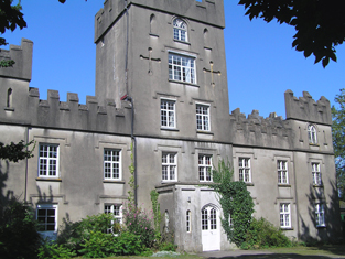
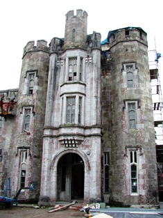
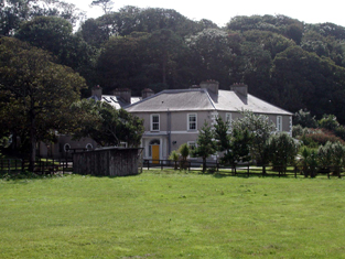
| Strancally Castle | John Keily held Strancally Castle in fee at the time of Griffith's Valuation, when it was valued at £61. Lewis refers to it as "a modern castle, seat of J. Keily" in 1837. There is a lithograph and extensive description of the castle and demesne in the sale notice of 1856. After this the castle came into the ownership of the Whitelock Lloyd family. In 1906 it owned by George W. Lloyd and valued at over £63. The 1943 ITA Survey provides a detailed description of the house from that time including the art collection and library. It is still extant and has been renovated in recent years. An extensive farmyard, valued at £37 in 1851, is located in Kilmanicholas townland at X078903. This property was valued at over £40 in 1906. |
|
| Knockanore House | Rev. Thomas Queally was leasing a property at Knockanore valued at £10 10s from the Keily estate in 1851. It is not shown on the 6-inch Ordnance Survey Map but is labelled Knockanore House on the 25-inch map of the 1890s. The property appears to have fallen into disuse during the twentieth century. | |
| Ballyhamlet House | James Parker was leasing Ballyhamlet from the Earl of Shannon's estate in 1851 when it was valued at £17. There is still an extant house at the site. | |
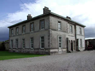
| Headborough | At the time of Griffith's Valuation, Headborough was held in fee by Mrs. Catherine Smith [Smyth] and valued at £60. Lewis refers to it as the seat of Rev. Percy Scott Smyth in 1837. In 1906 it was owned by Percy Smyth with a valuation of £50. Smith mentions Headborough as the seat of William Smith. In 1943 the ITA survey notes that the stone used in its building was transported from county Kerry. It is still extant and occupied. |

|
| Snugborough | In 1786 Wlson refers to Snugborough as the seat of Mr Smith. Mrs. Helena Greaves was leasing this property to Richard Walsh in 1851 when it was valued at £10 10s. An extensive farmyard complex still survives at the site. |

|
| Camphire House | Held in fee by Christopher Ussher in 1851 when it was valued at £28. It was the residence of Christopher M. Ussher in the 1870s. Buildings at this location were in the possession of the Ussher family in 1906 and valued at almost £6. In the 1940s the ITA survey noted that it was occupied by Mrs. Chearnley but owned by the Dobbs family and had formerly been a residence of the Ussher family. The Irish Army also seemed to have occupied part of the building during World War II. Camphire is still extant and occupied. |
|
| Cherrymount House | Described by Lewis in 1837 as the "occasional residence" of Captain Parker. It was being leased by Thomas Carpenter from the Parker estate at the time of Griffith's Valuation, when it was valued at £24 10s. In 1852 it was offered for sale in the Encumbered Estates Court when it was described as "a suitable dwelling house and demesne, formerly occupied by the owner". It was purchased by Maj-Gen Sir Joseph Thackwell and remained in the possession of that family until the twentieth century. It is now a ruin. | |
| Garryduff House | Garryduff was held in fee by Thomas Garde at the time of Griffith's Valuation, when the buildings were valued at £35 10s. Lewis refers to it as the seat of H. Garde in 1837. This house is no longer extant. | |
| Aglish House (Decies) | Aglish House was leased by James O'Brien from the representatives of James Nagle, in 1851, when it was valued at almost £14. It is still extant and occupied. |
|
| Ballingowan House (South) | Robert Dower was leasing this property from William Villiers-Stuart at the time of Griffith's Valuation, when it was valued at £13 5s. A house still exists at this site. | |
| Bleach | At the time of Griffith's Valuation, Charles Graves was leasing property from the Villiers-Stuart estate which included a house and mill. The complex was valued at over £37. By the later nineteenth century Bleach House is shown here but the mill in not shown. A house is still extant at the site. | |
| Cooneen Mill | Charles Musgrave was leasing this extensive property from Sir Richard Musgrave at the time of Griffith's Valuation, when it was valued at £31 5s. It is recorded as disused on the 25-inch Ordnance Survey Map of the 1890s. Some ruins remain at the site. | |
| Shanakill (Decies) | In 1851, this property was leased by Edmund Dower from Thomas J. Fitzgerald when it was valued at almost £10. A house and farm are still extant at this location. | |
| Ballynaparka House | In 1851, this house was held in fee by Thomas J. Fitzgerald and valued at over £31. Leet had recorded it as the seat of Patrick Dwyer in 1814. In 1906 it was still the property of the Fitzgerald estate and valued at over £10. There is still a house at this location. | |
| Tinnascart House | In 1851 this property was leased by Robert Dower from William C. Poole when it was valued at £14 10s.The 1874 Dower estate sale notice indicates that the house had been built within the previous 15 years at a cost of £2000. It is labelled as Tinnascart House on the 25-inch Ordnance Survey map of the later nineteenth century. The location is now a racehorse training enterprise. | |
| Ardsallagh House | Mrs.Olivia Ronayne was leasing this property from the estate of Lord Stuart de Decies at the time of Griffith's Valuation, when it was valued at £10 10s. It is labelled Ardsallagh House on both the 6-inch and 25-inch Ordnance Survey maps. Extant buildings remain at the site. | |
| Laurentum | At the time of Griffith's Valuation, Richard Coughlan was leasing this property from the Villiers-Stuart estate, when it was valued at £11. It does not appear on the 6-inch Ordnance Survey map but is named as Laurentum on the later 25-inch map. There is still an extant house at the site. | |
| Ballynamultina House | Francis Kennedy was leasing this property from the Mansfield estate at the time of Griffith's Valuation, when it was valued at £18 10s. Leet also refers to it as his residence in 1814. Smith states it was the seat of Mr. Mansfield in the late eighteenth century. A house is still extant at the site. | |
| Clashmore | Clashmore was held in fee by the Earl of Huntingdon at the time of Griffith's Valuation, when it was valued at £34. The site marked on the 1st-edition Ordnance Survey map is not that recorded on the later 25-inch map. Smith refers to the earlier house as the seat of Mr. Power and Wilson refers to it as the seat of Richard Power in 1786. The Irish Tourist Authority Survey of the 1940s suggest the later house was never fully completed and by then had all but disappeared. Much of the extensive farmyard, however, is still extant and in use. |
|
| Bayview (Clashmore) | Rev. Michael Purcell was leasing this property from Lord Decies estate in 1851 when it was valued at £12. There is still an extant house at this site. | |
| Rockview (Clashmore) | Leased by Richard Bayley from the Villiers-Stuart estate at the time of Griffith's Valuation, when it was valued at almost £7. It is labelled Rockview on both the 6-inch and 25-inch Ordnance Survey maps. There is still an extant house at the site. | |
| Glenlicky Mill | At the time of Griffith's Valuaton Rev. James Elliott was leasing this substantial property to Thomas Page, when it was valued at £44. It included a house and mill. Noted on the 25-inch Ordnance Survey Map of the later nineteenth century as Glenlicky Mill. The buildings are now ruinous. | |
| Lackendarra House | In 1851, Mrs. Eleanor Fitzgerald was leasing this property from Rev. James Elliott when it was valued at £11 5s. In 1894 it appears to have been occupied by a Russell family. | |
| Monatray | In 1851 Pierce S. Smith [Smyth), a minor, held Monatray in fee when it was valued at £35. In 2013 it was offered for sale. The sale details suggest it was built by Percy Smyth of Headborough as a summer residence in the 1830s. In the twentieth century it was occupied by a religious order and later a country house club before returning to private ownership in the 1980s. In recent years the house name is spelt Monatrae. In 2014 Monatrae was offered for sale. |
|
| Newtown House (Kinsalebeg) | Built after the first Ordnance Survey, Michael Kennedy was leasing this property from the Smyth estate in 1851 when it was valued at £13 10s. It is noted on the 25-inch Ordnance Survey Map as Newtown House. There is still an extant house at the site. | |
| Pilltown House | Declan Tracy was leasing this property from the Kennedy estate at the time of Griffith's Valuation, when it was valued at over £12. Smith refers to it as "Pilltown, not long since the estate of the Walshes". The house is labelled Pilltown House on the 25-inch map of the 1890s. It is no longer extant. Tracy is noted as the owner of over 450 acres in county Waterford in the 1870s. A substantial mill, valued at £39, in the same townland was being leased by Peter Moore Fisher [X129800]. It was included in the sale of Fisher property in the Landed Estates Court in November 1865. The mill appears to have fallen into disuse by the end of the nineteenth century though the ruins remain. | |
| Mayfield (Kinsalebeg) | In 1851 Thomas P. Carew was leasing this property from the Smyth estate when it was valued at over £20. A house labelled Mayfield appears at this location on the 1st edition Ordnance Survey map. In 1837 Lewis noted it as the seat of J. Gee. It is still extant and occupied. |
|
| Prospect Villa (Kinsalebeg) | Prospect Villa seems to have been built in the later nineteenth century, close by an earlier house known as Mayfield. A house at Prospect Hall is described by Smith as "a handsome seat with good improvements made by the late Stephen Bernard" In 1786 Wilson refers to "Prospect Hall" as the seat of Mr. "Barnet". There is still an extant building at the site. |
|
| Woodbine Hill | George Roche held this property from the Smyth estate in 1851 when it was valued at over £26. Local sources suggest it was built by him earlier in the nineteenth century. It is still extant and occupied. |
|
| Cappagh (Decies-within-Drum) | In 1851 James Gee was leasing this property from Lord Decies estate when it was valued at £19. This area has been subjected to severe coastal erosion and these buildings are no longer extant. | |
| Clashanahy | Sir Richard Musgrave held this property on lease from the Decies estate at the time of Griffith's Valuation, when it was valued at almost £18. There is still an extant property at this site. | |
| Lackandarra Lodge | At the time of Griffith's Valuation, Richard Chearnley held this property in fee when it was valued at almost £10. On the 25-inch Ordnance Survey Map of the 1890s it is labelled Lackandarra Lodge. A farm is still extant at the site. | |
| Lackandarra A | Mrs. Eleanor Power was leasing this property from the Chearnley estate at the time of Griffith's Valuation, when it was valued at £9. There are still buildings extant at the site. | |
| Clifton | Situated on the coast just south of Youghal, Clifton was occupied by Sir William Homan in 1837. Griffith's Valuation records John Keily junior as resident when the house was valued at £62. Buildings are still extant at the site. | |
| Green Park | Captain H. Parker of the Royal Navy was resident at Green Park in 1837. By the time of Griffith's Valuation William Carberry was the occupier holding the building valued at £38 from Pim Jackson. Extensive modern building has occurred in this area. | |
| Ballyvergan House | In 1786 Wilson refers to Ballyvergin as the seat of Robert Uniacke. By the time of Griffith's Valuation, this townland is part of the Leader estate. The house, valued at £12 was occupied by James O'Brien. This may be the property labelled Ballyvergan House on the 25-inch Ordnance Survey map in the 1890s.Buildings still exist at the site. |