Blarney Castle
Houses within 10km of this house
Displaying 65 houses.
Houses within 10km of Blarney Castle
Displaying 65 houses.
| House name | Description | |
|---|---|---|
| Grange (Athnowen) | Smith records Mr Onesiphorus Phaire as resident at Grange, Ovens, in 1750. Wilson, writing in 1786, refers to it as the seat of Mr. Whyte. This house was the home of the Hawkes family in the 19th century, occupied by J. Hawkes in 1814 and 1837 and by John Hawkes in the early 1850s, when the house was valued at £12 and held from Sir John Walsh. A house is still extant at the site. | |
| Springmount | In 1837 and at the time of Griffith's Valuation this property was occupied by Samuel McCarthy. Valued at £19.10 shillings it was held from Lady Carbery's estate. There is still an extant house at the site. | |
| Clashanure | Home of a number of generations of the Allen family in the 18th and 19th centuries. Occupied by the representatives of Kyrle Allen at the time of Griffith's Valuation and held from Robert Meade. The buildings were valued at £15 and the Allens also had a mill valued at £13. Still extant and occupied. |
|
| Classes | Classes was occupied by William O'Callaghan in the early 1850s and held from John Stevely. The buildings were valued at £11. There are two houses at Classes on the 1st edition Ordnance Survey map. Classes House is located at W562705 while the second is labelled Classes House East and located at the site of the current Classes House which bears a date label of 1823. |
|
| Lisheens | The residence of Richard Donovan at the time of Griffith's Valuation, held from the representatives of John Stevely and valued at £16. | |
| Oriel House | Built in the first decade of the 19th century by the Board of Ordnance. The house was occupied by Charles Wilkes, the superintendant of the gunpowder mills until purchased by the Tobins of Liverpool in the mid 1830s. Mrs Tobin was a painter and their residence became known as Oriel House under Tobin ownership. The house has been a hotel since 1983. |

|
| Woodside | Wilson refers to Wood-side as the seat of Mr. Carleton in 1786. It was occupied by John Carleton in 1814 and by the Reverend E.M. Carleton in 1837. By the early 1850s the house was occupied by Horace Townsend and held by him in fee. It was valued at £40. It had become known as Kilcrenagh by the publication of the 25-inch Ordnance Survey map in the 1890s. Donnelly states that it was burnt in May 1921 during the War of Independence when it was the residence of the family of Ebenezer Pike. The National Inventory of Architectural Heritage notes that it is now in ruins. | |
| Rock Lodge | A house on the Donoughmore estate, occupied by R. Carleton in 1837 and by Henry Osborne Seward at the time of Griffith's Valuation when it was valued at £25. A house is still extant at the site. | |
| Coolyduff House | At the time of Griffith's Valuation this house valued at £16 was occupied by Alfred Parnell and held from Richard Beamish. Labelled as Coolyduff House on the 25-inch Ordnance Survey map of the 1890s. There is still an extant house at the site. | |
| Lackenshoneen | Benjamin Cross occupied this house in the mid 19th century. He held it from Philip Cross and the buildings were valued at £12. The buildings have all but disappeared on the 25-inch edition Ordnance Survey map of the 1890s and nothing remains at the site now. | |
| St Anne's Hill | Richard Barter occupied a house valued at £55 in the townland of Kilnamucky at the time of Griffith's Valuation. St Anne's Hill is marked on the first Ordnance Survey map in this townland. By the 1890s this property had become absorbed into a complex of buildings labelled Hydropathic Establishment. The National Inventory of Architectural Heritage notes that most of the complex is now in ruins though Maranatha House survives as a residence. |

|
| Ardrum | The seat of the Colthurst family, baronets, valued at £85 in the mid 19th century. The Colthursts moved from here to Blarney in the 1870s. However Sir George St John Colthurst is still given as the occupier in 1906 when the house was valued at £45. In 1944 the Irish Tourist Association survey noted it as originally the seat of the Colthursts and still owned by the family. The house is now demolished. | |
| Dawstown | A house on the Putland estate in county Cork, built by Dean Davies early in the 18th century and occupied by his family until the early 19th century. In the 1940s the Irish Tourist Association Survey claimed that he had built the house following his "being turned out of Blarney Castle by the Hollow Blade Company". George Davis was resident in 1810. Occupied by Edmond Mullane in the early 1850s and valued at £12. In the 1940s it was the residence of John Turpin. The house was accidently burnt down in 1956. | |
| Surmount/Sirmount | Sirmount was the residence of Emmanuel Moor in 1750. In 1786 Wilson refers to it as the seat of Mr. Hawkes. This house was occupied by G. Hawkes in 1837 and by Quaile Hawkes in the early 1850s. The property was held from Lady Carbery. The buildings were valued at £8.15 shillings. It is no longer extant. | |
| Bride View | Occupied by Samuel Hawkes and held from the representatives of William Hawkes at the time of Griffith's Valuation. The buildings were valued at £13.10 shillings. The property at this location is labelled Knockanemore House on the 25-inch Ordnance Survey map of the 1890s. There is still an extant house at the site. | |
| Ballyshoneen | A house valued at £13.10 shillings at the time of Griffith's Valuation, occupied by James Cross and held from Anthony Morgan. It is labelled Ballyshoneen on both the 1st and 25-inch edition Ordnance Survey maps. A house and substantial farm still exist at the site. | |
| Bawnnafinny | Described at the time of Griffith's Valuation as a caretaker's house, valued at £12 and held by St John Jefferyes in fee. | |
| Woodview | A house named Wood-view near Cork was occupied by Thomas Cuthbert in 1814. The Reverend William Spedding occupied Woodview in the early 1850s. He held it from Sir George Colthurst and the buildings were valued at £12. A house is still extant at the site. | |
| Inishleena | Located on the Devonshire estate, Inishlenna Abbey was occupied by Cross Fitzgibbon at the time of Griffith's Valuation and in the 1870s. The buildings were valued at £10. The location of the Abbey is now under water as part of a reservoir. | |
| Greybrook | A house occupied by Samuel Harrison at the time of Griffith's Valuation and held from Ambrose Hickey. It was valued at £15.10 shillings. Greybrook Villa and 50 acres was held on a lease dated 1857 from Samuel Harrison to William Edward Leche and occupied by Edward Corah. Leche's interest was advertised for sale in March 1863 and Corah's in August 1865. | |
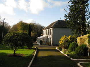
| Cloghroe House | In 1786 Wilson refers to Cloghroe as the seat of Mr. Capel. In the late 18th century this house passed by marriage from the Capel family to the Fitzgerald family. J. C. Fitzgerald was resident at Cloghroe in 1814. The house, valued at £28, was occupied by Thomas Keogh in the early 1850s and held from Thomas Fitzgerald. In 1944 the Irish Tourist Association Survey referred to it as the residence of Major O'Mahony of Blarney Mills. A house is still extant at Cloghroe. | |
| Inchbeg | Located on the Fitzgerald estate, this house was occupied by Henry Young, at the time of Griffith's Valuation. The buildings were valued at £11.15 shillings and he also held a mlll valued at £84. A house is still extant at the site. |
|
| Firmount | A Townsend family home, occupied by Horace Townsend in 1837 and by William Coghlan at the time of Griffith's Valuation. It was then valued at £14.10 shillings and was held from Horatio Townsend. The sale rental of 1877 records a fee farm grant of Firmount from John Crewe Chetwood Townsend to Arthur Chute dated 1871 and a fee farm grant from Arthur Chute to J.C.C. Townsend executed the following year. A house is still extant at the site. | |
| Knockane | A house valued at £14.10 shillings in the early 1850s when it was occupied by Henry Ruby and held from Samuel P. Townsend. The original house is no longer extant. | |
| Garraun | George C. Stawell held this property from Sir George Colthurst at the time of Griffith's Valuation. The buildings were valued at £7.10 shillings. This house was still occupied by the Stawells in the 1870s. A house and farm are still extant at the site. | |
| Garrycloyne | Leet records Robert McCarthy occupying Garrycloyne in 1814. "Burkes Irish Family Records" states that Garrycloyne Castle was acquired by Samuel Philip Townshend from John Travers in 1837. The buildings were valued at £45 in the early 1850s and held by Samuel Townsend in fee. The house was later the home of the Barrys. In the 1940s the roof was taken off the house and it has remained a ruin ever since. | |
| Greenfort | A house valued at £10 occupied by Francis Wyse and held by him in fee at the time of Griffith's Valuation. | |
| Birchhill Cottage/Birchhill House | This house was occupied by John Travers at the time of Griffith's Valuation. He held it from Francis Wyse and it was valued at £10.10 shillings. Jane Clerke occupied a mansion house valued at £20 in this townland in 1906. It is labelled Birchhill Cottage on the 1st edition Ordnance Survey map but as Birchhill House on the 25-edition of the 1890s. A house is still extant at the site. | |
| Newcastle | The buildings at Newcastle were valued at £18 in the early 1850s, occupied by Daniel Donohoe and held from Francis Wyse. | |
| Knockanroe | A house valued at £17 at the time of Griffith's Valuation and held by Robert A. Rogers in fee. It is not marked on the first Ordnance Survey map and was probably built in the 1840s. | |
| Cloghfadda House | Occupied by Joseph Wiseman in the early 1850s, held from Robert A. Rogers and valued at £12. The Crofts sale rental of 1881 record Cloughfadda House as a comfortable residence in "owner's hands". A house is still extant at the site. | |
| Glancam | This house was occupied by Robert Aldworth at the time of Griffith's Valuation, held by him in fee and valued at £8. Extensive buildings remain at the site, the centre of a large farming enterprise. | |
| Carrigrohane Castle | A fortified house that came into the possession of the Hoare family through marriage with a member of the Baker family in the 1770s. In 1786 Wilson refers to Carrigrohan as the seat of Mr. Colthurst. Reconstructed in the 1830s by Augustus Robert McSweeny, a corn merchant, who also leased the floor mills nearby. At the time of Griffith's Valuation Jane McSweeny was resident. The Castle later reverted back to the Hoares who owned it until the 1940s. They are mentioned by the Irish Tourist Association survey as resident there. It is still extant. |

|
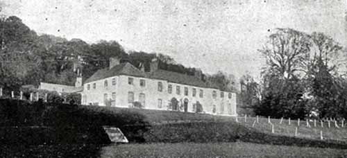
| Carrignavar | The castle of Carrignavar was from the mid 17th century the seat of this the senior branch of the McCarthy clan. Bence Jones writes that Carrignavar is a late 19th century castellated house incorporating the remains of the old castle. Lewis refers to Carrignavar as the seat of Justic McCarthy in 1837 and Justin McCarthy junior was resident at the time of Griffith's Valuation when the buildings were valued at £28. Bought by John Sheedy in the 20th century and sold by him in the 1950s to the Sacred Heart Fathers. The house is part of their college complex. |

|
| Doughcloyne | Originally the home of the Ronayne family, it passed by marriage to the Sarsfields. Occupied by Dr Sarsfield in the 1770s and 1780s, by Mr Haynes in 1814, by D. Sarsfield in 1837 and by Thomas R. Sarsfield in the early 1850s, who held it in fee, value £43. In 1894 Slater notes it as the seat of Capt. T.R. Sarsfield. This house is no longer extant. | |
| Turret Farm House | At the time of Griffith's Valuation occupied by St John Jeffreys and held by him in fee, the buildings were valued at £26. | |
| Leemount | The residence of John T. Hartnell in 1814 and of Nicholas C. Brabazon at the time of Griffith's Valuation. Brabazon held the house valued at £72 from St John Jeffreys with 118 acres. The 1870s landowners' records indicate it as owned by Henry Lindsey Young and Slater records it as his residence in 1894. Leemount is still extant. |

|
| Mount Desert | The home of the Dunscombe family in the 18th and 19th centuries, it was noted by Wilson as the seat of Mr. Dunscombe in 1786. The house was occupied by George Dunscombe in 1814 and by Nicholas Dunscombe in the early 1850s when it was valued at £55. Still valued at the same amount in 1906 when it was occupied by Robert Dunscombe. The house is no longer extant and the Bon Secours Health Care unit is now located at this site. |
|
| Waterfall | Occupied by Austin Esq in the 1770s and 1780s and by T. Austin in 1837. Leased by Edward Austen who held from the representatives of Viscount Midleton in the mid 19th century. The buildings were valued at £14. The house shown at this location on the 1st edition Ordnance Survey map has disappeared by the time of the publication of the 25-inch edition in the 1890s. Buildings do still exist at the site. | |
| Castle White | Occupied by Whyte Esq in the 1770s Wilson refers to this property as Rochfordstown in 1786. George M. White was the owner in 1837 and held by him in fee at the time of Griffith's Valuation when the house was valued at £35. Lucia P. Hawkes was recorded as the occupier of two mansion houses in this townland in 1906, one valued at £27 and the other at £53. Castle White is still extant. In 2023 it was offered for sale by Sothebys International. |
|
| Chetwynd | The Pigotts were established at Chetwynd in the early 18th century and Wilson refers to it as their seat in 1786. By the end of the century they were resident in county Laois. In 1837 J. Forrest was the proprietor of Chetwin and in the mid 19th century William Bateman occupied the house, valued at £25, which he held from John Dennis. Two houses are marked on the first Ordnance Survey map for Chetwynd. It is not clear which one was the Pigott house. | |
| Kilbarry | In the mid 19th century occupied by George Wise and held from James H. S. Barry. The buildings were valued at £35. | |
| Ballincurrig | W.C. Logan occupied Ballincurrig Cottage in 1837 and William Coppinger occupied a house at Ballincurrig valued at £33 and held by him in fee at the time of Griffith's Valuation. | |
| Cleve Hill | Samuel Perrott was residing at Cleve Hill in 1837 and in the early 1850s when the house was valued at £68 and held from Alexander McCarthy. Cleve Hill a modern family mansion on 13 acres was advertised for sale in October 1873, the estate of Joseph Gadsden Nash and Arthur Power Harty, bankrupts. | |
| Hampstead | The residence of G. Britton in 1814 and of Lieutenant Boyle Hill in 1837. Occupied by John H. Bainbridge at the time of Griffith's Valuation. He held the property in fee and the house was valued at £22. The house is not labelled on the 25-inch Ordnance Survey map of the 1890s and is no longer extant. | |
| Ballygaggin | Occupied by Edmond Murphy at the time of Griffith's Valuation, valued at £30 and held from the Duke of Devonshire. | |
| Frankfield | Located on the side of what is now the Frankfield Golf Club, Frankfield House was occupied by S. Lane in 1837 and by the Very Reverend H. J. Newman in the mid 19th century. Reverend Newman held it from William Lane and the buildings were valued at £60. | |
| Lee Cottage | Marked on the first Ordnance Survey map this house was occupied by Henry O. Seward in the early 1850s when it was valued at £52 and held from the Ecclesiastical Commissioners. Now incorporated into the university. | |
| Garrane | In the early 1850s Francis Hennis occupied a house valued at £30 from William Howe Hennis. A building still exists at this site. | |
| Lehenaghbeg | A house valued at £14 in the mid 19th century and held by Edward Casey from James H. S. Barry. Edward Casey was the owner of 121 acres at Lehenaghbeg in the 1870s. | |
| Lehenagh | Occupied by T. Curtis in 1837. By the early 1850s Mary Curtis was resident holding the house valued at £28 from the Reverend Edward H. Newinham. | |
| Lehenagh House | A home of a member of the Newingham family in 1814 and of Charles Mathew in the mid 19th century.James Mathews of Lehenagh owned 107 acres in the 1870s. This house no longer exists. | |
| Ashton | A house occupied by John Cotter from at least 1814 until his death in 1864 and by Mrs Catherine Cotter until at least 1871. It is not clear if John Cotter was a member of the Cotter family, baronets. The house is now part of the Ashton School complex. | |
| Gawsworth | In the mid 19th century this house valued at £19 was occupied by Russell Fitton and held from the representatives of Robert Hedges and Mr Pratt. | |
| Woodhill | Originally this property belonged to the Dennis family. Following the marriage of Elizabeth Dennis to Cooper Penrose, a Quaker, of Waterford, it passed into the possession of the Penrose family, who enlarged the house. Another Cooper Penrose was the occupant in 1814 and in the mid 19th century holding the property from James Murphy. The buildings were valued at £100. The house was demolished circa 1980s. | |
| Ballycannon | The home of the Spread family in the 18th century, by the time of Griffith's Valuation the buildings were valued at £7 and occupied by Michael and John Daly who held the property from the representatives of William Spread. A building is still extant at this location. | |
| Wilton | In 1786 Wilson refers to "Willtown" as the seat of Mr. Izod. Charles H. Leslie occupied Wilton in 1814 and in 1837. By the mid 19th century Matthew Leslie was resident, holding the house valued at £55 from John Craig and H. Mitchell. A college is now located at this site. | |
| Ballynora | A house valued at £14 and held by Thomas Magner in the mid 19th century from the representatives of John McSweeny. | |
| Shanakiel | Daniel Leahy is recorded as the occupier of Shanakiel House in the first half of the 19th century. The house was valued at £85 in the early 1850s and held from the Earl of Cork and Orrery. This house no longer exists and its site is located in the grounds of a hospital. | |
| Maglin | A house valued at £15 and held by James Barry [Berry] from John Popham and others at the time of Griffith's Valuation. Buildings are still extant at this location. | |
| Rosanna | Rosanna was the home of the Webb family in the 19th century, occupied at the time of Griffith's Valuation by Hannah (widow of the Reverend Dr John Webb) valued at £75 and held from St John Jeffreys. A building is still located at this site. | |
| Spud Villa | This house is marked on the first edition Ordnance survey map. Anne and Jane Wise occupied a house in the townland of Mount Desert valued at £38 and held from Thomas Wise in the mid 19th century. | |
| Rathpeacon House | At the time of Griffith's Valuation, Rathpeacon House was occupied by William le Fanu leasing from Richard Thomas when the house was valued at £27. In the 1870s it is recorded as the residence of John Davis. | |
| Ballincollig | In 1786, Wilson mentions a seat of Mr.Lloyd at Ballincollig, "near the ruins of the castle". By the time of Griffith's Valuation, this area appears to have been in the possession of Thomas Tobin and the house may have been that leased by Rev. David Horgan, when the buildings were valued at £14. A substantial farm still exists at this site. | |
| Greenfield (Ballincollig) | In 1786, Wilson refers to Greenfield, near Ballincollig, as the seat of Mr. Carleton with another house, the seat of Mr. Wetheral, opposite. Greenfield House is labelled on the 1st edition Ordnance Survey map but is not shown on the 25-inch edition of the 1890s. Greenfield Upper, across the road, is shown on both maps. At the time of Griffith's Valuation this townland was in the possession of Francis Carleton. Greenfield House was valued at £11 while the second house in the townland was valued at almost £10. Neither were occupied. A building is still extant at the Greenfield Upper site though extensive modern housing has been built in the surrounding area. |