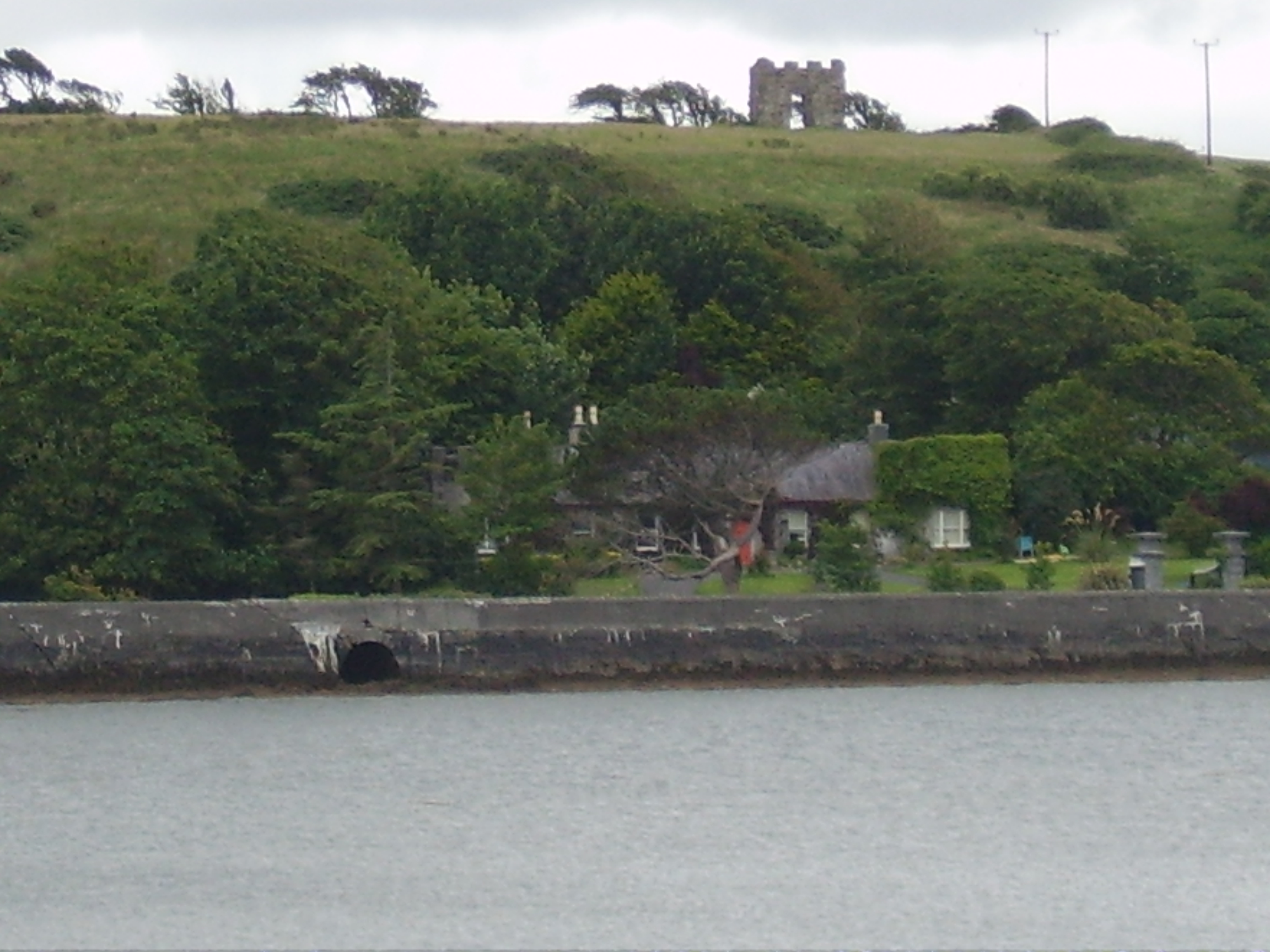
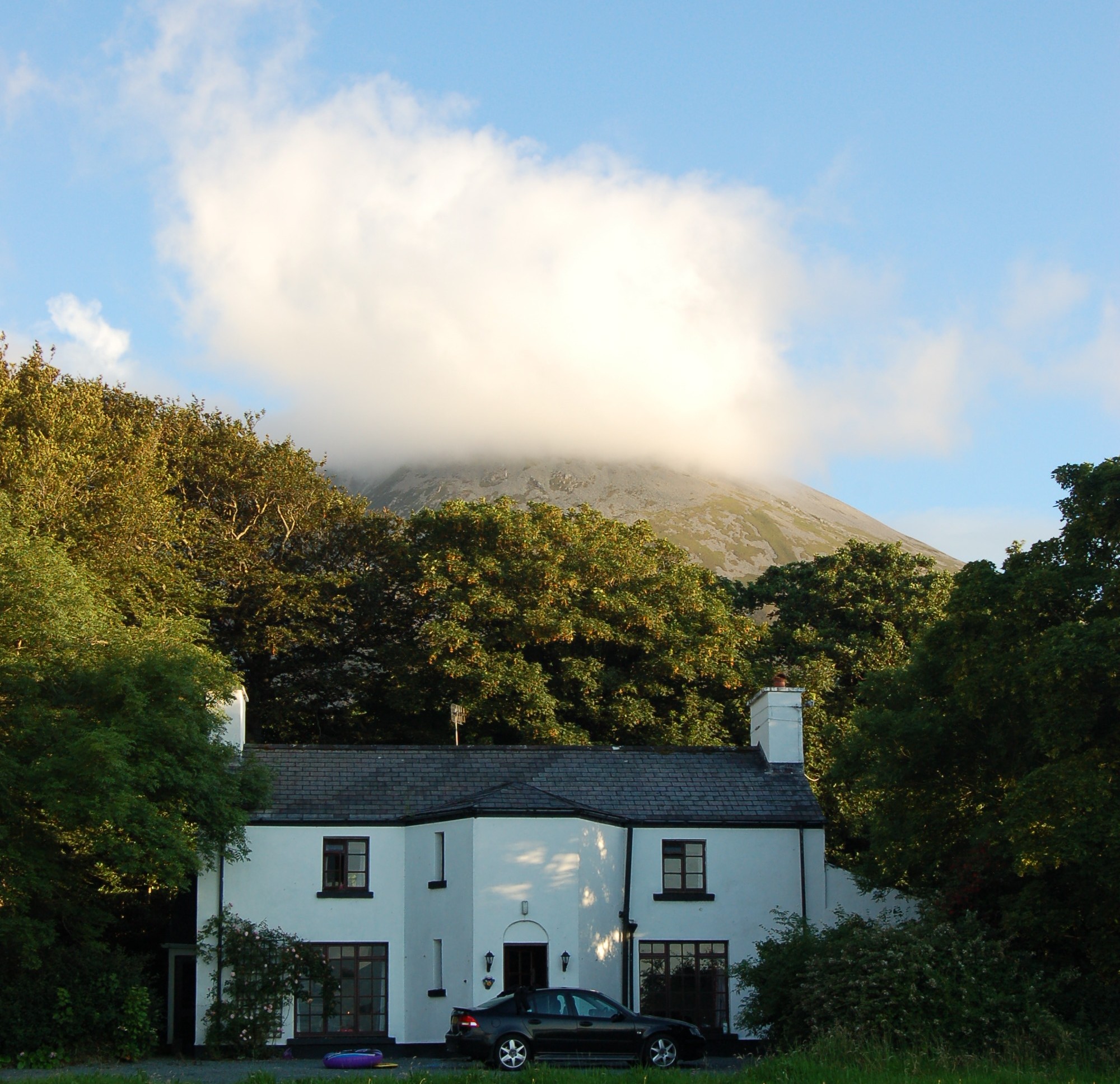
Mount Browne
Houses within 15km of this house
Displaying 36 houses.
Houses within 15km of Mount Browne
Displaying 36 houses.
| House name | Description | |
|---|---|---|
| Greenhills | Greenhills was part of the estate of the Marquess of Sligo until the sale to William Livingstone in 1854 and was let to Joseph Bourke in the early 19th century. It was later occupied by Archibald Stavert who held it from William Livingstone at the time of Griffith's Valuation. It was owned by Matt Fahy in the late 1990s and is still extant. |
|
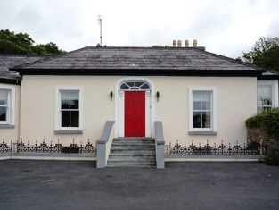
| Newport House | Built in the late 18th century, this house was the main residence of the O'Donels in the 19th century. It now functions as a hotel. |
|
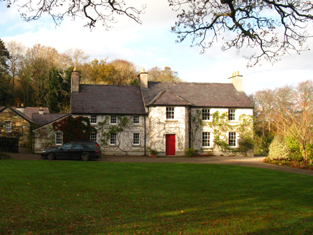
| Ross House | Ross House was built by Lewis O'Donel, a son of Lewis O'Donel of Killeen, Crossmolina, county Mayo and a first cousin of the first Sir Neal O'Donel, baronet. The house was inhabited by Captain and Mrs William Houstoun at the time of Griffith's Valuation. They later moved to Doolough and Delphi in the barony of Murrisk. The house was purchased by Middleton O'Malley about 1880 and Slater records it as his residence in 1894. It is now the home of Mrs Meike Blackwell, whose mother-in-law was an O'Malley. | |
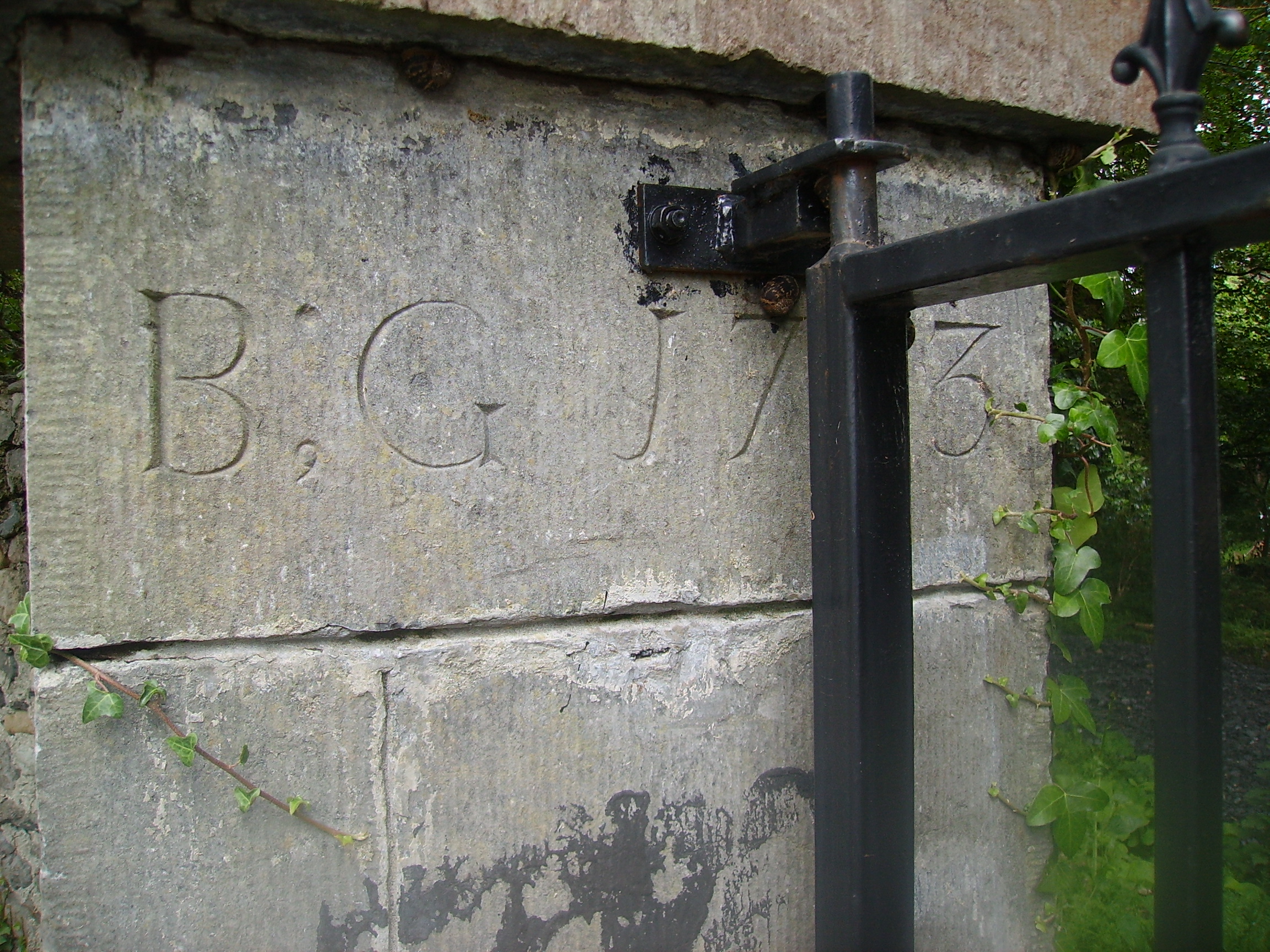
| Milcum House | Ruane states that this house was built in 1754 by the Browne family [of Westport] and that it was first known as 'Seamount'. There was another Milcum house, built in the small townland of Milcum by the Binghams in the early 18th century, which was the house marked 'in ruins' on the first Ordnance Survey map. Seamount was occupied by Connell O'Donel in 1837. At the time of Griffith's Valuation it was unoccupied but in the possession of Nathaniel P. Simes. In the 20th century it was the home of Miss Laprimandaye, Sir Anthony Beever, the Brittains, the Percivals and Mr and Mrs Peter Mullowney. Milcum is still extant and occupied. |
|
| Westport House | Built on the site of the O'Malley castle of Cathair na Mart by Colonel John Browne, expanded by his grandson to the design of Richard Cassels, the house has remained in the possession of the Browne family for over three centuries. They still live there and the house and its grounds function as a major tourist attraction. |
|
| Cherry Cottage | A house inhabited mainly by agents to the Marquess of Sligo, including George Hildebrand in the mid nineteenth century and George Taylor in the early 20th century. At the time of Griffith's Valuation it was valued at £15. The Hastings interest in this house was sold in the Landed Estates' Court in November 1874. It is still extant. |
|
| Summerville/Villa Lodge | A house orginally built for a member of the Browne family, it was leased by the 2nd Marquess of Sligo to Courtney Kenny of Ballinrobe in 1830 and was used by the Kennys as a summer residence. Courtney Kenny leased the property to John Sidney Smith, agent to the Westport estate in 1855. The house was valued at £14 at this time. A drawing, map and 20th century accounts re this property are included in the Kenny Papers. |
|
| Prospect House | Home of the Buchanan family in the latter part of the 19th century. Slater refers to it as the seat of Col. Henry J. Buchanan in 1894. Still extant and very well maintained. |
|
| Murrisk Lodge | Murrisk Lodge was held in fee by John C. Garvey at the time of Griffith's Valuation, when it was valued at £20. The principal home of the Garvey family, it was sold in the 1960s to James Fair. In 2007 the old building was demolished and a new hotel was being developed. |
|
| Marino Lodge | An early 19th century house, the residence of Major Owen O'Malley in 1814 and of J.Cuff in 1837. It was leased by John Fair from the Earl of Lucan's estate at the time of Griffith's Valuation, when it was valued at £10. Marino Lodge is still extant and in good repair. |
|
| Trafalgar Lodge | Described in the sale advertisement of 1866 as a commodious dwelling in the cottage style on the seashore, containing 'good parlour, four bedrooms, with coach house, stabling, piggery and other useful offices, the entire forming a square and enclosing a spacious yard'. The occupant was James Louden and the house had formerly been the residence of Captain Butcher of the Mayo Rifles. In 1874 the interest of Bridget Hastings in Trafalgar Lodge was advertised for sale in the Landed Estates' Court. | |
| Moyour | This property was held in fee by Martha McDonnell at the time of Griffith's Valuation, when it was valued at almost £5. Described in the sale advertisement of 1870 as a 'commodious thatched house'. It is labelled as "in ruins" on the 25-inch Ordnance Survey map of the 1890s. | |
| Altamont Villa | A Browne house described in the 1830s as a slated house with 2 stories at the rear. Also known as Mallow Cottage and possibly New Brighton Lodge, it was leased by the 2nd Marquess of Sligo to Neal Davis in the late 1830s. Sold to William O'Brien, whose widow left it to the Convent of Mercy. | |
| Teevmore | A two-storey house occupied by James Stuart in 1837 and owned by Nathaniel P.Simes at the time of Griffith's Valuation but unoccupied. Substantial buildings are shown at the site on the 1st edition Ordnance Survey map but these have all but disappeared by the publication of the 25-inch edition of the 1890s. Some of the old outbuildings have been converted into a house. |
|
| Knockranny | A house in the town of Westport occupied by the Livingstones. It was valued at £40 at the time of Griffith's Valuation which included the house, offices, gate lodge and another lodge. This may have been the house marked on the first Ordnance Survey map as Westport Lodge. This building now forms part of the Sacred Heart School complex. |
|
| Errew | An unoccupied house and offices valued at £11 were held by James Hardiman at the time of Griffith's Valuation. A school and monastery are shown on the 25-inch Ordnance Survey map of this area in the 1890s. These buildings are still extant. | |
| Hazelrock Lodge | Valued at £5 at the time of Griffith's Valuation and held by the Honourable George Frederick Yelverton from Viscount Avonmore. The National Inventory of Architectural Heritage contends that it was built in the early nineteenth century for Barry John Yelverton, third Viscount Avonmore. It is now a ruin. |
|
| Kilboyne | Described at the time of the first Ordnance Survey as a 'good house surrounded by a neat but small demesne'. At the time of Griffith's Valuation it was held in fee by Sir Samuel O'Malley and valued at £12. A modern house exists at the site now. | |
| Rosmindle | An O'Malley house occupied by a Mr Garvey in 1814, it was in ruins by the time of the first Ordnance Survey. | |
| Kinturk | A residence of the Bourke family in the early 19th century, situated beside Kinturk Castle. In 1786 Wilson refers to it as the seat of Mr. Burke. The townland was in the possession of Rev. H.N. Ormsby at the time of Griffith's Valuation. | |
| Pheasant Hill | A Sheridan home from the late 18th century to the late 19th century. Wilson, writing in 1786, refers to "Dan" as the seat of Mr. Sheridan. By the time of Griffith's Valuation it was held by John Sheridan from the Earl of Lucan's estate with a valuation of £3. It is not shown on the 25-inch map of the 1890s and modern buildings exist in the area now. | |
| Portroyal | In 1786 Wilson refers to Port Royal as the seat of Mr. Gildea. At the time of Griffith's Valuation, the townland was in the possession of James and Anthony Knox Gildea and the house was valued at £2 10s. The house is not shown on the 25-inch Ordnance Survey map of the 1890s. | |
| Raheens | A house south west of Castlebar, noted by Wilson as the seat of A.N. Browne in 1786. Held by the Browne family from their relatives the Lords Kilmaine. At the time of Griffith's Valuation, it was occupied by Henry Browne and valued at over £16. It is now a ruin. |
|
| Rocklands | A house occupied by various agents to the Earls of Lucan, including Ellison, Davis and Larminie. In 1786 Wilson refers to it as the seat of Mr. Ellison. At the time of Griffith's Valuation, it was occupied by Neal Davis, holding from the Earl of Lucan, and valued at £15. The site appears to be occupied by a larger modern building. | |
| St Audries | An 18th century house on the shore of Saleens Lake on the outskirts of Castlebar, named after the home of the 1st Countess in Somerset, England. St Audries was leased to Owen Lindsey in 1769 and his family maintained an interest in the property and the farm at Drumsheen until the early 19th century. The Reverend Archdeacon Warburton was living in the house in 1814. By the time of the first Ordnance Survey the house was in ruins. | |
| Rosehill | Built by Sir Samuel O'Malley in the early 19th century but a ruin by the time of the first Ordnance Survey. Occupied by Mr P.Gibbons in 1814. | |
| Snugborough | A property leased from the Brownes of Raheens, the O'Malleys built a house here in 1765, costing £900. It was badly damaged in 1798 and was recorded to be in a dilapidated state in the Ordnance Survey Name Books. It is labelled as Snugborough House on the 1st edition Ordnance Survey map of 1838 but is not labelled on the later 25-inch edition and nothing now remains. | |
| Spencer Park | A house occupied by a junior branch of the Burrishoole family descended from Patrick O'Malley. They held the house during the second half of the 18th century and much of the 19th century from the Earls of Lucan. By the time of Griffith's Valuation it was occupied by John C. Larminie. In 1858 Larminie sold his interest in the O'Malley's lease of Spencer Park, which had been renewed on 7 Oct 1842 for three lives or 31 years. The Freeman's Journal reported that it was purchased in trust by Mr. Jordan. The site is now occupied by modern housing. | |
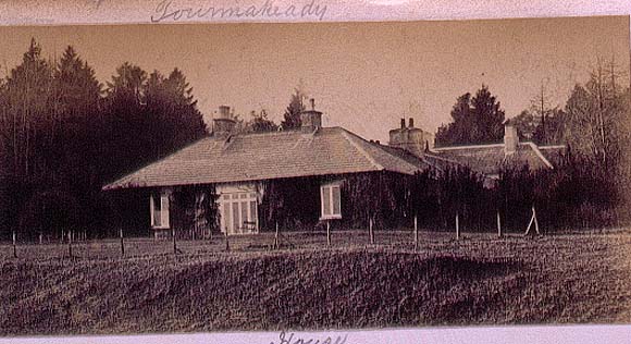
| Toormakeady Lodge | Robert Graham in 1836 refers to "Mr Plunket's cottage residence" while in 1837 Lewis describes it as a summer lodge of Dean Plunkets. Sold in 1876 to the Mitchell family of Bradford. Restored in the 1960s and used as a guest house. |
|
| Mount Gordon | An 18th century house, occupied in the 1770s by 'Garden' [Gardiner]. Wilson refers to it as the seat of Mr. Garden [Gardiner] in 1786. It was occupied by Mary Boyd at the time of Griffith's Valuation, when the house was valued at £43. It is still extant and occupied. |
|
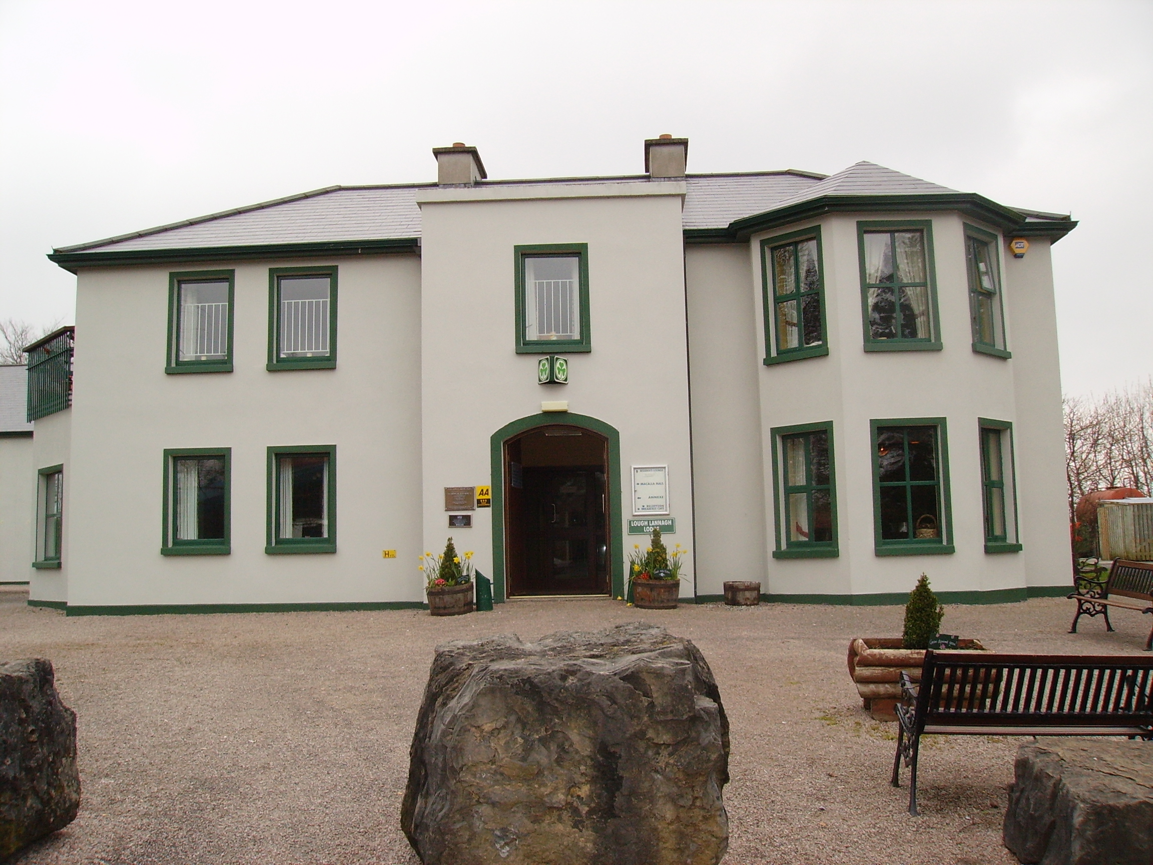
| Creagh's Villa | At the time of Griffith's Valuation, this property appears to be have been leased by Mary Boyd fron the Lucan estate when it was valued at £12. In the 1870s it was the residence of Bernard Peyton. It was destroyed by fire in 1996 and subsequently demolished to make way for the Lough Lannagh holiday complex which includes a building similar to the design of the original house. |
|
| Rossanrubble | A small building is shown in this townland at the time of the first Ordnance Survey. Jonathan Pim was the owner of the townland at the time of Griffith's Valuation but there were no buildings with substantial valuation. A house labelled Rosbarnagh Lodge is shown on the 25-inch Ordnance Survey map of the 1890s and this building is still extant. | |
| Belclare | At the time of Griffith's Valuation all of Belclare townland was held by James Pinkerton and John Thompson who had a large milling business there, as well as three houses valued at £26, £13 and £18. The Livingstones must have bought out Pinkerton and Thompson. Belclare Lodge is marked on the OS map of 183. The Livingstone's house is shown on the 25-inch map of the 1890s, labelled Shivdella House, which is still extant. Buildings were demolished at Belclare in the late 20th century to make room for building development. |
|
| Castleburke | A home of the Bourke family and their descendants. Occupied by Patrick Horan in 1814 and from 1821 James Tuohy was the tenant. The castle was in ruins by the time of the first Ordnance Survey circa 1838. It is now owned by Eamonn de Burca. | |
| Kinnewry House | Home of Charles Crotty in the second half of the 19th century. The grid reference for this property is approximate. | |
| Drumminroe | Malachy Tuohy held a house valued at £8 from George Henry Moore at the time of Griffith's Valuation. Members of the Tuohy family still occupy this house. |