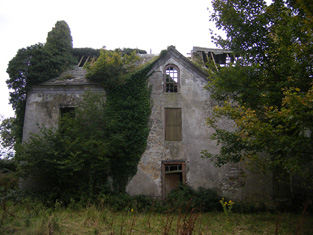
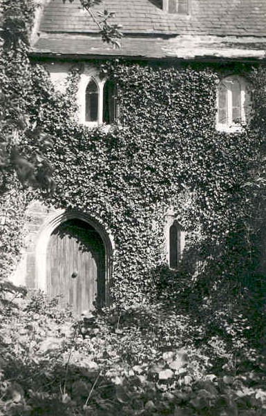
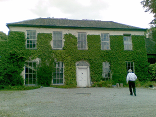
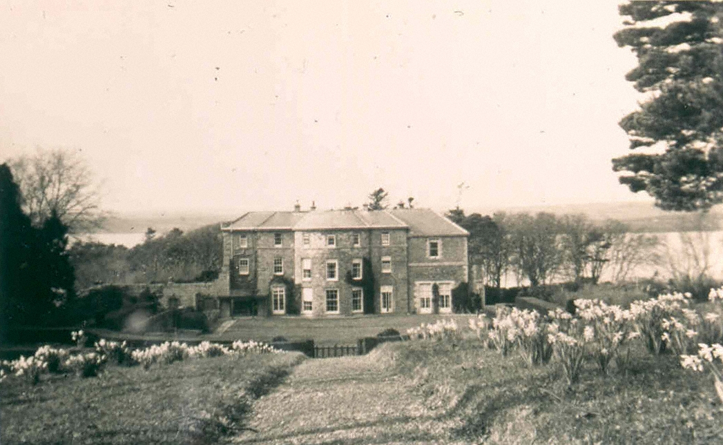
Morgans North
Houses within 10km of this house
Displaying 30 houses.
Houses within 10km of Morgans North
Displaying 30 houses.
| House name | Description | |
|---|---|---|
| Ross Hill | Ross Hill House was the home of George Ross Lewin and his descendants until the end of the 19th century. He was the second son of Harrison Ross Lewin of Fort Fergus, High Sheriff of county Clare in 1755. The house is still inhabited. |

|
| Cahercon/Cahiracon | A house situated on the bank of the Shannon, the seat of the Scott family until at least the 1850s. The sale rental of 1854 gives a detailed description of the house which included 16 bedrooms. By the mid 19th century James Kelly held the house in fee. The buildings were valued at over £53. The Honourable Charles William White, second surviving son of Baron Annally, was living at Cahiracon in the mid 1870s and it was a seat of that family in 1894. The Vandeleurs lived here for a short time at the beginning of the 20th century. Bought by the Maynooth Mission to China in 1920 and sold by them to the Salesian Sisters of St John Bosco in 1962. The house later became the centre of Cahercon Community College. Cahercon is now owned by Clareman Paddy Whelan of Limestone Quarries. |

|
| Clifton | Built by the Scotts of Cahiracon for the use of their agents circa 1830s, this house was in the possession of James Kelly by the time of Griffith's Valuation when the house was recorded as unoccupied. It became St Brigid's Convent for postulants of the Columban Sisters in the 1920s and was demolished in 1979. |
|
| Ballyleaan Lodge | Lewis records Ballylane Lodge as the residence of W. Coppinger. At the time of Griffith' s Valuation William Coppinger held in fee at Ballyleaan 142 acres, a lodge, offices and gate lodge. The property was later inherited by the O'Connell family and by marriage passed to John Charles Coppinger O'Connell (later Bianconi) in the 1870s. The mansion house valued at £41 was in the possession of John O'Connell in 1894 and in 1906. Weir writes that the house was completely demolished in 1970. |
|
| Crovraghan | A house situated on the Wyndham estate, occupied by John Tatlow in 1814 and J. O'Donnell in 1837. James O'Donnell held the house, valued at just over £10, from Colonel George Wyndham at the time of Griffith's Valuation. Later the home of the Cannon family until the 1970s. |
|
| Shore House | The O'Gradys lived at Shore House from at least the 1820s. Jane O'Grady held the house from John Bindon Scott at the time of Griffith's Valuation, when it was valued at £14.10 shillings. Jane O'Grady married Daniel O'Connell of Kilgory. The home of the Hogan family at the end of the 20th century. |
|
| Fort Anne | The residence of S. E. Johnson in 1837, built by his father William. The house was occupied by Richard Johnston in the early 1850s who held the it from the Reverend R. Dickson, who held the demesne in fee. In 1906 this house valued at £13.15 shillings was occupied by William D. Dickson. The original house is no longer extant. | |
| Ballysteen | Inhabited by James Massey in the early 1850s who held the property from the Earl of Clare. The house was valued at £11+ at that time. Though still extant it has fallen into disuse. |

|
| Movena | A house on the Roche estate occupied by Bridget Farrell in the early 1850s when the buildings were valued at £11. Movena is marked on the first edition Ordnance Survey map. It is now a ruin. |
|
| Waterpark House | A house on the Monteagle estate, the residence of Catherine Nolan in the early 1850s, when it was valued at £10. It is labelled as Waterpark House on the 25-inch Ordnance Survey map of the 1890s. A house is still extant at the site. | |
| Corgrig House | Gerald Griffin was the proprietor of Corgrig in 1826, Mrs Griffin occupied Congrieff in 1837 and Gerald Griffin held Corgrig from Lord Monteagle in the early 1850s. The Ordnance Field Name Books state that Peter Griffin was the proprietor circa 1840 and that his father had erected this house about 80 years previously. It is still extant though with modern housing now occupying much of the surrounding area. The 25-inch Ordnance Survey map of the 1890s also shows a house known as Corgrig Lodge in the same townland at R253511. | |
| Shanagolden House | According to the Ordnance Field Name Books this house was erected in 1812 on the site of a former house. This three-storied house was situated on the Monteagle estate and was occupied by John Griffin in 1814 and by the Reverend George Vincent, rector of Shanagolden in 1837. His son Arthur Vincent was resident in the early 1850s when the house was valued at £20 and in the 1870s when he is recorded as owning 267 acres in county Limerick. It is no longer extant. | |
| Old Abbey | The home of the Greene family for most of the 18th century. In 1786 Wilson refers to "Abbey" as the seat of Mr. Greene. Subsequent tenants were the Hodges and the Morgans. The Ordnance Field Name Books state that part of the building was very ancient and that a new front had been built in 1805. George Morgan was resident in 1814, William Morgan in 1837 and in the early 1850s, when he held the property from the Earl of Cork. Old Abbey passed to Willliam's daughter, Mrs Wardell, and stayed in the possession of the Wardell family into the 20th century. It is no longer extant. |
|
| Castletown | The main residence of the Waller family in the 18th and 19th centuries, now demolished. The house was valued at £80 in the early 1850s when it was the residence of the Reverend William Waller. By 1906 its value was reduced to £72.5 shillings and it was occupied by the Reverend John Thomas Waller who was also resident in 1894. The surveyor for the Irish Tourist Association Survey in 1944 refers to the house being recently levelled to the ground. | |
| Bushyisland | This house was the residence of Peter Lowe in 1814 and in 1837. John Peppard MD was the occupier at the time of the first Ordnance Survey and of Griffith's Valuation. He held the property from Bolton Waller and had converted the house into an asylum. | |
| Ballysteen | Home of the Westropp family in the 18th and 19th centuries and occupied by Colonel John Westropp in 1814. The Ordnance Survey Field Name Books circa 1840 state that John Westropp built the house in 1809 on the site of the former house. By 1837 it had passed to his nephew Edmond Odell who had assumed the name Westropp. Ballysteen valued at £40 was held by Edmund Westropp in fee at the time of Griffith's Valuation and in 1906 by Richard Westropp when its value had increased to almost £45. |
|
| Glenagaureen | The Ordnance Survey Field Name Books circa 1840 record an unoccupied house named Glenagordon in Ballysteen, built 1826 by Edmund Odell Westropp. A vacant house valued at £16 and held by Edmund Westropp was recorded in Griffith's Valuation for Ballysteen. | |
| Milltown | The Reverend Champagne was resident at Milltown from at least 1837. He is recorded as the occupier of this house in the early 1850s when he held the house valued at £28 from the Reverend Tyrell Evans. | |
| Ballynacourty | A house occupied by Thomas Davenport from at least 1837. The Ordnance Survey Field Name Books circa 1840 state that the house was built by John Evans "about 90 years" previously. It was two storeys high. The house was valued at £15 in the early 1850s and was held from Daniel D. Power. The house is still extant and now owned by John Feheney. For more information see www.iverusresearchfoundation.com (See ‘Research Notes’, Ballinacourty House). |
|
| Mount Trenchard | Lewis described this mansion formerly called Cappa as "beautifully situated on the banks of the Shannon". Marked as "Cappo" on the Taylor and Skinner map of the 1770s. Home of the Rice/Spring Rice family in the 19th century, valued at £40 in the 1850s and at £54 in 1906. Occupied by the Military in 1944, sold to Lady Holland in 1947 and to the Sisters of Mercy in 1953 who opened a school. |
|
| Kilcosgrave | Occupied by Danie Sheahan in 1814. The Ordnance Survey Field Name Book states that Kilcosgrave House was built on the site of the Castle and was formerly the residence of the Langford family. It was then a ruin except for one part which had been converted into a farm house. The name of this house is usually spelt Kilcosgriff. | |
| Castle Hewson | The seat of the Hewson family of county Limerick. William Hewson was in residence at the time of Griffith's Valuation when the buildings were valued at £23. Castle Hewson is no longer occupied but William Hewson, a descendant of George Hewson, resides in a building closeby and is restoring the property. A tower house stands beside the house. |

|
| Riddlestown Park | The seat of a branch of the Blennerhassett family, built circa 1730, it passed by inheritance to the Knight of Glin. In 1786 Wilson wrote that it was was the seat of Mr. Blennerhasset. Described by Lewis in 1837 as ''the ancient mansion of Gerald Blennerhassett'' on the banks of the Deel. It was held in fee by Gerald Blennerhasset at the time of Griffith's Valuation when it was valued at £22. Passed to the Knight of Glin in the early 20th century and then sold. It is still extant. |

|
| Altavilla | Bence Jones writes that this house was built by the Bateman family in the mid 18th century to the design of Francis Bindon. In 1786 Wlson refers to it as the seat of Jon Bateman. The Ordnance Survey Name Book records that Altaville House was a rectangular building of four storeys built in 1749 by Mr Bateman and that it was then [circa 1840] undergoing repairs by Peter Griffin of Corgrieff. At the time of Griffith's Valuation it was inhabited by Peter Griffin who had carding mills and offices closeby. He held the property from William Dickson. It is still extant. |

|
| Ballycullen House | This house was built in 1740 by Carrol Naish on the foundation of Ballycullen Castle according to the Ordnance Survey Name Book. Occupied by Patrick C. Nash in 1814 and by Carroll Nash at the time of Griffith's Valuation, it was held from Henry Hare and valued at £14. It is still extant and was restored during the twentieth century. | |
| Ballyclogh | A house on the Monteagle estate, leased to John Copley for ever. The house was 3 storeys high and had been repaired in 1810 by Copley. His representatives were subletting the house to Patrick Griffin by the time of Griffith's Valuation when the buildings were valued at £32. This house is now a ruin. |

|
| Ballynort | A Taylor residence which passed by marriage to the Massy family. In1786 Wilson describes it as" the pleasant seat of Mr. Massey". The townland of Ballynort, 657 acres, was held in fee by Standish O'Grady and E.T. Massy at the time of Griffith's Valuation. This house is marked "in ruins" on the first Ordnance Survey map. The buildings were valued at £4+. There is no trace of the house on the 25-inch Ordnance Survey map of the 1890s. | |
| Inchirourke More | The residence of Hunt Esq in the 1770s and in 1786. Occupied by Edward Hunt in 1814. At the time of Griffith's Valuation, Robert Hunt held the house, valued at £6.5 shillings, and over 500 acres in the townland of Askeaton from Sir Matthew Blakiston. It is still extant. |

|
| Betty Ville House | This house is marked on the first edition Ordnance Survey map. Located on the Blakiston estate, it was occupied by John Shaughnessy in the mid 19th century and held from the Messrs Young. It was valued at £5. |

|
| Foynes House | In 1837 Lewis describes a house on Foynes Island as a "handsome marine villa, the summer residence of the Earl of Dunraven". The 1st edition Ordnance Survey map shows a house named Foynes House on the southern part of the island. By the time of Griffith's Valuation this is in possession of Peter Griffin, leasing from the Spring-Rice estate and with a valuation of £1 15s. The later 25-inch Ordnance Survey map shows a much smaller property labelled Burneen, close to the site of Foynes House. This latter property is still extant. |