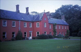
Cratloe House
Houses within 5km of this house
Displaying 12 houses.
Houses within 5km of Cratloe House
Displaying 12 houses.
| House name | Description | |
|---|---|---|
| Cratloe Woods | An 17th century house with a 19th century addition, the Irish home of the Stafford O'Briens and still in the family's possession. On the first edition Ordnance Survey map this house appears to straddle the border of the townlands of Cratloe and Portdrine. The house was held by Augustus Stafford at the time of Griffith's Valuation, valued at £24. In 1894 it was the seat of F.H.Stafford-O'Brien. It is still extant. |
|
| Burtonhill House | Weir writes that this house was probably built by the Carrigaholt Burtons as a sporting lodge. It is marked on the first edition Ordnance Survey map. The Burton Conynghams had a large estate in the parish of Killeely so there can be no doubt that the house was named after them. By the time of Griffith's Valuation it was valued at £11 and Edward H. Goggin was in residence. He held the property from Mrs Taylor. William B. Goggin of Burton Hill married Frances Maria Whitestone in the second half of the 19th century. see http://brew.clients.ch/RichardClare.htm | |
| Summerhill House | Built on the Marquess of Conyngham's estate by the time of the first Ordnance Survey, this house valued at £10 was occupied by John Frost in the mid 19th century and it continued to be the home of the Frosts until the 1970s. A substantial farm still exists at the site. | |
| Meelick House | A house built by the time of the first Ordnance Survey on the Marquess of Conyngham's estate and occupied by William Roche at the time of Griffith's Valuation, when it was valued at £11. This house is no longer extant. | |
| Clonmacken | Built in 1700 by Reverend Edmund Palmer according to the Ordnance Survey Field Book, this two-storey house was occupied by Henry D'Esterre in 1814, by Captain Vereker in 1834 and by 1839 was the seat of John Brown Finch. In the early 1850s it was the residence of John Sharp, situated on the Lansdowne estate, it was held from Lawrence Kelly. | |
| Bunkers Hill | A mid 19th century house, the home of James Forost (1827-1907), author of ''The History and Topography of the County of Clare'' (1893), who held the house and 139 acres from Lord George Quin. He was the eldest son of William Frost and his wife Mary Ryan and he married Bedelia daughter of Augustine Moran of Willbrook. He left the house to the Dundon family who sold it to the Ryans circa 1917. Members of the Ryan family still live at Bunkers Hill. | |
| Brickhill | The home of the Maghlin family in the early 18th century, it passed by marriage to the Blood family. Occupied by the Lysaght family in the mid 18th century. Edward Lysaght, songwriter and lawyer, known as 'Pleasant Ned' was born at Brickhill in 1763. The house is not named on the first Ordnance Survey map and a 20th century house now occupies the site. [Grid reference is approximate]. | |
| Cooper Hill | The residence of James Cooper in 1814 and occupied by Mrs [Honora] Cooper in 1837. Inherited by James Cooper Tuthill circa 1844 who then assumed the surname Cooper. The house was valued at £45 at the time of Griffith's Valuation and in 1906 when it was occupied by James Cooper. It was advertised for sale in ''Country Life'' (28 April 1955), bought by Cement Ltd who ran a model dairy farm on the property for some years. A large dairy enterprise still operates on the property. The house is a ruin. |

|
| Tervoe | Bence Jones writes that the house was built in 1776 by Colonel W.T. Monsell MP on the site of an earlier house. Wilson refers to it in 1786 as "the pleasant seat of W.T. Monsell". In 1894 Slater notes it as a residence of Lord Emly. A De La Poer grandson of the 1st Baron Emly succeeded to Tervoe in the 20th century and it was demolished in the 1950s. A detailed description of the interior of the house is given by the Irish Tourist Association surveyor in 1943. |

|
| Coolraine House | Occupied by John Vereker at the time of Griffith's Valuation, valued at £30 and held from the Marquess of Lansdowne. It was still extant until the 1940s but the site is now occupied by suburban housing. | |
| Tivoli | Marked on the first Ordnance Survey map, Tivoli Cottage valued at £48 was occupied by Major Wheeler and held from Sir Matthew Barrington at the time of Griffith's Valuation. Since 1952 it has been the centre of a boys' secondary school known as Villiers School. |

|
| Pass House | In 1786 Wilson writes that Pass House was the seat of Mr. Peacock. By the time of Griffith's Valuation the house was occupied by Solomon Frost, leasing from the Peacock estate and valued at over £5. The property does not appear on the 25-inch Ordnance Survey map of the 1890s. |