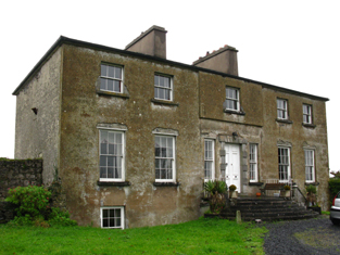
Greenhills
Houses within 10km of this house
Displaying 20 houses.
Houses within 10km of Greenhills
Displaying 20 houses.
| House name | Description | |
|---|---|---|
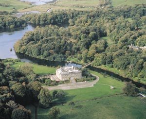
| Westport House | Built on the site of the O'Malley castle of Cathair na Mart by Colonel John Browne, expanded by his grandson to the design of Richard Cassels, the house has remained in the possession of the Browne family for over three centuries. They still live there and the house and its grounds function as a major tourist attraction. |
|
| Mount Browne | A house built in the early 18th century and used by the first generations of Brownes at Westport. Wilson describes it as the seat of Mr. Browne in 1786. It was later occupied by Denis Browne, Member of Parliament, brother of the 1st Marquess of Sligo, and other family members. It was leased by John D. Browne from the Marquess of Sligo's estate at the time of Griffith's Valuation, when it was valued at £30. The Irish Tourist Association file of the 1940s states that the mansion had been demolished. | |
| Knockranny | A house in the town of Westport occupied by the Livingstones. It was valued at £40 at the time of Griffith's Valuation which included the house, offices, gate lodge and another lodge. This may have been the house marked on the first Ordnance Survey map as Westport Lodge. This building now forms part of the Sacred Heart School complex. |
|
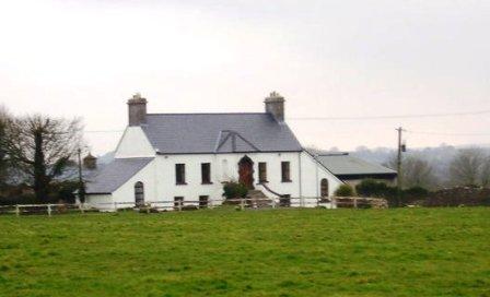
| Ballynew House | In the 18th century Ballynew was the home of a branch of the Miller family of Milford, near Kilmaine, county Mayo. In 1777 Robert Miller of Ballynew married a Bridget Young of Harristown, county Roscommon. Ballynew became a Bourke home in the 19th century through a Miller/Bourke marriage. Ballynew is still extant and occupied. |
|
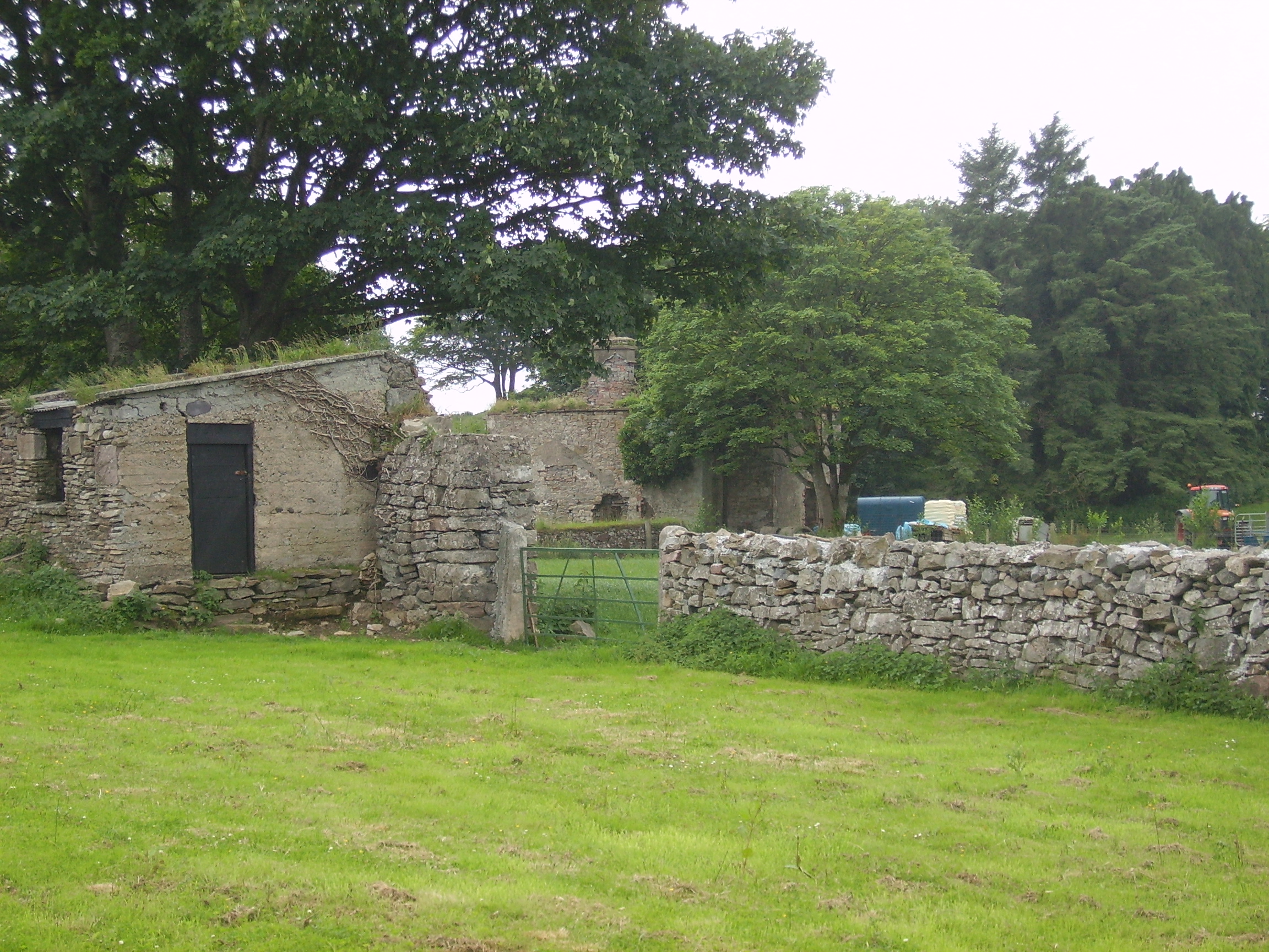
| Errew | An unoccupied house and offices valued at £11 were held by James Hardiman at the time of Griffith's Valuation. A school and monastery are shown on the 25-inch Ordnance Survey map of this area in the 1890s. These buildings are still extant. | |
| The Grove | At the time of the first Ordnance Survey the house was described as the former residence of Captain Bourke. It became the home of James Faulkner in the late 1860s until his death in 1911. It was used as a nursing home from 1926. In 1993 it was sold and rebuilt as luxury apartments. |
|
| Hawthorn Lodge | Mulloy writes that in 1789 this house was leased by George O'Malley from the Ellison family and that the O'Malleys lived there until the late 19th century. It was generally known as 'Lodge'. The house was sold to the Carson family in 1905. Charles O'Malley and his son, St Clair O'Malley, were agents to the Earls of Lucan. This house appears to be named Tallyhoe, the residence of Cuffe esquire, on the Taylor and Skinner map. Hawthorn Lodge is still extant and has been occupied by descendants of George O'Malley since the 1990s. |
|
| Hazelrock Lodge | Valued at £5 at the time of Griffith's Valuation and held by the Honourable George Frederick Yelverton from Viscount Avonmore. The National Inventory of Architectural Heritage contends that it was built in the early nineteenth century for Barry John Yelverton, third Viscount Avonmore. It is now a ruin. |
|
| Kilboyne | Described at the time of the first Ordnance Survey as a 'good house surrounded by a neat but small demesne'. At the time of Griffith's Valuation it was held in fee by Sir Samuel O'Malley and valued at £12. A modern house exists at the site now. | |
| Kinturk | A residence of the Bourke family in the early 19th century, situated beside Kinturk Castle. In 1786 Wilson refers to it as the seat of Mr. Burke. The townland was in the possession of Rev. H.N. Ormsby at the time of Griffith's Valuation. | |
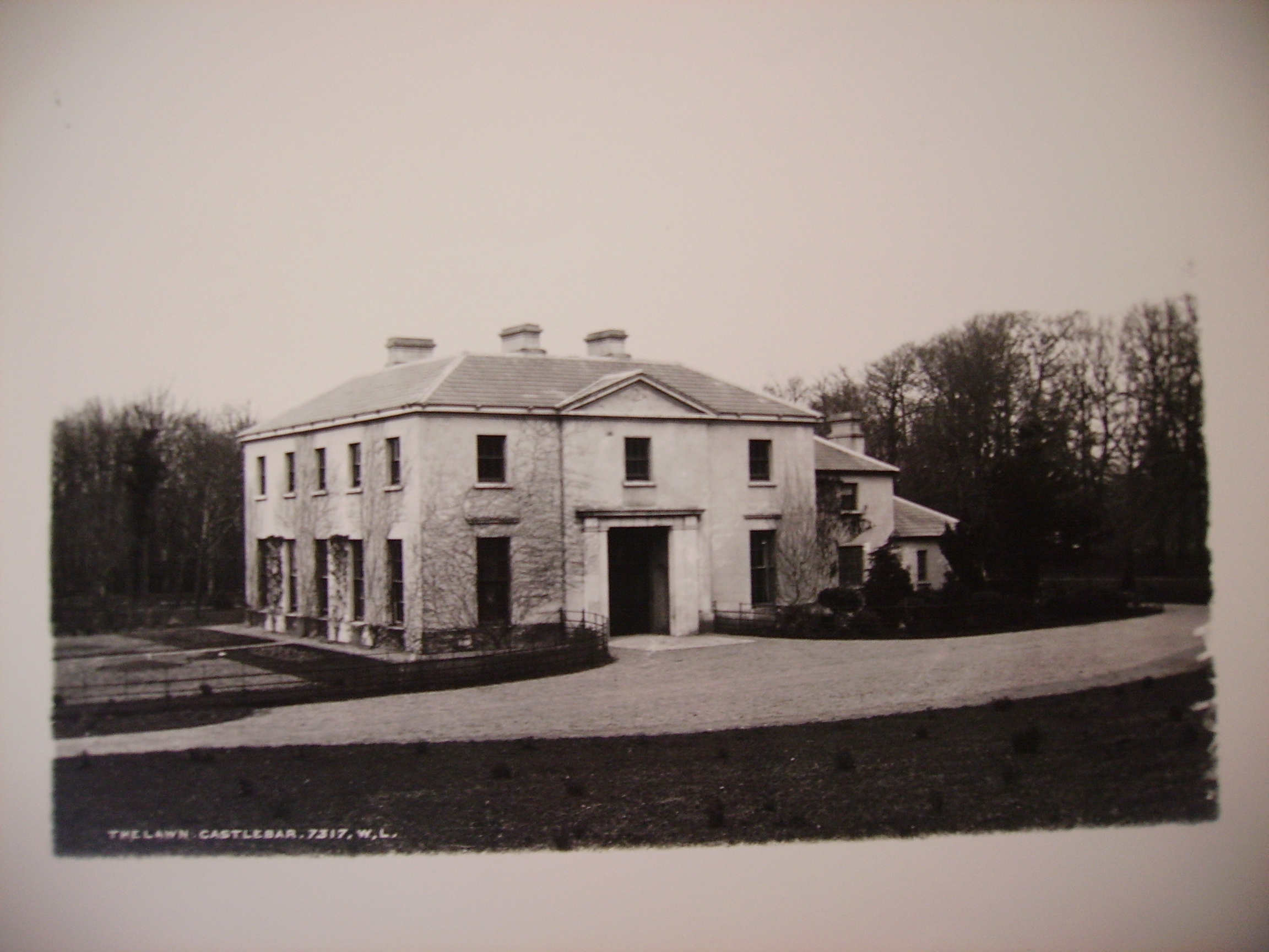
| The Lawn | Castlebar House was burnt in 1798. When resident in Castlebar in the 19th century the Earls of Lucan lived in the lodge known as 'The Lawn', described in the Ordnance Survey Name Books as the residence of St Clair O'Malley, who was agent to the Earls of Lucan in the 1830s. Castlebar House is referred to as the seat of the Earls of Lucan in 1894. This building is now part of a school complex. |
|
| Pheasant Hill | A Sheridan home from the late 18th century to the late 19th century. Wilson, writing in 1786, refers to "Dan" as the seat of Mr. Sheridan. By the time of Griffith's Valuation it was held by John Sheridan from the Earl of Lucan's estate with a valuation of £3. It is not shown on the 25-inch map of the 1890s and modern buildings exist in the area now. | |
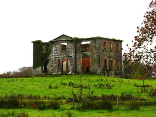
| Raheens | A house south west of Castlebar, noted by Wilson as the seat of A.N. Browne in 1786. Held by the Browne family from their relatives the Lords Kilmaine. At the time of Griffith's Valuation, it was occupied by Henry Browne and valued at over £16. It is now a ruin. |
|
| Rocklands | A house occupied by various agents to the Earls of Lucan, including Ellison, Davis and Larminie. In 1786 Wilson refers to it as the seat of Mr. Ellison. At the time of Griffith's Valuation, it was occupied by Neal Davis, holding from the Earl of Lucan, and valued at £15. The site appears to be occupied by a larger modern building. | |
| St Audries | An 18th century house on the shore of Saleens Lake on the outskirts of Castlebar, named after the home of the 1st Countess in Somerset, England. St Audries was leased to Owen Lindsey in 1769 and his family maintained an interest in the property and the farm at Drumsheen until the early 19th century. The Reverend Archdeacon Warburton was living in the house in 1814. By the time of the first Ordnance Survey the house was in ruins. | |
| Snugborough | A property leased from the Brownes of Raheens, the O'Malleys built a house here in 1765, costing £900. It was badly damaged in 1798 and was recorded to be in a dilapidated state in the Ordnance Survey Name Books. It is labelled as Snugborough House on the 1st edition Ordnance Survey map of 1838 but is not labelled on the later 25-inch edition and nothing now remains. | |
| Spencer Park | A house occupied by a junior branch of the Burrishoole family descended from Patrick O'Malley. They held the house during the second half of the 18th century and much of the 19th century from the Earls of Lucan. By the time of Griffith's Valuation it was occupied by John C. Larminie. In 1858 Larminie sold his interest in the O'Malley's lease of Spencer Park, which had been renewed on 7 Oct 1842 for three lives or 31 years. The Freeman's Journal reported that it was purchased in trust by Mr. Jordan. The site is now occupied by modern housing. | |
| Mount Gordon | An 18th century house, occupied in the 1770s by 'Garden' [Gardiner]. Wilson refers to it as the seat of Mr. Garden [Gardiner] in 1786. It was occupied by Mary Boyd at the time of Griffith's Valuation, when the house was valued at £43. It is still extant and occupied. |
|
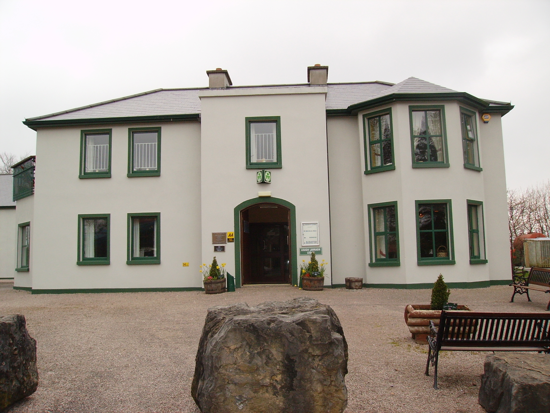
| Creagh's Villa | At the time of Griffith's Valuation, this property appears to be have been leased by Mary Boyd fron the Lucan estate when it was valued at £12. In the 1870s it was the residence of Bernard Peyton. It was destroyed by fire in 1996 and subsequently demolished to make way for the Lough Lannagh holiday complex which includes a building similar to the design of the original house. |
|
| Drumminroe | Malachy Tuohy held a house valued at £8 from George Henry Moore at the time of Griffith's Valuation. Members of the Tuohy family still occupy this house. |