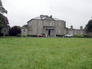
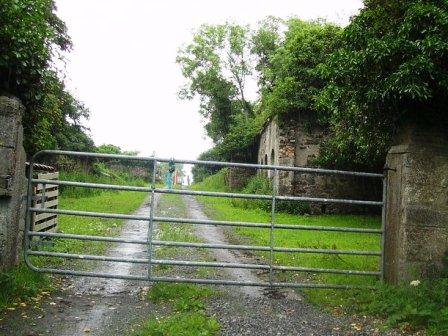
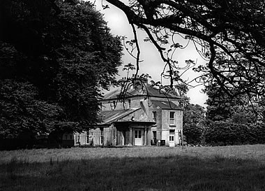
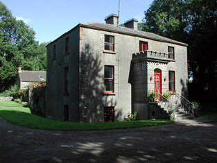
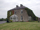
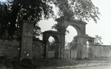
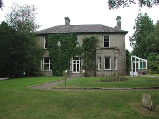
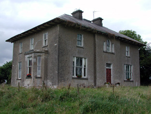
Mount Pleasant
Houses within 15km of this house
Displaying 73 houses.
Houses within 15km of Mount Pleasant
Displaying 73 houses.
| House name | Description | |
|---|---|---|
| Carrowroe Park | The home of the Goff family in the 19th century. Described by Lewis as a substantial and handsome mansion of limestone with a Doric portico, the residence of R. Goff. In the 1850s occupied by the Reverend William Battersby, who held the property from the Earl of Essex. Reverend Battersby was married to Mary Maud Caulfield, a daughter of John Caulfield, Archdeacon of Kilmore. The house was valued at £65. By the 1870s the residence of John Burke and the seat of Lt-Col. Michael A. Burke in 1894. Still extant and offered for sale in 2008 (Irish Times, 5 June 2008). |
|
| Mount Prospect | This house was the residence of John Browne in 1814. Recorded as the seat of Mr Fallon at the time of the first Ordnance Survey in the 1830s but in ruins by the mid 1850s. though a small portion of the house is labelled Mount Prospect on the 25-inch Ordnance Survey map of the 1890s. Small fragments of the building remain at the site. | |
| Ryefield | At the time of Griffith's Valuation Andrew Cummins was leasing a house at Ryefield valued at £17 to John Dowd. It was occupied by John Cummins, agent to Nicholas Cummins at the time of the first Ordnance Survey. | |
| Beechwood | A residence of the Hughes family in the 18th century. The sale rental of 1859 states that Beechwood was for many years the residence of the late Mr Ferrall. Daniel Ferrall of Beechwood was issued with a game licence in 1822. Occupied by Daniel Irwin in the 1850s when the house was valued at £40, by the Tolers in the 1880s and by Clare M. Nolan in 1906. Norton states that the Irwin brothers were nephews of Daniel Ferrall. Beechwood is no longer extant. |
|
| Ballaghawbeg | Richard Irwin's estate owned a herd's house valued at £2 together with over 400 acres at Ballaghawbeg, barony of Castlereagh, at the time of Griffith's Valuation. The Census of Elphin in 1749 recorded that Charles O'Conor, farmer, held this property at the time. Some ruins exist at the site. | |
| Emlagh | Robert Irwin was leasing a property valued at £5 + 230 acres at Emlagh, barony of Castlerea, to Patrick Flynn, at the time of Griffith's Valuation. The Census of Elphin indicates that John Irwin resided there in 1749. Gormley states that the house was probably built around 1740 and extended in the early 1800s. By the 1880s the Irwins had sold Emlagh to Walter McDermott. The house was later demolished. | |
| Milltown | Roderick O'Conor/O'Connor occupied the property at Milltown, barony of Castlerea, valued at £36, at the time of Griffith's Valuation. It was also recorded as his seat in both 1814 and 1837. Gormley states that nothing of the house now remains save for traces of the mile long avenue. | |
| Heathfield | Patrick Balfe was leasing the property at Heathfield, valued at £36, to John Butler at the time of Griffith's Valuation. Lewis records Heathfield as the seat of Nicholas Balfe. It was also his seat in 1814. Gormley states that this house was originally known as Belgard Lodge and was part of the estate of Thomas Dillon of Belgard Castle, county Dublin. Richard Irwin of Fernhall acted as his agent in Roscommon. By 1830 the Heathfield estate was owned by Patrick Balfe and by the 1850s it was occupied by the Butler family, originally of Cherryfield, Elphin. They continued to occupy the house until the 1940s. The house is still extant. | |
| Cloverhill | Latouche esquire lived at Cloverhill in 1778 and Wilson refers to it as the seat of John La Touche in 1786. The residence of Thomas Hurst in 1814 and of John Hurst in 1837. Occupied by Edward Jones, who held from Thomas Booth, at the time of Griffith's Valuation. The main road has been directed through the site and only a few ruins remain. | |
| Fern Hall | At the time of the first Ordnance Survey the Trant family were recorded as the proprietors of the townland of Polranny, barony of Castlereagh, including Fern Hall House. Henry Dillon Trant was leasing it to John Irwin at the time of Griffith's Valuation when it was valued at almost £5. Gormley states that this branch of the Irwins was the oldest in the area, having been recorded there in the sixteenth century. The house was not in good repair by the end of the nineteenth century and no trace remains now. | |
| Brierfield | The Hawkes family built a chapel of ease at Brierfield in 1720. Brierfield was their main residence in the 18th and 19th centuries. Sold to Cox Cotton in the late 19th century, no longer extant. | |
| Ballymacurly | Andrew McDermott was farming at Ballymackeriley, parish of Cloonygormican in 1749. Occupied by Michael Nolan in 1837 and in the 1850s and held from Hugh O'Byrne. |
|
| Runnamoat | Runnamoat was occupied by Bryan Fallon in 1749 and noted by Wilson as a seat of the Fallons in 1786. It was the residence of James Fallon in 1814. Acquired by James Balfe, tenth son of Walter Balfe, the house passed by marriage to the Chichesters who leased it to Richard Kelly in the 1850s, when it was valued at £70. Occupied by Raleigh Chichester Constable in 1906. This house is sometimes referred to as Runnimead. Burnt in the 1920s. | |
| Newtown | Originally an Irwin property, bought by the Brownes in the 18th century. Held by the Very Reverend Henry M. Browne at the time of Griffith's Valuation and occupied by Henry Farmer. | |
| Temp House | A house called Tempe was occupied by Charles O'Connor in 1814. IN the 1850s it was leased by Tobias Kelly from Catherine Mennons and valued at £13. A house is still extant at the site. | |
| Church Park | Church Park was occupied by Benjamin Reeves in 1814. It is shown on the First edition Ordnance Survey map of the 1840s but is not labelled on the later 25-inch edition of the 1890s. The house is no longer extant but entrance gates are still visible. | |
| Gillstown | The residence of Mr John Stafford in 1749 and of J. Hogg in 1837. Occupied by Thomas Cox in the second half of the 19th century, who held the property from John Blakeney. Valued at £5 in the 1850s. In 1906 the buildings at Gillstown were valued at £8.10s and were occupied by the representatives of Thomas Cox. | |
| Holywell | Originally a Gunning home that passed to the Blakeneys by marriage. In 1786 Wilson mentions it as the seat of Charles Blakeney. Occupied by C. W. Blakeney in 1837 and by Henry Smyth in the 1850s who held the property from John Goodall. The property is no longer extant. | |
| Essex Lawn | Built after the First Ordnance Survey on part of the estate of the Earl of Essex, this house was occupied by John Kelly in the 1850s when it was valued at £18 10s. It is still extant. |
|
| Derrane House | The home of the Corr family in the 19th century, Henry Corr is recorded as living at "Durham" in 1814. Henry "Gorr" was residing in a property here valued at £12 at the time of Griffith's Valuation. It is recorded as "Derrane House [in ruins]" on the 25-inch Ordnance Survey map of the 1890s and very little trace remains of it now. | |
| Roxborough | Wilson, writing in 1786, refers to Roxborough as the seat of "Mr. Irvine". The residence of John Irwin in 1814 and of A. Brown in 1837. In the 1850s occupied by John Gaynor, when the house was valued at £20. The property is now a ruin. | |
| Drumdaff | Charles Croghan, a farmer, lived at Drumduff in 1749. Home of the Digby family in the 19th century. Held in fee by George Digby at the time of Griffith's Valuation when the buildings were valued at £17.It is still extant and maintained. |

|
| Lisbride | Occupied by John B. Purdon in 1814 and in 1822 by Arthur Browne. Patrick Duignan was resident at the time of Griffith's Valuation, when the house was valued at £12. A house still exists at the site. | |
| Kilteeven House | Still occupied by the Mapothers in 1906, when the house was valued at £20. Some ruined buildings remain at this site. |
|
| Carrowmore | Carrowmore was occupied by John Davis at the time of Griffith's Valuation, when it was valued at £8 and leased from the Gunning estate. It is labelled Carrowmore House on the 25-inch Ordnance Survey map of the 1890s. A house still exists at the site. | |
| Fairymount | The home of Edward Mills in 1814. In 1828 Edward Mills of Fairymount was a member of the Grand Panel of county Roscommon. Residence of Mr Lyster at the time of the first Ordnance Survey. By the time of Griffith's Valuation the largest house in the townland of Fairymount was valued at £1.15s, leased by Anne Lyster to Michael Connolly. | |
| Cloonyquin | Home of the French family, including the song writer Percy French, sold by the family in the 1950s. In 1786 Wilson refers to it as a seat of Arthur French in 1786. Valued at £24 in the mid 19th century. The house was demolished in the 1960s. See www.percyfrench.ie. |
|
| Mullymucks/Fortview | Built post 1838, though the National Inventory of Architectural Heritage suggests it is a modified 18th century house. Occupied by Francis Lyng in the 1850s, when it was valued at £24. It is still extant and now known as Fortview House. |
|
| Munsborough House | Built post 1838 and occupied by Edward Pearse in the 1850s, when it was valued at £20. Extensive buildings are shown at the site on the 25-inch edition Ordnance Survey map of the 1890s, labelled Munsborough House. A house and large farm are still extant at the site. | |
| Ballybride | James O'Farrell was leasing over 180 acre and a herd's house from Louisa Pelly at Ballybride, barony of Roscommon, at the time of Griffith's Valuation. | |
| Mount Dillon | Lewis writes that the house was situated on an isolated hill and formed "a conspicuous object in the surrounding scenery". Valued at £15 in the mid 19th century. Wilson, in 1786, refers to it as the seat of Mr. Dillon. In the possession of Samuel Russell in 1906 when the buildings were valued at £3. It is no longer extant. | |
| Smith Hill | Smithhill was in the demesne of The Palace at Elphin. It was the residence of the Reverend Oliver Jones, grandfather of Oliver Goldsmith, in the early 18th century. It was the home of Robert Jones Lloyd in the late 18th and early 19th century and of the Reverend John Lloyd in 1837. The house was unoccupied at the time of Griffith's Valuation when it was valued at £8 and held by Robert Lynch. The Ordnance Survey Field Name Books record that Goldsmith's father was born at Ardnagowna [or possibly Oliver himself, see http://en.wikipedia.org/wiki/Smith_Hill_(house)]. |
|
| Rooaun Lodge | At the time of Griffith's Valuation occupied by John Morton and held by him in fee, valued at £3. A house at Rooaun valued at £18 was occupied by T.A.F. O'Flaherty in 1906. | |
| Ballagh | In 1814 James O'Connor was residing at Ballagh. Described as a good dwelling house at the time of the first Ordnance Survey. Occupied by Denis O'Conor in the 1850s, held from Theobald Dillon and valued at £6. In 1906 James D. O'Connor occupied Ballagh, valued at £17. It is no longer extant. | |
| Martinstown | In 1786 Wilson refers to Martin's-town as the seat of Mr. Davys. The residence of George Davis in 1814 and of Mr Davis in the 1830s, apparently held from the Digby family. By the time of Griffith's Valuation Ballymartinmore was in the possession of George Digby and a vacant house valued at £4 was held by Edward Flynn. The house is no longer extant. |

|
| Lissadorn | Lissadorn was a Crofton home from the mid 17th century. It became a Lloyd home in the 18th century following the marriage of Catherine Crofton and John Yeadon Lloyd in 1786. By 1814 Joseph Healy was living at Lisadurn. Burke's ''Landed Gentry of Ireland'' (1904) records the second son of Walter Balfe of Heathfield as John Balfe of Lissadorn. J. Balfe was residing at Lissadorn in 1837. At the time of Griffith's Valuation, Bernard Balfe held Lissadorn, valued at £20, from Viscount Lorton. It is no longer extant. On the first Ordnance Survey map (1838) the demesne included a smaller house named Ryefield. |
|
| Cargins Park | The home of the Kelly family from the mid 18th century. Wilson refers to "Cargans, the seat of the late Daniel Kelly" in 1786. It was occupied by John D'Arcy when the estate was sold in 1852. A Victorian three bay house was the home of Daniel Kelly. Sold to Captain Drought in the mid 19th century, held by him in fee and valued at £15. The present house is not the same as Kelly's Victorian one. Renovated in the early 21st century. | |
| Cloonfree | The residence of William Mahon. Apparently the residence of George Knox in the 1840s. http://www.ballykilcline.com/story_f.html | |
| Cloonahee | Residence of Gilbert Conry in 1814 and of John Conroy esq in 1822. According to a note with the sale rental of 1853 the house was accidently burnt and a good farm house built as a replacement. The home of John Heague in the mid 19th century. Occupied by Richard Hague and valued at £40 in 1906. |
|
| Castlenode House | Residence of Thomas Morton esq in 1822 and of J. Morton in 1837. In the mid 1850s, George Walpole was the occupant of this house, which he held from the Pakenham Mahon estate when it was valued at £8. A house still occupies the site of the original Castlenode House. | |
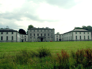
| Strokestown House | Late 17th century house altered in the early 19th century and home of the Mahon family for three centuries. In 1786 Wilson described it as "fine mansion house with ample and beautiful demesne". Referred to as "Bawn House", the mansion of Lord Hartland, by Lewis in 1837. Valued at £70 in the mid 19th century. Now a major tourist attraction containing the Famine Museum. http://www.strokestownpark.ie/ |
|
| Newtown Glebe | Newtown Lodge was occupied by Anthony Dignam in 1814 and the Glebe House at Newtown, valued at £18, was occupied by Reverend Joseph Morton at the time of Griffith's Valuation. It was leased from the Pakenham-Mahon estate. It is still extant. | |
| Cloonfinlough Lodge | Occupied by Robert Devenish at the time of Griffith's Valuation, who held the property from John Caulfeild. Buildings are still extant at the site. | |
| Clogher Beg | Mary Gormley writes that this house was built by the Knoxes who acquired some of the Plunkett of Castle Plunkett estate. Occupied by Thomas Stafford at the time of Griffith's Valuation, held from James Murphy. | |
| Foxborough | In 1786 Wilson refers to Foxborough as the seat of Arthur French. Occupied by Patrick Taaffe at the time of Griffith's Valuation, who was leasing from Christopher French. The house was then valued at £20. It is now a ruin though the stable yard survives. | |
| Raheen | Occupied by Major Fawcett in 1837 and by John Irwin in the mid 1850s who held the property from Francis Murphy. In 1840 John Irwin had married Margaret Harken of Raheen House, Elphin. |
|
| Ardkeenagh House | Michael Plunkett was farming at Ardkeenagh in 1749. In 1814 it was the home of Nicholas Peyton and of Mrs Hawkes in 1837. At the time of Griffith's Valuation the house was vacant but the surrounding lands were held by Patrick Moran from James Somerville. Buildings are still extant at the site. | |
| Bloomfield | In the possession of John Farrell in 1814 and of H. O'Farrell medical doctor in 1837. In the mid 19th century held by the Reverend Peter Toler in fee and valued at £10. Toler appears to have purchased Bloomfield from the sale of the Cargins Park estate by the trustees of Daniel Kelly. | |
| Cloonmurray | Leased by Marcella Dillon to the Reverend Michael Lennon at the time of Griffith's Valuation and valued at £9. Some ruins remain at the site. | |
| Mount Browne | At the time of Griffith's Valuation occupied by George Browne who held the property from James G.Plunkett, valued at £25. The sale rental of the Gunning Plunkett estate in June 1857 states that Mount Browne was held by a fee farm grant from Jane Plunkett, mother and guardian of the owner, to George Browne, dated 30 Oct 1852. Occupied by the representatives of Arthur Browne in 1894 and 1906. | |
| Bettyfield | Recorded as the seat of Sir John Conroy or O'Mulconry in the Ordnance Survey Field Name Books. Arthur O'Connor was the main tenant in the townland of Shankill at the time of Griffith's Valuation. | |
| Creta | Occupied by George Harken in 1814 and Daniel Hughes in the mid 1850s and valued at £8. Creta Cottage was occupied by Captain Dillon in 1837. A house is still extant at the site. | |
| Toberpatrick | Originally a Wynne property, occupied by Mulloy McDermott in 1837. In the 1830s the townland is recorded as including the ruins of Clooncaface House. The residence of Alonzo Lawder in the mid 19th century, held in fee and valued at £20. Occupied by B. F. McDonnell in 1906. A later house is extant at the site now. | |
| Cherryfield | Home of the Mills family in 1778. Noted by Wilson as "the fine seat of Oliver Mills" in 1786. Lewis refers to it as a seat of the same family in 1837. It was occupied by Michael Butler in the 1850s and held from John Carroll, valued at £10. It came into the ownership of the McGreavy family in the latter part of the nineteenth century and remained in their possession until the 1960s. It is now derelict. | |
| Castleplunkett | Gormley states that the Plunketts built a mansion near Castleplunkett village sometime between 1655-1660. This building was later destroyed by fire in the mid-nineteenth century and the stones later used in building in the area. | |
| Moss Hill | Occupied by Peter Conry in 1814 and by Captain Conry in 1837. | |
| Lisroyne Lodge | A house on the outskirts of Strokestown, part of the Strokestown House demesne, valued at £10 at the time of Griffith's Valuation and occupied by Michael Flynn. Some buildings are still extant at the site. | |
| The Palace | Built as the residence of the Protestant Bishop of Elphin in 1685 from money bequeathed by Bishop Hudson. Altered in the mid 18th century and remained as the Bishop's residence until 1845. At the time of Griffith's Valuation the home of Arthur O'Conor, younger brother of Denis O'Conor of Mount Druid. Valued then at £55 and held from the Ecclesiastical Commissioners. Accidentally burnt in 1911, the main block is now demolished. | |
| Toomona | The home of Michael Connor, a gentleman in 1749, just outside Tulsk. The residence of Michael's grandson Peter O'Connor in 1814 and 1837. At the time of Griffith's Valuation Toomona was valued at £10 and was occupied by Maria French who held it from Lord Crofton. Later occupants included Colonel Lynham, Matt Flanagan, the Murphy and Fallon families. Accidently burnt in the 1970s. | |
| Kinard | Possibly a Plunkett house at the end of the 18th century. At the time of Griffith's Valuation John Clarke occupied the house which he held from James Somerville, valued at £5. It is labelled Kinard House on both the 1st and 25-inch edition Ordnance Survey maps. A house is still extant at the site. | |
| Lisnaneane | Gormley states that the widow of Dominick O'Conor Don lived at Lisnanean after Dominick's death in 1795. Later it was the home of Malachy Madden in 1814 and of Catherine O'Conor Don's nephew Robert Nolan and his family in the 1830s. No demesne is marked on the first Ordnance Survey map. At the time of Griffith's Valuation the house was valued at £5 and was held by Robert Nolan in fee. A house still exists at the site. | |
| Rossmore | Rossmore East was part of the estate of James Murphy at the time of Griffith's Valuation. The house was built circa 1860s (Buildings of Ireland). However the Ordnance Survey Field Name Books record a house and large gardens in the 1830s. |
|
| Brook Lodge | The Ordnance Survey Name Books refer to Brook Lodge in the south of this townland. The house is labelled Brook Lodge on the 1st edition Ordnance Survey map but seems to have disappeared by the time the 25-inch edition was published in the 1890s. Modern buildings occupy the site now. | |
| Corbally House (Roscommon) | Patt Dunn, an agent, was living at Corbally in 1749. The home of members of the Plunkett family in the early 19th century. Occupied by William Phibbs at the time of Griffith's Valuation, held from John Egan and valued at £8. A house still exists at the site. | |
| Grove | This house, near Roscommon town, is named Bob's Grove on the Taylor and Skinner map, the residence of Ormsby esquire. Wilson also refers to it as the seat of Mr. Ormsby in 1786. Occupied by Christopher Davies in 1814. The house is labelled Grove on the1st and 25-inch edition Ordnance Survey maps. | |
| Cloonagh Lodge | An extensive complex of mills is shown at this location on the 1st edition Ordnance Survey map of 1840, including two flour mills. At the time of Griffith's Valuation, Matthias McDonnell was leasing mill properties, valued at £67, from the estate of the Marquis of Sligo. In addition he was leasing a house valued at £4. Cloonagh Lodge is shown on the 25-inch Ordnance Survey map of the 1890s. A house is still extant at the site. . | |
| Ballyoughter | Occupied by John Goldsmith at the time of Griffith's Valuation. He held the house valued at £8 and 60 acres from Marcus McCausland. Another John Goldsmith was residing in Ballyoughter a hundred years earlier at the time of the Elphin Census. Wilson also refers to the house as the seat of Mr. Goldsmith in 1786. A later house, also named Ballyoughter House, is shown on the 25-inch Ordnance Survey map of the 1890s and there is still a house at this site, | |
| Grange House | This house marked on the first Ordnance Survey map but not named would appear to have been the Ormsby's main residence in this townland. In 1786 Wilson refers to Grange as the seat of Gilbert Ormsby. It is labelled Grange House on the 25-inch Ordnance Survey map of the 1890s. The townland was part of the Farrell estate at the time of Griffith's Valuation. There is still a house extant at this site. | |
| Curraghroe | At the time of Griffith's Valuation this property was in use as a Constabulary Barracks, valued at £5 and leased from the estate of Theobald Dillon. Local sources suggest the police were withdrawn from the barracks in the late 1860s. In modern times it has become known as Sullivan's Cross. The house is still extant and occupied and in 2014 was offered for sale. | |
| Durham Lodge | Elizabeth Sandys advertised for sale "Durham Lodge" and 39 acres in July 1854. The Sandys house was valued at £3 in the 1850s and in 1906. This house was held in fee by William "Sands" at the time of Griffith's Valuation. It is not named on the 1st edition Ordnance Survey map but is shown as Durham Lodge on subsequent editions. A farm is still extant at the site. | |
| Rathcline House | St. George Johnston was leasing this property from Colonel Henry White’s estate at the time of Griffiths Valuation in the early 1850s when it was valued at almost £38. Earlier, in 1837, Lewis referred to it as the seat of L. White. The National Built Heritage Service suggests the current house was built c.1820 though there is evidence to suggest there was an earlier house, also owned by the White family, at the site in the 1770s. Rathcline House served as a convent for the Sisters of Mercy in the mid-20th. It is still extant. |
|
| Fair View (Longford) | Jeremiah Gibson was leasing this property from the Gunning estate at the time of Griffiths Valuation in the mid-1850s, when it was valued at over £18. A later house possibly exists at the site now. | |
| Barnacor Mill | John Costello was leasing this property from Luke White’s estate at the time of Griffiths Valuation, when it was valued at £28. Some buildings still remain at the site. |