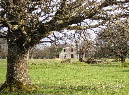
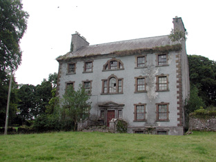
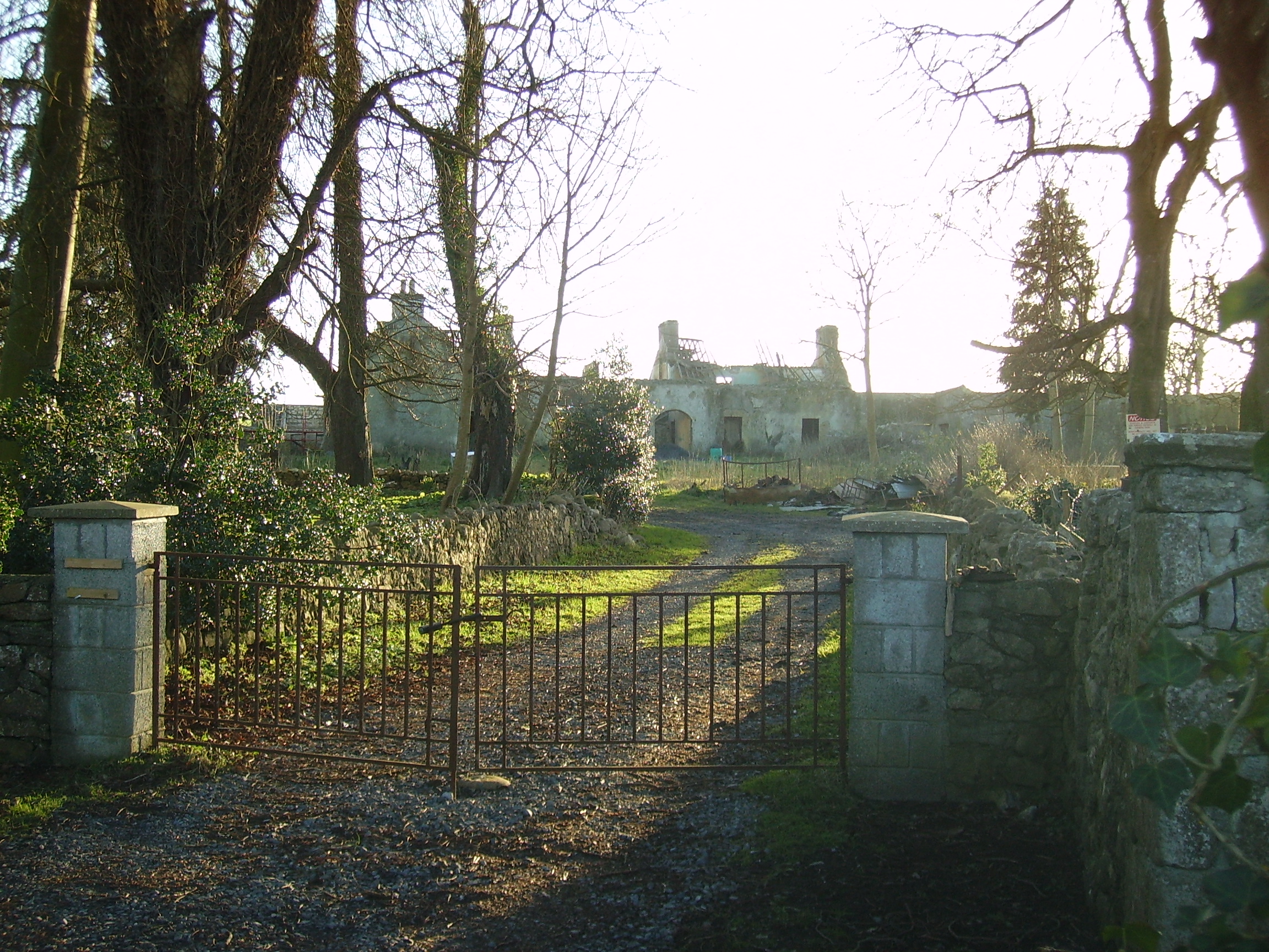
Camma Lodge
Houses within 10km of this house
Displaying 37 houses.
Houses within 10km of Camma Lodge
Displaying 37 houses.
| House name | Description | |
|---|---|---|
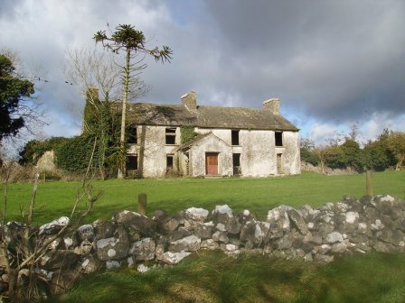
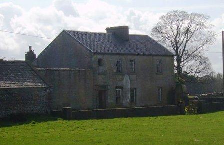
| Claremont | Described in the Ordnance Survey Name Books as a 'neat modern building', the house was located close to the bank of the River Suck. It was the home of Gonville ffrench and he held it from the D'Arcy family. In the D'Arcy sales rental of May 1851 there is reference to 'the splendid mansion' of Gonville ffrench. Occupied by the Honourable Clarinda ffrench in the 1850s who held the property from the Right Honourable Richard W. Greene, valued at £21. The house is now a ruin. |
|
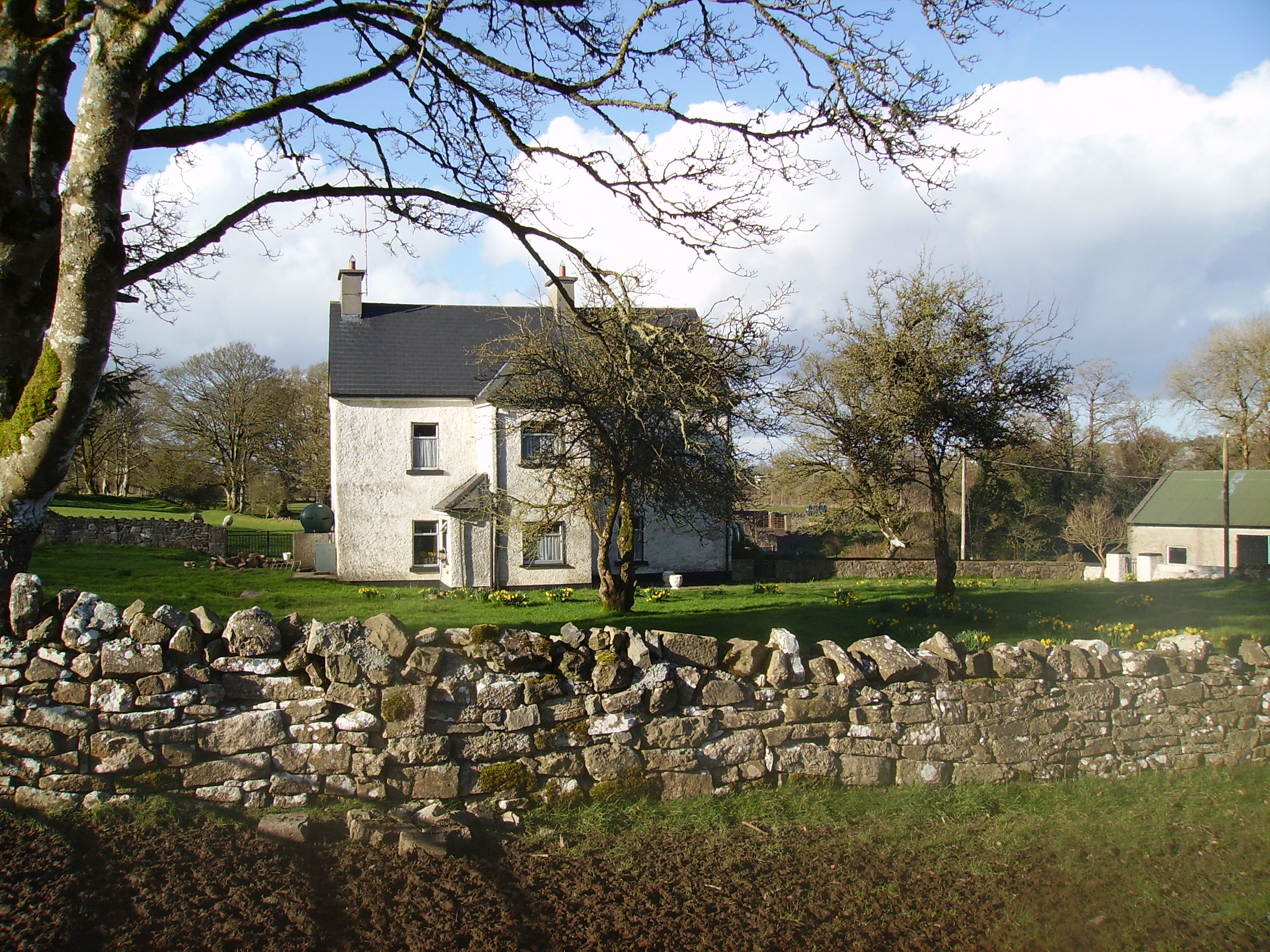
| Lackan | Occupied by James Lyster in 1814 and by Patrick McDonnell at the time of Griffith's Valuation. The house is modernised and still used as a family home. |

|
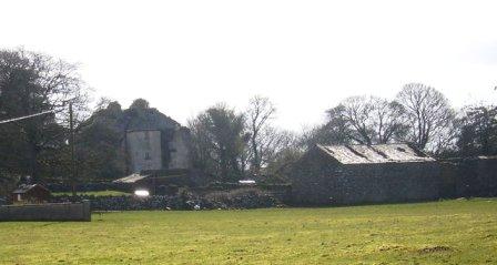
| Scregg | A Kelly home built in 1767, occupied by J.E. Kelly in 1837 and Eliza Kelly in the 1850s. In the sale rental of 1856 the house is described as a respectable mansion, 3 stories high with basement and attic stories and a view of the Shannon River. Occupied in 1906 by the representatives of Henry Potts. The house is extant but no longer lived in. It is currently (2009) being restored with support from the Irish Georgian Society, see http://www.igs.ie/Programmes/Conservation-Grants/Scregg-House.aspx |
|
| Rahara | In the 1830s and at the time of Griffith's Valuation the home of Alexander Sproule who held Rahara from the Blake Knox family. The house was originally a thatched one storey building. On the night of the Big Wind in 1839 the thatch was blown away and the house was rebuilt with an additional storey and a slate roof. Now the home of the Donnelly family. |

|
| Longfield | The Sproules were settled at Longfield from the late 17th century. At the time of the first Ordnance Survey described as a house of small dimensions with ruins attached on the south side. Lewis records Longfield as the residence of P. Sproules. The house is now a ruin. |
|
| Coolderry | Occupied by Thomas Kelly in 1814 and by Bryan Fenerty in the 1850s. | |
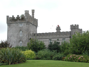
| Moyvannan Castle | 16th century tower house with late 19th century extension. In the sale rental of the Domvile estate 1865 it is described as a handsome and commodious residence. In 1986 Moyvannan was restored by Don Panoz, Chairman of the Elan Corporation. |
|
| Keoghville | Built by Laurence Keogh and his wife Mary Fallon at the end of the 18th century. They were the grandparents of Judge Keogh. Described in the Ordnance Survey Name Books as still in the occupation of Keogh, the representaive of the ancient proprietors of Doohy-Keogh 'but he is poor and nearly shook'. This must be Ross Keogh who resided in Keoghville in 1837. By the time of Griffith's Valuation the house was held in fee by John McKay and valued at £15. Abandoned in the 20th century and replaced by a modern bungalow, the yard is still in use. |
|
| New Park | A Lyster home from the early 18th century, inherited by the Smyths of Barbaville through marriage. Held in fee and valued at £38 at the time of Griffith's Valuation. The home of Marcus Anthony Levinge in 1906. The house remained in Levinge hands until about the 1940s when the roof was removed. In the early 1970s the house was restored as a hotel by Paddy Kenny. |

|
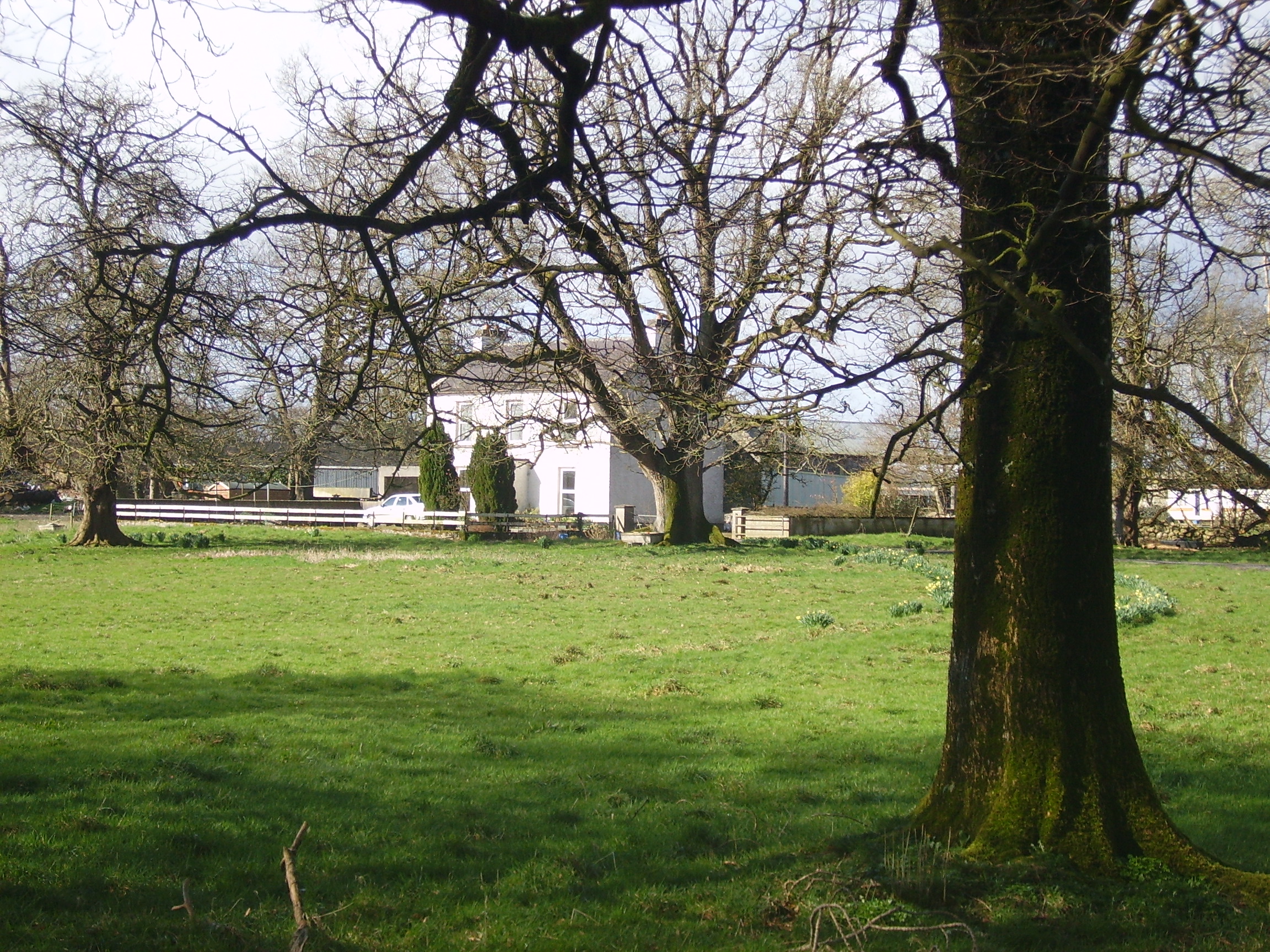
| Curraghboy House | Occupied by J. Byrne or Burne in the 1830s and by Thomas W. Jefferson at the time of Griffith's Valuation and still a family residence. |
|
| Lysterfield | Originally a Lyster property that later came into the possession of Lord Ashtown, a descendant of Anthony Lyster. The home of members of the Lyster family until the mid 1830s and occupied by Mr John Burne at the time of the first Ordnance Survey and by Henry Trench in the 1850s. Nothing now remains except some red bricks, possibly part of a fireplace, at the corner of a farmyard. |
|
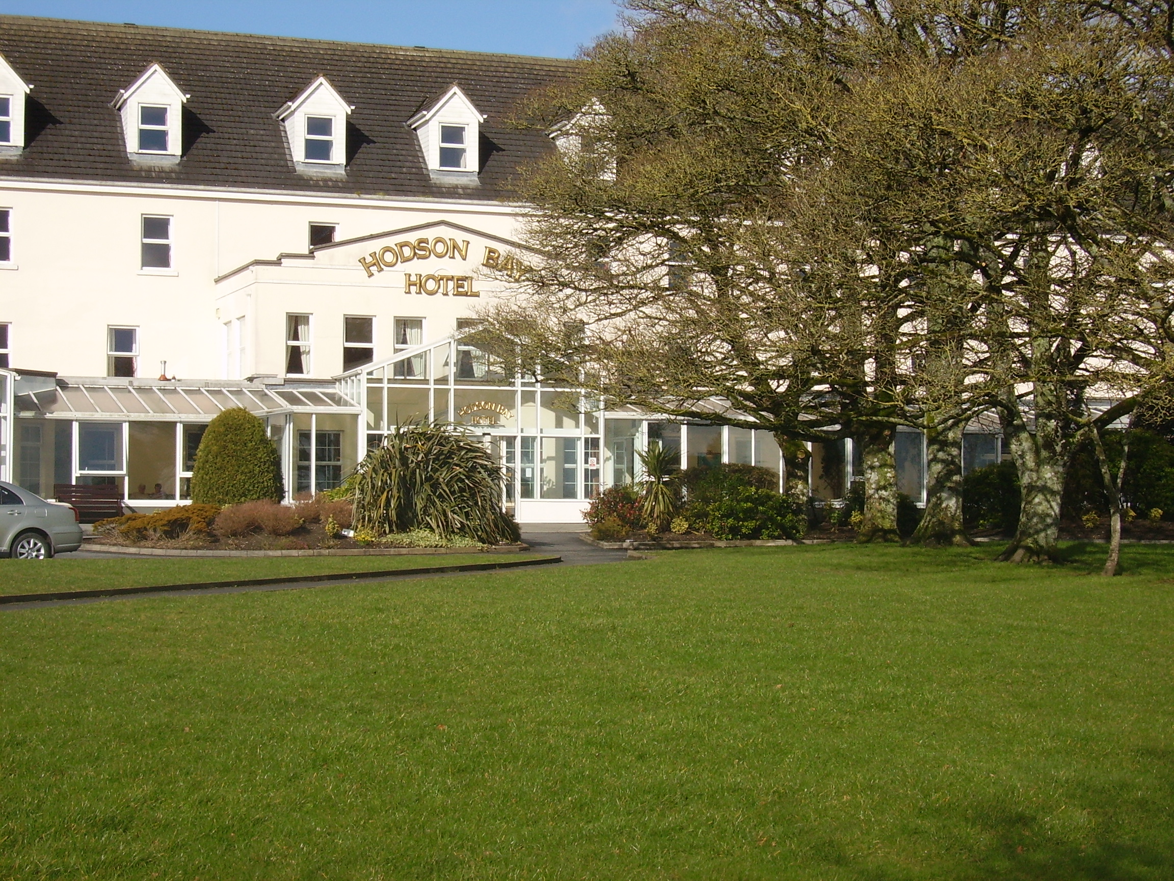
| Hodson Bay | The home of the Hodson family on the shore of Lough Ree. At the time of Griffith's Valuation occuppied by Leonard Hodson junior and Samuel Hodson, who held from the Court of Chancery. Now greatly expanded and functions as a hotel. |
|
| Lissygreaghan | Held in fee by J. P. Gannon at the time of Griffith's Valuation when the house was valued at £4.10 shillings. | |
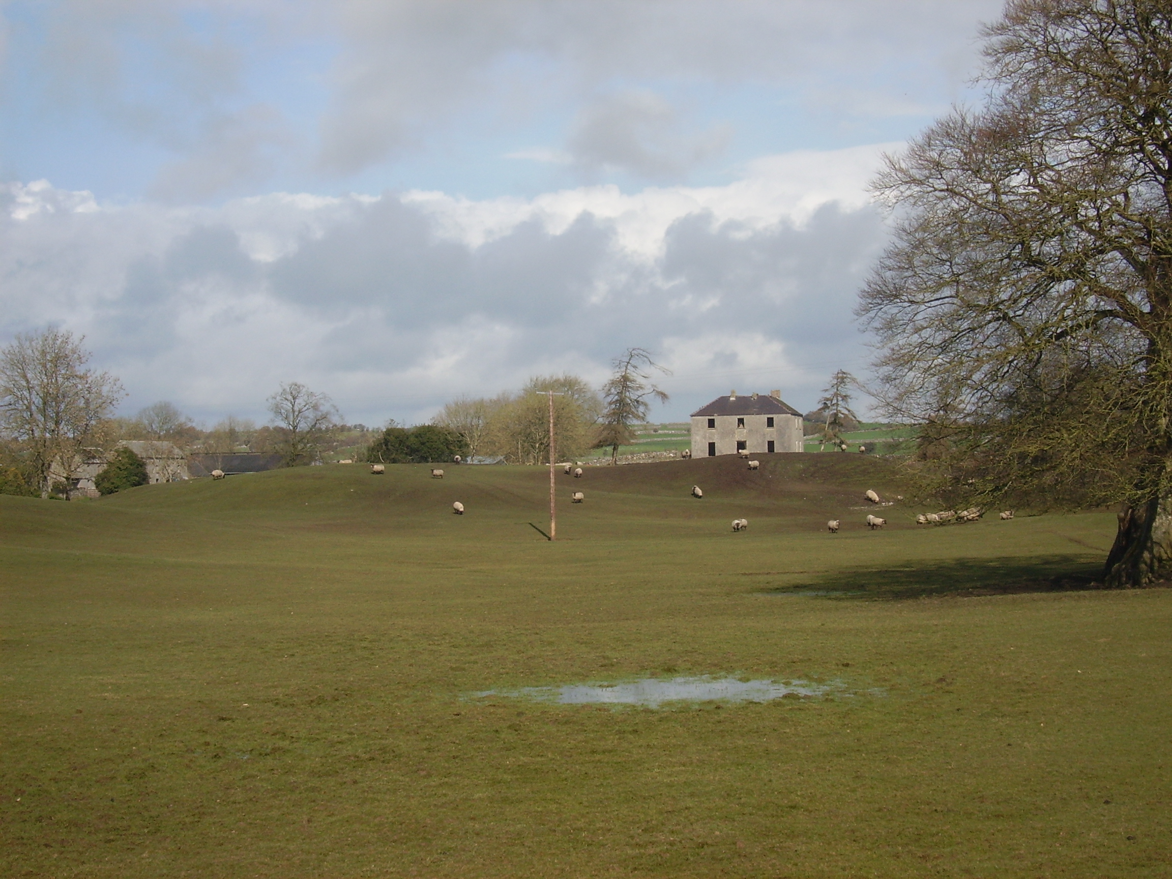
| Kiltoom | Crofton Kelly bought or acquired the Kiltoom property where he built a house in the mid 18th century. Occupied by Thomas H. Strevens who held a number of townlands from Sarah Kelly at the time of Griffith's Valuation and left to him at her death. Kiltoom remained a Strevans home until the 1970s, now a derelict building. |
|
| Rockhill | Occupied by John Burne in 1814 and described as a tolerably good farmhouse at the time of the first Ordnance Survey. Occupied by E. Hodson in 1837 and by Thomas Wilson who held it from James Wilson in the 1850s. Thomas Wilson was still resident in the 1870s. |
|
| Turrock | This house was in ruins by the time of the first Ordnance Survey in the mid 1830s. The Kellys lived at Weston, county Meath, from the mid 19th century to the 1930s. | |
| Bellgrove House | Described in the Ordnance Survey Field Name Books as a small house with a demesne of 115 acres. Occupied in 1837 by O. Irwin and the residence of John C. Davis at the time of Griffith's Valuation. Demolished in the mid 20th century. | |
| Kellybrook | Wilson records this house as a Kelly residence in 1786. The seat of Denis Kelly in the 1830s and of Jane Kelly in the 1850s who held the property from Esther Dillon and the representatives of Maria Boswell. The house was valued at £3. Still occupied by a family named Kelly. |
|
| Carrownure House | In the mid 1850s valued at £20 and owned by Richard Bond in fee, who advertised it for sale in 1856. Described as a modern edifice on the shore of Lough Ree. The sale rental includes a lithograph. Bought by Bernard William Bagot in 1858 from Edward John Irwin. Sold by the Bagots to Samuel Auchmuty in 1903. Owned by the Auchmutys in the 20th century and known as Carnure House. |

|
| Camlagh | The Newcomens resided at Camlagh in the mid 18th century and then leased the property to the Keoghs. Occupied by a Cruise in 1814 and described as a house of small dimensions at the time of the first Ordnance Survey. Occupied by E. Kilkenny in 1837 and by James Kelly and James Naughton in the 1850s. | |
| Esker | Occupied by W. Kelly in 1837. Bought by the Glennon family and occupied by them for most of the 20th century, still extant. |

|
| Feacle/Fighill | The residence of Dennis Keogh in 1814, occupied by R. Keogh in 1837 and by Richard Keogh in the 1850s when the house was valued at £2. The house has been known as Fighill since at least 1837. The old house is no longer lived in. |
|
| Larkfield House | Built circa 1780, this house was the home of Joseph Sproule at the beginning of the 19th century. Bought by Edward Larkin in 1839 and sold to John Holton in 1873. A succession of owners followed until it was bought by the Naughton family in 1923. | |
| Woodberry House | In the possession of Richard Bermingham in the mid 18th century, when he sold it to Philip Parker of Erris, county Mayo and his wife, Maria Kelly. It appears to have remained in Parker ownership until purchased by the Holton family in the 1850s. Now owned by Louis Walsh. | |
| Cloonagh | The home of a branch of the Fallon family from the mid 18th century. Wilson refers to it as the seat of John Fallon in 1786. Occupied by James Mannion in 1814 and described in the 1830s as "a well built modern mansion forming three fourths of a cross". Occupied by James Bailey at the time of Griffith's Valuation, when it was part of the Trench estate. It is now a ruin. | |
| Ballina | Wilson refers to Ballyna as the seat of Mr. Fallon in 1786. Occupied by Malachy Fallon in 1814. It was held in fee by Anthony Fallon at the time of Griffith's Valuation when it was valued at £6. Occupied by John Duignan in 1906. It is still extant. |
|
| Gort | A home of the O'Kellys in the mid 18th century. Occupied by "Doyle esquire" in 1778 and 1786 and by Simon J. Dowell in 1814. The house is labelled Gort on the 1st edition Ordnance Survey map but is not named on the 25-inch edition of the 1890s. The townland was in the possession of Elizabeth Dowell at the time of Griffith's Valuation when she was leasing a house valued at £4 10s to Michael Kelly. Some ruins exist at the site now. | |
| Newcomen Castle | Newcomen residence in the 18th century. It is shown on the 1st edition Ordnance Survey map but only the site of the castle is recorded on the later 25-inch map of the 1890s. | |
| Cloghan Castle | In the early 1850s Cloghan Castle was in the possession of Richard Burke as agent to the trustees or owners. It is labelled as "in ruins" on the 25-inch Ordnance survey map of the 1890s and a house constructed nearby. A building is still extant at the latter site. | |
| Ardmullan | Built post 1838 and described as a steward's house at the time of Griffith's Valuation when it was occupied by Thomas Pim junior who held it in fee. A mansion valued at £23 was still in the possession of Thomas Pim in 1906. The house no longer exists but some of the yard buildings remain. |
|
| Grange | The Lyster house at Grange was knocked down in the early 19th century after the sale to Farrell and a new one built. | |
| Cuilleen House | A branch of the Naghten family lived at Cuilleen in the 1830s. Malachy Naghten of Cuilleen died in 1865 aged 63 and is buried in Drum Old Cemetery. The house is labelled Cuilleen House on the 1st edition Ordnance Survey map of the 1830s but is not shown on the later 25-inch edition of the 1890s and no trace is visible now. | |
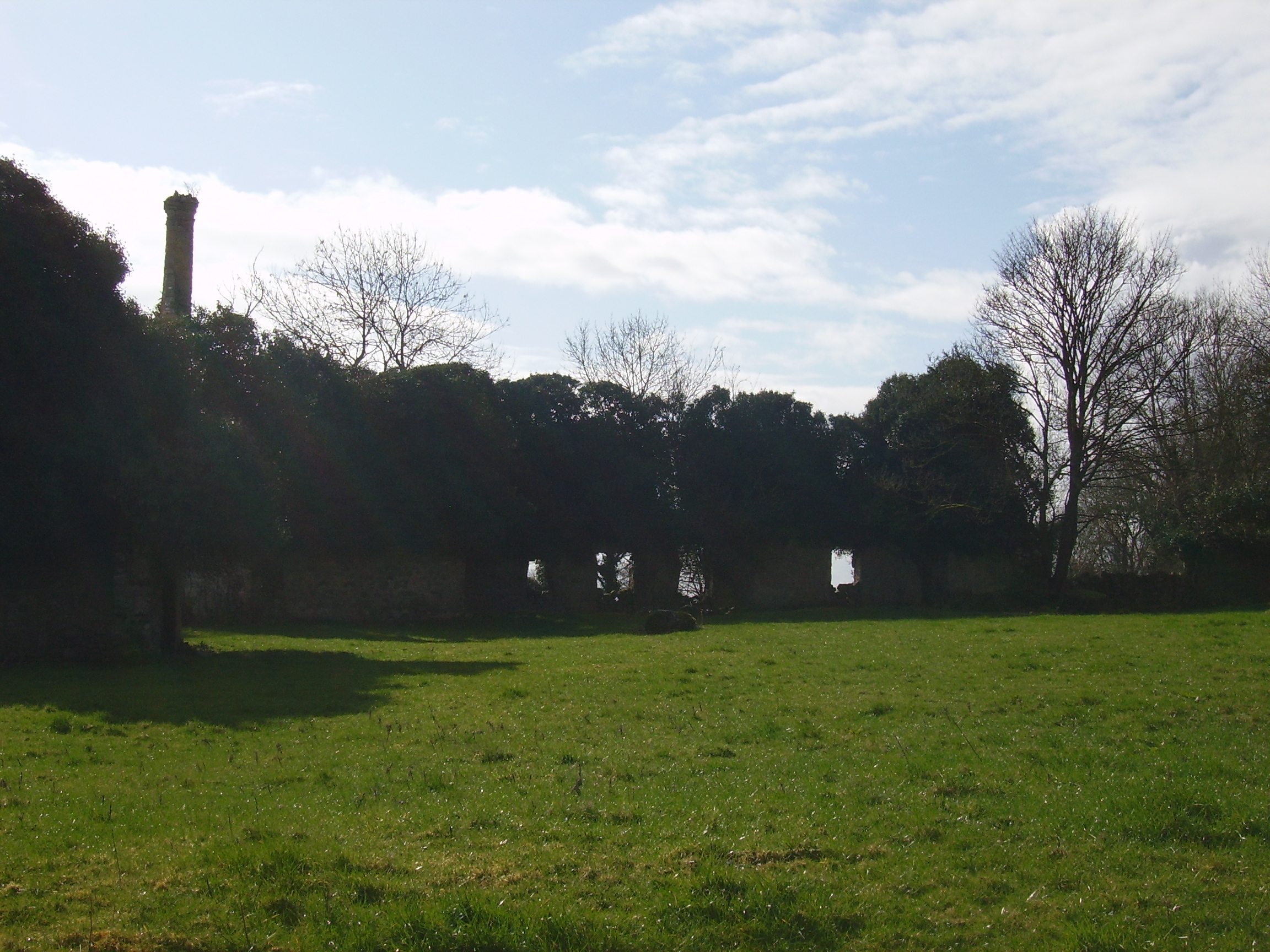
| Kilmore | Originally a Shaen property which passed by marriage to the Carters. A house and 4 acres were leased by Sir Arthur Shaen to William Hartly on 3 Aug 1706 (see sale rental 1855). In 1749, 1778 and 1786 it was occupied by the Waller family. The house was a ruin by the 1830s. | |
| Corkip | In 1786, Wilson refers to Cork, the seat of Mr. Tough. This appears to be an 18th century house associated with the Lyster family, later occupied by the Keoghs and now in ruins.The townland was in the possession of Arthur Beamish by the time of Griffith's Valuation and there was a herd's house valued at 15s. |
|
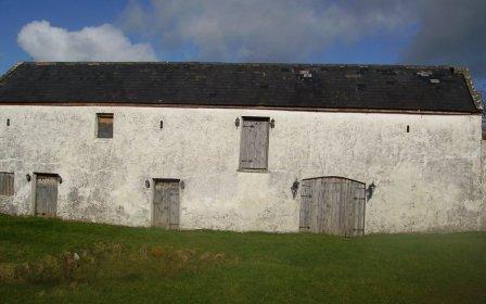
| Burnbrook | A house with mills closeby on the river. | |
| Correal | Built in 1888 by Percy Magan and valued at £35 in 1906. Burnt in 1921 when it was the home of the Walker family. A smaller house was rebuilt. | |
| Ballagh | The residence of John Kelly in 1814. At the time of Griffith's Valuation, there is no house with a substantial valuation in the townland, which was the property of "Bernard Kelly, a minor, in chancery". |