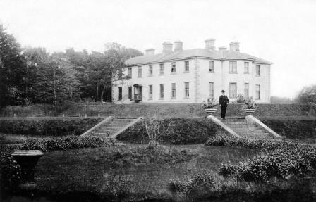
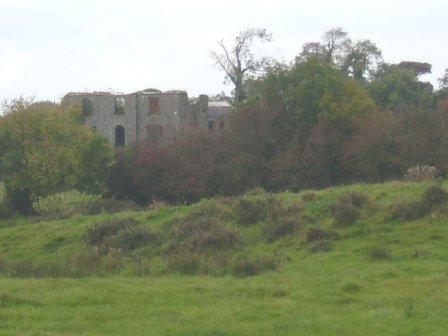
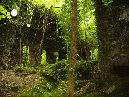
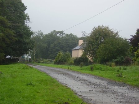
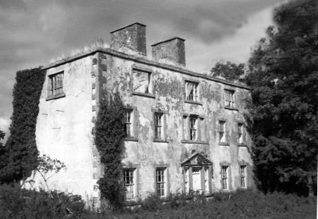
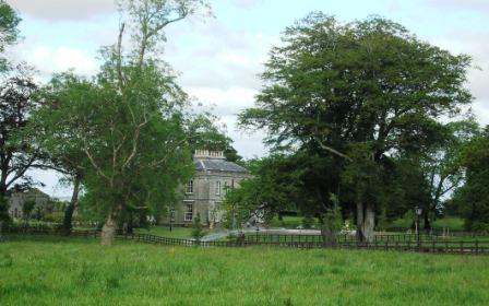
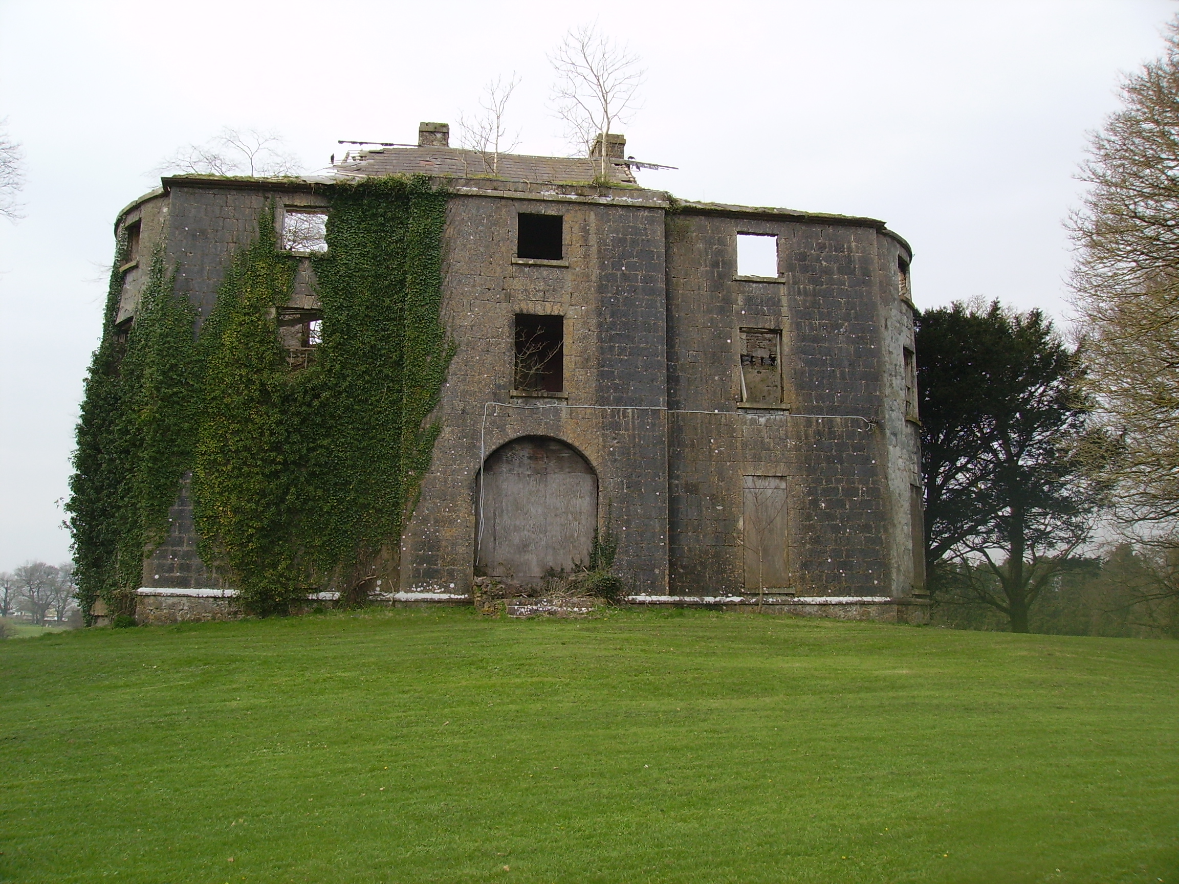
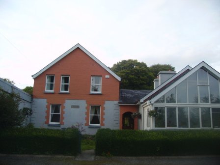
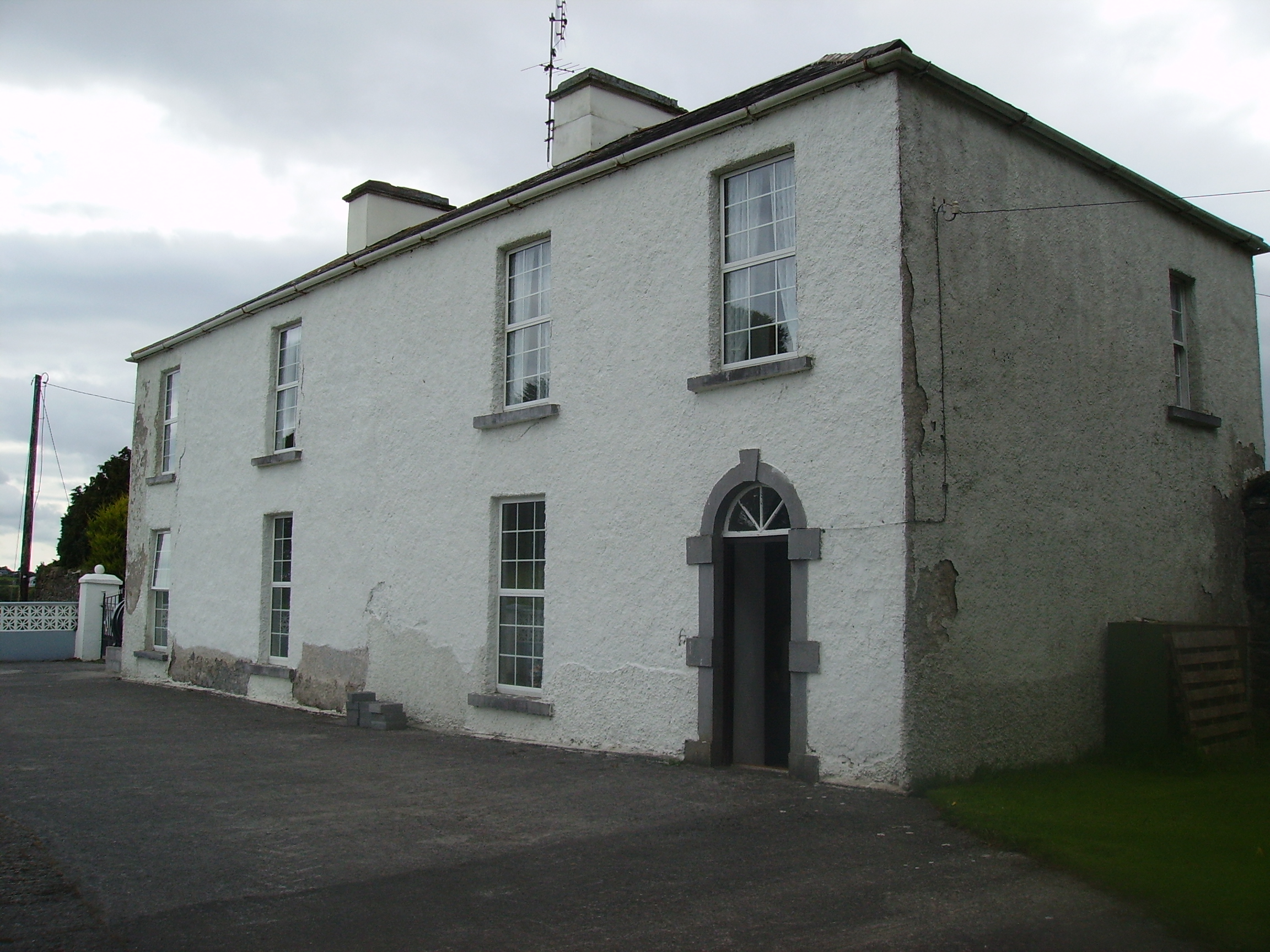
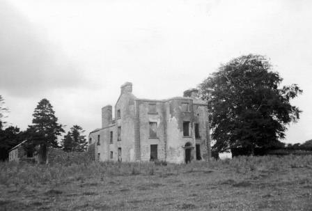
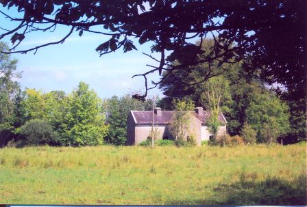
Prospect
Houses within 15km of this house
Displaying 49 houses.
Houses within 15km of Prospect
Displaying 49 houses.
| House name | Description | |
|---|---|---|
| Ballinvilla | The home of the Crean family in the 19th century. Ballinvilla was held in fee by Austin F. Crean at the time of Griffith's Valuation when it was valued at £7. This house no longer exists. | |
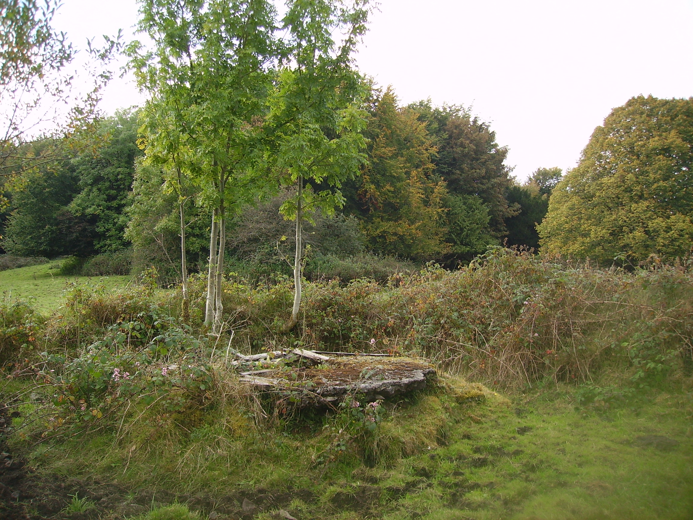
| Lugboy | Home of the Nolan family and the Nolan Ferrall family, this house no longer exists. The only feature still visible is a well in what was once part of the yard. |
|
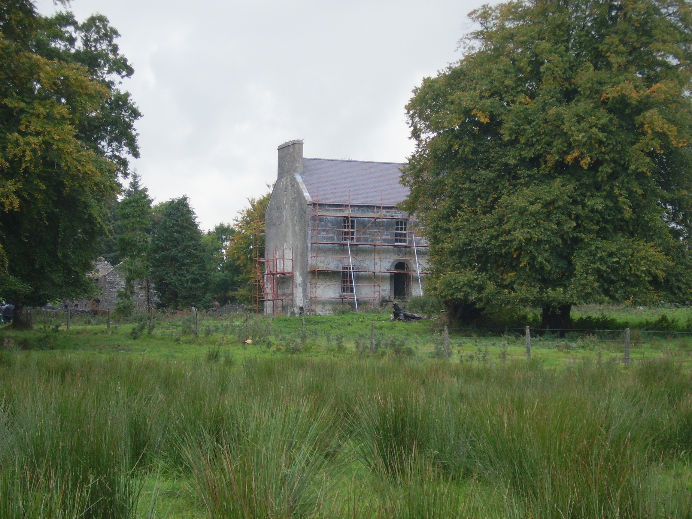
| Holywell | At th time of Griffith's Valuation, John Burke Jnr. and Gerald Burke were jointly leasing this property from Hugh Burke, when the buildings were valued at £14. In 1786 Wilson refers to Holywell as a seat of Mr. Dillon. Some renovations were made to the house in 2005 by its current owner Eamon Healy. |
|
| Doonmacreena | In 1786 Wilson notes "Dunmacrene" as the seat of Mr. Blake. The sales rental of 1851 states that the old house at Doonmacreena was the residence of Mr Blake's ancestor 'now in ruins'. |
|
| Woodstock | There is no substanial house marked on the first Ordnance Survey map for the townland of Woodstock. | |
| Carrowneden | Jon Treston was leasing this house, valued at £4, from the O'Farrell estate at the time of Griffith's Valuation. A house is still extant at the site. | |
| Dalgin | In 1786 Wilson refers to "Dalygan" as the seat of Mr. Birmingham. It was held in fee by Michael Bermingham at the time of Griffith's Valuation when it was valued at £17. Inhabited by the Birminghams and later the Kirwans until 1954, subsequently demolished. Out buildings still remain at the site beside a modern bungalow, the home of Mr John Curran. |
|
| The Grove | A house on the outskirts of the town of Tuam, occupied by Mrs Cheevers in 1814 and by Patrick Kelly at the time of Griffith's Valuation, who held it from Martin S. Kirwan. Earlier, in 1786, Wilson refers to it as the seat of Martin Kirwan. The house was described in the sale rental of the early 1860s as having two large reception rooms, eight bedrooms and two water closets. Run as a hospital by the Bon Secour Sisters 1945-2001. | |
| Castletown | A Bodkin property, a small house is marked on the first Ordnance Survey map. A herd's house valued at £2 was held by James D'Arcy in fee at the time of Griffith's Valuation. Farm buildings exist at the site. | |
| Clonbern Park | A house built after the publication of the 1st edition Ordnance Map. The property in this townland was held by Charles O'Rorke at the time of Griffith's Valuation when it was valued at almost £8. Clonbern Park no longer exists but the stable block and walled garden are still evident on the site. |
|
| Ballintava | In 1906 Samuel Barret owned the mansion house at Ballintava which was valued at almost £14. The house is extant and appeared to be in the process of renovation in the early 21st century. |

|
| Carrolton House | The house known as Beagh Lodge, an O'Carroll house, is shown on the First Edition Ordnance Survey . It is not visible on the 25-inch Ordnance Map of the 1890s. A house on a nearby site is labelled Carrolton House on the latter map. The original house is not extant though there are later buildings. |

|
| Fort Browne | By the mid 1850s the house was valued at £2.15s and was occupied by Margaret Burke. It is now derelict. |
|
| Carrowntryla | Occupied by Henry esq in the 1770s and in 1786. It was the home of the Handcock family in the 19th century, sold to Captain Dick in 1897 and occupied by him in the early years of the 20th century. Bought by Major Gerald Stratford Handcock in 1928 and inherited by his niece, Mrs Voss, who sold the house to Hector McDonnell, a Galway building contractor. The house is no longer extant. |
|
| Mount Kelly | A Kelly property in the mid 18th century, which passed to a branch of the Bellew family through marriage. The original house was known as Drum House but was in ruins by the 1820s. Mount Kelly was owned by John William Browne at the time of Griffith's Valuation. The 19th century house appears as Lakeview.on the 1st edition Ordnance Survey map but as Mount Kelly on the 25-inch edition of the 1890s. A house still exists at the site. |
|
| Millbrook | Millbrook House was held in fee by John Bermingham at the time of Griffith's Valuation when the house was valued at £11 and the nearby mill (M412635) at £12. Both buildings are now in ruins. |
|
| Carnaun/Carnane | Carnaun was occupied by the Kirwan family in the mid 19th century when Mary Anne Kirwan was leasing from the Ecclesiastical Commissioners. The property was valued at £12. A house is still extant at the site. | |
| Castlegrove | Originally a Blake house, it was occupied by the Lewins from 1888. Wilson refers to Castle-Grove as the seat of Mr. Blake in 1786. It would seem that this house was replaced in the nineteenth century as, although listed in Leets directory of 1814, the sale rental of 1852 records Castlegrove as a mansion house erected 'within the last twelve years'. It included a ballroom, oak staircase and numerous bedrooms. It was bought by John William Cannon. The sale rental includes a lithograph of the house. Castlegrove was burnt in 1922 and is now a ruin. |
|
| Newborough | Occupied by Lynch esq in the 1770s, this house passed to the Crean family by marriage. Newborough became a Blake house in the early 19th century. At the time of Griffith's Valuation there were two houses valued at £3 in the townland of Bunagarraun, occupied by Patrick Higgins and Margaret Higgins, who held from Patrick Crean Lynch. The original house is not extant. |
|
| Kilcloghan | A house in the townland of Mount Potter, marked as Thornhill on the First edition Ordnance Survey map but as Kilcloghan House on the 25-inch map of the 1890s. Occupied by Charles Blake junior in 1850 and held from Jeremiah Tully. Subsequently the home of Arthur Netterville Blake. A modern house exists at the site now. | |
| Belmont | Home of the Blakes in the late 18th century and first half of the 19th century. Wilson refers to it as the seat of John Blake in 1786. Recorded as a steward's house at the time of Griffith's Valuation when it was held by James D. Meldon from the Bishop of Tuam. The original house is now a ruin. |
|
| Quarrymount | Built in the 1830s, Quarrymount [also known as Kilcloony] was the home of the Bodkin family in the latter half of the 19th century and is reputed to have replaced an early home in the nearby townland of Ardnagall. The house was leased to Edward O'Kelly in 1881 for 31 years. By the early 20th century it was in the hands of the Congested Districts' Board and passed onto the Land Commission who sold the house and 220 acres to the Gordon family. In 1971 Henry Gordon sold the house and remaining 20 acres. The house has been extensively renovated in the early 21st century by the Costellos. |
|
| Siller House | On the 1838 Ordnance Survey map Siller House is marked as a substantial residence in the townland of Kilcloony. However by the time of Griffith's Valuation there was no house of more than £2 valuation in the townland of Kilcloony. There is no house at this location on the 25-inch Ordnance map of the 1890s. | |
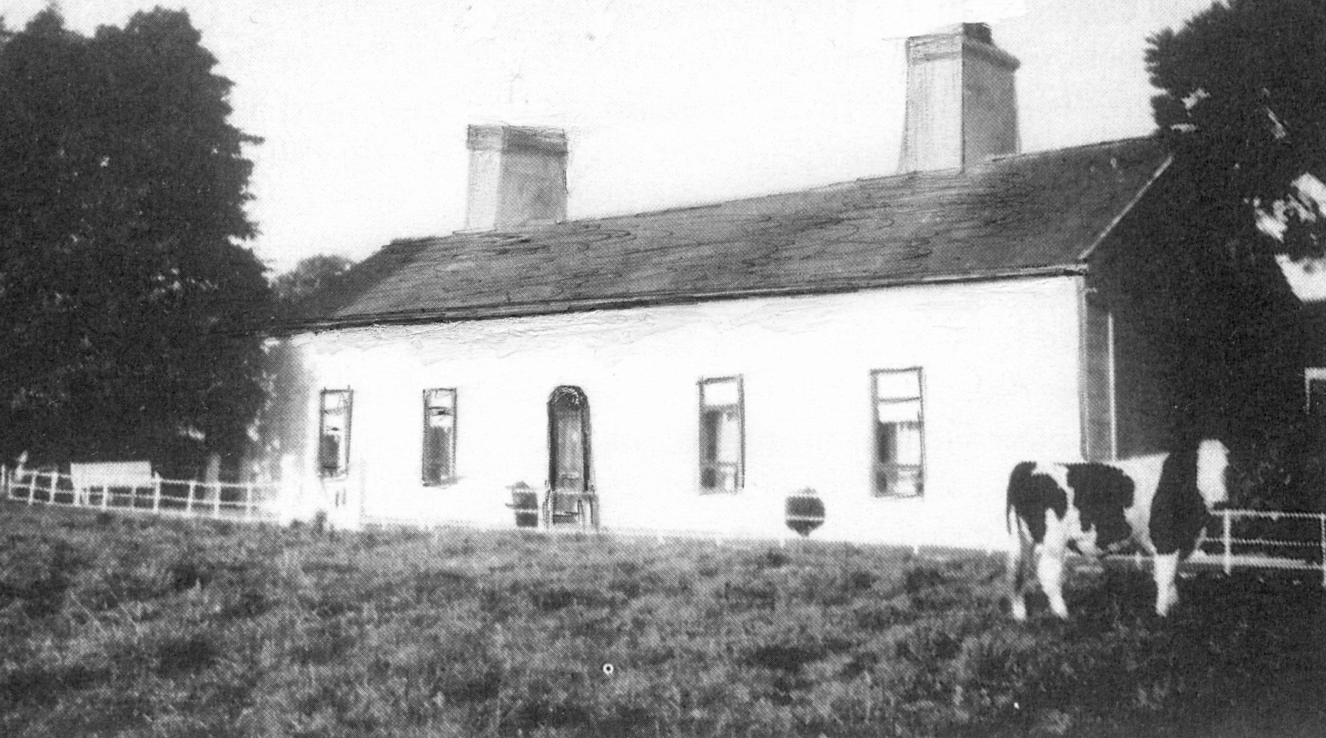
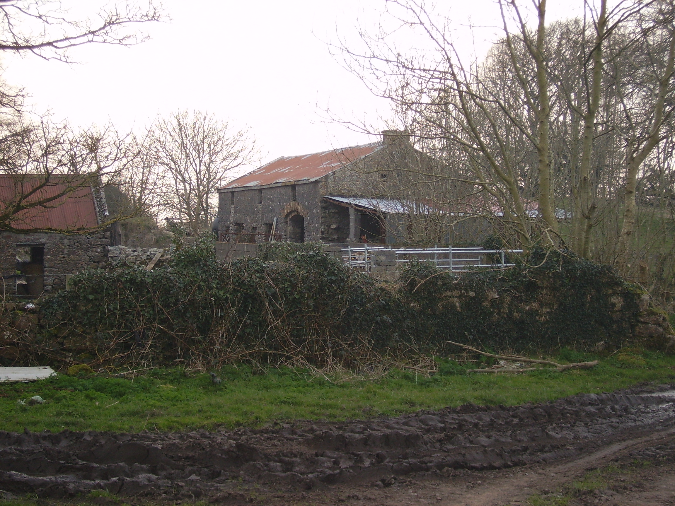
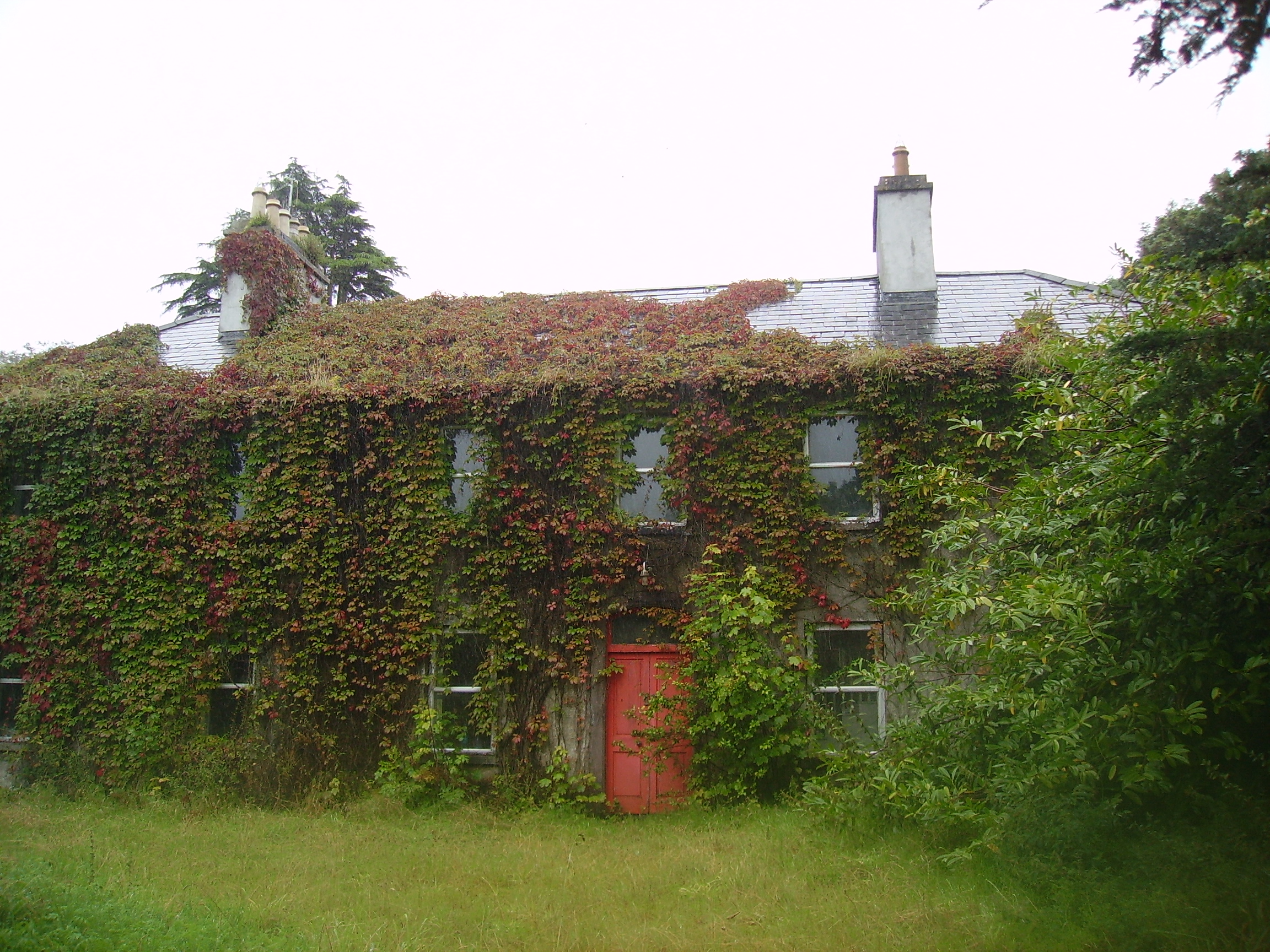
| Joyce Grove House [Browne's Grove] | A house at this site was occupied by the Joyces in the 1770s and in 1814. It is shown on the first edition Ordnance Survey map at M466578. The property was later acquired by the Browne family and is labelled Browne's Grove on the 25-inch map of the 1890s. A modern house is located in front of the site of the nineteenth century house. The impressive entrance gates still remain. |
![Photo of Joyce Grove House [Browne's Grove]](https://landedestates.ie/storage/img/orig/2505.jpg)
|
| Oakmount | Built post 1838 and occupied by Edward Kelly at the time of Griffith's Valuation when the house was valued at £9. A house is still extant at the site. |
|
| Bermingham/Birmingham House | An 18th century house which was originally the seat of the Bermingham family, Barons Athenry and Earl of Louth. Occupied by Richard D'Arcy in 1814 and uninhabited in 1837. It was leased to John Irwin Dennis the following year and bought by him in 1851 from Clifford Trotter. Since then the house has been the home of the related families of Dennis, O'Rorke and Cusack Smith. The house and demesne were advertised for sale early in 2007. The Clonbrock Estate Papers, Collection List 54 in the National Library contain early 19th century rentals of the Bermingham estate. |
|
| Gallagh | Built in 1844 with money inherited by Cornelius O'Kelly from his uncle Count John Dillon O'Kelly. By the early 20th century this house was part of the estate of W.A. Ryan. Subsequently it was sold to the Congested Districts Board and then to Tobias Joyce of Leenane, county Galway. It was accidentally burnt in 1932. |
|
| Castlemoyle | Built in the 18th century, this house was the residence of Deane esq in the late 1770s and 1780s and occupied in 1814 by Thomas Browne. It was held by Edward Blake in fee in the mid 1850s when it was valued at £8. Sebastian Nolan bought it from the Blakes and lived there until the late 1880s. It is now a substantial ruin. |
|
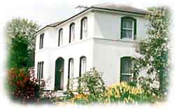
| Gardenfield | Home of a branch of the Kirwan family from the late 18th century to the mid 20th century. The original house was replaced by the present house circa 1870. Following the death of Edward Kirwan the estate was divided by the Land Commission in the 1950s. Gardenfield House is now a bed and breakfast. http://www.corrib.net/BedBC14.htm |
|
| Ballygaddy | Occupied by Kirwan esq in the 1770s and in 1786. It was the residence of Thomas Lally in 1814 and, from the 1830s, of John Daly, who held it from Nesbitt Kirwan. The house was valued at £5 at the time of Griffith's Valuation. The site is now occupied by farmbuildings. | |
| Queensfort Lodge | An old building still appears to be extant behind a large modern house. |
|
| Fear More | Occupied by William Roper junior at the time of Griffith's Valuation and by John J. Daly in 1906. | |
| Hazelwood House | Not built at the time of the first Ordnance Survey in the mid 1830s. Valued at £13 at the time of Griffith's Valuation. The remains of the stable buildings are still visible. |
|
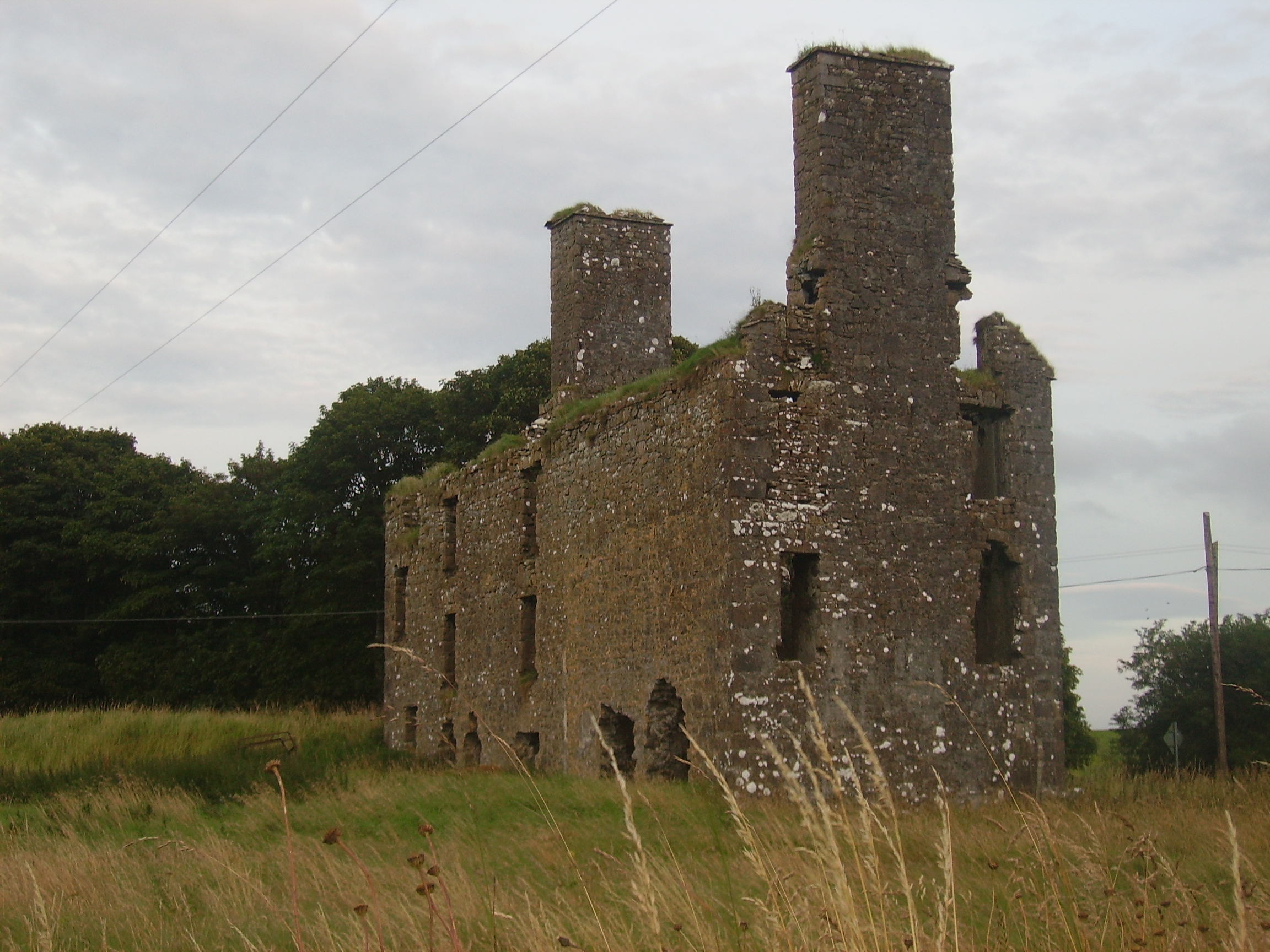
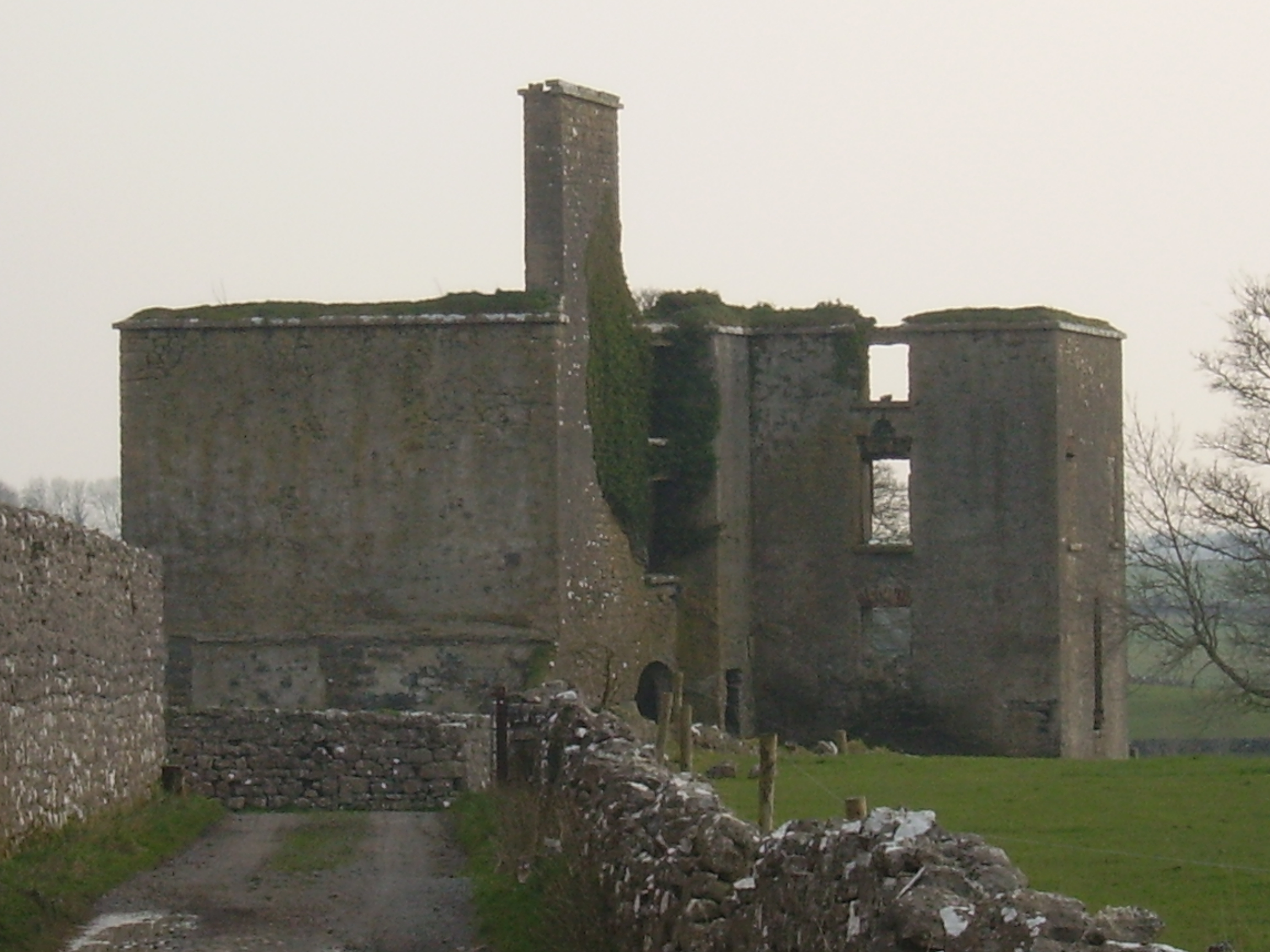
| Dunmore House | William D. Griffith, brother of Richard Griffith of ''Valuation'' fame, was agent to Sir George Shee in the mid 19th century and lived at Dunmore House. In 1894 Slater refers to Dunmore House as the seat of Captain Robert W. Martin. A fine ruin situated on the edge of the golf course. |
|
| Castletown | The Knight of Glin stated that this was a late 18th century and early 19th century house built for the O'Haras. This may be the residence known as Tullinadaly, occupied by William Brannock, recorded in 1814, and by James Kirwan in 1837. Earlier, in 1786, Wilson refers to "Tullinadaly" as the seat of Mr. Bodkin. Valued at £15 and occupied by Laurence Mullins at the time of Griffith's Valuation. It is now a ruin. |
|
| Wilford | Occupied by W. Lindsey in 1837. A roofless ruin now occupies the site. |
|
| Dunmore Castle | A tower house occupied by the Ouseley family from the late 17th century. In ruins by the late 19th century. |

|
| Woodfield | Home of a branch of the Kirwan family in the 18th and early 19th centuries. By the time of Griffith's Valuation, the townland was owned by the Hancock family but no house had a substantial valuation. A house still exists at the site. | |
| Carrowpadden | Carrowpadden House is marked on the Taylor and Skinner map of 1778. In 1786 Wilson refers to it as the seat of Mr. Higgins. A herd's house occupied by Thomas Higgins who held it from James Higgins is recorded in the townland of Carrowpadden East at the time of Griffith's Valuation. It was valued at almost £5. This property appears to have been built after the first Ordnance Survey map was published. There is still a house extant at the site. | |
| Lowberry | The Encumbered Estates' Sale notice of May 1856 indicates that the mansion at Lowberry had "formerly" stood in the demesne and recommends it as a "most desirable site for building". It is shown on the First Edition Ordnance Survey map but no buildings are recorded in the townland at the time of Griffith's Valuation. It is labelled "Lowberry House (in ruins)" on the 25-inch map of the 1890s. A portion of these ruins still remain at the site. | |
| Brooklawn | A Blake home occupied by John Griffin in 1814. At the time of Griffith's Valuation Charles Blake held the townland of Fartamore from James Lynch. A house valued at £10 was being leased from him by the Bord of Works. Fartamore is still extant but unoccupied. |
|
| Oldtown | A single storey house until the early 20th century when a second storey was added to part of the house. Occupied by the Bourkes from the 18th century until the 1920s and then by the Curran family. Restored by the present owner in the late 1990s. |
|
| Cuillaun | Part of the Oranmore and Browne estate in the mid 19th century, occupied by Frenches, Brownes and by Edward Rush at the time of Griffith's Valuation, when the house was valued at £7. Now the home of the Donnellys. |
|
| Knocknagur | Sometimes spelt Cnocnagur. | |
| Rockfort | Valued at £4 in the mid 19th century when it was occupied by Thomas Bourke who held from David Ruttledge. The Westport Estate Papers contain two 17th century maps of Levallyroe in the possession of Gerald Dillon and held from the Blakes. The Malones also had an interest in Levallyroe and Boleyboy. | |
| Queensfort House | This house no longer exists. It was the home of a branch of the Leonard family in the 19th century. At the time of Griffith's Valuation it was held in fee by Stephen J. Leonard and valued at £16. |
|
| Dunmore Lodge | Melvin states that the Dunmore estate had been inherited by the Gores in the early eighteenth century and that Ralph Gore resided at Dunmore during that century. His mansion was subsequently in use as a barracks until it was destroyed during the Civil War in the early twentieth century. Marked on the Taylor and Skinner map of 1778 as the residence of the Earl of Ross and also noted as "the fine seat of the Earl of Ross" by Wilson in 1786. In 1814 Leet noted "Dunmore Lodge" as the residence of John Egan. | |
| Cloontreston | The notice advertising the sale of Michael Francis Treston's property at Cloontooa, barony of Clanmorris states that "the dwelling house with the offices, garden and demesne, known as Cloontreston, is in fair order and condition, suitable as a residence for a gentleman". At the time of Griffith's Valuation the townland was owned by John Treston who also held a herd's house there. The house is labelled Cloontreston on twentieth century maps. Buildings are still extant at the site. | |
| Cloonkeen Lodge (Kilkerrin) | Cloonkeen Lodge is shown on the 25-inch edition Ordnance Survey map of the 1890s. It occupies the site of an earlier settlement, Ballyphillipeen, shown on the 1st edition Ordnance Survey map. At the time of Griffith's Valuation this townland was held by William P. Cullen who held a house, valued at almost £5 in fee there. The building is still extant though not apparently in use. |
|