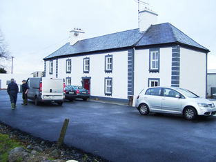
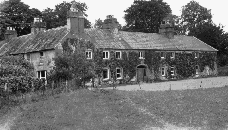
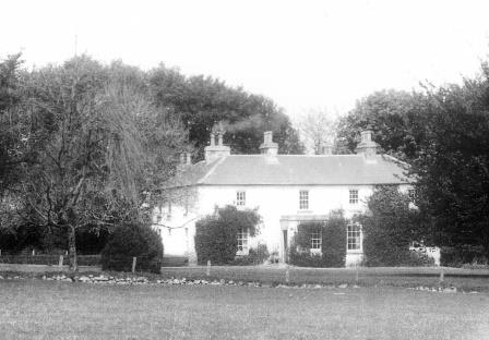
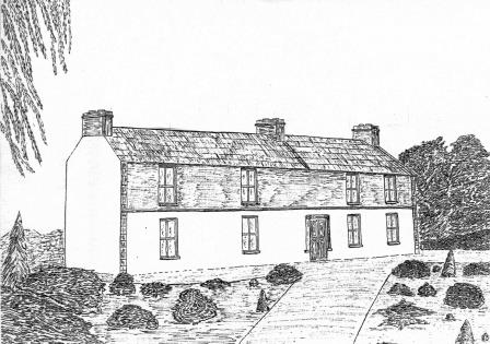
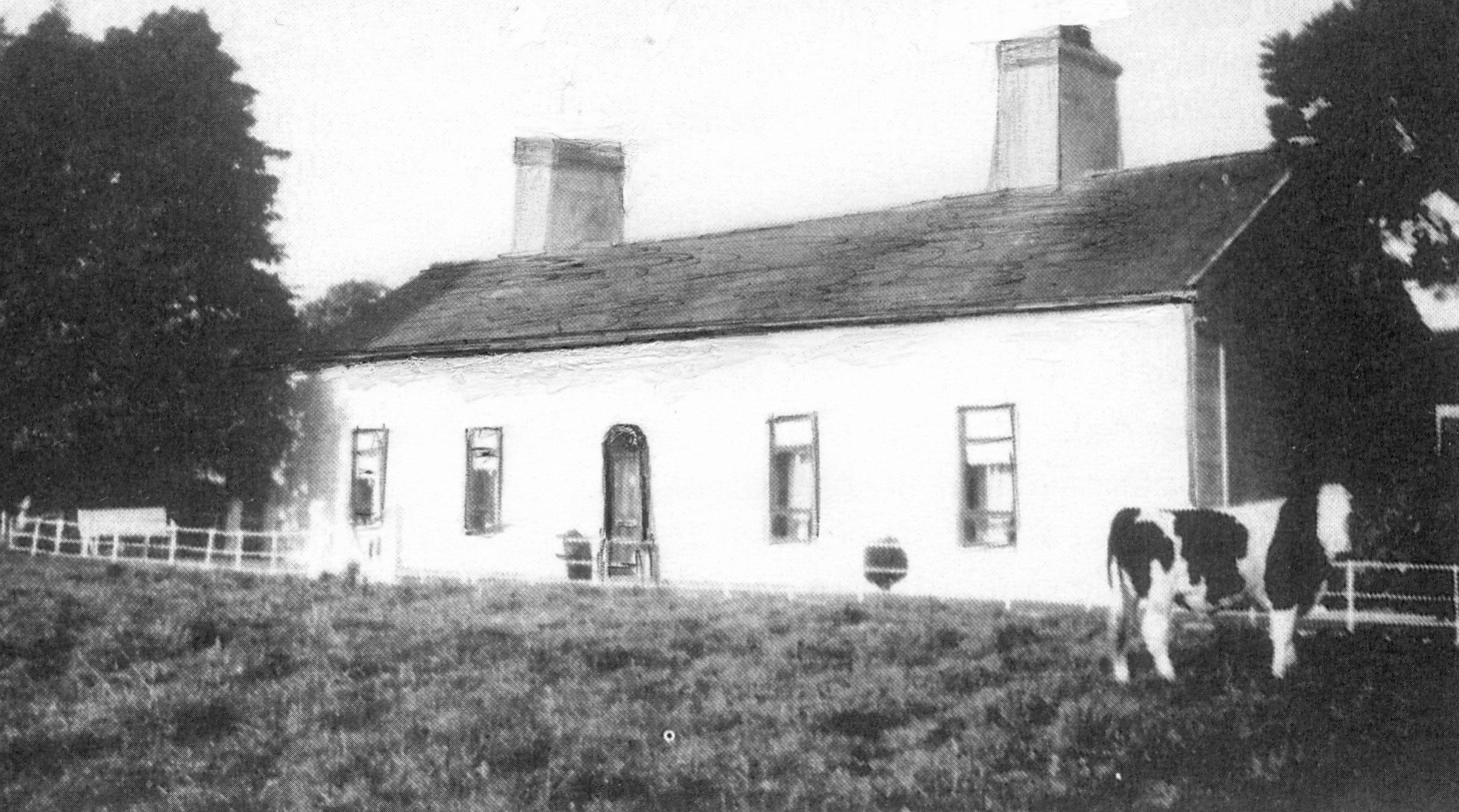
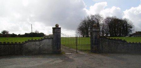
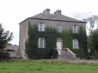
Skehaghard
Houses within 10km of this house
Displaying 35 houses.
Houses within 10km of Skehaghard
Displaying 35 houses.
| House name | Description | |
|---|---|---|
| Cappagh | Occupied by Dillon Hughes at the time of Griffith's Valuation, when it was valued at £11 10s. He was leasing the property from Alexander Beatty. The National Inventory of Architectural Heritage suggests that this is originally a seventeenth century house with later additions. It is still extant and well-maintained. |
|
| Newforest | Built prior to 1777, Wilson refers to it as the seat of Mr. D'Arcy in 1786. It was held in fee by Richard D'Arcy at the time of Griffith's Valuation when it was valued at £24. It was demolished in the latter half of the 20th century. |
|
| Wellfort | Marked on the first edition Ordnance Survey map as Wilfort House, this property was held in fee by Richard D'Arcy at the time of Griffith's Valuation when it was valued at £18. It is named as Wellfort House on the 25-inch Ordnance Survey map of the 1890s. Wellfort is no longer extant. |
|
| Kentstown | The sales rental of June 1851 records the leasing of Kentstown, by Netterville and Geoffrey Davies, to Thomas Davies, for 31 years from 10 July 1838. It was held in fee by him at the time of Griffith's Valuation when it was valued at £12. In the 1877 sales rental the house was described as having "a parlour, drawing room, 6 bedrooms, kichen, dairy and servants' hall". A house is still extant at the site. | |
| Clooncah | A house built after the publication of the 1st Ordnance Survey map, at the time of Griffith's Valuation it was by John Love. The house was valued at £12 and held from John Armstrong. In 1885 Walford describes John Armstrong as a magistrate for county Galway, and of "Clooncagh and South Hill, Clifden". The site at Clooncah is now occupied by farm buildings. | |
| Turlough House (Ballymoe) | Held in fee by John Cheevers at the time of Griffith's Valuation when the buildings were valued at £7 10s. Occupied by John J. Cheevers in the early 20th century. This house is no longer extant | |
| Glinsk House | In 1786 Wilson refers to Glinsk as the "seat of the late Sir John Burke" and also as the seat of Sir Rickby Burke. Glinsk Castle and a substanial house are both marked on the 1838 Ordnance Survey map. The castle is shown on the 25-inch map of the 1890s but there is no trace of the house. At the time of Griffith's Valuation, Allen Pollok held buildings valued at £1 15 at the site, recorded as a herd's house. | |
| Kedagh Park | Held by Bartholomew Kelly in fee at the time of Griffith's Valuation when it was valued at £11 10s. The house is labelled Kedagh Park on the First Edition Ordnance Survey map but as Clondoyle House on the 25-inch map of the 1890s. A house still exists at the site. | |
| Cloondoyle | In 1786, Wilson refers to "Clondowel" as the seat of Mr. Blake. At the time of Griffith's Valuation it was occupied by Thomas Kelly and held from [his father] Bartholomew Kelly. The house was valued at £8. It is labelled Clondoyle House on both the First and 25-inch editions of the Ordnance Survey map. A house still exists at the site. |
|
| Ashfield | At the time of Griffith's Valuation held by John Kelly in fee when the house was valued at £8. A building still exists at the site. | |
| Fairfield | Valued at £18 and held in fee by Pollok at the time of Griffith's Valuation. It is no longer extant. | |
| Millford | Allen Pollok held a steward's house and offices valued at £16 at Millford at the time of Griffith's Valuation. Extensive buildings remain at the site. | |
| Curraghbog | Leased by Allen Pollok to Michael Kelly in the mid 1850s when it was valued at £7. A house is still extant at the site. | |
| Newtown | John Burke, a gentleman, was living at Newtown in 1749. Valued at £4 in the mid 1850s. The property seems to have disappeared by the time of the 25-inch Ordnance map of the 1890s. | |
| Mount Kelly | A Kelly property in the mid 18th century, which passed to a branch of the Bellew family through marriage. The original house was known as Drum House but was in ruins by the 1820s. Mount Kelly was owned by John William Browne at the time of Griffith's Valuation. The 19th century house appears as Lakeview.on the 1st edition Ordnance Survey map but as Mount Kelly on the 25-inch edition of the 1890s. A house still exists at the site. |
|
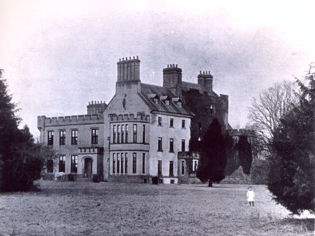
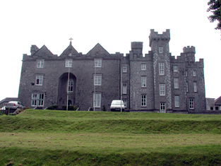
| Aghrane Castle/Castle Kelly | A 16th century tower house with 19th century additions. Castle-Kelly is recorded by Wilson as the seat of Denis Kelly in 1786. Lithographs of the entrance to Castle Kelly, Castle Kelly and Ballygar town are included in the sales rental of 1863. It was bought by the Bagots, sold by them to the Department of Agriculture in 1910 and demolished in 1919. Parts of the demesne are now owned by Coillte, the Forestry Service. |
|
| Rookwood | The house, located on the border between counties Galway and Roscommon, was built in the late 1720s by a branch of the Ormsby family of Tobervaddy. Jane Ormsby married Robert Waller. Both Wilson and Taylor and Skinner record that Rookwood was occupied by Major Waller in the 1780s. The house was later leased by the Thewles family. Edmund Kelly purchased the lease of Rookwood from his cousin, James Thewles, in 1800. The house was occupied by the Taaffes in the early 19th century and by the Kellys from the 1830s. In 1900 Dr Charles E. Crean of Ballyhaunis bought Rookwood and sold it to the Land Commission in 1922. The house was intermittently occupied until the 1940s and gradually became derelict. |
|
| St Brendans | Occupied by the Honourable Thomas ffrench from the 1830s to 1850s who held the house from the Honourable Martin ffrench. It is now almost ruinous. |
|
| Dunamon | A tower house with 18th and 19th century additions, In 1786 Wilson refers to Dunamon, the seat of Mr. Caulfeild, as "a fine old castle". Occupied by John Shiel, leasing from the Caulfeild estate at the time of Griffith's Valution, when it was valued at £35. In 1894 Slater refers to it as a residence of St.Geroge Francis Caulfeild. Bought by the Divine Word Missionaries from the Land Commission in 1939 and now in use as a care centre. |
|
| Corra More | The residence of Colonel W. Caulfield in 1814. The home of Christopher Balfe, ninth son of Walter Balfe of Heathfield, in the 1830s. John Cornwall occupied the house in the mid 1850s when the house was valued at £23. Extensive high walls as well as the yard remain but the present owners live in a modern bungalow. |

|
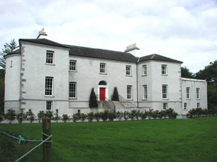
| Castlecoote | An 18th century house which has recently been restored. Occupied by T. and J. Nolan in 1814 and by William John McLoughlin in the 1850s, when the house was valued at £40. In 1894 it was the seat of Arthur and Francis Chute. See www.castlecootehouse.com. |
|
| Emlaghkeadew | At the time of Griffith's Valuation this house was ccupied by Louis Ormsby when it was valued at almost £10. It is no longer extant and a modern house exists at the site now. | |
| Castlestrange | Named after the L'Estrange family who held the land and castle in the late 16th century, Castlestrange appears to have belonged to the Gunning family early in the 18th century. A house was built by the Mitchell family in the 18th century which at the time of Griffith's Valuation was valued at £47. In 1894 the residence of James Mulry and occupied by Thomas Mulry in 1906. The original house, coach house and stables are now in ruins but other outbuildings have been converted into a home. |

|
| Coolmeen | Referred to as a herd' s house at the time of Griffith's Valuation when it was occupied by William Harrison who held it from Patrick Curtis. The house now extant at the site is not the original one. |
|
| Tobervaddy | The Ordnance Survey Field Name Books record the ruins of an old castle. The Discovery map mark a fortified house. A branch of the Ormsby family resided at Tobervaddy in the 18th century. and Wilson, writing in 1786 refers to Tobervaddy as the seat of Mr. Ormsby. Robert Irwin held the townland at the time of Griffith's Valuation. |
|
| Fort William/Fort Lyster | A house on the outskirts of the village of Athleague, it was the home of N. J. French in 1837. It was valued at £20 and was occupied by Henry West who held the property from Anne Lyster in the 1850s. The house, marked as Fort William on the first Ordnance Survey map, later became known as Fort Lyster. Still valued at £20 and occupied by the representatives of William Jameson in 1906. It was the home of Aileen Cust the first woman veterinary surgeon in the British Isles in the early 20th century. Modern farm buildings occupy the site but the entrance gates remain. |
|
| Emlaghroyin | Built circa 1770, occupied by McDermot esquire in 1778 and also noted as the residence of Thomas McDermott by Wilson in 1786. The seat of Oliver Armstrong at the time of Griffith's Valuation, held from St George Caulfeild and valued at £30. This house is still extant. |
|
| Rushfield House | Occupied by Patrick Shiel at the time of Griffith's Valuation .Labelled Rushfield House on the 25-inch Ordnance Survey map of the 1890s. There is still a house at the site. | |
| Kilbegnet House | Occupied by John Shiel at the time of Griffith's Valuation and valued at £25. The property is labelled Kilbegnet House on the 25-inch edition of the Ordnance Survey map. A house is still extant at the site. | |
| Temp House | A house called Tempe was occupied by Charles O'Connor in 1814. IN the 1850s it was leased by Tobias Kelly from Catherine Mennons and valued at £13. A house is still extant at the site. | |
| Church Park | Church Park was occupied by Benjamin Reeves in 1814. It is shown on the First edition Ordnance Survey map of the 1840s but is not labelled on the later 25-inch edition of the 1890s. The house is no longer extant but entrance gates are still visible. | |
| Rockfield | Another Mitchell house in the townland of Castlestrange, occupied by D. Merry in 1837 and by David Wakefield in the 1850s. It is not shown on the 25-inch Ordnance Survey map of the 1890s. Rockfield was the home of Christopher and Mary Anne Irwin in 1749. | |
| Balydooley Lodge | John Hanley was leasing this property from St. George Caulfeild at the time of Griffith's Valuation, when it was valued at £5. It is still extant. | |
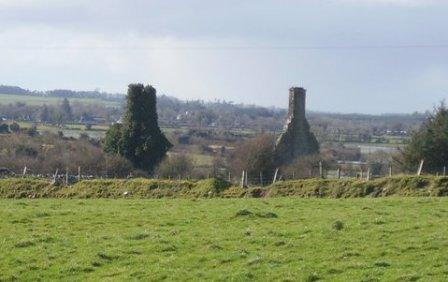
| Cloonlyon | In 1786 Wilson refers to Clonlyon, the seat of Mr. Kelly. The 1st edition Ordnance Survey map shows ruins in this townland. | |
| Ardmore (Dunamon) | In 1786 Wilson refers to Ardmore as the seat of Mr. Croaghan. By the 1830s an extensive demesne is shown in the area but no house is visible. The townland is in the possession of St. George Caulfield of Dunamon by the time of Griffith's Valuation. |