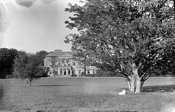
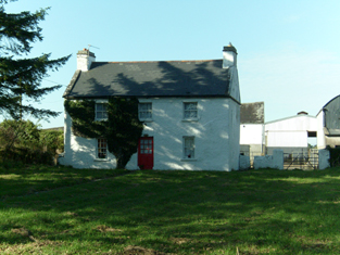
Pallas
Houses within 5km of this house
Displaying 12 houses.
Houses within 5km of Pallas
Displaying 12 houses.
| House name | Description | |
|---|---|---|
| Esker Lodge | James Martin was leasing a property valued at £15 from Andrew Browne's estate at Esker, barony of Tiaquin, at the time of Griffith's Valuation. It is labelled Esker Lodge on both the 1st and 25-inch edition Ordnance Survey maps. A small amount of ruins remain at the site. | |
| Caltra Lodge | The home of P.J.Joyce in the late 1830s and of Mary Joyce in the 1850s. The Joyces held this house from the Bellews of Mount Bellew. On the 25-inch map of the 1890s it is labelled as Caltra Park. The ruin of the original house was visible until the end of the twentieth century, | |
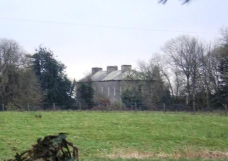
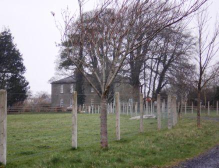
| Clonbrock | Designed by William Leeson and built in the 1780s. In 1837 Lewis recorded it as the seat of Lord Clonbrock. In 1786 Wilson refers to Clonbrock as the seat of R. Dillon. At the time of Griffith's Valuation the house at Clonbrock was valued at £100. In 1906 it was valued at £135. The house was badly damaged by fire in the 1980s and only one wing is now inhabited. |
|
| Ballybaun | At the time of Griffith's Valuation, Lord Clonbrock owned a mill, gate house and other buildings valued at £35 in the townland of Ballybaun, parish of Ahascragh. The gate house is still extant and occupied. Local sources suggest it was at one time used as a school for children in the area. |
|
| Doon House | At the time of Griffith's Valuation Charles Filgate was leasing a house valued at £5 and 400 acres from the Clonbrock estate. In the 1830s, he is noted in the Ordnance Survey name books as the agent for several county Galway estates, including the Mahons of Castlegar and the Blakeneys of Abbert. Doon House wsa constructed within a ring fort and the remains of the building still exist. | |
| Lowville | Lowville was originally the seat of Nathanial Lowe who held this estate in the mid-18th century and Wilson refers to it as his seat in 1786. In 1814 it was the residence of the Hon. Mrs. Low. In 1837 Lewis recorded Lowville as the seat of W. McDonagh. It was still occupied by Walter McDonagh in the 1850s and was valued at £45. By 1906 it was in the possession of Bernard Connaughton and was valued at £33. It was later the home of the Byrne family but was sold in the early 1970s and ceased to be residential. It is now a ruin. |
|
| South Park | At the time of Griffith's Valuation, Lawrence Kerrans was leasing a property valued at £11 from the Clonbrock estate at Kilglass, parish of Ahascragh. It is not named on the first edition Ordnance Survey Map but is labelled South Park on the 25-inch edition produced in the 1890s. The house is still extant and occupied. |
|
| Cloonatleva | Samuel Johnston was leasing a property valued at almost £5 at Cloonatleva Lower, barony of Kilconnell, from the Hodson estate at the time of Griffith's Valuation. The original building is not shown on the later 25-inch Ordnance Survey map of the 1890s. Modern farm buildings occupy the site now. | |
| Cloonatleva Mill | James Tyrrell was leasing a house and mill, valued at £6, together with land, at Cloonatleva, barony of Kilconnell, from the Hodson estate at the time of Griffith's Valuation. The building is described as "disused" on the 25-inch Ordnance Survey map of the 1890s. | |
| Fohenagh | Sir Henry Grattan Bellew dates this house from the 1830s. In 1906 Norah Johnston was the owner of buildings valued at £10 at Fohenagh as well as over 500 acres of untenanted land. Various members of the Johnston family had held lands in the area at the time of Griffith's Valuation mostly leased from the Hodson estate. Buildings still remain at this site. | |
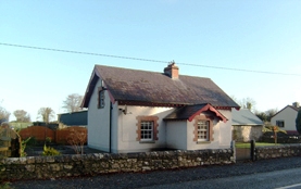
| Alloonbaun/Church View | At the time of Griffith's Valuation Rev. Joseph Seymour was leasing this house from the Clancarty estate when it was valued at almost £8. It is still extant and occupied. |
|
| Milverton | Thomas Hunt was leasing a property valued at £20 from the Mahon estate at the time of Griffith's Valuation. Extensive corn mills are shown at this site at the time of the First Ordnance Survey but by the 1890s it is occupied by a house labelled Milverton which is still extant. |

|