Tiaquin
Houses within 5km of this house
Displaying 7 houses.
Houses within 5km of Tiaquin
Displaying 7 houses.
| House name | Description | |
|---|---|---|
| Monivea | An O'Kelly tower house, acquired by the ffrenches in the early 17th century, who made additions in the 18th century. Held in fee by Robert French at the time of Griffith's Valuation when it was valued at £40. In 1894 Slater refers to it as the seat of Acheson French. In 1938 it was bequeathed by Kathleen French to the State as a home for artists, subsequently demolished and now only the original tower remains. A mausoleum, modelled on the tower house and constructed at the end of the nineteenth century, is located in the adjacent woodland. |

|
| Corrandoo House | This property was granted to the ffrenches in the late 17th century in lieu of Monivea Occupied by the Reverend Mr Marsh in the 1770s sand 1780s, by M. Dowdall in the 1830s and Thomas Kenny at the time of Griffith's Valuation when it was valued at £10. It is no longer extant. |
|
| Glennagloughaun North | A building valued at £12 was occupied by Digby French at the time of Griffith's Valuation, this may have been the old charter school marked on the first Ordnance Survey map. The latter building appears to have fallen into disuse by the 1890s and the site is now occupied by a farm supply stores. | |
| Killaclogher House/Spring Park | This property is labelled Spring Park on the First edition Ordnance Survey map and as Killaclogher House on the 25-inch edition of the 1890s. It was the main home of the Kenney family in the 18th and 19th centuries. At the time of Griffith's Valuation it was valued at over £16 and held in fee by James C. Kenny. The house is no longer extant. |

|
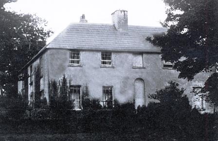
| Temple | This property is labelled Temple House on the 25-inch Ordnance Survey map having been built after the publicaiton of the 1st edition maps. In the 1850s William Poole was leasing the property from the Graves estate when the buildings were valued at £10. Substantial ruins still exist at the site. |
|
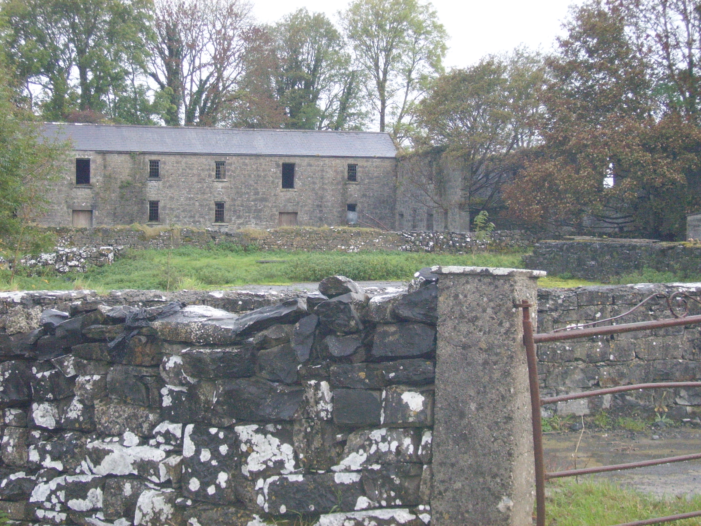
| Colmanstown | Originally a French property which became a Quaker settlement. Griffith's Valuation describes the buildings as a herd's and steward's house occupied by Edward Barrington and partners and then valued at £30. Buildings on both sides of the road mark the site of Colmanstown. Only the walls remain of some of these buildings, others are still in use. |
|
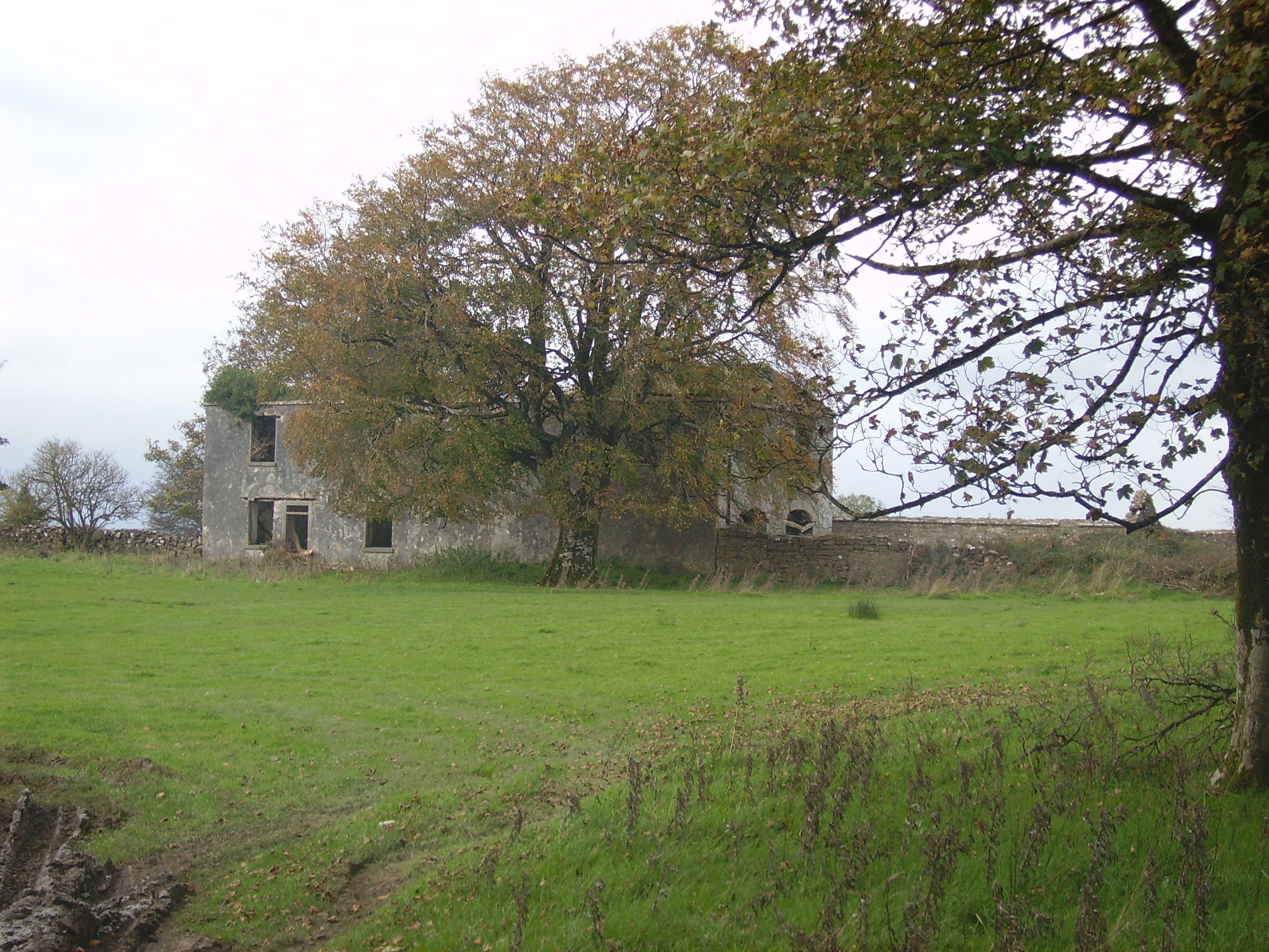
| Knockbrack | A house built in the early 1850s by the Hall family and occupied by them until 1922. In 1906 it was valued at £36. The roof of the house was later removed. Only the outline of the basement walls now remain. The farmyard buildings are still used by the Feeney family. |
|