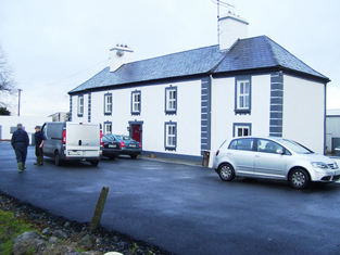
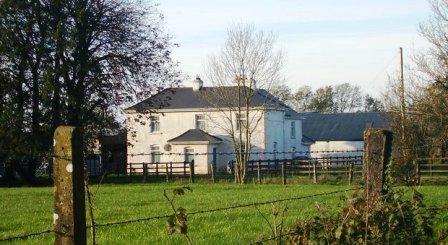
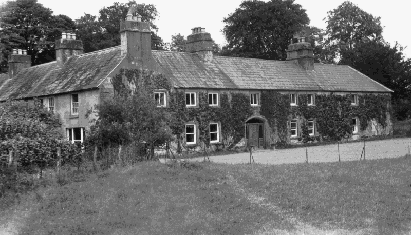
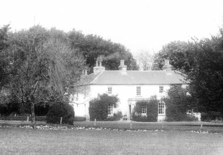
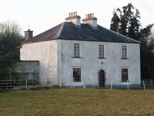
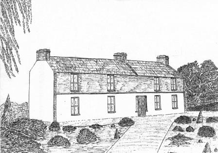
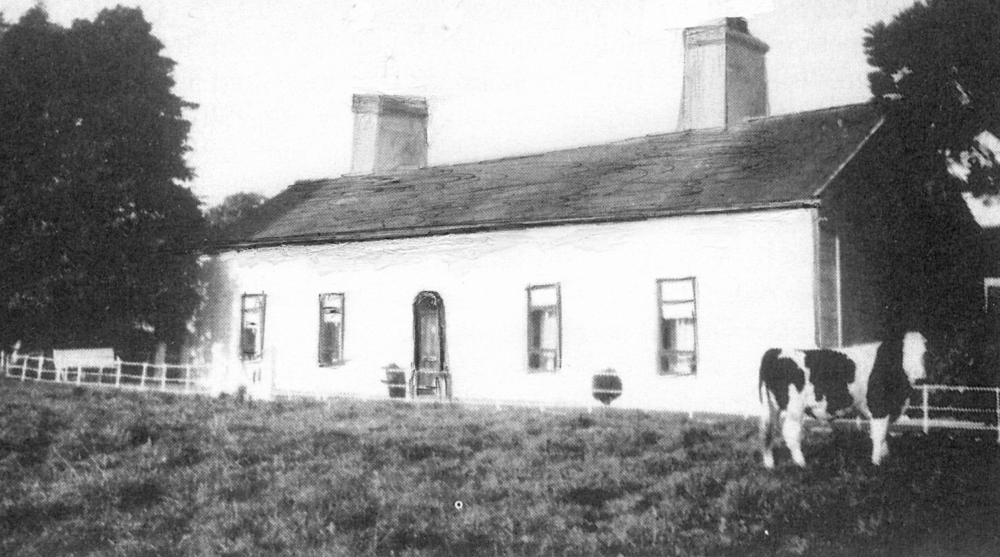
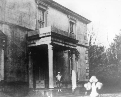
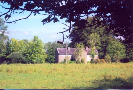
Castletown
Houses within 10km of this house
Displaying 22 houses.
Houses within 10km of Castletown
Displaying 22 houses.
| House name | Description | |
|---|---|---|
| Cappagh | Occupied by Dillon Hughes at the time of Griffith's Valuation, when it was valued at £11 10s. He was leasing the property from Alexander Beatty. The National Inventory of Architectural Heritage suggests that this is originally a seventeenth century house with later additions. It is still extant and well-maintained. |
|
| Mountsilk | This property was held in fee by Michael O'Kelly at the time of Griffith's Valuation, when it was valued at £6. A later house seems to have been constructed by the time the 25-inch Ordnance map was published in the 1890s. This house is no longer extant though a farm still exists at Mount Silk. |
|
| Elmhill | Occupied by Edward Rochfort in 1814. By the time of Griffith's Valuation there was no house with a valuation of more than £1.18 shillings in the townland. The 25-inch map of the 1890s shows a later building called Elmhill House slightly north of the original building. There is still an extant house at the site. |
|
| Newforest | Built prior to 1777, Wilson refers to it as the seat of Mr. D'Arcy in 1786. It was held in fee by Richard D'Arcy at the time of Griffith's Valuation when it was valued at £24. It was demolished in the latter half of the 20th century. |
|
| Wellfort | Marked on the first edition Ordnance Survey map as Wilfort House, this property was held in fee by Richard D'Arcy at the time of Griffith's Valuation when it was valued at £18. It is named as Wellfort House on the 25-inch Ordnance Survey map of the 1890s. Wellfort is no longer extant. |
|
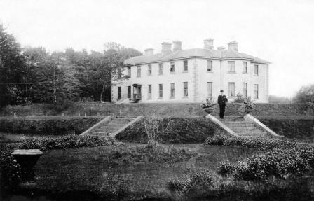
| Moat Lodge | Built by the Digby family in the mid 19th century. Home of the Gilmores in the mid 20th century and now of Mr and Mrs Jarlath Donnellon. In the Blake of Ballyglunin Papers Thomas Murphy in a letter to Martin J. Blake dated 1837, refers to his involvement in the building of a house at Moate for Mr Digby, National Archives M6936/38/29. |
|
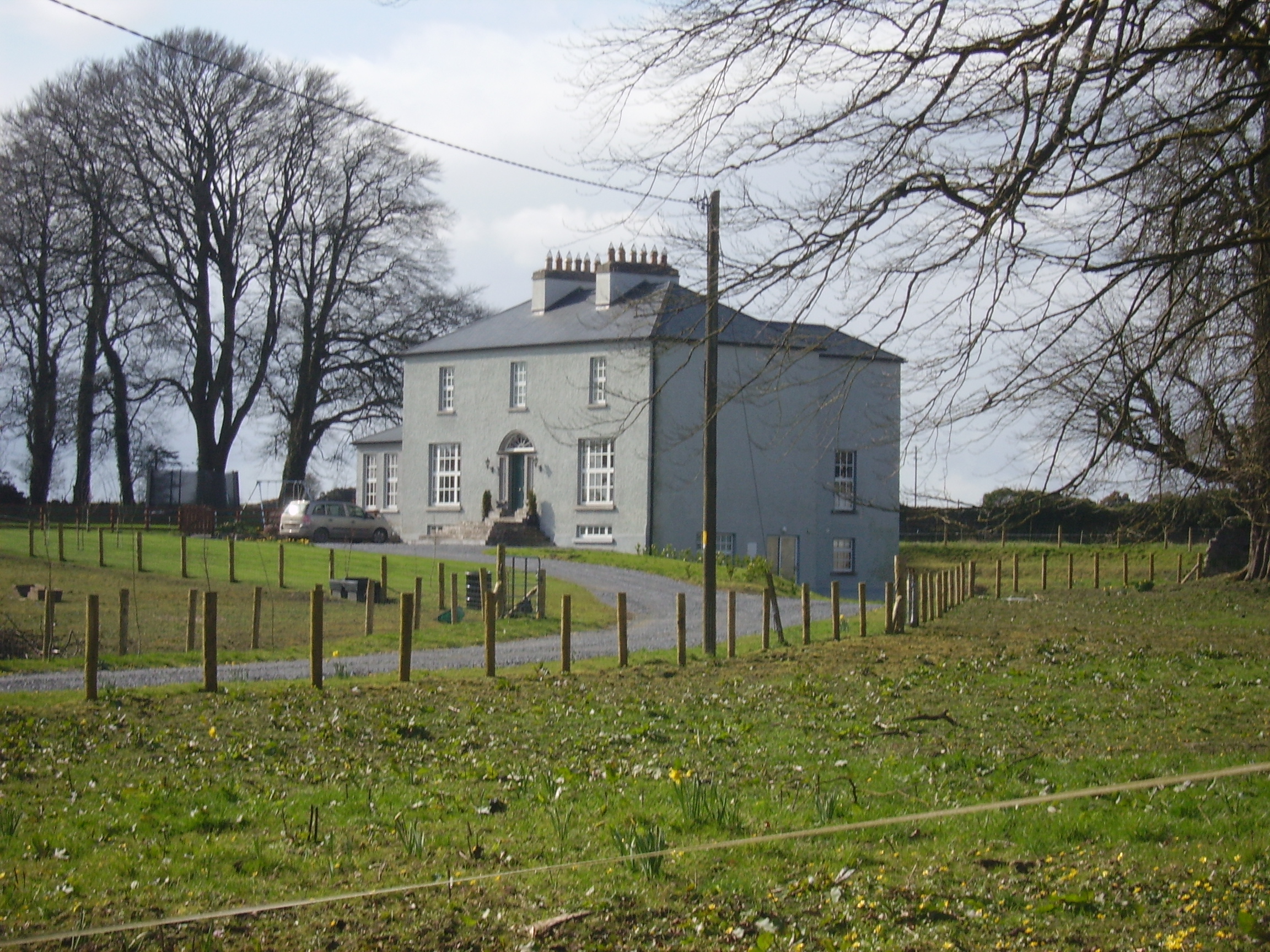
| Summerville/Thomastown | Home of Dominick G. Bodkin in 1814. The Bodkins intermarried with the Kilkellys. In 1855 the mansion house was described as 3 storeys high and in good repair. By the 1870s John Lyons of Summerville, Moylough, owned 218 acres in county Galway. In 1906 another source records Summerville, valued at £13.10 shillings, as occupied by John Lyons. Renovated in 2006 by its present owner Pat Lyons. |
|
| Fiddaun Lodge | In 1786 Wilson refers to Fidane as the seat of Mr. Kelly. Melvin writes that John Dennis, the famous huntsman, was born at Fiddaun in 1800. Charles O'Rorke was leasing it from the Redington estate in the mid 1850s when the house was valued at almost £5. A house still exists at the site. |
|
| Kentstown | The sales rental of June 1851 records the leasing of Kentstown, by Netterville and Geoffrey Davies, to Thomas Davies, for 31 years from 10 July 1838. It was held in fee by him at the time of Griffith's Valuation when it was valued at £12. In the 1877 sales rental the house was described as having "a parlour, drawing room, 6 bedrooms, kichen, dairy and servants' hall". A house is still extant at the site. | |
| Lakeview | Built by the Carr family and occupied by Michael Carr at the time of Griffith's Valuation when the house was valued at £13. A house is shown though not labelled on the 1st edition Ordnance Survey Map. It is named as Lakeview House on the 25-inch edition of the 1890s. Lakeview is still extant. |
|
| Clonbern Park | A house built after the publication of the 1st edition Ordnance Map. The property in this townland was held by Charles O'Rorke at the time of Griffith's Valuation when it was valued at almost £8. Clonbern Park no longer exists but the stable block and walled garden are still evident on the site. |
|
| Moyloughmore | The O'Rorkes lived in the rectory at Moylough. At the time of Griffith's Valuation, Reverend John O'Rorke was leasing a property valued at £11 from Charles O'Rorke. The rectory is still extant. |
|
| Carrowleana House | At the time of Griffith's Valuation occupied by Andrew W. Irwin and valued at £15. The house has been demolished but the stables are still extant. | |
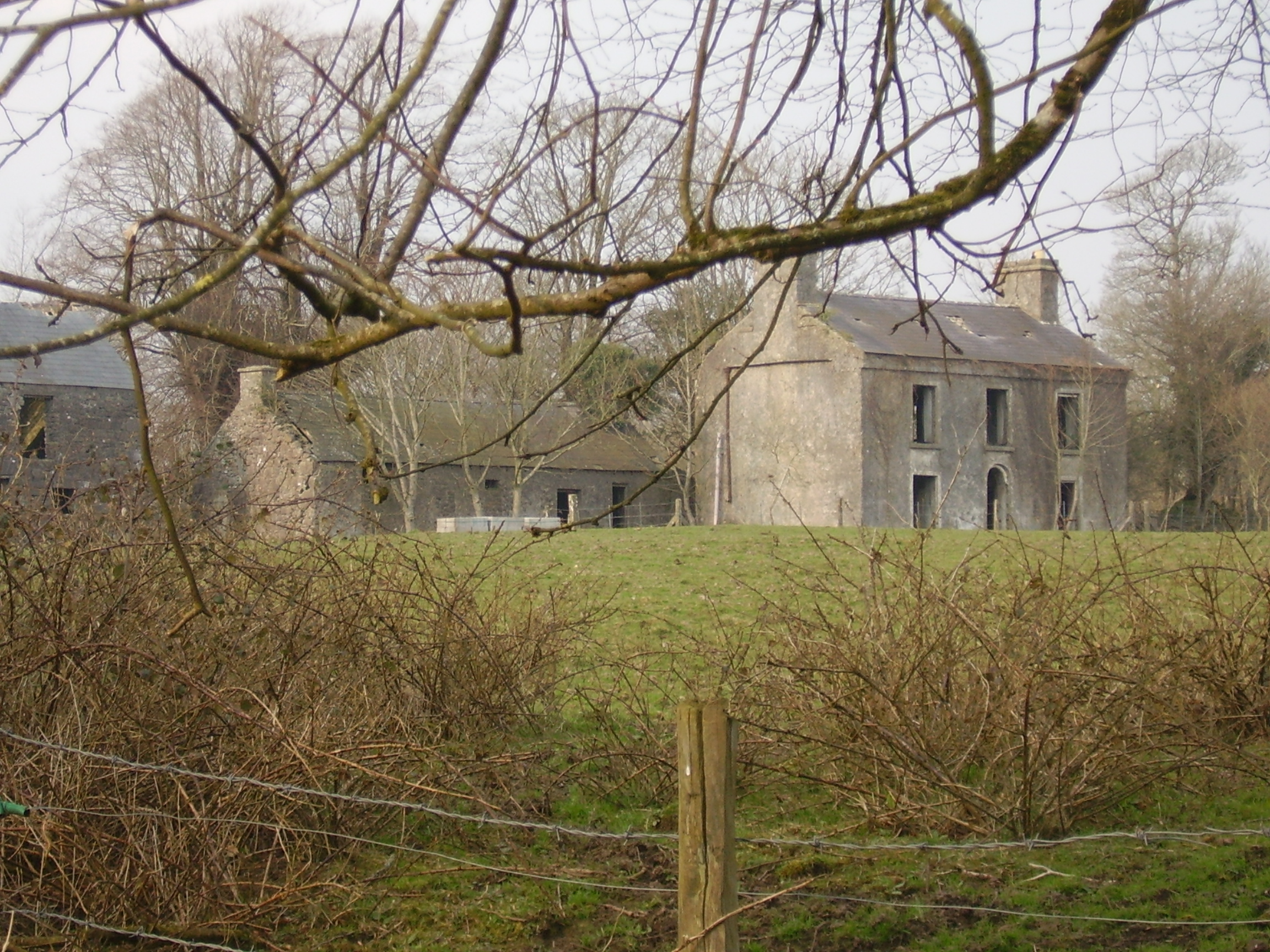
| Fort Browne | By the mid 1850s the house was valued at £2.15s and was occupied by Margaret Burke. It is now derelict. |
|
| Kedagh Park | Held by Bartholomew Kelly in fee at the time of Griffith's Valuation when it was valued at £11 10s. The house is labelled Kedagh Park on the First Edition Ordnance Survey map but as Clondoyle House on the 25-inch map of the 1890s. A house still exists at the site. | |
| Cloondoyle | In 1786, Wilson refers to "Clondowel" as the seat of Mr. Blake. At the time of Griffith's Valuation it was occupied by Thomas Kelly and held from [his father] Bartholomew Kelly. The house was valued at £8. It is labelled Clondoyle House on both the First and 25-inch editions of the Ordnance Survey map. A house still exists at the site. |
|
| Ashfield | At the time of Griffith's Valuation held by John Kelly in fee when the house was valued at £8. A building still exists at the site. | |
| Mount Kelly | A Kelly property in the mid 18th century, which passed to a branch of the Bellew family through marriage. The original house was known as Drum House but was in ruins by the 1820s. Mount Kelly was owned by John William Browne at the time of Griffith's Valuation. The 19th century house appears as Lakeview.on the 1st edition Ordnance Survey map but as Mount Kelly on the 25-inch edition of the 1890s. A house still exists at the site. |
|
| Netterville Lodge | A two storey 19th century house, the home of the Nettervilles and the Gerrards. Came into the possession of the Fallon family of Runnimeade, county Roscommon, following the death of Marcella Gerrard in 1865. Occupied by Cecilia Fallon in 1906, later demolished. Both Taylor and Skinner and Wilson indicate a second Fallon property, Highlake, in the area in the 1780s. |
|
| Springlawn | Occupied by John W. Maunsell at the time of Griffith's Valuation and valued at £5. This house is no longer extant. | |
| Woodbrook | Originally a Netterville home, Woodbrook was located in the demesne of Netterville Lodge and is marked on the first Ordnance Survey map of 1838. At the time of Griffith's Valuation it was described as a steward's house valued at £5. It is now a ruin. | |
| Cloonkeen Lodge (Kilkerrin) | Cloonkeen Lodge is shown on the 25-inch edition Ordnance Survey map of the 1890s. It occupies the site of an earlier settlement, Ballyphillipeen, shown on the 1st edition Ordnance Survey map. At the time of Griffith's Valuation this townland was held by William P. Cullen who held a house, valued at almost £5 in fee there. The building is still extant though not apparently in use. |
|