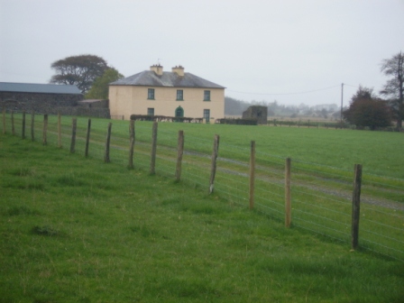
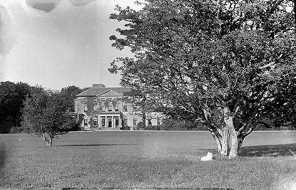
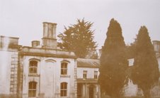
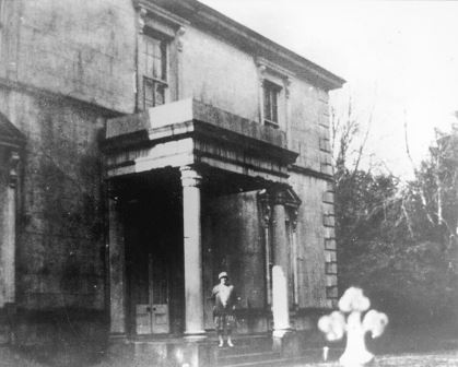
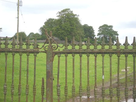
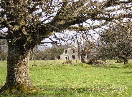
Ticooly/Tycooly
Houses within 10km of this house
Displaying 43 houses.
Houses within 10km of Ticooly/Tycooly
Displaying 43 houses.
| House name | Description | |
|---|---|---|
| Castleffrench | Castle ffrench is said to have been built c.1779 by Charles Ffrench, then Mayor of Galway. Wilson, in 1786, in one instance refers to "Clougher" as the seat of Mr. French but in a later reference notes Castle-French as "the fine seat of Sir Thomas French". In 1814 and again in 1837 it is recorded as the residence of Lord French. In 1856 it was occupied by James Thorngate when it was valued at £40. It is still extant and occupied and in 2006 was offered for sale. |

|
| Waterloo House | In 1786, Wilson refers to a house in this area as Fair-Hill, the seat of Mr. French. Waterloo was the home of the Concannons from the 1820s to the early 20th century. It was held in fee by Edmund Concannon at the time of Griffith's Valuation, when it was valued at over £20. It is still extant and occupied. |
|
| Esker Lodge | James Martin was leasing a property valued at £15 from Andrew Browne's estate at Esker, barony of Tiaquin, at the time of Griffith's Valuation. It is labelled Esker Lodge on both the 1st and 25-inch edition Ordnance Survey maps. A small amount of ruins remain at the site. | |
| Cruise Lawn | Held by William Cruise from James Galbraith at the time of Griffith's Valuation when the house was valued at £5. It is named Cruice Lawn on the 25-inch Ordnance Survey map of the 1890s. Cruice Lawn is now a ruin. | |
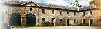
| Greenville | Occupied by William Dillon in 1814, by P. Cruise in the 1830s and by John F. Browne at the time of Griffith's Valuation when it was valued over £5 and was part of a farm of over 250 acres. Peter Tyrell was leasing a mill at Greenville from the Bellew estate at the same time. Buildings, including the substantial stables, still exist at the site. |

|
| Caltra Lodge | The home of P.J.Joyce in the late 1830s and of Mary Joyce in the 1850s. The Joyces held this house from the Bellews of Mount Bellew. On the 25-inch map of the 1890s it is labelled as Caltra Park. The ruin of the original house was visible until the end of the twentieth century, | |
| Corgary or Corgerry | The house known as Corgary was part of the Joyce estate. At the time of Griffith's Valuation, it was occupied by Eleanor Morgan, leasing from Walter Joyce, and valued at £30. It was shown on the 25-inch Ordnance Survey map of the 1890s but labelled "in ruins" on the 6-inch map of 1932. | |
| Cloverfield | Joseph E. Nolan was resident at the time of Griffith's Valuation when the house was valued at £4. It appears to have become ruinous by the time of the 25-inch Ordnance Survey map of the 1890s. | |
| Kentstown | The sales rental of June 1851 records the leasing of Kentstown, by Netterville and Geoffrey Davies, to Thomas Davies, for 31 years from 10 July 1838. It was held in fee by him at the time of Griffith's Valuation when it was valued at £12. In the 1877 sales rental the house was described as having "a parlour, drawing room, 6 bedrooms, kichen, dairy and servants' hall". A house is still extant at the site. | |
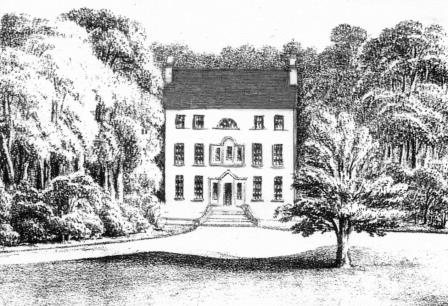
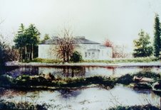
| Clonbrock | Designed by William Leeson and built in the 1780s. In 1837 Lewis recorded it as the seat of Lord Clonbrock. In 1786 Wilson refers to Clonbrock as the seat of R. Dillon. At the time of Griffith's Valuation the house at Clonbrock was valued at £100. In 1906 it was valued at £135. The house was badly damaged by fire in the 1980s and only one wing is now inhabited. |
|
| Mountbellew | A three storey house built in the 18th century. In 1786 Wilson refers to it as the seat of Michael Belew. Extensively renovated in the mid 19th century and valued at £80 at the time of Griffith's Valuation. It was demolished in the late 1930s. |

|
| Ballybaun | At the time of Griffith's Valuation, Lord Clonbrock owned a mill, gate house and other buildings valued at £35 in the townland of Ballybaun, parish of Ahascragh. The gate house is still extant and occupied. Local sources suggest it was at one time used as a school for children in the area. |
|
| Ahascragh Glebe/Rectory | At the time of Griffith's Valuation, Rev. Sir William Mahon was leasing a house valued at £20 in the townland of Ahascragh West, barony of Kilconnell, to Reverend Peter Browne. He was also leasing property in this townland to Thomas Hunt. Reverend Mahon was rector of Rawmarsh, Yorkshire. This property is still extant and occupied as a private house. |
|
| Pallas | At the time of Griffith's Valuation John J. Bodkin was leasing a property at Pallas, parish of Fohanagh, to Thomas O'Connor. The house was valued at £3 but was accompanied by over 600 acres. A new house appears to have been constructed after the publication of the 1st edition Ordnance Survey map. It is labelled Pallas on the 25-inch edition of the 1890s. It is now derelict. |
|
| Lowville | Lowville was originally the seat of Nathanial Lowe who held this estate in the mid-18th century and Wilson refers to it as his seat in 1786. In 1814 it was the residence of the Hon. Mrs. Low. In 1837 Lewis recorded Lowville as the seat of W. McDonagh. It was still occupied by Walter McDonagh in the 1850s and was valued at £45. By 1906 it was in the possession of Bernard Connaughton and was valued at £33. It was later the home of the Byrne family but was sold in the early 1970s and ceased to be residential. It is now a ruin. |
|
| South Park | At the time of Griffith's Valuation, Lawrence Kerrans was leasing a property valued at £11 from the Clonbrock estate at Kilglass, parish of Ahascragh. It is not named on the first edition Ordnance Survey Map but is labelled South Park on the 25-inch edition produced in the 1890s. The house is still extant and occupied. |
|
| Clooncannon/Cloncannon/Runnamead | Far Kelly was resident at Cloncannon in 1749. It is described in the Ordnance Survey Name Books as the residence of William Kelly. This property was offered for sale in the Encumbered Estates in July 1850. At that time it was occupied by Mathew C. Browne. John and Edward Lennon were occupying this property, valued at £9, at the time of Griffith's Valuation. It was part of a holding of almost 400 acres. Joseph Trumperant Potts laid the foundation stone for his house known as Runnymeade in 1866 (''Saunders Newsletter'', 23 June 1866). It is labelled as Runnamead House on the 25-inch Ordnance Survey map of the 1890s. In 1906 a house valued at £10 at Clooncannon Kelly was part of the Clonbrock estate together with almost 400 acres of untenanted land.. It is no longer extant. | |
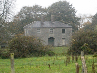
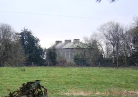
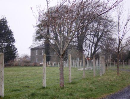
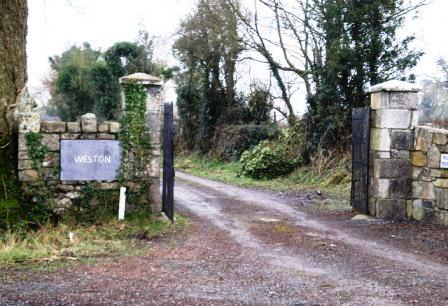
| Weston | John D. Mahon was leasing this property, valued at £35, from Sir William Mahon, at the time of Griffith's Valuation. It is described as unoccupied at the time of the first Ordnance Survey. The National Inventory of Architectural Heritage indicates that the original Weston house is now demolished. A smaller house, known as Weston Lodge, was also located in the demesne (M779403). It is no longer extant. |
|
| Killian | This house was the main residence of the Cheevers family, valued in the mid 19th century at £45. The house is no longer extant but the gate lodge survives. |
|
| Netterville Lodge | A two storey 19th century house, the home of the Nettervilles and the Gerrards. Came into the possession of the Fallon family of Runnimeade, county Roscommon, following the death of Marcella Gerrard in 1865. Occupied by Cecilia Fallon in 1906, later demolished. Both Taylor and Skinner and Wilson indicate a second Fallon property, Highlake, in the area in the 1780s. |
|
| Aghrane Castle/Castle Kelly | A 16th century tower house with 19th century additions. Castle-Kelly is recorded by Wilson as the seat of Denis Kelly in 1786. Lithographs of the entrance to Castle Kelly, Castle Kelly and Ballygar town are included in the sales rental of 1863. It was bought by the Bagots, sold by them to the Department of Agriculture in 1910 and demolished in 1919. Parts of the demesne are now owned by Coillte, the Forestry Service. |
|
| Ballybaun | Wilson refers to Ballybawne as the seat of Mr. Kelly in 1786. Occupied by John Kelly in 1837 and by John Mahon at the time of Griffith's Valuation. The sales rental of 1863 includes a lithograph of Ballybaun, which was described as 4 storeys high. The house was occupied by the Mahon family until 1916 when it was taken over by the Congested Districts' Board. It is no longer extant. |
|
| Thornfield | Occupied by John Mahon at the time of Griffith's Valuation and held from the Kellys. The sales rental of 1863 includes a lithograph of Thornfield which was sold privately to Christopher Bagot. It continued to be occupied by the Mahon family until 1917, when it was taken over by the Land Commission, Henry English inhabited the house until the 1950s. This house on the Galway/Roscommon border now appears to be a ruin, with a substantial garden wall still intact. |
|
| Riversdale | In the 1830s the house is described as "on rising ground and in good repair" Held by James Kelly in fee at the time of Griffith's Valuation when it was valued at £22. The original house is no longer extant. | |
| Muckloon | In 1786 Wilson mentions "Muckland" as the seat of Mr. Kelly. Occupied in the mid 1850s by Richard P. Lloyd to whom most of the Kelly estate was let. The house was then valued at £20. It is no longer extant. | |
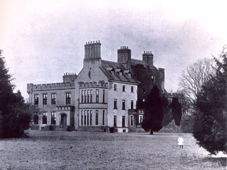
| Castlegar | The principal residence of the Mahon family, designed by Sir Richard Morrison circa 1801, replacing an earlier house. Wilson, writing in 1786, refers to this earlier house as the seat of Mr. Mahon. In the 1830s the Ordnance Survey Name Books describe it as in good repair but Sir Ross Mahon was not resident there at the time. Sir William Mahon was still in possession of the property in 1906 when it was valued at £67. In 1979 the house was sold by the Mahons to John Horan, who advertised the house for sale again in 1988. The house is still extant. |
|
| Castlegar | At the time of Griffith's Valuation held by Robert R. Smith in fee and valued at £12. In 1906 it was owned by his representatives and was valued at £20. | |
| Springlawn | Occupied by John W. Maunsell at the time of Griffith's Valuation and valued at £5. This house is no longer extant. | |
| Ballinamore House or Curraghboy Lodge | The residence of Martin ffrench held by him in fee at the time of Griffith's Valuation and valued at £35. The house is noted on the 1st edition OS map as Curraghboy Lodge. In 1906 the owner was Michael Neary. |
|
| Ballinlass | William Kelly was residing at Ballinglass, parish of Killeroran, in 1749. Occupied by Nicholas D'Arcy from the 1830s to the early 1850s and by Malachy Fallon in the mid 1850s. Buildings exist at the site. | |
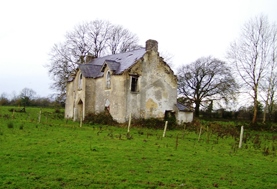
| St Brendans | Occupied by the Honourable Thomas ffrench from the 1830s to 1850s who held the house from the Honourable Martin ffrench. It is now almost ruinous. |
|
| Claremont | Described in the Ordnance Survey Name Books as a 'neat modern building', the house was located close to the bank of the River Suck. It was the home of Gonville ffrench and he held it from the D'Arcy family. In the D'Arcy sales rental of May 1851 there is reference to 'the splendid mansion' of Gonville ffrench. Occupied by the Honourable Clarinda ffrench in the 1850s who held the property from the Right Honourable Richard W. Greene, valued at £21. The house is now a ruin. |
|
| Woodbrook | Originally a Netterville home, Woodbrook was located in the demesne of Netterville Lodge and is marked on the first Ordnance Survey map of 1838. At the time of Griffith's Valuation it was described as a steward's house valued at £5. It is now a ruin. | |
| Cloonatleva | Samuel Johnston was leasing a property valued at almost £5 at Cloonatleva Lower, barony of Kilconnell, from the Hodson estate at the time of Griffith's Valuation. The original building is not shown on the later 25-inch Ordnance Survey map of the 1890s. Modern farm buildings occupy the site now. | |
| Cloonagh | The home of a branch of the Fallon family from the mid 18th century. Wilson refers to it as the seat of John Fallon in 1786. Occupied by James Mannion in 1814 and described in the 1830s as "a well built modern mansion forming three fourths of a cross". Occupied by James Bailey at the time of Griffith's Valuation, when it was part of the Trench estate. It is now a ruin. | |
| Taghboy House | Built in the 1860s by the O'Rorkes and home to Mary O'Rorke for the rest of the 19th century. Valued at £9.5s in 1906. The last occupants were the Kelly family who were still in residence in the 1930s. | |
| Cloonatleva Mill | James Tyrrell was leasing a house and mill, valued at £6, together with land, at Cloonatleva, barony of Kilconnell, from the Hodson estate at the time of Griffith's Valuation. The building is described as "disused" on the 25-inch Ordnance Survey map of the 1890s. | |
| Fohenagh | Sir Henry Grattan Bellew dates this house from the 1830s. In 1906 Norah Johnston was the owner of buildings valued at £10 at Fohenagh as well as over 500 acres of untenanted land. Various members of the Johnston family had held lands in the area at the time of Griffith's Valuation mostly leased from the Hodson estate. Buildings still remain at this site. | |
| Bellew's Grove | Slater refers to Bellew's Grove as a seat of Lord Grey de Ruthin in 1894. It was held by Mrs. Bellew at the time of Griffith's Valuation and valued at £30. Buildings still exist at the site. | |
| Milverton | Thomas Hunt was leasing a property valued at £20 from the Mahon estate at the time of Griffith's Valuation. Extensive corn mills are shown at this site at the time of the First Ordnance Survey but by the 1890s it is occupied by a house labelled Milverton which is still extant. |

|
| Ballyforan | In 1786 Wilson refers to a house at Ballyforan, the seat of Mr. Kelly. This may be the unamed property shown on the 1st edition Ordnance Survey map, close to the river Suck, which is labelled The Lodge on the subsequent 25-inch edition. At the time of Griffith's Valuation, this property was held from the Greene estate by Thomas Kenny. The house was valued at almost £7 and the nearby mills at £23. It is now a ruin. | |
| Cloonlyon | In 1786 Wilson refers to Clonlyon, the seat of Mr. Kelly. The 1st edition Ordnance Survey map shows ruins in this townland. | |
| Ashfield (Tiaquin) | IN 1786, Wilson refers to Ashfield as the seat of Mr. Blakeney. On the 1st edition Ordnance Survey map a tree-lined avenue and buildings are shown but not named. None of the buildings are visible today though a portion of the avenue remains. |