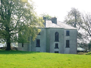
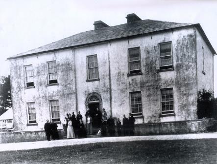
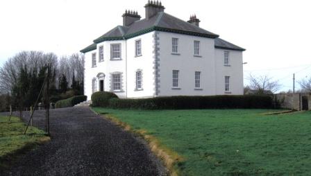
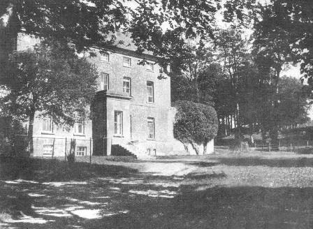
Ballybroder
Houses within 5km of this house
Displaying 12 houses.
Houses within 5km of Ballybroder
Displaying 12 houses.
| House name | Description | |
|---|---|---|
| Masonbrook | Masonbrook was originally the seat of the Mason family but was later bought by the Smyth estate. At the time of Griffith's Valuation it was occupied by James Smyth and was valued at £60. It is recorded in the Valuation and the 1906 report on Untenanted Demesnes as located in the townland of Moanmore East but is shown in the townland of Masonbrook on the 1st edition OS Map of 1842. In 1906 it was valued at £60. It is not shown on the 25-inch edition Ordnance Survey map and is no longer extant. |

|
| Lynchfort House | Martin J. Lynch was occupying this house at the time of Griffith's Valuation when it was valued at £10. Lynchfort House is still extant and in good condition though it is not clear if it is continuously occupied. |
|
| Woodmount House (Loughrea) | The 1st edition OS map indicates Woodmount House at Knockadikeen, barony of Loughrea. At the time of Griffith's Valuation James Smyth was leasing this townland from the Clanricarde estate. The property included a herds' and labourers' houses valued at £2. | |
| Danesfort (Loughrea) | On the first edition Ordnance Survey map this house is labelled Lisduff House but on the 25-inch edition of the 1890s it has become known as Danesfort. In the mid 19th century it belonged to a branch of the Dolphin family of Turoe. By the early 20th century Danesfort was inherited through marriage by the Tighes of The Heath, near Ballinrobe, county Mayo and in 1906 was the property of Robert Dolphin Tighe when it was valued at almost £16. It is no longer extant. |
|
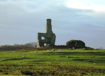
| Wallscourt | Wallscourt House is described as "in ruins" on the 1st edition 6" OS map. Very little now remains of it except for one chimney. |
|
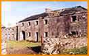
| Dartfield | The home of R. Blake in the 1830s. By the time of Griffith's Valuation, Dartfield was the property of Maria L. Blake and was valued at £28. Later occupied by Geoghegans, Hardys and now home to the horse museum run by the Leahy family though the house itself is largely ruinous. |
|
| Ballydugan | In 1786 Wilson refers to Ballydugan as the seat of William Burke. Rev. Michael Burke was the owner of Ballydugan at the time of Griffith's Valuation, when it was valued at £24. In 1906 Michael H. Burke owned the mansion house at Ballydoogan then valued at almost £27. It was burnt in 1922 but rebuilt, with modifications, in 1929. Much of the family and estate archives were destroyed in the fire of 1922. Ballydugan is still extant and occupied. |
|
| Rafarn House | At the time of Griffith's Valuation, Rafarn House was leased from the Clanricarde estate by Thomas Tully and was valued at £17 and was accompanied by over 400 acres. In 1814 it was recorded as the residence of Joseph Tully. It is still extant. |

|
| Cooleeney/Coolinny/Cooleeny | At the time of Griffith's Valuation this property was occupied by James Daly and was valued at £15. When offered for sale in February 1863 the house was occupied by Eleanor M. Lynch. In 1906 it was in the possession of John J. Smyth of Masonbrook and was valued at £20. Cooleeney is still extant and occupied. | |
| Summerhill House (Loughrea) | In 1786 Wilson writes that Summerhill House, on the outskirts of Loughrea, was the seat of Mr. Persse. By the time of Griffith's Valuation in the 1850s, the property was occupied by Henry Dolpin, leasing from the Clanricarde estate, when it was valued at almost £8. Parts of the building have disappeared by the 1890s and the site is now part of a school. | |
| Mount Pleasant (Loughrea) | In 1786 Wilson writes that Mount Pleasant was the seat of Mr. Daly. At the time of Griffith's Valuation, the townland was in the possession of the Clanricarde estate but the only building with substantial valuation was the militia barracks. The house is no longer extant though the area is still known as Mountpleasant. |
|
| Fortlands House (Loughrea) | In 1786 Wilson refers to a charter-school at Loughrea and this premises is labelled on the 1st edition Ordnance Survey map. However, by the time of Griffith's Valuation, it appears to have reverted to use as a house, leased by John Smyth from the Clanricarde estate and valued at £11. The house at this location is labelled Fortlands House on the 25-inch Ordnance survey map of the 1890s. A house is still extant at the site. |