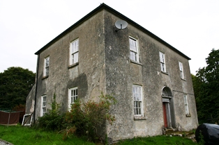
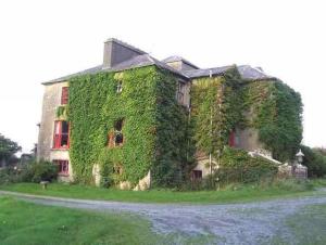
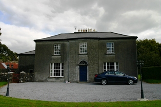
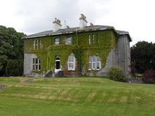
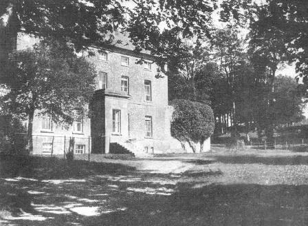
Abbeyville
Houses within 5km of this house
Displaying 11 houses.
Houses within 5km of Abbeyville
Displaying 11 houses.
| House name | Description | |
|---|---|---|
| Masonbrook | Masonbrook was originally the seat of the Mason family but was later bought by the Smyth estate. At the time of Griffith's Valuation it was occupied by James Smyth and was valued at £60. It is recorded in the Valuation and the 1906 report on Untenanted Demesnes as located in the townland of Moanmore East but is shown in the townland of Masonbrook on the 1st edition OS Map of 1842. In 1906 it was valued at £60. It is not shown on the 25-inch edition Ordnance Survey map and is no longer extant. |

|
| Glenville | The Earl of Clancarty was leasing a house valued at £12 in Cahercrea East to Margaret Daly in 1855. This house is still extant and now known as Glenville. In the adjoining townland of Ballycoony Clancarty was leasing a house valued at £4 as well as 118 acres to John Hardy. |
|
| Woodmount House (Loughrea) | The 1st edition OS map indicates Woodmount House at Knockadikeen, barony of Loughrea. At the time of Griffith's Valuation James Smyth was leasing this townland from the Clanricarde estate. The property included a herds' and labourers' houses valued at £2. | |
| Kilchreest Glebe | Rev. William O'Grady was leasing this property from the Persse estate & John & Eliza Gloster. It was originally church lands. In 2006 this property was still extant and was offered for sale together with a property known as Killinan House nearby. |
|
| Millmount House | Thomas Phayre was leasing this property from the Earl of Clancarty's estate at the time of Griffith's Valuation. It also included a mill, herd's house and 150 acres. The National Inventory of Architectural Heritage suggests it was built in the 1760s. It is still extant and occupied. |
|
| Grousehill House | Patrick Murphy was leasing 66 acres and buildings valued at over £1 from the Earl of Huntingdon's estate at Killeenadeema West, barony of Loughrea, at the time of Griffith's Valuation. This includes the property described as Grousehill House, in the same townland, on the 1st edition OS map. The house is not recorded on the later 25-inch map. A modern building exists at the site. | |
| Curheen House | Sometimes known as Coorheen House. In 1786 Wilson refers to Curheen as the seat of Mr. Loftus. At the time of Griffith's Valuation, this was a small property occupied by Andrew Egan, leasing from the Clancarty estate and valued at £1 5s. Extended and enlarged sometime after this, by the 1890s it had become Curheen House, resided in by the Aitken family, agents for the Clancarty estate. Later the residence of the RC Bishop of Clonfert. |
|
| Summerhill House (Loughrea) | In 1786 Wilson writes that Summerhill House, on the outskirts of Loughrea, was the seat of Mr. Persse. By the time of Griffith's Valuation in the 1850s, the property was occupied by Henry Dolpin, leasing from the Clanricarde estate, when it was valued at almost £8. Parts of the building have disappeared by the 1890s and the site is now part of a school. | |
| Mount Pleasant (Loughrea) | In 1786 Wilson writes that Mount Pleasant was the seat of Mr. Daly. At the time of Griffith's Valuation, the townland was in the possession of the Clanricarde estate but the only building with substantial valuation was the militia barracks. The house is no longer extant though the area is still known as Mountpleasant. |
|
| Cottage (Loughrea) | In 1786 Wilson refers to Cottage as the seat of Mr. Varo [?]. At the time of Griffith's Valuation, the property was leased by Bryan Rynn from the Clanricarde estate and valued at £4. The original house is no longer extant. | |
| Fortlands House (Loughrea) | In 1786 Wilson refers to a charter-school at Loughrea and this premises is labelled on the 1st edition Ordnance Survey map. However, by the time of Griffith's Valuation, it appears to have reverted to use as a house, leased by John Smyth from the Clanricarde estate and valued at £11. The house at this location is labelled Fortlands House on the 25-inch Ordnance survey map of the 1890s. A house is still extant at the site. |