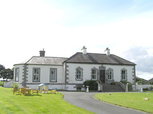
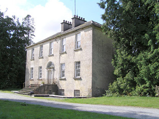
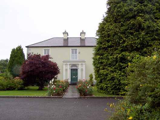
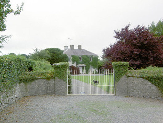
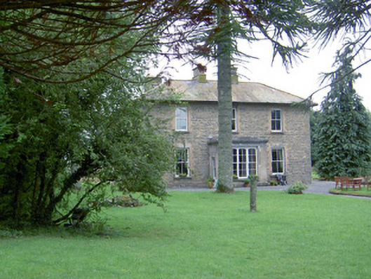
Grillagh House
Houses within 10km of this house
Displaying 36 houses.
Houses within 10km of Grillagh House
Displaying 36 houses.
| House name | Description | |
|---|---|---|
| Mount Dillon | Lewis writes that the house was situated on an isolated hill and formed "a conspicuous object in the surrounding scenery". Valued at £15 in the mid 19th century. Wilson, in 1786, refers to it as the seat of Mr. Dillon. In the possession of Samuel Russell in 1906 when the buildings were valued at £3. It is no longer extant. | |
| Bawn House (Longford) | In 1837 Lewis described Bawn House as the property of Mr. Fox but the seat of Arthur Griffith. The Ordnance Survey Name Books note the occupant as Mr. Babington in the mid-1830s. John Daly was leasing the house from John S. Kirwan’s estate at the time of Griffiths Valuation in the early 1850s when it was valued at almost £19. In 1906 it was the property of Henry B. Armstrong and valued at £13. There is a ruin at the site. | |
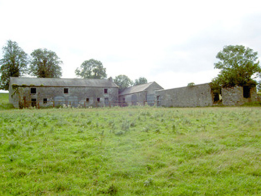
| Mount Jessop | In 1837 Lewis referred to Mount Jessop as the seat of F. Jessop. At the time of Griffiths Valuation in the early 1850s it was leased by the representatives of Thomas Conroy to Henry Crawford, when it was valued at almost £19. This is the same valuation assigned to it by the original Valuation Office books in 1839 when the occupier was John Jessop. The National Built Heritage Service suggests it was demolished c.1980. A substantial stable block and other estate architecture survives. |
|
| Rockspring | In 1837 Lewis referred to Rockspring House as the seat of W. Coates. He was still the occupier recorded in the Valuation Office books in 1840, when the house was valued at almost £9. By the time of Griffith Valuation in the early 1850s the property was being leased by James O’Keeffe from John Cooke. A house is still extant at the site. | |
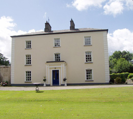
| Viewmount House (Longford) | Edward C. Hill was leasing this property from Francis Hughes at the time of Griffiths Valuation in the early 1850s, when it was valued at £17. It is visible but not labelled on the 1st edition OS map but is shown as Viewmount House on the later 25-inch edition. The Ordnance Survey Name Books described it as 'a good dwelling house with a good kitchen garden' in the mid-1830s. The National Built Heritage Service associates the property with the Cuffe and Pakenham families and dates the original house to the mid-18th century. It has, in the past, been operated as a luxury guesthouse |
|
| Cloonturk | At the time of Griffiths Valuation in the early 1850s, James Shaw was leasing this property for Richard Greville’s estate, when it was valued at £13 and included a mill. It is no longer extant | |
| Mullagh House (Longford) | The 1906 Untenanted Demesnes survey shows a valuation of almost £13 for buildings in the townland of Mullagh, owned by Miss K.S. frances Cordner. At the time of Griffiths Valuation in the early 1850s this was held in fee by Reverend John Cordner and had a valuation of almost £4. He also held most of remainder of the townland. The Greville estate was the lessor for the remainder. The National Built Heritage Service suggests that Mullagh House, which is now derelict, was built c.1880. | |
| Rathcline House | St. George Johnston was leasing this property from Colonel Henry White’s estate at the time of Griffiths Valuation in the early 1850s when it was valued at almost £38. Earlier, in 1837, Lewis referred to it as the seat of L. White. The National Built Heritage Service suggests the current house was built c.1820 though there is evidence to suggest there was an earlier house, also owned by the White family, at the site in the 1770s. Rathcline House served as a convent for the Sisters of Mercy in the mid-20th. It is still extant. |
|
| Danesfort (Moydow) | Reverend Francis Gregg was leasing this property from the Cooke estate at the time of Griffiths Valuation when it was valued at almost £21. In 1777 Taylor and Skinner had recorded the house at "Cranny" as the property of the West family. The house is labelled Danesfort on the 25-inch Ordnance Survey map of the early 20th century. It is still extant but derelict. |
|
| Gorteenboy | James Egan was leasing this property, which included a mill, from William Wilson’s estate at the time of Griffiths Valuation in the 1850s, when it was valued at £20. It is not shown on subsequent Ordnance Survey maps. | |
| Cordivin | At the time of Griffiths Valuation, Reverend Robert Moffett was leasing this property to James Ganley, when it was valued at £14 and included a mill. It is shown on the 1st edition Ordnance Survey map but does not appear on subsequent editions. | |
| Cloonta | Nicholas McGaver held this property in fee at the time of Griffiths Valuation in the 1850s, when it was valued at almost £12. The Ordnance Survey Name Books describe the property as a 'good farmhouse with trees and plantations' in the 1830s. The 1906 Untenanted Demesnes survey record a valuation of almost £12 when it was owned by Patrick McGaver. It is now ruinous. | |
| Brianstown House | In 1837 Lewis refers to Brianstown as the seat of Thomas G. Auchmuty. At the time of Griffiths Valuation in the early 1850s, it was held in fee by Henry Musters when it was valued at £22. The earlier Valuation Office books from 1840 note Auchmuty as the owner and the Valuation as £24. In 1814 Leet referred to it as the residence of Samuel Auhmuty. Brianstown is still extant and occupied. |
|
| Middleton House | Michael Quinn held Middlton in fee at the time of Griffiths Valuation in the early 1850s, when it was valued at almost £13. In 1837 Lewis referred to Middleton as the seat of H. Montfort while in 1814 Leet notes it as the residence of W.B. Montfort. It is still extant. |
|
| Castlerea (Longford) | At the time of Griffiths Valuation in the early 1850s, John Bole was leasing Castlerea from the Kirwan estate, when it was valued at £15. In 1837 Lewis had noted Castlerea as the residence of Mrs. Bole. The Ordnance Survey Name Books suggest that the townland was the property of the Jessop estate in the 1830s. The 1906 Untenanted Demesnes report notes it as the property of Charles Webb with a valuation of £15. It is still extant. |
|
| Newpark House (Rathcline) | Luke Bushe Fox held a property in fee here at the time of Griffiths Valuation in the early 1850s, with a valuation of almost £3. The original property in Newpark townland is labelled Newpark House on the 6” OS map. It appears to have become ruinous later. By the end of the 19th century Cordara House had been constructed at a different site in the same townland. It has since been demolished though some estate buildings remain at the site. In 1837 Lewis had recorded Newpark House as the seat of a Captain W.J. Davys. | |
| Lismore (Longford) | At the time of Griffiths Valuation in the early 1850s, Thomas Gill appears to have been leasing this property from the Douglas estate when it was valued at £8. In 1906 the buildings were valued almost £17 and it was still held by the Douglas estate. It is still extant. | |
| Richmond Mill | At the time of Griffiths Valuation in the early 1850s, William Fleming was leasing this substantial site from the Gunning estate when the buildings were valued at £95. The Valuation Office Books note a valuation of £72 in 1840. The property is labelled as a distillery on the 1st edition Ordnance Survey map but as corn mill on the 25-inch map. The ruins of the miller’s house and mill buildings are still visible at the site. |

|
| Fair View (Longford) | Jeremiah Gibson was leasing this property from the Gunning estate at the time of Griffiths Valuation in the mid-1850s, when it was valued at over £18. A later house possibly exists at the site now. | |
| Rhynmount (Rinnmount) | Reverend G. Moore was leasing this property from George J. Mitchell at the time of Griffiths Valuation, when it was valued at £10. It is labelled Rinn Mount on the 1st edition Ordnance Survey map but as Rhynmount on the later 25-inch edition. A modern house exists at this site now. | |
| Springfield (Clogher) | At the time of Griffiths Valuation in the early 1850s, Valentine S. Ripton was leasing this property from Reverend George Moore when it was valued at £10. The Valuation Office Books of 1840 also record him as the occupant. The house is labelled Clogher on the 1st edition Ordnance Survey map of 1838 but as Springfield on the 25-inch edition of the early 20th century. A house is still extant at the site. |
|
| Aghareagh House | At the time of Griffiths Valuation in the early 1850s John O’Beirne held this property in fee when it was valued at £20. The Valuation Office books compiled in 1840 referred to Henry Mulaniff as the occupier at that time. He is also recorded as a landholder in the townland in the Tithe Applotment records of 1831. Aghareagh is still extant and occupied. |
|
| Mullalagher | This property was held in fee by Charles Levinge at the time of Griffiths Valuation, when it was valued at over £17. In 1906 it was part of the estate of R.W.C. Levinge and valued at £13. This house is no longer extant. | |
| Glenmore (Moydow) | Noble Armstrong was leasing this property from the King Harman estate at the time of Griffiths Valuation, when it was valued at almost £12. Both Lewis in 1837 and Leet in 1814 referred to it as the seat of Newcomen Armstrong. It is extant but disused. |
|
| Moydow Glebe | In 1837 Lewis noted Moydow Glebe as the residence of Reverend Armstrong. At the time of Griffiths Valuation in the 1850s it was held in fee by Reverend William C. Armstrong when it was valued at over £20. The house is extant but disused. |
|
| Mosstown (Ballymahon) | At the time of Griffiths Valuation, in the 1850s, this property was leased by Arthur Kingston from the King-Harman estate. The property was valued at £30 with a mill valued at £50. Lewis referred to Mosstown as the seat of Arthur Kingston in 1837. Mosstown has been demolished but the ruins of the mill and some estate architecture remains. |
|
| Cormaglava House | William Lewis was leasing this property from William Montfort [Bond] at the time of Griffiths Valuation in the 1850s when it was valued at £12. The Ordnance Survey Name Books note that the townland was the property of Lady Rosse in the 1830s. A house is still extant at this site. | |
| Barnacor Mill | John Costello was leasing this property from Luke White’s estate at the time of Griffiths Valuation, when it was valued at £28. Some buildings still remain at the site. | |
| Newtown Parochial House | At the time of Griffiths Valuation in the 1850s, this house was occupied by Reverend Nicholas O’Flanagan, leasing from Colonel Henry White. The property was valued at £10. The National Built Heritage Service suggests that the house was built at the same time as the adjacent church in 1833, described in the Ordnance Survey Name Books as 'a splendid new chapel'. It is still extant and occupied. |
|
| Lislea House (Ballymahon) | Lislea House was leased by Elizabeth Bickerstaff from the Smyth estate at the time of Griffiths Valuation in the early 1850s, when it was valued at £12. In 1837 Lewis noted it as the seat of J.C. Bickerstaff. It is still extant. Datestones on the estate buildings suggest two phases of development at the site, in the 1820s and the 1860s. Elizabeth Bickerstaff was the owner of over 350 acres in County Longford in the 1870s |
|
| Cordara House | By the end of the 19th century Cordara House had been constructed at a different site in Newpark townland. It has since been demolished though some estate buildings remain at the site. |
|
| Toneen | Captain Geoffrey Power was leasing this property from the Slator estate at the time of Griffiths Valuation in the early 1850s, when it was valued at over £13. In 1837 Lewis referred to “Towend” as the seat of “Jeffrey Keating Power”. The extant house at Toneen dates from the later 19th century. |
|
| Torboy House | Phillip McCutcheon was leasing Torboy from Colonel Palliser’s estate from at least the early 1840s, as shown in the Valuation Office House books. At the time of Griffiths Valuation in the early 1850s the house was valued at over £12. The Landed Estates Court sale notice of 1862 indicates Philip McCutcheon had renewed his lease on this property in 1848. Torboy House is still extant and occupied. |
|
| Monascallaghan House | This property was described as a herd’s house belonging to the Palliser estate at the time of Griffiths Valuation in the early 1850s, when it was valued at £2 5s. The Ordnance Survey Name Books noted that the townland was part of the Jessop estate. In 1906 it was the property of Dr. J. McCutcheon and valued at almost £3. A house is still extant at the site. | |
| Laurel Lodge (Ballymahon) | At the time of Griffith’s Valuation in the 1850s, the property at this site was described as a herd’s house with a value of £4. It was occupied by Edward Phillips, leasing from the King Harman estate. A larger house was later erected on the site and is still extant. |
|
| Mullolagher | This property was held in fee by Charles Levinge at the time of Griffiths Valuation in the early 1850s when it was valued at over £17. Henry Levinge was a property owner in the townland in the Tithe Applotment records in the 1830s. A house is still extant at the site. |