Hilltown
Houses within 10km of this house
Displaying 27 houses.
Houses within 10km of Hilltown
Displaying 27 houses.
| House name | Description | |
|---|---|---|
| Bob's Grove/Farren Connell | The Nugent home known as Bob’s Grove dates from the mid-18th century. It was later known as Farren Connell possibly after alterations were made in the mid-19th century. In 1814, Oliver Nugent was resident at Bob’s Grove. In 1837, Lewis records Christopher E.J. Nugent as proprietor. At the time of Griffith’s Valuation Christopher’s representatives held the property in fee. It was valued at £24 for rates. Emily Nugent, a widow, was resident in 1901 and her son Colonel Oliver Nugent and his wife in 1911. Farren Connell continues to be the home of this family. |
|
| Dungummin House | Dungummin House with a very small demesne is named on the first edition six inch Ordnance Survey map (publ. 1837). In 1814 Leet records John Ingham of Dungimmon, Mount Nugent. Joseph Lynch was the occupier recorded in Griffith’s Valuation. He held the property, described as a herd’s house and valued at £12.10.0., from Thomas Whitney. Michael Palles Lynch of Dungimon, county Cavan and of Coola, county Westmeath, sixth son of Joseph Lynch of Roebuck House, county Cavan, is recorded in Walford’s 1910. | |
| Lisnabrin | This house, located on the outskirts of Mount Nugent, was built after the first edition six inch Ordnance Survey map (publ. 1837) was compiled. John Love was the occupant in the 1850s, holding the property, valued at £13, from the Most Reverend J.G. Beresford. A Lynch family home at the beginning of the 20th century and still a residence. |
|
| Roebuck | Roebuck was a Lynch home from at least the early 19th century when Edward Lynch was recorded as resident in 1814. Lewis records W. Reilly as the proprietor of Roebuck. In the 1850s Joseph Lynch was the occupant recorded in Griffith’s Valuation, when the buildings were valued at £15 and held from the Representatives of William O’Reilly Adams. By 1906, Henry Galligan was occupying this 'mansion' house valued at £15 for rates and 365 acres of untenanted land. | |
| Coolure | Coolure was held in fee by Sir Richard Pakenham at the time of Griffiths Valuation in the early 1850s when it was valued at £84. The National Built Heritage Service suggests it was built c.1775 with a later extension in the 1820s. It was likely built for Captain (later Admiral) Thomas Pakenham on his marriage to Louisa Staples, who were the parents of Sir Richard Pakenham. In 1906 it was part of the estate of Hugh P. Wilson and valued at £24. Coolure is still extant and occupied. Its extensive stable block was located in the neighbouring townland of Lispopple and was valued at £9 at the time of Griiffiths Valuation. |
|
| Newtown House (Fore) | This house was enlarged after the publication of the 1st edition Ordnance Survey map in the 1830s. Elizabeth Ferrally was leasing the property from the Pakenham estate at the time of Griffiths Valuation in the early 1850s when it was valued at £9. The Valuation Office books of 1838 also noted her as the owner when the house had a valuation of almost £6. A house is still extant at the site. | |
| Tullynally Castle | The National Built Heritage Service suggests the bulk of Tullynally Castle was built c.1730 but may incorporate the fabric of a house built for Henry Pakenham in the mid-C17. It had a number of phases of construction throughout its long history. Formerly known as Pakenham Hall, it has been the seat of the Pakenham family for over 350 years. At the time of Griffiths Valuation in the mid-1850s it was valued at £200 and had the same valuation in 1906. It is still extant and occupied by the Pakenham family. |
|
| Tromra House | Tromra was being leased by Wiilliam Riggs from the Pakenham estate at the time of Griffiths Valuation in the early 1850s when it was valued at £13. The Valuation Office Books of 1839 indicate Mrs. Mary Anne Riggs was occupying a property valued at £10 at that time. Tromra is still extant and occupied. |
|
| Kinturk House | Kinturk House, located just south of Castlepollard, is a five-bay three-storey over basement country house, built about 1760, remodelled and extended in 1821 for William Dutton Pollard (1789-1839) by Charles Robert Cockerell (1788-1863). It was valued at £90 in 1906. The house remained in the possession of the Pollard/Pollard Urquhart family until the mid-1930s when it was sold to the Congregation of the Sacred Hearts of Jesus and Mary who, in turn, sold it on to the Midland Health Board in 1971. |

|
| Benison Lodge | Benison Lodge, west of Lough Lene, is named on both the first edition six inch and 25 inch OS maps. O’Brien describes it as a late 18th century, five-bay, two-storey house, probably by the O’Reilly family, one of whom was shot dead in the house in 1803 by the coachman. In 1814 Thomas H Smyth lived here and the Rev T Smyth in 1837. By the time of Griffith’s Valuation (publ. 1854) John Henry Roper was occupying the house, valued at £30 and held from William P Urquhart of Castlepollard. In the 1870s Henry J Roper of Benison Lodge owned 447 acres. In the early 20th century Richard O’Neill and family were living in a first class house in this townland. The house is now a ruin. | |
| Sallymount House | Sallymount House is a three-bay two-storey house with dormer attic, dating from the early 19th century. It was the home of the Rotheram family for much of the 19th and 20th centuries. The Rotherams acquired it from the Nugent family. G S Rotheram was resident in 1837 and Griffith’s Valuation (publ. 1854) records George Rothram as the occupant holding the house valued at £35 from Priscilla Nugent. Members of the Rotheram family owned 560 acres in the 1870s. The estate was acquired by the Land Commission in the early 1960s and the house became derelict but has been restored recently. | |
| Gillardstown | Gillardstown is named on both the first edition six inch and 25 inch OS maps. A Mrs Scully was living at Gillerstown, Castlepollard, in 1814. At the time of Griffith’s Valuation (publ. 1854) Thomas Webb occupied the house, valued at £25 and held from Robert A Ellis. The house was the home of William Evans, a Civil Engineer and Law Agent, and his family in 1901 and of William Hardy, a farmer and his wife in 1911. The house is now the centre of a farming complex. | |
| Loughpark | Lough Park House, situated on the shores of Lough Lene to the south east of Castlepollard, this five-bay two-storey house, built about 1790 was home to the Evans family for much of the 19th century. N Evans was resident in 1837 and Michael Evans at the time of Griffith’s Valuation (publ. 1854). He held the house valued at £20 from William P Urquhart of Castlepollard. Thomas Pender, farmer and family lived here in 1901 and Samuel R Sutton, farmer and family in 1911. The property remains a family home. |
|
| Lough Bawn | Lough Bawn House, Carrick, a two-storey, four-bay house built c 1840s as it is not marked on the first edition OS map. It was the home of the Battersby family. George Battersby held it in fee at the time of Griffith’s Valuation (publ. 1854) when the building was valued at £28.5. John Radcliff Battersby, JP and farmer, and family were resident at the beginning of the 20th century and the house remains in the possession of Battersby descendants, see https://landedfamilies.blogspot.com/2021/06/459-battersby-of-bobsville-lakefield.html |

|
| Cummerstown House | Cummerstown House, a two-storey, three-bay house, not built at the time of the first edition OS map but named on the 25 inch. Occupied by Laurence Levey at the time of Griffith’s Valuation (publ. 1854) when the building was valued at £10.10 and held from the trustees of Wilson’s Hospital. Home of farmer Samuel O’Neill and family at the beginning of the 20th century, now the address of Cummerstown Farm Aviation Ltd. | |
| Glenidan | Glenidan House is named on both the first edition six inch and 25 inch OS maps. Stephen Moore lived at Glenidan in 1814. Lewis records it as the residence of Blandford. Robert McCormick held Glenidan, valued at £10.10 from Patrick E Murphy at the time of Griffith’s Valuation (publ. 1854). This house appears to be still extant. | |
| Gore Port [Derrymacegan] | In the 1850s Captain Alexander Walker was leasing this property from the Gore estate when it was valued at £15. It is labelled Derrymacegan on the 1st edition OS map but as Gore Port on subsequent editions. The National Inventory of Architectural Heritage suggests the earlier part of the property dates from the mid 18th century and the later part from the early 19th century. O'Brien suggests that it was Captain Walker who built the later building, c.1835. Sir Samuel Walker, Lord Chancellor of Ireland, 1892-95, was born at Gort Port in 1832. The house is still extant. | |
| Annis Grove | This property was valued at almost £10 at the time of Griffiths Valuation in the early 1850s when it was leased by Patrick Lynch from the Gore estate. O'Brien states that it was occupied by the Lynch family from at least the early nineteenth until the last quarter of the twentieth century. He indicates that it was originally known as Money, from the townland in which it is situated. It is now a ruin. | |
| Tullystown | At the time of Griffiths Valuation in the early 1850s James McCullagh was leasing this property from the Duke of Buckingham’s estate when it was valued at £11. It was still in the McCullough family in 1906 with the same valuation. O'Brien records that Tullystown was damaged by fire in 2013 and gives an account of the various buildings that have existed at this site. |
|
| Carlanstown | At the time of Griffiths Valuation Wiilliam McCullogh was leasing this property from the Duke of Buckingham’s estate when it was valued at £13. It is located close to the site of Carlanstown Castle and labelled Carlanstown House on the 25-inch Ordnance survey map. O'Brien suggests it was built c,1830. Both he and the National Inventory of Architectural Heritage provide extensive details of its associations with older structures at the site and the connections with the Nugent family. Carlanstown is still extant and occupied. |

|
| Gaulstown House (Fore) | The National Inventory of Architectural Heritage suggests this house was built about 1730. At the time of Griffiths Valuation it was occupied by Andrew Mulligan, leasing from Hubert de Burgh’s estate, when it was valued at £21. It had previously been the seat of the Lill family who had succeeded to de Burgh property and adopted that surname. The house is labelled Gaulstown on the 25-inch Ordnance Survey map. It is still extant. |
|
| Castletown Cottage | At the time of Griffiths Valuation this property was held in fee by Samuel Reynell when it was valued at almost £8. O'Brien suggests that the original property was built c.1840. The National Inventory of Architectural Heritage indicates it was extended in the mid C19. The Valuation Office books of 1841 noted a house valued at almost £7 in this townland, then occupied by James Campbell. The house is labelled Castletown Cottage on the 25-inch edition OS map of the early C20. It is still extant and in use. |
|
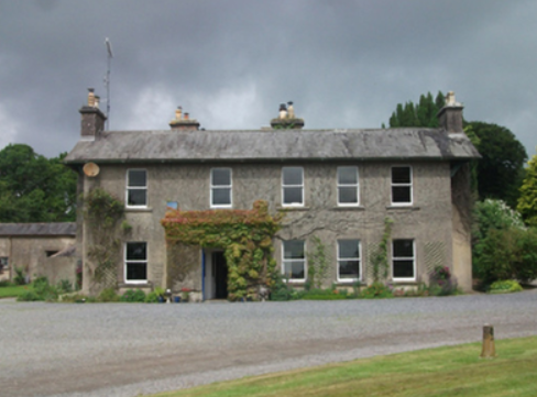
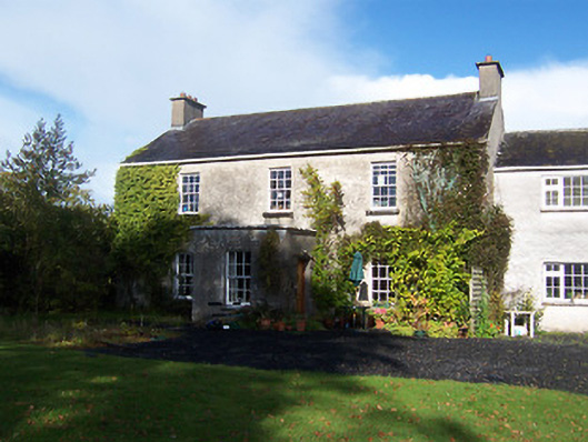
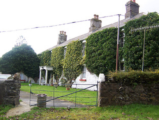
| Lickbla House [ Rockbrook](Fore) | Thomas Fagan was leasing this property from James Fallon at the time of Griffiths Valuation in the early 1850s when it was valued at almost £19 and included a mill. In 1906 it was the property of Patrick J. Fagan and valued at almost £21. The National Inventory of Architectural Heritage suggests that it dates from c.1800 but with later modifications. It is labelled Rockbrook on the 1st edition OS map but as Lickbla House on later editions and is still extant and occupied. |
](https://landedestates.ie/storage/img/orig/3618.png)
|
| Newcastle (Fore) | Walter Keating was occupying Newcastle at the time of Griffiths Valuation in the early 1850s when it was leased from the Urquhart estate and valued at £19. In 1839 the Valuation Office Books indicate that George Keating was the occupier with a valuation of £23. It is still extant. | |
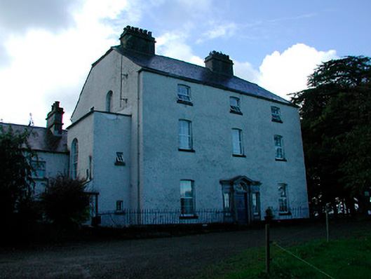
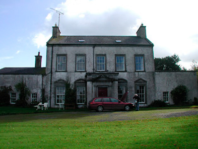
| Turbotstown [Turbotstown House] | The National Inventory of Architectural Heritage suggests that the present house at Turbotstown was built in the early decades of the nineteenth century, on the site of an earlier house. At the time of Griffiths Valuation in the early 1850s it was held in fee by Gerald Dease when the buildings were valued at £80. In 1906 it was still the property of Major Gerald Dease and valued at £84. It was occupied by the Dease family until the 20th century and is still extant. O'Brien provides a detailed account of this house and its occupants. On the 1st edition Ordnance Survey map it is labelled Turbotstown House but on the 25-inch edition of the early 20th century it is labelled Turbotston. |
![Photo of Turbotstown [Turbotstown House]](https://landedestates.ie/storage/img/orig/3616.png)
|
| Lakeview House (Fore) | John Smith was leasing this property from Reverend Thomas Smith at the time of Griffiths Valuation when it was valued at £15. The Valuation Office books of 1838 state that the house then held by Reverend Thomas Smith was valued at £16. It is still extant and in use. | |
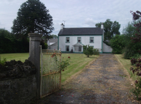
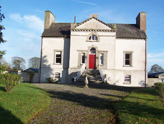
| Mayne Glebe [Mayne Rectory] | Mayne Rectory was leased by Reverend William Eames from the estate of Reverend Thomas Smith at the time of Griffiths Valuation when it was valued at £8. In 1839, the Valuation Office books recorded that it was occupied by Reverend Richard Handy and had a valuation of almost £9. The National Inventory of Architectural Heritage suggests it was built c.1812. It is still extant and in use. |
![Photo of Mayne Glebe [Mayne Rectory]](https://landedestates.ie/storage/img/orig/3615.png)
|