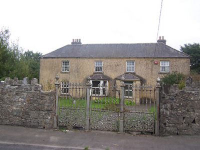
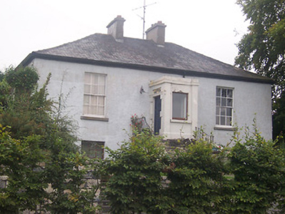
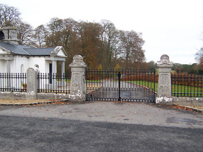
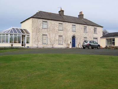
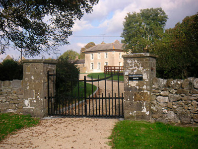
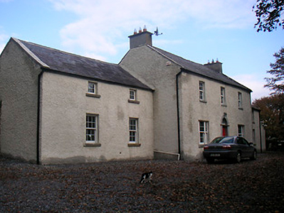
Cooksborough House
Houses within 10km of this house
Displaying 55 houses.
Houses within 10km of Cooksborough House
Displaying 55 houses.
| House name | Description | |
|---|---|---|
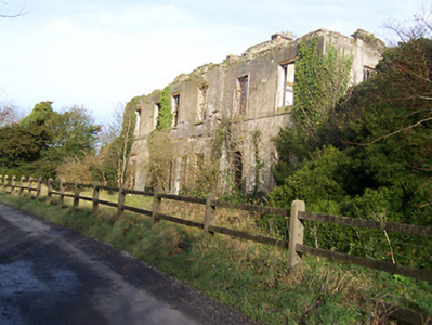
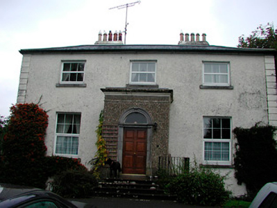
| Ballynagall | Ballynagall, a six-bay two-storey Regency style house, built in the early 19th century for James Gibbons at the cost of £30,000 (Lewis) and was reputedly built using the fabric of an existing castle on site, known as Castle Reynell (boi). Reynell of Castle Reynell is recorded on the Taylor and Skinner maps of the late 1770s. The interior plasterwork was executed by George Stapleton, son of the stuccadore Michael Stapleton. The Smyth Papers in the National Library contain letters to James Gibbons from John Robinson and Francis Johnston relating to the building of Ballynagall, 1810-1815 (Mss 18,926-18,927). Ballynagall remained in the possession of the Gibbons family until 1846 when ownership passed to James Middleton Berry, nephew of James Gibbons. At the time of Griffith’s Valuation (publ. 1854) the buildings were valued at £110 and held by JWM Berry in fee. Inherited by Thomas James Smyth of the Drumcree family in 1855, it remained in Smyth ownership until sold in 1963 (O’Brien). It is now a ruin. |
|
| Martinstown | Martinstown is marked on the first edition OS map but is named on the later 25 inch map. It was built c.1820, on a L-shaped plan with two-storey return to the rear (boi). John Kerr held most of this townland from Thomas R Evans at this time and occupied the house valued at £12. Other Kerr family members occupied houses valued at £7 and £8.10. |
|
| Kilmaglish | Kilmaglish House not built at time of first edition OS map but is marked on the 25 inch map. At the time of Griffith’s Valuation (publ. 1854) it was valued at £17, occupied by William Levinge and held from Sir Richard Levinge. Occupied by Thomas Robinson, a farmer and his son William in 1901 and 1911. It is still extant surrounded by large farmyard. | |
| Claremount House | The original house is named on the first edition OS map and the present house on the 25 inch map. It is a four-bay two-storey country house built after Griffith’s Valuation (publ. 1854) and replaced an earlier Claremount House, located to the northwest and marked on the Taylor and Skinner maps of the late 1770s, when occupied by Tyrrell Esq. From the mid-18th century this property was leased by the Tyrrells from the Rochforts of Belvedere. The present house was built and remained the home of the Ronaldsons until 2015 when it was advertised for sale. |
|
| Enniscoffey | Named on the first edition OS map and the 25 inch map, this was a late 18th century two-bay, two-storey house built in front of an older house. In 1837 Mark Anthony Levinge was residence, as he was also at the time of Griffith’s Valuation (publ. 1854), when the house was valued at £34 and held with over 900 acres from Daniel Molloy. Tenison Levinge and his wife were the occupants in 1901 and 1911. The house is now demolished. | |
| Woodville | Named on the first edition OS map, this is a three-bay two-storey over basement country house, built about 1785. At the time of Griffith’s Valuation (publ. 1854) it was the home of John G O’Keeffe, who held the house valued at £10.10 from Daniel Molloy. Functioned as a restaurant for a time and was recently for sale. |
|
| Gaybrook House | This house was built on land originally belonging to the Gay family who sold it to Ralph Smyth before the end of the 18th century. Smyth built the three-storey three-bay house which had extensive outbuildings and pleasure grounds as shown on the first edition OS map. Leet records him as the occupant in 1814 and his widow Mrs A Smyth was resident in 1837. Their son Robert was the occupant at the time of Griffith’s Valuation (publ. 1854) holding the house valued at £95 in fee. Col James Smyth and family were resident at the beginning of the 20th century. The house was demolished by the Land Commission about 1960 (boi). | |
| Rathcam or Lemongrove House | Rathcam House, previously known as Lemongrove, is a four-bay two-storey house, built about 1830 to replace an earlier house. Lemmongrove is marked on the Taylor and Skinner maps of the late 1770s occupied by Wilton Esq. Joseph Lemmon of Lemmongrove is mentioned in a deed of assignment dated 1771. Leet records Joseph Lemon of Lemongrove in 1814. Valued at £18, it was occupied by John ‘Lennon’ at the time of Griffith’s Valuation (publ. 1854) and held from Christopher Wilson [Wilton?]. The Lemons were still resident at the beginning of the 20th century. John D Lemon was the occupant in 1906 when the mansion house was valued at £23 and held with 262 acres of untenanted land. |
|
| Larkfield House | Larkfield House, situated in the southern half of the small 17 acre townland of Clonmoyle, its demesne was situated to the south in the townland of Vilanstown. It is named on the first edition OS map. In 1837 it was occupied by Francis Pratt Smyth, who was also resident at the time of Griffith’s Valuation (publ. 1854) when the house was valued at £20.15 and held from Frederick Lestrange. Larkfield was still in the possession of the representatives of the Rev Samuel L’Estrange when it was part of a sale of Violetstown in the Encumbered Estates Court on 4 July 1874. Mrs Henrietta Hodson and her daughter occupied the house in 1901 and in 1911. The site is now a green field. | |
| Lynn Lodge | Lynn Lodge previously known as Lynn House, as named on the first edition OS map. A three-bay two-storey house, built early 19th century by the Swift family, possibly incorporating the fabric of an earlier structure. Jonathon Swift (1667-1747) wrote letters from Lynn House. Lynn the property of Swift Esq is recorded on the Taylor and Skinner maps of the late 1770s. It was the residence of Meade Swift in 1814. Lynn House was in the ownership of R. Swift and was the residence of the Rev. G. M. Dennis in 1837. By 1850 the house was known as Lynn Lodge and was occupied by Toriano L’Estrange when the interest of Richard Swift in the property, consisting of the house and about 100 acres was for sale in the Encumbered Estates Court. Valued at £23 at the time of Griffith’s Valuation (publ. 1854), occupied by John Cronin and held from Terence D Nolan. In 1906 Charlotte Swifte occupied a mansion house valued at £23 at Lynn which she held with 72 acres of untenanted land. This house is now the centre of a stud. |
|
| Lynn House | Lynn House, situated close to the shore of Lough Ennell, is named on the 25 inch map at this location. A house, offices, gatelodge and lodge were all held by Richard Swift MD in fee at the time of Griffith’s Valuation (publ. 1854), when they were valued at £12. A building remains on this site. | |
| La Mancha | La Mancha is situated facing Lough Ennell and named on the first edition OS map. This house was occupied by William Wynne in 1814 and was the property of Richard Swift in 1837, who held it in fee and valued at £18 at the time of Griffith’s Valuation (publ. 1854). This house is still extant. |
|
| Bloomfield | Bloomfield is named on the first edition OS map, situated close to the shore of Lough Ennell, it is now a hotel and leisure centre. O’Brien writes that the house was a long low two-storey nine-bay building now greatly altered. It was most likely built by the widow of the 2nd Earl of Belvedere after her marriage to Abraham Boyd in 1815. In 1837 Lewis records the Countess of Belvedere as the proprietor. Purchased [or leased] by Col John Caulfield of Benown/Harmony Hall in 1842 from George A Boyd who had inherited it from his mother. At the time of Griffith’s Valuation (publ. 1854) Col Caulfeild was the occupant holding the house valued at £40 from George A Boyd. Purchased by Charles B Marlay later in the 19th century. Functioned as a military hospital and convent in the 20th century until it became a hotel in the 1980s. | |
| Lynnbury | Lynnbury, situated near the shore of Lough Ennell, is named on first edition OS map. It is a two-storey, three-bay late 18th century house building, home of Thomas Swift who married Frances Dennis. He died in 1803 and was succeeded by his eldest son Rev Meade Swift, (died 1837) who took the additional name of Dennis when he and his brother John inherited the estates of their uncle James Dennis, Lord Tracton (O’Brien). Richard Bourne resided in the house in 1837. At the time of Griffith’s Valuation (publ. 1854) the house was valued at £40, occupied by Captain Charles Wynne and held from Paul Meade Dennis. In 1906 Lynnbury, valued at £65 was occupied by Gustavus Rochfort Hyde, who held it with 83 acres of untenanted land, see Wade of Aughrim. This house has been restored in recent times. |
|
| Ennel Lodge/Fort William | Ennell Lodge, previously known as Fort William as shown on the first edition OS map. This is a three-bay two-storey over basement house, built about 1800. It was valued at £13 but unoccupied at the time of Griffith’s Valuation (publ. 1854). Eliza Dennis was the immediate lessor. |
|
| Belville Cottage | Belville Cottage, five-bay single-storey house, built about 1820, marked on the first edition OS map and named on the 25 inch map. At the time of Griffith’s Valuation (publ. 1854) it was occupied by Florence Mahony, held from Eliza Dennis and valued at £10. |
|
| Clonmoyle House | Clonmoyle House, Tullanisky, is a two-storey, three-bay over basement house. The present house was built after 1838 and replaced an earlier house as recorded on the first edition OS map. In 1814 the older house was the home of David Jones. O’Brien writes that David Jones married Frances, daughter of Alexander Swift of Lynn in 1771. By the time of Griffith’s Valuation (publ. 1854) Charles Joley or Joly was resident holding the house valued at £35 from Thomas Walsh. Henry E Joly was in possession in the 1870s. |
|
| Annaskinnan | Annaskinnan, located just south of the Grand Canal and west of Hyde Park, this house had laid out gardens marked on the first edition OS map. It was part of the estates belonging to the Crown in the early 19th century. At the time of Griffith’s Valuation (publ. 1854) the house was valued at £13, occupied by William Garty and held from Alexander Montgomery. Members of the Garty family were still resident in 1901. Complex of buildings now located on the site. | |
| Corbetstown | Corbetstown house, a D’Arcy home, is named on the first edition OS map. It is a three-bay two-storey over basement house, built about 1820. It must have replaced an earlier house as a D’Arcy is recorded at Corbetstown in the late 1770s. Francis D’Arcy was resident in 1814 and John D’Arcy in 1837. By the time of Griffith’s Valuation (publ. 1854) Joseph Purser was resident holding the house valued at £32 from the Earl of Longford. Occupied by Elizabeth and Frances Reynell in 1911, this house remains extant. |
|
| Curristown | Curristown House was a property in the ownership of the Purdon Family from about 1760. The house, a two-storey, three-bay late 18th century building, was the home of George Purdon in 1814 and 1837. Valued at £21 it was unoccupied at the time of Griffith’s Valuation (publ. 1854). Augustus C Purdon was the immediate lessor. Occupied by Algernon Briscoe and family in 1901, the house remained a Briscoe home until the mid-20th century. It was demolished in the late 20th century. |
|
| Huntingdon | Huntingdon, a five-bay two-storey over basement country house, built about 1770 by the Purdon family, it remained a Purdon home for all of the 19th century. Robert Purdon was resident in 1814 and 1837. Augustus Cooke Purdon held the house from Robert Purdon at the time of Griffith’s Valuation (publ. 1854), when it was valued at £20. Purdon family members were still resident in the early decades of the 20th century and the house remains extant. |
|
| Joristown | Joristown House, set in a large demesne, with a deer park to the west, as recorded on the first edition OS map, this was a Purdon home from the early 19th century as Peter Purdon was resident in 1814 and 1837. At the time of Griffith’s Valuation (publ. 1854) the house was unoccupied, valued at £16 and held from Augustus C Purdon. Shepherd Hugh Lambe was living in a house in Joristown with two of his cousins, held from General Purdon in 1901 and John Purdon in 1911. This house is now demolished. |
|
| Lisnabin Castle | Lisnabin House, located a short distance south east of Huntingdon, this three-bay two-storey castellated country house was built about 1824 by Edward Purdon to replace an earlier house that burnt down and which is referred to on the Taylor and Skinner maps of the late 1770s and by Leet in 1814 as the home of Edward Purdon. Described as 'a handsome castellated mansion recently erected', by Lewis, it was valued at £40 at the time of Griffith’s Valuation (publ. 1854) and was the residence of the same Edward Purdon who held it in fee. His son George Nugent Purdon of Lisnabin owned over 1,000 acres in the 1870s and it remained a Purdon home until the early 21st century when it was sold. |
|
| Riggs Villa/Greenhills | Located a short distance north west of Killucan, this building is named Riggs Villa on the first edition OS map and Greenhills on the 25 inch map. It is a three-bay two-storey house, built about 1830, with two-bay two-storey return to the northeast (boi). Riggville Cottage was the home of Edward Riggs in 1814 and of Anthony Fawcett at the time of Griffith’s Valuation (publ. 1854) when it was valued at £11.10 and held from the Earl of Longford. Two Fawcett sisters were living in Killucan at the time of the 1911 census. This house is extant. |
|
| Lowtown House | Lowtown House described by O’Brien as a late 17th century, two-storey, nine-bay house over a basement built by Anthony Dopping, Bishop of Meath. Generations of Doppings lived here including four successive Anthonys. The house is referenced in Taylor and Skinner maps of the 1770s. In 1814 Samuel Dopping resided and in 1837 his son William lived here. In 1843 William married Jane daughter of the Rev Cecil Crampton and they emigrated to Australia, as did his older brother Anthony John some years later. William Dopping and his mother Anne of Lowtown appear to have been having financial difficulties in 1842 as two judgements against them for a debt of £1,840 was assigned to Philip Crampton, Lowtown, Co Westmeath MD and George Ribton Crampton, Upper Mount St, Dublin, see Dopping-Hepenstal Papers in NLI Ms. 35,871 (7). Anne Dopping, widow of Samuel, was living in the house at the time of Griffith’s Valuation (publ. 1854). It was valued at £28 and she held it in fee. Occupied by Eleanor Mary Crampton at the beginning of the 20th century and then by the Glennon family. Sold to the Land Commission in the 1950s the house was subsequently demolished and is now a green field site. | |
| Woodfort | Woodfort, named on the first edition OS map, situated in a small demesne. This was a five-bay two-storey house built about 1800 and altered in the mid-19th century. At the time of Griffith’s Valuation (publ. 1854) it was occupied by Edmond R Nugent, held from the Earl of Longford and valued at £10. Now part of an extensive business complex. |
|
| Riverstown House | Riverstown House, originally known as Rathwire House, this five-bay single-storey over basement villa, was built about 1830 and was associated with a former corn mill run by the Hannons (boi). Occupied by Benjamin Hannan, valued at £15 and held from the Earl of Longford at the time of Griffith’s Valuation (publ. 1854). Samuel Clarke, agent and his wife lived here in 1901 and William Bailey, ex RIC and land agent’s assistant and his family were resident in 1911. It was bought by a Father O'Rourke in 1935 who opened the first Camillian Juniorate in Ireland here in 1949, it now functions as St Camillus Care Centre. |
|
| Wardenstown | Wardenstown is a five-bay two-storey early 18th century country house, built c.1810 possibly incorporating the fabric of an earlier house. The house is believed to have been three-storey high when built but was later reduced in height following a fire (boi). The Berry family lived at Wardenstown in the early 18th century. The Wardenstown Papers record that the estate was later acquired by the Vandeleur family from Kilrush, Co Clare through a connection with the Knight of Kerry (PRONI D3549/F). It is probable that the Vandeleurs built the present house. In 1814 George Webb lived at Wardenstown and in 1837 T M Webb. At the time of Griffith’s Valuation (publ. 1854) Capt Crofton Thomas Vandeleur occupied the house valued at £20 and held from the Knight of Kerry and other Fitzgerald family members. Capt Crofton T. Vandeleur, lived here in the 1870s and it was still the home of members of the Vandeleur family in the early years of the 20th century. In more recent times the home of the Potterton family. |
|
| Clonlost | Clonlost house is shown amidst a large demesne on the first OS map. The Nugent family were settled at Clonlost from the 17th century. The house was a two-storey, five-bay, late 18th century building (O’Brien). In 1814 it was the home of Lt Col Nugent. Lewis records it as the ‘ancient family seat of J Nugent’. At the time of Griffith’s Valuation (publ. 1854) Captain John J Nugent held it in fee when the house was valued at £40 and he owned an estate of over 3,000 acres in the 1870s. His daughter married William Lamb Palmer of Rahan, Co Kildare and it was their son Charles Colley Palmer who inherited Clonlost. Members of the Palmer family were still resident in the early years of the 20th century. The house is now a ruin. | |
| Edmondstown | Edmondstown named on both the first six inch and 25 inch OS maps. At the time of Griffith’s Valuation (publ. 1854) Richard W Reynell was the occupier, holding the house valued at £10 from the representatives of Marcus Sinnott. Buildings remain at the site. | |
| Killynan House | Killynan House was located on the border between the two Killynan townlands of Pratt and Cooke. It was the home of the Reynell family who held it from the Winter family. Reverend Edward Reynell is recorded on the Taylor and Skinner maps of the late 1770s and was resident until his death in 1788. He was succeeded by his son Richard who occupied the house in 1814 and 1837. Richard was later succeeded by his son, Richard Winter Reynell, who died in 1887. The Reynells were related to the Winter family. This house is now demolished but outbuildings survive. |
|
| Clondrisse House | Clondrisse House, a small building marked on the first edition OS map and named on the 25 inch map. A small two-bay two-storey over basement house built about 1800 and extended in the late 19th century. O’Brien writes that it was the home of Myles O’Reilly in the first two decades of the 19th century. Rev Francis Winter, vicar of the nearby St. John the Baptist's Church of Ireland church was the occupant in the 1840s while Rodney Purdon was resident at the time of Griffith’s Valuation (publ. 1854), holding the house valued at £16, from Samuel Winter. Home of Major John Purdon retired in 1911. |
|
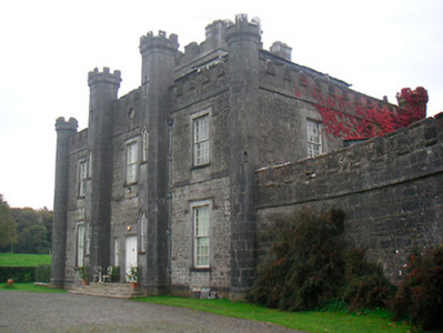
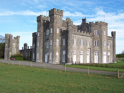
| Knockdrin Castle | A Gothic Revival castle built about 1815; it is not recorded by Leet. Located east of Lough Owel and north of Lough Drin, this castle was built by Sir Richard Levinge (1785-1848) 6th Bt to replace High Park, the Levinges’ old family home and was designed, most probably, by James Shiel. It was valued at £100 in 1906. The Castle remained the home of the Levinge family until the mid-20th century when it was sold. It is now the home of the Prondzyunski family. |
|
| Rathconnell Court | Rathconnell Court is named on the first edition OS map and marked as ruins on the 25 inch map of the early 20th century. It was the home of the Adams family and was marked on the Taylor and Skinner maps of the 1770s. Occupied by Francis Adams in the early 19th century and by J Adams in 1837. Francis Adams was resident at the time of Griffith’s Valuation (publ. 1854) holding the house valued at £18 in fee. | |
| Reynella | Reynella House is a seven-bay two-storey country house on T-shaped plan built about 1770 by Richard Reynell. In 1814 it was the seat of Richard M Reynell and in 1837 Lewis records that Reynella was 'the elegant residence of the late R. M. Reynell, Esq., now the property of a minor, situated in a fine demesne, adorned with a lake and extensive plantations'. Valued at £27 it was occupied by John Rynd at the time of Griffith’s Valuation (publ. 1854) and held from Blayney T Balfour. This house was home to the broadcaster Marian Finucane and her husband in the 1980s and was a guest house in more recent years. |
|
| Ballinderry Cottage | Ballinderry cottage, named on both the first six inch and 25 inch maps, Ballinderry was originally a home of William Judge of Mosstown (O’Brien). Located on the southern outskirts of Mullingar, at the time of Griffith’s Valuation (publ. 1854) Godfrey Fetherstonhaugh held the building valued at £11 from Anne ‘Cowper’ or Cooper. Home of the Bayley family at the beginning of the 20th century. O’Brien writes that a hospital now stands on the site. | |
| Ballyglass | Ballyglass, a four-bay two-storey house, built about 1820, is named on both the first six inch and 25 inch OS maps and located just north east of St Finian’s College near Mullingar. In 1814 it was the home of John McLaughlin. At the time of Griffith’s Valuation (publ. 1854) James William McLoughlin resided, holding the house valued at £16.10 in fee. This house is still extant. |
|
| Charlestown House | Charlestown House, Balnamona, is named on both the first six inch and 25 inch maps. It was the home of Tennison Lyons in 1814. Hill J M Walsh was resident here at the time of Griffith’s Valuation (publ. 1854) when the house was valued at £15 and held from John C Lyons. There is a building still on the site, part of Charlestown stud. | |
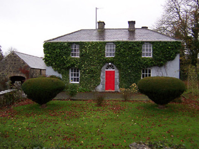
| Clonard House | Bellview, now known as Clonard House, is a two-bay two-storey over basement house, built about 1800, located in the town of Mullingar, home of the Walsh family. Robert Walsh was resident in 1814 and Thomas Walsh in 1837. He was still resident at the time of Griffith’s Valuation (publ. 1854), when the house was valued at £40 and held in fee. In 1876 Thomas Walsh of Bellvue owned 528 acres. In the mid-20th century this house was the residence of the Catholic Bishop of Meath. Since then it has been a tourism headquarters and an entertainment venue (O’Brien) and was for sale in 2022. |
|
| Culleen House | Culleen House is marked on the first edition OS map and had greatly expanded by the time of 25 inch, only the outbuildings remain now. O’Brien describes it as long, low seven-bay, two storey early Victorian house, purchased by Mr Mc Loughlin, a Dublin merchant, from Sir John de Blaquiere of Portloman. A Thomas McEvoy occupied Culleen in 1814. It was later sold to Godfrey Levinge, a grandson of the 4th Baronet, who was resident at the time of Griffith’s Valuation (publ. 1854), holding the house, valued at £30 in fee. Home of Thomas M Reddy and family at the time of the 1901 and 1911 censuses. This house is no longer extant. | |
| Levington Park | Levington Park is located close to the southern shore of Lough Owel. The seat of a branch of the Levinge family from the mid-18th century, it is a nine-bay two-storey country house with two-storey returns to the rear at either end (north and south), built about 1748 by Sir Richard Levinge 4th Baronet and altered in the early 19th century (boi). In 1814 Lady Levinge was resident. It was inherited by the 4th Baron’s second son Richard Hugh Levinge who was the owner in 1837. Valued at £27 at the time of Griffith’s Valuation (publ. 1854), occupied and held by Charles William Levinge in fee. Members of the Levinge family were still resident in 1901 but Hugo Fitzpatrick and his wife Gertrude were living here in 1911. O’Brien writes that Levington Park was later the residence of Edmund Dease, formerly of Turbotstown House. His son Maurice was the recipient of the first posthumously awarded Victoria Cross of World War I. The house had other owners until purchased by the author J P Donleavy in 1972. He died in 2017. |
|
| Annebrook | Annbrook or Annebrook in the town of Mullingar was originally a three-bay two-storey over basement house, built about 1810. It was the home of Dr Robert Barlow in 1837 and at the time of Griffith’s Valuation (publ. 1854), when it was valued at £38 and held from the Earl of Granard. Still a doctor’s residence in 1911 when Dr Joseph Dillon Kelly and his wife lived at Annebrook. Now functions as a hotel, the Annebrook House Hotel. See https://www.annebrook.ie/ |
|
| Monte Video/Prospect | This house was named Monte Video on the first edition OS map and as Prospect on the 25 inch map. A doctor’s residence at the time of Griffith’s Valuation (publ. 1854) when Dr Ferguson was in occupation. Valued at £13 it was held from Anne Cowper or Cooper. It was originally located on the outskirts of Mullingar but is now surrounded by a housing estate |
|
| Springfield (Mullingar) | Springfield, on the outskirts of Mullingar, is named on both the first six inch and 25 inch maps. At the time of Griffith’s Valuation (publ. 1854) it was occupied by Thomas Tuite, held from Charlotte Tighe and valued at £20. Now demolished and replaced by Assumption Villas. | |
| Sheepstown House | Sheepstown house is named on the early 20th century 25 inch OS map. At the time of Griffith’s Valuation (publ. 1854) it was occupied by James Seery, valued at £15 and held from the representatives of Robert M Tighe. The Seery family were still resident at the beginning of the 20th century. This house is extant. | |
| Dardistown | Dardistown, described by O’Brien as a two-storey, three-bay Georgian house, a Fetherstonhaugh home in the late 18th century. In 1837 Lewis records ‘Durdistown’ as the seat of Theobald Fetherstonhaugh. By the time of Griffith’s Valuation (publ. 1854) the Metge family was in possession. John Branigan held the house valued at £12 from John C ‘Medge’ Metge. The Simons family were living in a first class house at Dardistown at the beginning of the 20th century. Buildings still occupy the site. | |
| Killagh House | Killagh House, named on the first edition OS map with a tuck mill and two corn mills closeby. This five-bay two-storey house was built about 1740 and a three-storey tower house is connected to the rear. At the time of Griffith’s Valuation (publ. 1854) it was valued at £10, occupied by Patrick Connell and held from Sir John Nugent. This building is no longer in use. https://www.antaisce.org/killagh-house-killeagh |
|
| Rockview House | Rockview House is a three-bay three-storey building over a basement. It was built in the early 19th century (but not recorded by Leet) for the Fetherstonhaugh family. In 1837 Mrs Richard Fetherstonhaugh was resident. At the time of Griffith’s Valuation (publ. 1854) her son Richard occupied the house, valued at £70 and held from Thomas J Fetherstonhaugh. The Fetherstonhaugh family continued to occupy the house well into the 20th century and it remains a private residence. |
|
| Dysart | Dysart, located south of Delvin, is a three-bay two-storey over basement Palladian house built about 1757, for the Ogle family to designs by George Pentland. In 1814 and 1837 Nicholas Ogle was resident. By the time of Griffith’s Valuation (publ. 1854) Henry Ogle was the occupant holding the house valued at £25 in fee. The Ogle family still live here. |
|
| Gigginstown House | The original house, Gigginstown Lodge, was a Dardis home and is marked on the first edition OS map. It was occupied by Christopher Dardis in 1814 and Captain Brabazon O’Connor in 1837, who had married the widow of Michael Dardis. It is no longer extant (N528 615). Gigginstown House is described by O’Brien as ‘a two-storey, three-bay classical house designed by John S Mulvany’ built in the mid-1850s on a new site and recorded as unfinished at the time of Griffith’s Valuation (publ. 1854). Valued at £40, Elizabeth Busby was the occupant holding the house in fee. The property had been bought on her behalf and that of her sister in 1828. Alphonso Busby owned 1,408 at Gigginstown in the 1870s. James Taylor, farmer and his wife Kate were resident in the early 20th century. A stud and farm are now located at Gigginstown House, owned by Michael O’Leary, see https://www.gigginstownhouse.com/wp/ |
|
| Gartlandstown House | Gartlandstown House, located at the south eastern toe of Lough Derravargh, is a five-bay two-storey house, built about 1830 (boi) or perhaps replacing an earlier house as Garlandstown, Castlepollard, was the seat of Sterne Tighe in 1814. By 1837 J Murray was resident here and James Murray is recorded as the occupant at the time of Griffith’s Valuation (publ. 1854) when the house was valued at £10 and held from James W M Berry. O’Brien writes that Michael Hope was resident in 1869 and in the mid-1870s the representatives of Michael Hope held 487 acres at Gartlandstown. Members of the Hope family was still in occupation at the time of the 1901 and 1911 censuses. |
|
| Clondalever House | Clondalever House is marked on the first edition OS map, but expanded and named on the 25 inch map. At the time of Griffith’s Valuation (publ. 1854) it was valued at £14, occupied by Edward Hope, who held it from George W Mansell or Maunsell (Oakley Park). A house is still located on this site. | |
| Streamstown House | Streamstown House, located on the eastern shore of Lough Derravargh, is a five-bay two-storey house, built about 1800. At the time of Griffith’s Valuation (publ. 1854) it was occupied by Thaddeus Lynch, valued at £11 and held from Benjamin Chapman. Michael Hope, JP and farmer, and family were resident here in 1901 and his widow Eliza and family in 1911. |
|
| Craddanstown House | A building is marked on the first edition OS map at this site which is greatly expanded and named on the 25 inch map as Craddanstown House. The originally house probably dates from the early 19th century and the building was extensively altered sometime in the mid-19th century. Valued at £10 and occupied by James Gibson at the time of Griffiths Valuation (publ. 1854), when it was held from the Earl of Longford. James Gibson and family were still resident at the beginning of the 20th century. |
|
| Craddanstown Lodge | Craddanstown Lodge is named on the first edition OS map as Craddanstown House, and on 25 inch as Craddanstown Lodge. It is a three-bay two-storey house, built about 1800, with two storey wings on each side. Craddenstown House was the home of Lockhart Ramage in 1814 and 1837 so must refer to the Lodge. Lockhart Ramage was resident at the time of Griffith’s Valuation (publ. 1854), when the house was valued at £17 and held from the Earl of Longford. The census of 1911 records Lockhart Ramage aged 82, gentleman farmer, as head of the household. O’Brien writes that the house was sold in 2013 and it was on the market again in 2017. This house was more substantial than the other Craddanstown until the other was altered about 1860. |
|