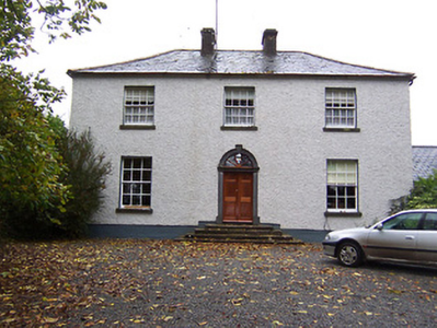
Sidebrook House
Houses within 5km of this house
Displaying 7 houses.
Houses within 5km of Sidebrook House
Displaying 7 houses.
| House name | Description | |
|---|---|---|
| Far View House | Far View House, an early 19th century two-bay, three storey house, originally a home of the North family. David North who married Catherine Pim was resident in 1837 and at the time of Griffith’s Valuation (publ. 1854), when the house was valued at £15 and held from Catherine Reynolds. The house was occupied by the Gavin family in the early 20th century. |
|
| West House | West House is a five-bay two-storey over a basement country, built about 1760, having projecting single-bay wings. O’Brien states that it was built by a family named West and that it was sold to Patrick Gavin in 1822 and that this family still live there. In 1814 it was the residence of Robert Johnston. At the time of Griffith’s Valuation (publ. 1854) it was valued at £9.10, occupied by Patrick Gavin and held from Catherine Reynolds. |
|
| Drumman Lodge | Drumman Lodge is named on first edition OS map. It is an early 19th century house of three-bays and two-storeys. In 1837 it was the home of T.M. Carew. At the time of Griffith’s Valuation (publ. 1854) Henry Green was the occupant, holding the house valued at £15 from an estate in Chancery, Rochfort v Brown. O’Brien writes that the Gavin family were resident between 1930s and 1980s and that the house has been recently restored. |
|
| The Cottage | The Cottage, Gallstown, is named on both the first edition OS map and the 25 inch. This was the seat of the North family at the end of the 18th century (O’Brien). By 1814 Hugh Sheil was resident and Lewis records Mrs Sheil of The Cottage. This family was related to the Sheils of Gortlumly. The house was occupied by Margaret Sheil at the time of Griffith’s Valuation (publ. 1854), valued at £10 and held from Lord Kilmaine. Home of employees of Lord Kilmaine in the early 20th century. The house is no longer extant. | |
| Gortumly | Lewis refers to John Sheil of Gortumly and a long building is evident in this townland on the first edition OS map. O’Brien writes that the Sheils were resident at Gortumly from the mid-18th century. Gortumly house is named on the 25 inch map and is located just south of the long building on the first edition map. O’Brien writes that the Sheils bequeathed the house to a Mr O’Neill about 1910. Patrick O’Neill, a farmer and clerk to the County Council, was resident with his family in 1911. The lands were later sold to the Land Commission and the house demolished. | |
| Whitewell House | Originally a home of the North family and occupied by Arthur Grose in 1837. At the time of Griffith's Valuation (publ. 1854) Whitewell was the residence of John G Battersby MD, valued at £9.10 and held from John North. O'Brien records that Elinor widow of John Roger North died here in 1858 and that the lands and house were leased to Laurence and Michael Gavin in 1859. The Gavins still own the lands but the house is a ruin. | |
| Gallstown | Gallstown/Gaulstown House was a large country house with extensive grounds as shown on the first edition OS map on which the house is named as Castletown, although the Taylor and Skinner map of the late 1770s refer to the house as Gaulstown Park. Its name changed to Gallstown House on the 25 inch map. It was an 18th century, three storey, seven-bay Palladian style house built by the 2nd Earl of Belvedere to replace the house in which his mother was imprisoned for over thirty years. In 1784 Sir John Browne of The Neale, Co Mayo, later 1st Baron Kilmaine, purchased the house from the 2nd Earl of Belvedere. Lord Kilmaine was recorded as resident in 1814, 1837 and at the time of Griffith’s Valuation (publ. 1854). Lewis refers to Gaulstown Park as the ‘splendid seat of Lord Kilmaine in the grounds of which is a very large larch tree, planted by Dean Swift’. The house was valued at £66 in the mid-19th century. O’Brien writes that the 5th Baron Kilmaine sold the house at Gallstown in 1918 and it was burnt in 1921 and the ruins demolished in the 1950s. |