| Description |
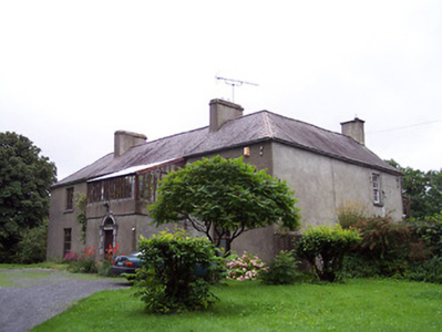
Sidebrook house is marked on the first edition OS map and named on the 25 inch map. It is a four-bay two-storey house built in the early 19th century and may incorporate the fabric of an earlier house. Taylor and Skinner record a Rochfort Esq at Sidebrook in their maps surveyed 1777-1783. It was later in the ownership of a J. Rochfort in 1837. At the time of Griffith’s Valuation (publ. 1854) John Rochfort held the house valued at £11 with 600 acres from Cooper Rochfort. In the possession of the Lawrence family for most of the 20th century. |