Barony: Fartullagh
Houses
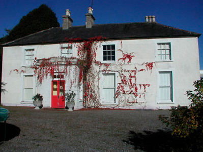
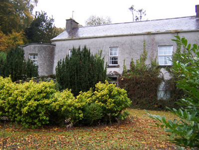
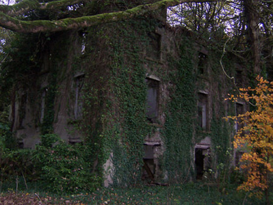
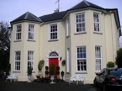
Displaying 39 houses.
| Name | Townland | Civil Parish | PLU | DED | Barony | County | Map Ref | |
|---|---|---|---|---|---|---|---|---|
| Carrick | Carrick | Carrick | Mullingar | Carrick 98 | Westmeath |
OSI Ref: N421447
OS Sheet: Discovery map: 48 |
|
|
| Robinstown | Robinstown | Carrick | Mullingar | Carrick 98 | Westmeath |
OSI Ref: N409244
OS Sheet: 33 Discovery map: 48 |
|
|
| Far View House | Castlelost West | Castlelost | Mullingar | Clonfad | Westmeath |
OSI Ref: N447405
OS Sheet: 33 Discovery map: 48 |
|
|
| West House | Castlelost West | Castlelost | Mullingar | Clonfad | Westmeath |
OSI Ref: N442409
OS Sheet: 33 Discovery map: 48 |
|
|
| Drumman Lodge | Drumman | Castlelost | Mullingar | Milltown | Westmeath |
OSI Ref: N494418
OS Sheet: 33 Discovery map: 48 |
|
|
| Sidebrook House | Farthingstown | Castlelost | Mullingar | Castlelost | Westmeath |
OSI Ref: N473397
OS Sheet: 33 Discovery map: 48 |
|
|
| The Cottage | Gallstown | Castlelost | Mullingar | Gaybrook 75 | Westmeath |
OSI Ref: N478422
OS Sheet: 33 Discovery map: 48 |
||
| Gortumly | Gortumly | Castlelost | Mullingar | Gaybrook 75 | Westmeath |
OSI Ref: N473421
OS Sheet: 33 Discovery map: 48 |
||
| Calverstown | Calverstown | Clonfad | Mullingar | Clonfad 100 | Westmeath |
OSI Ref: N410418
OS Sheet: 33 Discovery map: 48 |
|
|
| Dalystown House | Dalystown | Clonfad | Mullingar | Clonfad 100 | Westmeath |
OSI Ref: N403423
OS Sheet: 32 Discovery map: 48 |
||
| Dalystown | Dalystown | Clonfad | Mullingar | Clonfad 100 | Westmeath |
OSI Ref: N395425
OS Sheet: 32 Discovery map: 48 |
|
|
| Guilford House | Guilford or Davidstown | Clonfad | Mullingar | Clonfad 100 | Westmeath |
OSI Ref: N407393
OS Sheet: 33 Discovery map: 48 |
|
|
| Newcastle | Newcastle | Clonfad | Mullingar | Ballykilmore 96 | Westmeath |
OSI Ref: N422395
OS Sheet: 33 Discovery map: 48 |
|
|
| Templeoran House | Templeoran North | Clonfad | Mullingar | Clonfad 100 | Westmeath |
OSI Ref: N409394
OS Sheet: 33 Discovery map: 48 |
||
| Claremount House | Claremount or Cummingstown | Enniscoffey | Mullingar | Enniscoffey 74 | Westmeath |
OSI Ref: N498451
OS Sheet: 26 Discovery map: 48 |
|
|
| Woodville | Enniscoffey or Caran | Enniscoffey | Mullingar | Enniscoffey 74 | Westmeath |
OSI Ref: N486471
OS Sheet: 26 Discovery map: 48 |
|
|
| Enniscoffey | Enniscoffey or Caran | Enniscoffey | Mullingar | Enniscoffey 74 | Westmeath |
OSI Ref: N489458
OS Sheet: 26 Discovery map: 48 |
||
| Gaybrook House | Gaybrook Demesne | Enniscoffey | Mullingar | Gaybrook | Westmeath |
OSI Ref: N465464
OS Sheet: 26 Discovery map: 48 |
||
| Rathcam or Lemongrove House | Rathcam or Lemongrove | Enniscoffey | Mullingar | Enniscoffey 74 | Westmeath |
OSI Ref: N485453
OS Sheet: 26 Discovery map: 48 |
|
|
| Kilbride | Kilbride | Kilbride | Mullingar | Carrick 98 | Westmeath |
OSI Ref: N441439
OS Sheet: 33 Discovery map: 48 |
|
|
| Dunboden Park | Kilbride | Kilbride | Mullingar | Carrick 98 | Westmeath |
OSI Ref: N436445
OS Sheet: 33 Discovery map: 48 |
|
|
| Whitewell House | Whitewell | Kilbride | Mullingar | Carrick 98 | Westmeath |
OSI Ref: N447437
OS Sheet: 33 Discovery map: 48 |
||
| Larkfield House | Clonmoyle | Lynn | Mullingar | Russellstown | Westmeath |
OSI Ref: N478488
OS Sheet: 26 Discovery map: 48 |
||
| Lynn Lodge | Lynn | Lynn | Mullingar | Belvidere 80 | Westmeath |
OSI Ref: N438511
OS Sheet: 28 Discovery map: 41 |
|
|
| Lynn House | Lynn | Lynn | Mullingar | Belvidere 80 | Westmeath |
OSI Ref: N422497
OS Sheet: 28 Discovery map: 48 |
||
| La Mancha | Lynn | Lynn | Mullingar | Belvidere 80 | Westmeath |
OSI Ref: N424491
OS Sheet: 28 Discovery map: 48 |
|
|
| Bloomfield | Lynn | Lynn | Mullingar | Belvidere 80 | Westmeath |
OSI Ref: N424488
OS Sheet: 28 Discovery map: 48 |
||
| Lynnbury | Lynn | Lynn | Mullingar | Belvidere 80 | Westmeath |
OSI Ref: N427495
OS Sheet: 28 Discovery map: 48 |
|
|
| Ennel Lodge/Fort William | Lynn | Lynn | Mullingar | Belvidere 80 | Westmeath |
OSI Ref: N433493
OS Sheet: 28 Discovery map: 48 |
|
|
| Belville Cottage | Lynn | Lynn | Mullingar | Belvidere 80 | Westmeath |
OSI Ref: N428489
OS Sheet: 28 Discovery map: 48 |
|
|
| Clonmoyle House | Tullanisky | Lynn | Mullingar | Belvidere 80 | Westmeath |
OSI Ref: N446494
OS Sheet: 26 Discovery map: 48 |
|
|
| Violetstown | Vilanstown | Lynn | Mullingar | Belvidere 80 | Westmeath |
OSI Ref:
OS Sheet: 26 Discovery map: |
|
|
| Anneville | Anneville or Rathduff | Moylisker | Mullingar | Belvidere 80 | Westmeath |
OSI Ref: N438469
OS Sheet: 26 Discovery map: 48 |
|
|
| Belvidere/Belvedere | Belvidere | Moylisker | Mullingar | Belvidere 80 | Westmeath |
OSI Ref: N419476
OS Sheet: 26 Discovery map: 48 |
|
|
| Tudenham Park/Rochfort | Rochfort Demesne | Moylisker | Mullingar | Belvidere 80 | Westmeath |
OSI Ref: N418471
OS Sheet: 26 Discovery map: 48 |
|
|
| Tallyho | Tallyho | Moylisker | Mullingar | Belvidere 80 | Westmeath |
OSI Ref: N429470
OS Sheet: 26 Discovery map: 48 |
|
|
| Tyrrellstown | Tyrrellstown | Moylisker | Mullingar | Belvidere 80 | Westmeath |
OSI Ref: N444463
OS Sheet: 26 Discovery map: 48 |
|
|
| Tore | Rathgarrett | Newtown | Mullingar | Ballykilmore | Westmeath |
OSI Ref: N428366
OS Sheet: 39 Discovery map: 48 |
||
| Gallstown | Gallstown | Pass of Kilbride | Mullingar | Gaybrook 75 | Westmeath |
OSI Ref: N482432
OS Sheet: 33 Discovery map: 48 |