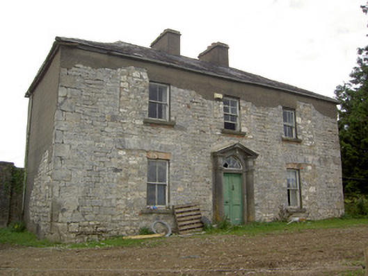
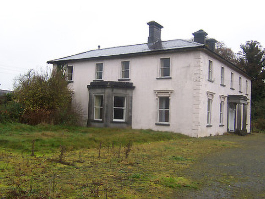
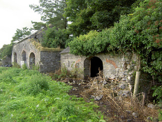
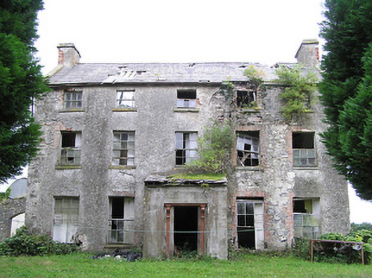
Creevy House (Longford)
Houses within 10km of this house
Displaying 37 houses.
Houses within 10km of Creevy House (Longford)
Displaying 37 houses.
| House name | Description | |
|---|---|---|
| Ballinlough House | Thomas Gosslin was the immediate lessor of Ballinlough House at the time of Griffiths Valuation in the early 1850s, when it was valued at £18. In 1814 Leet referred to it as the residence of J.C. Irwin. In 1835 the Valuation Office books mention Edward Irwin as the occupier. The building is still extant but no longer in use. |
|
| Bracklagh | The house faced Bracklagh Lough, very close to the border between counties Cavan and Longford. It is marked on the first edition six inch Ordnance Survey map (publ. 1837). In the mid-19th century it was inhabited by Captain Mark Ker and held from the Ecclesiastical Commissioners. The rateable valuation was £15. Home of Matthew William Webb and family in 1901. A building is still extant on this site. | |
| Fortland | Leet records Fort-land, Mount Nugent, as the home of the Reverend H. Maxwell in 1814. Lewis records W. Gosling as the occupant of Fortland in 1837. The first edition Ordnance Survey map (publ. 1837) shows Fortland to have been a substantial property with laid out gardens and plantations and a demesne of over 300 acres. It was the home of the Hon Somerset Maxwell at the time of Griffith’s Valuation. He held the property in fee and the buildings were valued at £27. By 1906 this valuation had increased to £52.10.0. and the house was the home of Mrs Maxwell. The house is demolished and the site now a green field. | |
| Arley Cottage | A graphic of Arley Cottage ‘belonging to Colonel Barry’ in the National Library is dated circa 1820s, see http://catalogue.nli.ie/Record/vtls000550550. The Farnham Papers also refer to Arley Cottage in 1822. Lewis records Arley as the property of Lord Farnham and it was occupied by the Hon Somerset Maxwell in the mid-1840s and by the Hon Richard Maxwell in the mid-1850s when it had a rateable valuation of £20. The Hon. Henry Maxwell was the occupier in 1906. This building is no longer extant. | |
| Lakeview (Garrison) | A house on the Farnham estate, named on the first edition Ordnance Survey map (publ. 1837), valued at £11.10.0. in the mid-19th century when occupied by Edward Soren and held from David Kellett. | |
| The Cottage | This house is located close to Lough Sheelin and on the roadside. In the mid-19th century it was valued at £12, occupied by James Sneyd and held from Andrew Booth Bell. In 1906, the townland of Bellsgrove was in the occupation of Matthew William Webb and The Cottage had a rateable valuation of £7. It appears to be still extant. | |
| Kilnahard House | Described by the National Inventory of Architectural Heritage as a castellated country house built circa 1820. Kilnahard is situated on the shore of Lough Sheelin. In the mid-19th century it was occupied by Tuite Dalton, who held the property from Andrew Bell. The buildings had a rateable valuation of £18. This house is still a residence. | |
| Hollywell | Located on the Farnham estate and known as Tara Cottage on the first edition Ordnance Survey map (publ. 1837) and as Hollywell on the 25 inch map. An engraving in the National Library appears to be this house Hollywell Cottage and dates it to at least 1820, see https://catalogue.nli.ie/Record/vtls000152344. Occupied by the Reverend Henry Cottingham at the time of Griffith’s Valuation. Valued for rates at £14 the house was held from Mark Woods. The Reverend H. Cottingham held a townland in each of the parishes of Annagh and Urney at the time of Griffith’s Valuation. His representatives owned 381 acres in 1876. A building reduced in size continues to occupy this site. | |
| Summerville (Cavan) | Another house located on the west shore of Lough Sheelin. In 1814 James H. Cottingham was the proprietor of Summerville, Mount Nugent. The house was unoccupied at the time of Griffith’s Valuation but in the possession of William Webb. It was valued at £15.10.0. for rates. It was much reduced in size by the time the 25 inch map was compiled. A building still occupies the site. | |
| Rock House (Cavan) | Marked on the first edition Ordnance Survey map (publ. 1837). In the 1850s, this house was occupied by the Reverend Matthew Webb and held from George Wilton. It had a rateable valuation of £21. It is now the centre of a farming complex. | |
| Foxfield House | In 1814, Andrew Bell was resident at Foxfield (N435 888). In the 1850s John George Parr lived at Foxfield House, a residence on the other side of the road from the original Foxfield, which he held in fee. It was valued at £8 for rates. This house continues to be occupied. | |
| Dalystown House | Francis Tuite was leasing this property from the Thornton estate at the time of Griffiths Valuation, when it was valued at over £10. In the 1870s it was recorded as the address of Laurence Reynolds. This property is labelled Rockfield House on the 1st edition Ordnance Survey map but as Dalystown House on the 25-inch map of the early 20th century. In 1906 it was still in the ownership of Laurence Reynolds and valued at almost £23. The National Built Heritage Service suggests 1820 as a building date for the surviving farmyard complex. Dalystown House has been demolished. |
|
| Castle Nugent | At the time of Griffiths Valuation in the 1850s, William Webb was leasing this property from Arthur Kingston, when it was valued at £18. It was also recorded by Lewis as the seat of W. Webb in 1837. IN 1814 Leet referred to it as the residence of John West. The National Built Heritage Service suggests it was built c.1775. It is still extant but disused. |
|
| Derrycassan House | John Dopping held this property in fee at the time of Griffiths Valuation in the early 1850s, when it was valued at £36. Burke suggests it had been a D’Arcy property until the marriage of Alice D’Arcy to Anthony Dopping in the 18th century. It was in the ownership of Capt. J.D.L. Hepenstal and valued at £50 in 1906. Derrycassan House was acquired by the Forestry Service. The house was demolished and some of the stone used in the construction of St. Columba’s RC church not far away. Other estate architecture remains and there are woodland walks in the estate. | |
| Fernsborough | Thomas Gosselin was leasing this property from William Shirley Ball’s estate at the time of Griffiths Valuation when it was valued at £25. In 1837 Lewis noted “Fernsboro” as the seat of A. Burrows. It was also recorded as the seat of Alexander Burrowes by Leet in 1814. Fernsborough is no longer extant. Hussey de Burgh noted Thomas Gosselin as the proprietor of almost 300 acres in County Longford in the 1870s. | |
| Moorhill House | At the time of Griffiths Valuation in the 1850s, John Simpson was leasing this property from Major Blackall’s estate, when it was valued at £26. It is still extant. |

|
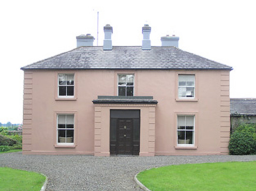
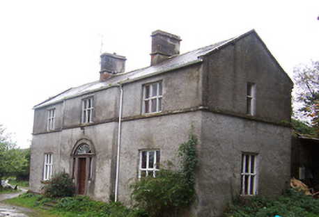
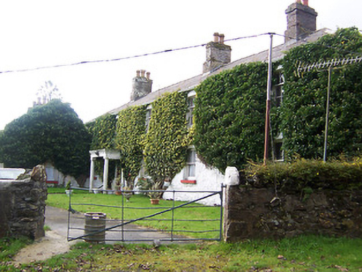
| Coolamber Manor [Cloonshannagh] | At the time of Griffiths Valuation in the early 1850s, Coolamber was held in fee by Major Blackall, when it was valued at £75. It is labelled "Cloonshannagh House" on the 1st edition OS Map but as "Coolamber Manor" on the later editions. The National Built Heritage Service suggests it was built c.1830 and significantly extended c.1880. It is still extant, having previously functioned as a rehabilitation facility. Extensive estate architecture also survives. |
![Photo of Coolamber Manor [Cloonshannagh]](https://landedestates.ie/storage/img/orig/3355.png)
|
| Lisryan | James Ennis was leasing this property from the Blackall estate at the time of Griffiths Valuation in the early 1850s, when it was valued at over £20. It is not labelled on any edition of the Ordnance Survey map, though a much-expanded building is shown on the 25-inch edition. The site is now occupied by a modern house. | |
| Moneyhoolaghan House | Benjamin Lloyd was leasing Moneyhoolaghan from the Blackall estate at the time of Griffiths Valuation in the early 1850s, when it was valued at £16. The National Built Heritage Service suggests the current house was built c.1880. It is still extant. |
|
| Coolamber | Philip O’Reilly was leasing this property from the Blackall estate at the time of Griffiths Valuation, when it was valued at almost £23. The property was associated with the Blackall family by whom, according to O'Brien, it was built c.1830. Later in the nineteenth century it came into the possession of the O’Reilly family. Towards the end of World War II it was, for a time, the home of Prince Ernest, Duke of Saxony. Since the early 21st century, it has been undergoing restoration and now serves as venue for occasional gardening courses. |
|
| Frankford House | Reverend Patrick Ratigan was leasing this property from Edward McEvoy’s estate at the time of Griffiths Valuation in the 1850s, when it was valued at £14. It held the same valuation when first valued in 1839. At that time it was occupied by Nathaniel O'Reilly. It is not extant now. | |
| Mossvale | The Ordnance Survey Name books of the 1830s noted Mossvale as the seat of J. Barber. At the time of Griffiths Valuation. in the early 1850s, it was being leased from the Hamilton estate by William Lewis, when it was valued at £20. It was later demolished but the stables and other estate architecture survives. |
|
| New Grove (Longford) | John Hynds was leasing this property from the Hamilton estate at the time of Griffiths Valuation in the 1850s, when it was valued at over £11. In 1837 Lewis referred to it as the seat of R. J. Hinds. It is now a ruin. In the 1870s, John Hinds of New Grove was recorded as the owner of over 240 acres in County Longford. |
|
| Erne Head | In 1837 Lewis referred to “Kilrea” as the seat of H. Dopping . Henry Dopping held this property in fee at the time of Griffiths Valuation in the 1850s when it was valued at £15. It is labelled Erne Head on the 25-inch Ordnance Survey map of the early 20th century. The house at Culray was the property of Reverend Francis Dopping in 1906 when it had a valuation of almost £18. It is no longer extant. | |
| Fernmount (Granard) | John B. Kirk was leasing this property from Richard Greville’s estate at the time of Griffiths Valuation in the 1850s, when it was valued at over £10. It is not named on the 6” OS map but a more substantial house is labelled Fernmount on the 25” map of the early 20th century. It is still extant. | |
| Higginstown House (Granard) | At the time of Griffiths Valuation in the early 1850s, Francis Tuite was leasing this property from Richard Greville’s estate when it was valued at £15. It is labelled Higginstown House on the 25” edition OS map of the early 20th century. The site is now occupied by large farm buildings. {Francis Tuite and his family are buried in the Church of Ireland church yard in Granard, see https://www.igp-web.com/IGPArchives/ire/longford/cemeteries/granard.htm ] | |
| Killasona House | Killasona House was occupied by Owen McCormack at the time of Griffiths Valuation in the early 1850s when it was valued at £10. It was leased from Richard Greville’s estate. McCormick was recorded as the owner of over 400 acres in County Longford in the 1870s. In 1906 it was owned by Richard Davoron and valued at over £17. It is still extant but disused. |

|
| Cloonfin House | John Thompson held this property in fee at the time of Griffiths Valuation in the early 1850s, when it was valued at £40. It has been demolished but a number of estate buildings survive. | |
| Toneen Lodge | At the time of Griffiths Valuation in the early 1850s, Nathaniel Callwell held this property in fee when it was valued at £25. A house labelled Toneen lodge is shown on the 1st edition Ordnance survey map at N343782. It is described as a small house in the Ordnance Survey Name Books. The current house, situated a short distance away, is labelled Toneen Lodge on the 25-inch edition of the early 20th century and is still extant. |

|
| Tully (Granard) | A steward’s house owned by Willougby Bond was located at Tully and valued at £15 at the time of Griffiths Valuation in the 1850s. The National Inventory of Architectural Heritage suggests this site had a long history dating back to an O'Farrell castle in the 17th century and later occupied by Newcomen and Wilson families before becoming part of the Bond estate. The Ordnance Survey Name Books mention that it was part of Major Bond's demesne with 'much old timber about the place'. Buildings still exist at this site. | |
| Gore Port [Derrymacegan] | In the 1850s Captain Alexander Walker was leasing this property from the Gore estate when it was valued at £15. It is labelled Derrymacegan on the 1st edition OS map but as Gore Port on subsequent editions. The National Inventory of Architectural Heritage suggests the earlier part of the property dates from the mid 18th century and the later part from the early 19th century. O'Brien suggests that it was Captain Walker who built the later building, c.1835. Sir Samuel Walker, Lord Chancellor of Ireland, 1892-95, was born at Gort Port in 1832. The house is still extant. | |
| Annis Grove | This property was valued at almost £10 at the time of Griffiths Valuation in the early 1850s when it was leased by Patrick Lynch from the Gore estate. O'Brien states that it was occupied by the Lynch family from at least the early nineteenth until the last quarter of the twentieth century. He indicates that it was originally known as Money, from the townland in which it is situated. It is now a ruin. | |
| Tullystown | At the time of Griffiths Valuation in the early 1850s James McCullagh was leasing this property from the Duke of Buckingham’s estate when it was valued at £11. It was still in the McCullough family in 1906 with the same valuation. O'Brien records that Tullystown was damaged by fire in 2013 and gives an account of the various buildings that have existed at this site. |
|
| Carlanstown | At the time of Griffiths Valuation Wiilliam McCullogh was leasing this property from the Duke of Buckingham’s estate when it was valued at £13. It is located close to the site of Carlanstown Castle and labelled Carlanstown House on the 25-inch Ordnance survey map. O'Brien suggests it was built c,1830. Both he and the National Inventory of Architectural Heritage provide extensive details of its associations with older structures at the site and the connections with the Nugent family. Carlanstown is still extant and occupied. |

|
| Castletown Cottage | At the time of Griffiths Valuation this property was held in fee by Samuel Reynell when it was valued at almost £8. O'Brien suggests that the original property was built c.1840. The National Inventory of Architectural Heritage indicates it was extended in the mid C19. The Valuation Office books of 1841 noted a house valued at almost £7 in this townland, then occupied by James Campbell. The house is labelled Castletown Cottage on the 25-inch edition OS map of the early C20. It is still extant and in use. |
|
| Newcastle (Fore) | Walter Keating was occupying Newcastle at the time of Griffiths Valuation in the early 1850s when it was leased from the Urquhart estate and valued at £19. In 1839 the Valuation Office Books indicate that George Keating was the occupier with a valuation of £23. It is still extant. | |
| Millbrook (Granard) | Patrick Flynn was leasing this house and milling complex from the Greville estate at the time of Griffiths Valuation in the early 1850s, when it was valued at over £13. |