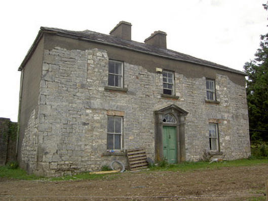
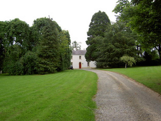
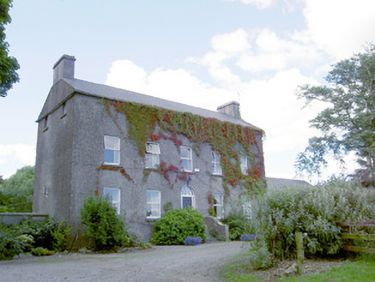
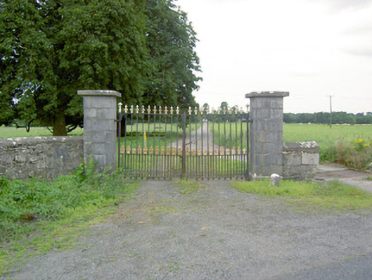
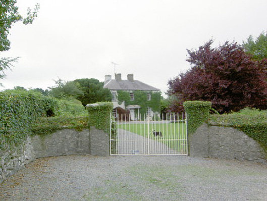
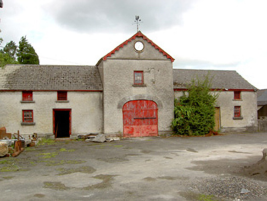
Lissard House
Houses within 15km of this house
Displaying 87 houses.
Houses within 15km of Lissard House
Displaying 87 houses.
| House name | Description | |
|---|---|---|
| Ballinlough House | Thomas Gosslin was the immediate lessor of Ballinlough House at the time of Griffiths Valuation in the early 1850s, when it was valued at £18. In 1814 Leet referred to it as the residence of J.C. Irwin. In 1835 the Valuation Office books mention Edward Irwin as the occupier. The building is still extant but no longer in use. |
|
| Moatfarrell House | At the time of Griffiths Valuation in the early 1850s, Moatfarrell was leased by William F. Ryan from the estate of Edward Murphy when it was valued at £18. In the early 1840 it had been occupied by Laurence O'Rourke. The National Built Heritage Survey suggests the extensive outbuildings were constructed in the mid-nineteenth century and notes that the property was occupied by the Fegan family in the 1890s. The building is still extant. | |
| Kilshruley House | At the time of Griffiths Valuation in the early 1850s, Major T.N. Edgeworth held this property in fee when it was valued at £20. It is labelled Kilshruley Manor on the 25-inch map of the early 20th century. It has since been demolished. A memorial stone at the site indicates that a castle belonging to the Adair family previously stood near the site. | |
| Dalystown House | Francis Tuite was leasing this property from the Thornton estate at the time of Griffiths Valuation, when it was valued at over £10. In the 1870s it was recorded as the address of Laurence Reynolds. This property is labelled Rockfield House on the 1st edition Ordnance Survey map but as Dalystown House on the 25-inch map of the early 20th century. In 1906 it was still in the ownership of Laurence Reynolds and valued at almost £23. The National Built Heritage Service suggests 1820 as a building date for the surviving farmyard complex. Dalystown House has been demolished. |
|
| Bawn House (Longford) | In 1837 Lewis described Bawn House as the property of Mr. Fox but the seat of Arthur Griffith. The Ordnance Survey Name Books note the occupant as Mr. Babington in the mid-1830s. John Daly was leasing the house from John S. Kirwan’s estate at the time of Griffiths Valuation in the early 1850s when it was valued at almost £19. In 1906 it was the property of Henry B. Armstrong and valued at £13. There is a ruin at the site. | |
| Castle Nugent | At the time of Griffiths Valuation in the 1850s, William Webb was leasing this property from Arthur Kingston, when it was valued at £18. It was also recorded by Lewis as the seat of W. Webb in 1837. IN 1814 Leet referred to it as the residence of John West. The National Built Heritage Service suggests it was built c.1775. It is still extant but disused. |
|
| Mount Jessop | In 1837 Lewis referred to Mount Jessop as the seat of F. Jessop. At the time of Griffiths Valuation in the early 1850s it was leased by the representatives of Thomas Conroy to Henry Crawford, when it was valued at almost £19. This is the same valuation assigned to it by the original Valuation Office books in 1839 when the occupier was John Jessop. The National Built Heritage Service suggests it was demolished c.1980. A substantial stable block and other estate architecture survives. |
|
| Rockspring | In 1837 Lewis referred to Rockspring House as the seat of W. Coates. He was still the occupier recorded in the Valuation Office books in 1840, when the house was valued at almost £9. By the time of Griffith Valuation in the early 1850s the property was being leased by James O’Keeffe from John Cooke. A house is still extant at the site. | |
| Derrycassan House | John Dopping held this property in fee at the time of Griffiths Valuation in the early 1850s, when it was valued at £36. Burke suggests it had been a D’Arcy property until the marriage of Alice D’Arcy to Anthony Dopping in the 18th century. It was in the ownership of Capt. J.D.L. Hepenstal and valued at £50 in 1906. Derrycassan House was acquired by the Forestry Service. The house was demolished and some of the stone used in the construction of St. Columba’s RC church not far away. Other estate architecture remains and there are woodland walks in the estate. | |
| Currygrane House | In 1837 Lewis noted “Curraghgrane” as the seat of W.L. Galbraith. At the time of Griffiths Valuation in the 1850s, William F. Ryan was leasing this property from the Misses Bond, when it was valued at £20. In 1906 it was valued at over £47 and in the ownership of James Wilson. This was the birthplace of Field Marshal Sir Henry Wilson, Britain’s chief military advisor at the end of WWI, assassinated in London in 1922. Currygrane House was burned a few weeks later and subsequently demolished. Extensive outbuildings remain at the site. |
|
| Garvagh House | At the time of Griffiths Valuation in the 1850s, Robert Grier held this property in fee, when it was valued at £20. In 1837, Lewis had referred to “Lakeview” as the seat of R. Grier. In 1906 James Wilson was recorded as the owner and the property was still valued at £20. It was later demolished. | |
| Vicarsfield | Reverend Theodore O’Moore was leasing this property from Robert Grier at the time of Griffiths Valuation in the early 1850s. It is now known as Vicarsfield House. The National Built Heritage Service suggests it was built in the 1820s. |
|
| Fernsborough | Thomas Gosselin was leasing this property from William Shirley Ball’s estate at the time of Griffiths Valuation when it was valued at £25. In 1837 Lewis noted “Fernsboro” as the seat of A. Burrows. It was also recorded as the seat of Alexander Burrowes by Leet in 1814. Fernsborough is no longer extant. Hussey de Burgh noted Thomas Gosselin as the proprietor of almost 300 acres in County Longford in the 1870s. | |
| Moorhill House | At the time of Griffiths Valuation in the 1850s, John Simpson was leasing this property from Major Blackall’s estate, when it was valued at £26. It is still extant. |

|
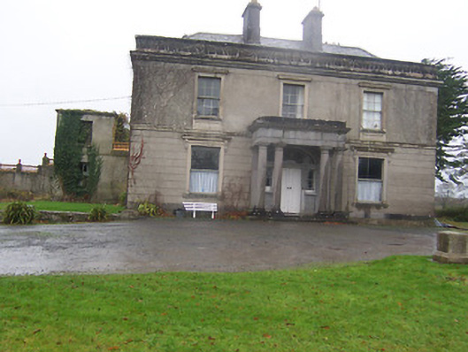
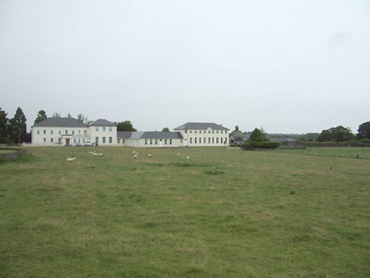
| Coolamber Manor [Cloonshannagh] | At the time of Griffiths Valuation in the early 1850s, Coolamber was held in fee by Major Blackall, when it was valued at £75. It is labelled "Cloonshannagh House" on the 1st edition OS Map but as "Coolamber Manor" on the later editions. The National Built Heritage Service suggests it was built c.1830 and significantly extended c.1880. It is still extant, having previously functioned as a rehabilitation facility. Extensive estate architecture also survives. |
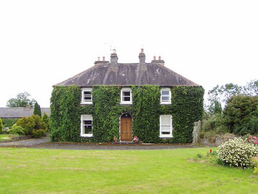
![Photo of Coolamber Manor [Cloonshannagh]](https://landedestates.ie/storage/img/orig/3355.png)
|
| Lisryan | James Ennis was leasing this property from the Blackall estate at the time of Griffiths Valuation in the early 1850s, when it was valued at over £20. It is not labelled on any edition of the Ordnance Survey map, though a much-expanded building is shown on the 25-inch edition. The site is now occupied by a modern house. | |
| Moneyhoolaghan House | Benjamin Lloyd was leasing Moneyhoolaghan from the Blackall estate at the time of Griffiths Valuation in the early 1850s, when it was valued at £16. The National Built Heritage Service suggests the current house was built c.1880. It is still extant. |
|
| Coolamber | Philip O’Reilly was leasing this property from the Blackall estate at the time of Griffiths Valuation, when it was valued at almost £23. The property was associated with the Blackall family by whom, according to O'Brien, it was built c.1830. Later in the nineteenth century it came into the possession of the O’Reilly family. Towards the end of World War II it was, for a time, the home of Prince Ernest, Duke of Saxony. Since the early 21st century, it has been undergoing restoration and now serves as venue for occasional gardening courses. |
|
| Ballinree House {Longford) | Phillip Kiernan was leasing Ballinree House from the Moore O’Farrell estate at the time of Griffiths Valuation, when it was valued at £5. A larger house is shown on the 25-inch Ordnance Survey map of the early 20th century. A house and large farm occupy the site now. This house was associated with the Farrell family in the 18th century as local sources recall "Bonny Pat Farrell" a United Irishman killed at the Battle of Granard in 1798. | |
| Williamstown House (Longford) | At the time of Griffiths Valuation in the early 1850s, Williamstown House was leased by William Allen from the Edgeworth estate, when it was valued at £10. A much smaller building appears at the site on the 1st edition Ordnance survey map. The National Built Heritage Service suggests the existing Williamstown was built c.1847. It is still in use. In the 1870s William Allen was recorded as the owner of almost 200 acres in County Longford. |
|
| Manor Mill House | William Cox was leasing this property from the Tuite estate at the time of Griffiths Valuation in the 1850s, when it was valued at £23 and included a mill. It is not labelled on the 1st edition six-inch Ordnance Survey map but appears as Manor Mill on the later 25-inch edition. It is no longer extant. | |
| Lissanure House | Lissanure House is labelled on the 25-inch Ordnance Survey map of the early 20th century. At the time of Griffiths Valuation in the early 1850s, the property at this site was occupied by William Green, leasing from the Tuite estate, when it was valued at £4. The National Built Heritage Service suggests that the current building replaced the earlier house in the 1850s. It is still extant but not used. |
|
| Frankford House | Reverend Patrick Ratigan was leasing this property from Edward McEvoy’s estate at the time of Griffiths Valuation in the 1850s, when it was valued at £14. It held the same valuation when first valued in 1839. At that time it was occupied by Nathaniel O'Reilly. It is not extant now. | |
| Mossvale | The Ordnance Survey Name books of the 1830s noted Mossvale as the seat of J. Barber. At the time of Griffiths Valuation. in the early 1850s, it was being leased from the Hamilton estate by William Lewis, when it was valued at £20. It was later demolished but the stables and other estate architecture survives. |
|
| New Grove (Longford) | John Hynds was leasing this property from the Hamilton estate at the time of Griffiths Valuation in the 1850s, when it was valued at over £11. In 1837 Lewis referred to it as the seat of R. J. Hinds. It is now a ruin. In the 1870s, John Hinds of New Grove was recorded as the owner of over 240 acres in County Longford. |
|
| Erne Head | In 1837 Lewis referred to “Kilrea” as the seat of H. Dopping . Henry Dopping held this property in fee at the time of Griffiths Valuation in the 1850s when it was valued at £15. It is labelled Erne Head on the 25-inch Ordnance Survey map of the early 20th century. The house at Culray was the property of Reverend Francis Dopping in 1906 when it had a valuation of almost £18. It is no longer extant. | |
| Clonwhelan | Richard White held this property in fee at the time of Griffiths Valuation when it was valued at £15. In 1814 Leet referred to it as the residence of Miss Godley. James Bond was the occupier at the time of the initial valuation in 1839 when it was valued at £12. It is still extant |
|
| Woodville (Granard) | Richard Lambert held this property in fee at the time of Griffiths Valuation, when it was valued at £16. In 1839 the Valuation Office books also note Lambert as the occupier of the property which was then valued at £12. The house survived into the twentieth century but is no longer extant. | |
| Cloonbalt | Hugh Peatton was leasing this property from Reverend Gray Porter at the time of Griffiths Valuation in the early 1860s, when it was valued at £23. In the 1830s the Ordnance Survey Name Books noted it as the seat of Richard Armstrong. In 1837 Lewis referred to “Clonbalt” as te property of the Earl of Belmore. A house is still extant at the site. | |
| Viewmount House (Longford) | Edward C. Hill was leasing this property from Francis Hughes at the time of Griffiths Valuation in the early 1850s, when it was valued at £17. It is visible but not labelled on the 1st edition OS map but is shown as Viewmount House on the later 25-inch edition. The Ordnance Survey Name Books described it as 'a good dwelling house with a good kitchen garden' in the mid-1830s. The National Built Heritage Service associates the property with the Cuffe and Pakenham families and dates the original house to the mid-18th century. It has, in the past, been operated as a luxury guesthouse |
|
| Cloonturk | At the time of Griffiths Valuation in the early 1850s, James Shaw was leasing this property for Richard Greville’s estate, when it was valued at £13 and included a mill. It is no longer extant | |
| Fernmount (Granard) | John B. Kirk was leasing this property from Richard Greville’s estate at the time of Griffiths Valuation in the 1850s, when it was valued at over £10. It is not named on the 6” OS map but a more substantial house is labelled Fernmount on the 25” map of the early 20th century. It is still extant. | |
| Higginstown House (Granard) | At the time of Griffiths Valuation in the early 1850s, Francis Tuite was leasing this property from Richard Greville’s estate when it was valued at £15. It is labelled Higginstown House on the 25” edition OS map of the early 20th century. The site is now occupied by large farm buildings. {Francis Tuite and his family are buried in the Church of Ireland church yard in Granard, see https://www.igp-web.com/IGPArchives/ire/longford/cemeteries/granard.htm ] | |
| Killasona House | Killasona House was occupied by Owen McCormack at the time of Griffiths Valuation in the early 1850s when it was valued at £10. It was leased from Richard Greville’s estate. McCormick was recorded as the owner of over 400 acres in County Longford in the 1870s. In 1906 it was owned by Richard Davoron and valued at over £17. It is still extant but disused. |

|
| Kilmore House (Westmeath) | At the time of Griffiths Valuation, Kilmore House was leased by Reverend Francis Kane from Reverend William Bowles and was valued at £10. The house is not visible on the 1st edition OS map but is labelled Kilmore House on the 25-inch edition. It is still extant and part of a farming enterprise. Lewis noted that the living of Kilmore was in the patronage of Fulke Greville in 1837. Reverend Francis Kane was afterwards rector of the parish of Fenagh, County Leitrim, from 1869 until his death in 1882. He had previously been vicar in the parish of Russagh, nearby to Street, County Westmeath, 1848-1855. | |
| Mullagh House (Longford) | The 1906 Untenanted Demesnes survey shows a valuation of almost £13 for buildings in the townland of Mullagh, owned by Miss K.S. frances Cordner. At the time of Griffiths Valuation in the early 1850s this was held in fee by Reverend John Cordner and had a valuation of almost £4. He also held most of remainder of the townland. The Greville estate was the lessor for the remainder. The National Built Heritage Service suggests that Mullagh House, which is now derelict, was built c.1880. | |
| Cloonfin House | John Thompson held this property in fee at the time of Griffiths Valuation in the early 1850s, when it was valued at £40. It has been demolished but a number of estate buildings survive. | |
| Creevy House (Longford) | George Dobbyn was leasing this property from the Maude estate at the time of Griffiths Valuation in the early 1850s when it was valued at £20. It is still extant. |

|
| Toneen Lodge | At the time of Griffiths Valuation in the early 1850s, Nathaniel Callwell held this property in fee when it was valued at £25. A house labelled Toneen lodge is shown on the 1st edition Ordnance survey map at N343782. It is described as a small house in the Ordnance Survey Name Books. The current house, situated a short distance away, is labelled Toneen Lodge on the 25-inch edition of the early 20th century and is still extant. |

|
| Baronstown | Baronstown was a large mansion in an extensive demesne on the western shore of Lough Iron, as shown on the first OS map, with many features such as a temple, summer house etc. Described by the National Built Heritage Service as an important late eighteenth-century Palladian villa with two storey wings, it was associated with the Malone Family/Lord Sunderlin. Taylor and Skinner noted it as a Malone property in 1777. Lord Sunderlin was resident in 1814. Following the death of Richard Malone in 1837 his sister Alicia who had married Henry O’Connor of Mount Pleasant, King’s County (Offaly) succeeded to the Baronstown and Shinglis estates. O’Brien writes that the building was burnt twice and rebuilt. The first time in 1889 and the second time in 1903 when it was replaced by a large Tudor villa to designs by James Franklin Fuller. In 1906 it was valued at £70 and was occupied by Colonel John R Malone who held it with 943 acres of untenanted land. Demolished by the Land Commission in the 1920s, it is now a greenfield site. |
|
| Rockfield/Cromlyn | A house known as Rockfield (N295657) is named on the first edition OS map at the southern end of Glen Lough. The lands and house were leased to John Crawford by Sir Peter Nugent in 1795. Matthew Crawford was resident in 1814. A later house a short distance to the east was built by the Crawfords in the late 1840s according to the sale rental of 2 December 1862, ‘The house, which is a spacious and well-built mansion erected within the last fifteen years at an expense of upwards of £2,000 … The house contains on the basement-story nine rooms, including kitchen, wine-cellar, scullery etc with every accommodation for servants. There are on the first floor four large reception-rooms, one dressing room, two pantries, bath-room etc. On the second floor, seven commodious and well-proportioned sleeping apartments besides bathrooms etc.’ This house was originally known as Rockfield and was valued at £36 at the time of Griffith’s Valuation (publ. 1854) when occupied by Matthew Crawford. The name of the house may have been changed to ‘Cromlyn’ when it was purchased by Charles John Battersby of Ballinalack in 1862. It is named as Cromlyn on the 25 inch map (circa 1914). The house remained in the possession of the Battersby family well into the 20th century. |
|
| Ardglass House | This house was rebuilt in the style of an Italianate Villa post Griffith’s Valuation, possibly incorporating the fabric of an earlier house on the same site. The original Ardglass House was the home of a Major A. P. Bond in 1837. Valued at £13.15 at the time of Griffith’s Valuation (publ. 1854), it was occupied by the representatives of A P Bond who held it in fee. The present house was in the ownership of William Perry Bond JP, in the 1880s. The house has had various owners in the 20th century and was for sale in 2017, see https://www.businesspost.ie/article/high-class-at-ardglass-co-westmeath/ | |
| Newpark Lodge | Newpark Lodge named on both the first edition OS map and the 25 inch map. Occupied by James Auchmuty JP in 1837 and at the time of Griffith’s Valuation (publ. 1854) when he held the house valued at £10 from the representative of A P Boyd. Now a modern building located at the site situated on the main road from Mullingar to Edgeworthstown. Newpark Lodge was for sale in 2021. | |
| Ballygarve | At the time of Griffiths Valuation, in the early 1850s, Christopher Reynolds was leasing this property from Robert Wybrants. The Ordnance Survey Name Books mention a ‘’good farmhouse’’ in the townland of Ballygarve in the 1830s. This property is now derelict. | |
| Danesfort (Moydow) | Reverend Francis Gregg was leasing this property from the Cooke estate at the time of Griffiths Valuation when it was valued at almost £21. In 1777 Taylor and Skinner had recorded the house at "Cranny" as the property of the West family. The house is labelled Danesfort on the 25-inch Ordnance Survey map of the early 20th century. It is still extant but derelict. |
|
| Oldtown House (Longford) | James and George Sydserffe were leasing this property from the Gregg estate at the time of Griffiths Valuation in the early 1850s, when it was valued at £25. The original Valuation Office books from 1839 had assigned it a valuation of £14. In 1837 Lewis had recorded “Old Bawn” as the seat of Thornton Gregg. The Ordnance Survey Name Books noted that 'it had a large garden and extensive out offices'. Oldtown House is still extant and in use. |
|
| Daramona House | The National Built Heritage Service suggests this house was built c.1850 by the Wilson family. In later times there was also an observatory at the site. At the time of Griffiths Valuation, it was held in fee by William Wilson and valued at over £28. In 1906 it was owned by John Wilson and valued at almost £73. It is still extant though apparently not in use. |
|
| Bungeggan | The 1906 Untenanted Demesnes survey records a valuation of £12 for this property then in the ownership of Joseph Dooner. At the time of Griffiths Valuation in the early 1850s this was a herd’s house, leased from William Wilson’s estate by Joseph Slevin and valued at almost £3. A stud farm occupies the site now. | |
| Cordivin | At the time of Griffiths Valuation, Reverend Robert Moffett was leasing this property to James Ganley, when it was valued at £14 and included a mill. It is shown on the 1st edition Ordnance Survey map but does not appear on subsequent editions. | |
| Newtownbond House | At the time of Griffiths Valuation in the early 1850s, James Auchmuty was leasing Newtownbond House from Henry Montford Bond, when it was valued at over £30. In 1906 it was owned by William Bond and valued at almost £32. It was demolished in the 20th century though estate architecture, including the entrance gates, remain. |
|
| Castlerea (Longford) | At the time of Griffiths Valuation in the early 1850s, John Bole was leasing Castlerea from the Kirwan estate, when it was valued at £15. In 1837 Lewis had noted Castlerea as the residence of Mrs. Bole. The Ordnance Survey Name Books suggest that the townland was the property of the Jessop estate in the 1830s. The 1906 Untenanted Demesnes report notes it as the property of Charles Webb with a valuation of £15. It is still extant. |
|
| Park Place | At the time of Griffiths Valuation in the 1850s, Ambrose Bole was leasing Park Place from the Jessop estate, when it was valued at over £27. The National Built Heritage Service dates the remaining walled garden evidence to the late 18th century and suggests that Park Place was the residence of the Moffat family. The Ordnance Survey Name Books of the 1830s note that the demesne was “cultivated by Mr. Robinson, the County Treasurer”. This is likely to be John Robinson, who, according to the Valuation Office Books, was the occupier in 1839, when the house was valued at £16. Family history sources suggest Ambrose Bole was a land agent, who managed the estates of the King-Harman and Shuldham families during the second half of the 19th century. Park Place was demolished in the 20th century but some estate architecture remains. |
|
| Crossea | John O’Byrne [O’Beirne] was leasing this property from the Ecclesiastical Commissioners at the time of Griffiths Valuation in the early 1850s when it was valued at over £10. The original Valuation Office books record a valuation of £12 in 1839. The Ordnance Survey Name Books suggest the townland was in the hands of Reverend Mr. Oliver in the mid-1830s. A large farm is still extant at the site. | |
| Templemichael Rectory | At the time of Griffiths Valuation in the early 1850s, Reverend John le Poer Trench was leasing this property from the Ecclesiastical Commissioners, when it was valued at £32. The National Built Heritage Service suggests it was built c.1840 on the site of an earlier house. In 1777 Taylor and Skinner indicated that the house at Templemichael was occupied by Dean Ryder. The later house is still extant and in use as a house. | |
| Greenfield House | At the time of Griffiths Valuation in the mid-1850s, this house was vacant though John Lynch was described as the immediate lessor. The house was valued at £12 at the time. The valuers' records from 1840 indicate that it was then occupied by William Biggers and valued at £13. The house is still extant. | |
| Carrigglas Manor (Carrickglass) | The National Built Heritage Service notes that the current Carrigglas Manor was built in the mid-19th century close to the site of an earlier Carrickglass House. Leet referred to this earlier house as the seat of Sir T. Newcomen in 1814. At the time of Griffiths Valuation in the early 1850s it was leased from the Provost and fellows of TCD by Thomas Lefroy and valued at £90. The demesne remained in the Lefroy family until c.2005. The house is not currently in use. |
|
| Lismoy Upper | Mrs. Fitzgerald was leasing this property from the Governors of Mercer’s Hospital at the time of Griffith’s Valuation, in the early 1850s, when it was valued at £18. The National Built Heritage Service suggests that the original house was built in the late 18th century but underwent several modifications in the 19th century. In 1837 Lewis recorded it as the seat of a Reverend J. Mitchell. Leet referred to it as the residence of Reverend Kilner Davidson in 1814. In the 1870s it was noted as an address for “H. Dundas”. It is still extant and occupied. |
|
| Minard House | At the time of Griffiths Valuation in the early 1850s the house at Minard was occupied by George Evers, leasing from the Douglas estate and valued at almost £9. The 1906 Untenanted Demesnes survey records a valuation of £13 for this property when it was still in the possession of the Douglas estate. The Longford Leader reported extensive damage by fire to the house in 2019. | |
| Lismore (Longford) | At the time of Griffiths Valuation in the early 1850s, Thomas Gill appears to have been leasing this property from the Douglas estate when it was valued at £8. In 1906 the buildings were valued almost £17 and it was still held by the Douglas estate. It is still extant. | |
| Ballinalee | Henry Reynolds was leasing this property from Reverend George Moore at the time of Griffiths Valuation in the early 1850s, when it was valued at over £15. It is possibly the building formerly in use as a Masonic Hall in the village and which the National Built Heritage Service suggests was converted to other uses in the 1840s. This building is extant but derelict. |
|
| Aghareagh House | At the time of Griffiths Valuation in the early 1850s John O’Beirne held this property in fee when it was valued at £20. The Valuation Office books compiled in 1840 referred to Henry Mulaniff as the occupier at that time. He is also recorded as a landholder in the townland in the Tithe Applotment records of 1831. Aghareagh is still extant and occupied. |
|
| Moydow Glebe | In 1837 Lewis noted Moydow Glebe as the residence of Reverend Armstrong. At the time of Griffiths Valuation in the 1850s it was held in fee by Reverend William C. Armstrong when it was valued at over £20. The house is extant but disused. |
|
| Ardagh House (Longford) | In 1837 Lewis had identified Ardagh House as the property of G.R. Fetherston. In 1814 Leet recorded it as the seat of Sir T. Fetherston, MP. At the time of Griffiths Valuation in the 1850s it was owned by his representatives and valued at £46. The National Built Heritage Service suggests the house was built c.1730 and altered twice in the nineteenth century. It was partially damaged by fire in 1922 and again in 1948. In the later twentieth century it served as a domestic economy training facility operated by the Mercy Sisters. Together with numerous estate buildings it is still extant though not currently in use. |
|
| Drombaun House | In 1837 Lewis referred to Drombawn as the seat of Peyton Johnson. At the time of Griffith’s Valuaton in the 1850s, the property was leased from the Fetherston estate by Henry Dobson and valued over £5. It is recorded as “in ruins” on the 25-inch Ordnance Survey map of the early twentieth century and the site is now occupied by farm buildings. | |
| Corboy (Longford) | At the time of Griffiths Valuation in the 1850s this property was leased by Bridget Phillips from the Fetherston estate and valued at £10. The National Built Heritage Service indicates that the house was later the home of John Philips, the last MP for County Longford. It had later become derelict but redevelopment has taken place at the site. | |
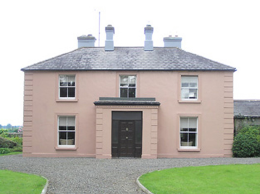
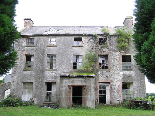
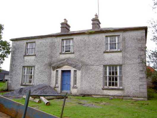
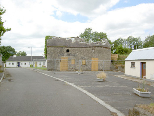
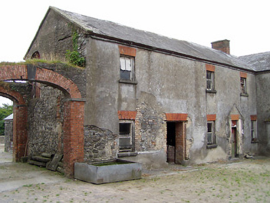
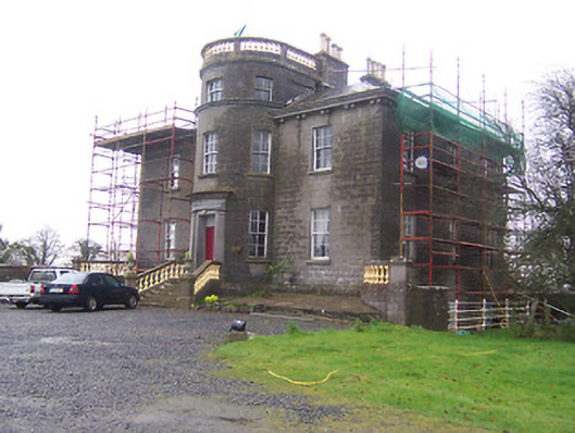
| Castlewilder [Cloghdoo House] | Richard P. O’Reilly, MD, held this property in fee at the time of Griffiths Valuation in the early 1850s, when it was valued at £30. On the 1st edition Ordnance Survey map it is labelled Cloghdoo House but as Castlewilder on the 25-inch edition of the early 20th century. The Ordnance Survey Name Books note that the townland at that time (1835) was the property of Mr. Wilder. In 1814 Leet referred to 'Castlewilden' as the seat of John Mangan. The National Built Heritage Service suggests the house and its complex of estate buildings was built in the 18th century but modified in the 1880s. |
![Photo of Castlewilder [Cloghdoo House]](https://landedestates.ie/storage/img/orig/3403.png)
|
| Foxhall (Ballymahon) | Richard M. Fox held this property in fee at the time of Griffiths Valuation in the 1850s, when it was valued at £40. The original valuation also noted it as his property in 1839 with a valuation of £39. In 1906 it was owned by the representatives of R.E. Fox. The Ordnance Survey Name Books mention that the demesne contained 38 acres of woodland in the mid-1830s. Leet referred to it as the residence of Richard Fox in 1814. The National Built Heritage Service suggests that the house at Foxhall was demolished in 1946. Estate architecture, including the stables, survives |
|
| New Port (Ballymahon) | At the time of Griffiths Valuation in the early 1850s, Patrick Ross was leasing this property from the Fox estate, when it was valued at almost £9. In 1814 Leet referred to it as the residence of J, Molloy. The Ordnance Survey Name Books mention it as a gentleman's residence belonging to Mr. Fox. The house is labelled New Port on the 1st edition Ordnance Survey map but does not appear on subsequent maps and is no longer extant. | |
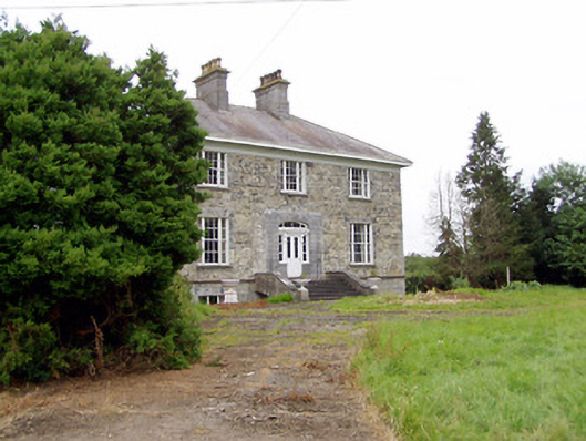
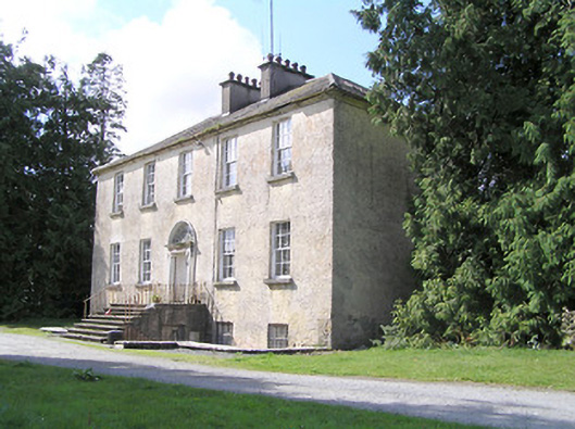
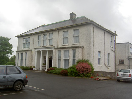
| Newtown House [Newtown Lodge] | Robert Hagerty was leasing this property from the Fox estate at the time of Griffiths Valuation in the early 1850s. The house at the site is labelled Newtown Lodge on the 1st edition Ordnance Survey map. The Ordnance Survey Name Books referred to this as a 'farm house' in the 1830s. A different house at the site is named as Newtown House on the later editions, the name by which it is still known. The National Built Heritage Service suggests the original house was built c.1810. It is extant and well-maintained. |
![Photo of Newtown House [Newtown Lodge]](https://landedestates.ie/storage/img/orig/3406.png)
|
| Sleehaun House | This property is not shown on the 1st edition OS map but is labelled Sleehaun Ho on the 25-inch edition of the early 20th century. It was occupied by Michael Ledwidge at the time of Griffiths Valuation in the early 1850s when it was valued at £13 and leased from the Fox estate. The National Built Heritage Service suggests it was built c.1850. It is still extant. |
|
| Treel House | William Atkinson was occupying Treel House at the time of Griffiths Valuation in the 1850s, when it and the adjacent mill were valued at £28. The National Built Heritage Service suggests the house was built c.1830. In 1839 the original Valuation Books, however, stated that at that time no house in the townland had a valuation of greater than £5 suggesting that Treel House was enlarged after that date. The Ordnance Survey Name Books noted in 1835 that the townland was then the property of Mr. Fox. Treel is still extant though not in use. |
|
| Whitehill House (Granard) | In 1837 Lewis referred to Whitehill House as the seat of H.B. Slator. At the time of Griffiths Valuation in the 1850s, Henry B. Slator was leasing Whitehill from Mrs. Fearon, when it was valued at £18. It is no longer extant. | |
| Toneen | Captain Geoffrey Power was leasing this property from the Slator estate at the time of Griffiths Valuation in the early 1850s, when it was valued at over £13. In 1837 Lewis referred to “Towend” as the seat of “Jeffrey Keating Power”. The extant house at Toneen dates from the later 19th century. |
|
| Knockagh House [Hermitage] | Francis Kenny was leasing this property from the Robinson estate at the time of Griffiths Valuation in the early 1850s, when it was valued at almost £12. On the 1st edition Ordnance Survey map it is labelled Hermitage. The Ordnance Survey Name Books refer to “the gentleman’s seat called Hermitage in this townland”. On the 25-inch edition of the early 20th century it is labelled “Knockagh House – in ruins”. | |
| Richmount Hill | John Higgins, MD, was leasing this property from Jane Richardson’s estate at the time of Griffiths Valuation in the 1850s, when it was valued at over £15. In 1814 Leet referred to it as the seat of Auchmuty Richardson. The National Built Heritage Service suggests that this house was built c.1720. It is still extant and occupied. |
|
| Richfort | James A. Richardson held this property in fee at the time of Griffiths Valuation in the early 1850s when it was valued at £15. Lewis had referred to Richfort as the seat of J.A. Richardson in 1837. In 1814 Leet noted it as the residence of Arthur Richardson. The house was demolished in the 20th century but the entrance gates remain. |
|
| Torboy House | Phillip McCutcheon was leasing Torboy from Colonel Palliser’s estate from at least the early 1840s, as shown in the Valuation Office House books. At the time of Griffiths Valuation in the early 1850s the house was valued at over £12. The Landed Estates Court sale notice of 1862 indicates Philip McCutcheon had renewed his lease on this property in 1848. Torboy House is still extant and occupied. |
|
| Sunfield House | George Gamerson was leasing this property from the King Harman estate in the 1850s when it was valued at £12. The valuers' original valuation, which also includes a description of all buildings on the site, was over £20. The house is not named on the 1st edition OS map but is labelled Sunfield House on the 25” ed. A substantial farm occupies the site including the original buildings |
|
| Cartroncar House | Richard Taylor was leasing this property from Thomas Bond’s estate at the time of Griffiths Valuation, when it was valued at £25. In 1835 James Bond was recorded by the valuers as the occupier and the house had a valuation of £32. The Ordnance Survey Name Books note the existence of the house and demesne of Cartroncar in the townland, 'the seat of J.W. Bond'. It is still extant but disused. |
|
| Tully (Granard) | A steward’s house owned by Willougby Bond was located at Tully and valued at £15 at the time of Griffiths Valuation in the 1850s. The National Inventory of Architectural Heritage suggests this site had a long history dating back to an O'Farrell castle in the 17th century and later occupied by Newcomen and Wilson families before becoming part of the Bond estate. The Ordnance Survey Name Books mention that it was part of Major Bond's demesne with 'much old timber about the place'. Buildings still exist at this site. | |
| Farraghroe House | Willoughby Bond held this property in fee at the time of Griffiths Valuation in the early 1850s when it was valued at £55. Lewis had also referred to ‘’Farra’’ as his seat in 1837. In 1905 it was owned by James W. Bond and valued at £67. The house was demolished in the 20th century but much estate architecture, including the Steward’s House, remains. |

|
| Kilmoyle | At the time of Griffiths Valuation in the early 1850s, Alexander McCormick was leasing this property from the estate of Captain W. Bond, when it was valued at £7. The 1906 Untenanted Demesnes survey records a valuation of almost £14 for the property when it was still part of the Bond estate. A modern house and large farm occupy the site now. | |
| Newpass | Griffiths Valuation notes the owners of Newpass as Elizabeth Westby and the representatives of Sir. G. Fetherson. Elizabeth Westby was the wife of William Westby and the daughter of George B. Whitney of Newpass. The house was unoccupied in the early 1850s and valued at £35. The National Inventory of Architectural Heritage suggests it was built c.1775 by the Whitney family, probably on the site of an earlier house. Taylor and Skinner noted it as a Whitney property in 1777. O'Brien states that Colonel Whitney first purchased the Newpass estate in 1670. In 1906 it was owned by Major E. Henry Fetherston Whitney and valued at £43. It is still extant. The estate also owned property in the nearby village of Rathowen. |
|
| Kildevin | Moses Sproule was leasing this property from William H. Little at the time of Griffiths Valuation in the early 1850s, when it was valued at £36. O'Brien states that a name plaque at the property indicates the building of the house by Robert Sproule in 1833. It was the residence of the Sproule family until the later part of the 19th century when it was acquired by Meredith Johnston and by the Tyndall family. It is still extant and has been offered for sale on a number of occasions since 2000. |
|
| Kilmore House (Moygoish) | At the time of Griffiths Valuation, Kilmore House was leased by Reverend Francis Kane from Reverend William Bowles and was valued at £10. The house is not visible on the 1st edition OS map but is labelled Kilmore House on the 25-inch edition. It is still extant and part of a farming enterprise. Reverend Francis Kane was afterwards rector of the parish of Fenagh, County Leitrim, from 1869 until his death in 1882. He had previously been vicar in the parish of Russagh, nearby to Street, County Westmeath, 1848-1855. | |
| Millbrook (Granard) | Patrick Flynn was leasing this house and milling complex from the Greville estate at the time of Griffiths Valuation in the early 1850s, when it was valued at over £13. | |
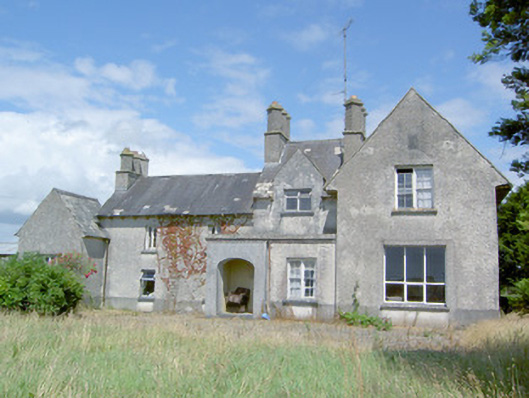
| Edgeworthstown House | The Edgeworth family had been settled at Edgeworthstown in the parish of Mostrim, County Longford, since the 17th century. At the time of Griffiths Valuation in the 1850s, Fanny Edgeworth was leasing the property from Charles Edgeworth, when it was valued at £45. [It is likely that Fanny was his stepmother} The National Built Heritage Service suggests the present building began in 1725 but had several rounds of modifications subsequently. In more recent years it has served as a health care facility. |
|