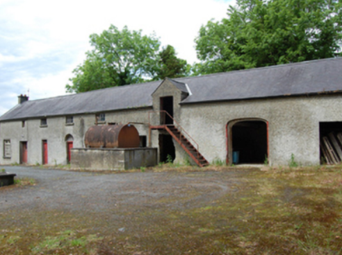
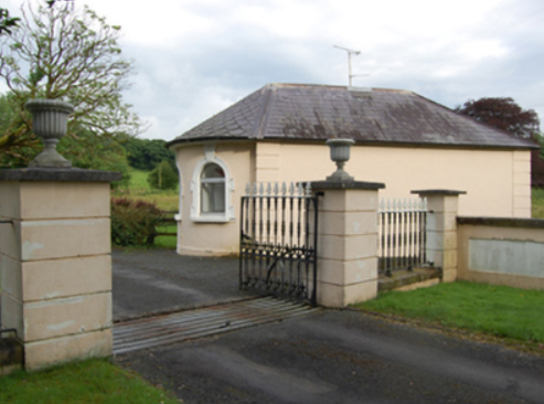
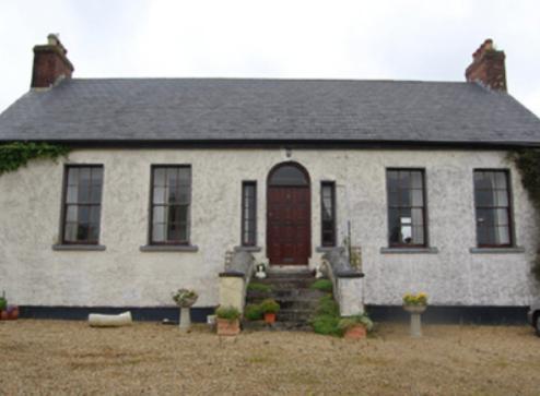
Moynehall House
Houses within 5km of this house
Displaying 15 houses.
Houses within 5km of Moynehall House
Displaying 15 houses.
| House name | Description | |
|---|---|---|
| Cullies House | Cullies House had a rateable valuation of £35 at the time of Griffith’s Valuation and was occupied by Nathaniel Montgomery and held from Edward K. Tenison. The entrance gates, lodge and outbuildings have become part of the St Patrick’s College complex. This house was demolished circa 1980 (National Inventory of Architectural Heritage]. |
|
| Kilmainham - The Cottage/Heath Lodge | Lewis refers to Kilmainham as the residence of A. Bell and the house is named as The Cottage on the first edition 6 inch Ordnance Survey map (publ. 1837). By the time of Griffith’s Valuation about 20 years later, Henry Montford was the occupier, holding the property from William Humphrys of Ballyhaise. The building would appear to have been extended by this time as its rateable valuation was £15. The house is named Heath Lodge on the 25 inch map. James Hartley and family were resident at Heath Lodge in 1901 while Hector John Atkinson and his wife Sybil were the occupants in 1911 holding the property from the representatives of James Harley. A building of similar shape still exists at this site. | |
| Bellville | The Fleming family were known to be at Bellville from the early 18th century. The house is named on the first edition six inch Ordnance Survey map (publ. 1837) and located facing two forts in a sizable demesne. Belville was the home of A. Fleming in 1814 and of Captain A. Fleming in the 1830s. By the 1850s, the occupant was Jane Kenny who held the property valued at £7 from Major General Fleming. At the beginning of the 20th century Bellville was the home of the Meikle family, originally from Scotland. It is still extant. | |
| Castle Cosby | Castle Cosby was situated close to a small lough of the same name. A number of other country houses were located in close proximity, such as Lismore. J. Whitethorne was resident at Castle Cosby in the 1830s and 1840s. By the mid-1850s Andrew Smith was the occupant holding the property from John E. Vernon. It was valued at £16. In 1876, Philip Smith of Castlecosby owned 77 acres in co Cavan. He married Delia Mary daughter of Corney Banahan of Renny, Co Roscommon and had a number of sons who became doctors. His third son Frederick Paul married in 1905 Isabella Ann daughter of Edward Smith of Bellamont Forest. Castlecosby was mainly known as Kevit Castle under Smith ownership. The house is now demolished but a gate lodge is still extant. |
|
| Ricehill House | Rice Hill was built in the mid-18th century. It was the home of the Bredin family in the first half of the 19th century. It is named on the first edition six inch Ordnance Survey map (publ. 1837). Described by Mulligan as a ‘classic Georgian gentleman’s farmhouse in a small demesne.’ Occupied by Patrick Finnegan and held from the representatives of Sophia Wright in the 1850s, when the buildings were valued at £3.10.0. It was still the home of the Finnegan family at the beginning of the 20th century and continues to be a residence. |
|
| Drumheel House | A house named on the first edition six inch Ordnance Survey map (publ. 1837) with extensive outbuildings and occupied by R. Bell. Griffith’s Valuation records William Smith as owner and occupier in the 1850s, when the buildings were valued at £23.10.0. A building of different shape now occupies this site. | |
| Kilmore Palace | A house built in the 1830s for Bishop George de la Poer Beresford, designed by William Farrell and resembling Rathkeeny. It replaced an earlier palace on a different site. Its rateable valuation was £100 in the 1850s, the Bishop of Kilmore being owner and occupier. This house continued to be the home of the Bishops of Kilmore until the early 21st century. It is now in private hands and currently for sale (2022), see https://theirishaesthete.com/tag/kilmore/ |

|
| Lisnamandra | Lisnamandra was a Sneyd family home in the 18th century. Frances Arabella Sneyd of Lisnamandra married Archdeacon Joseph Story (died 1767) of nearby Bingfield. One of their daughters Sophia married Robert Burrowes of Stradone House. Their grandson, James Edward Burrowes, was the occupant of Lisnamandra in the 1850s. He held the property valued at £20.10.0. from Earl Annesley. However previous to J.E. Burrowes’ occupation Lisnamandra had been the residence of Mrs Elliott in 1814 and of George Burdett L’Estrange in the 1830s. Hugh Hamilton Moore and his wife lived in Lisnamandra in the early 20th century. He was a barrister and Clerk of the Crown and Peace for county Cavan. | |
| Brookvale | Sometime in the early 18th century Alexander Brooke, second son of William Brooke who purchased Drumavanagh from the Saundersons in 1685 (Burke’s), settled at Drumavanagh with his wife Catherine a daughter of Richard Young of Drumgoon. The present house known as Brookvale, was built in 1845 by William Hague, a successful building contractor. It was located on the outskirts of Cavan town near the train station. By the mid-19th century the Reverend Andrew Hogg was resident holding the buildings valued at £24 from William Hague, junior. This house is still a fine residence. It was advertised for sale in 2000 for £500,000 (Irish Times, 8 June 2000). | |
| Arnmore | A building located at this site as marked on the first edition six inch Ordnance Survey map (publ. 1837) was expanded before Griffith’s Valuation. The buildings were in the mid-19th century valued at £38.10.0. and the house, known as Arnmore, was occupied by William A. Moore and held from Earl Annesley. William Armitage Moore of Arnmore was an executor to the will of his nephew, the 4th Earl Annesley, who died in 1874. In 1906, this property was in the possession of Lord Farnham. Today it is the club house of the County Cavan Golf Club. | |
| Earlsvale | A house built circa 1840s on the estate of Earl Annesley and occupied by Captain Francis Meik at the time of Griffith’s Valuation, when the buildings were valued at £18. This may have been the residence of the agent of Earl Annesley. | |
| St Swithin’s Cottage/Drumbar House | St Swithin’s Cottage is named on the first edition six inch Ordnance Survey map (publ. 1837). It was located in the demesne surrounding Farnham House and was later extended by the addition of another block. Abraham Brush, who was the estate agent, lived here in the mid-19th century, when the buildings were valued at £20. By the early 20th century the building was known as Drumbar House. It continues to be a residence. | |
| Farnham Castle | The seat of the Maxwell family, Earls of Farnham, built about the turn of the 18th century for John Maxwell, son of the Bishop of Kilmore, who had purchased the estate from the Waldrons. A library and other alterations designed by James Wyatt were added in the 1780s. In the early 19th century Francis Johnston was employed by the 2nd Earl to rebuild the house. The buildings were valued at £120 in the mid-19th century. The house was remodelled again in the 1960s when dry rot was found to be prevalent and much of the 18th building was demolished. The house remained in the possession of the Maxwell family until the early 21st century. It is now a country house hotel. https://www.farnhamestate.ie/ | |
| Ford Lodge | Located on the Farnham estate just outside Cavan town and close to St Patrick’s Cathedral, Fort Lodge is named on the first edition six inch Ordnance Survey map (publ. 1837). R. Young Reynolds of Fort Lodge, Cavan, was a subscriber to Lewis ‘Topographical Dictionary’. It was occupied by Theophilus Thompson in the mid-19th century and valued at £27 for rates. Home of William Henry Halpin, a solicitor, in the 1930s. | |
| Lisdaran | In the mid-19th century John Moore held a house valued at £12 in the townland of Lisdaran from Lord Farnham. The Moore family were still resident in the early 20th century. |