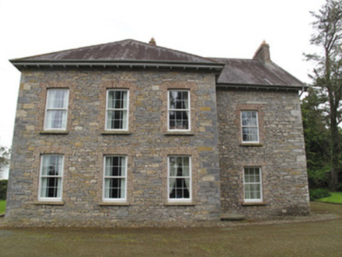
Bessmount Park
Houses within 5km of this house
Displaying 18 houses.
Houses within 5km of Bessmount Park
Displaying 18 houses.
| House name | Description | |
|---|---|---|
| Poplar Vale | Home of the Richardson family in the 18th and 19th centuries, Lewis records Major E. Richardson as proprietor. The house is named on the 1st edition 6 inch Ordnance Survey map (1836) surrounded by parkland and an extensive walled garden. The buildings were valued at £30 circa 1860 when John Richardson was the occupier holding the property from Robert Ellis. Edward John Richardson was resident in the early 20th century. In the 1940s St Patrick’s Agricultural College was established at Poplar Vale. | |
| Beech Hill | Located on the outskirts of Monaghan town, Beech Hill is named on the 1st edition 6 inch Ordnance Survey Map (1836). The buildings at Beech Hill were valued at £40 in the mid-19th century. William Murray was the occupant. He held the property from Lord Rossmore. Sarah Ker, eldest daughter of André Allen Ker, is described in Burke’s Landed Gentry of Ireland (1904) as resident here. In 1880 she married Fitzjohn Robert Irwin of Kilkeel, county Down. Beech Hill College, a secondary school, is now located on this site. | |
| Cornecassa | This house was the home of the Hamilton family from the early 19th century built by Dacre Hamilton. Lewis records it as the home of Dacre Hamilton, son of Sir James, who was agent for the Rossmore, Castleshane and Templeton estates. Cornakessagh House is named on the 1st edition 6 inch Ordnance Survey map (1836). At the time it had extensive laid out gardens and some plantations. James Hamilton was the occupant at the time of Griffith’s Valuation, circa 1860. He held the property from Lord Rossmore. It was valued at £120. The library was sold in 1922 following the death of Captain Hamilton. The main part of the house was demolished in 1934. The service wing survives as does the farmyard complex. See http://archiseek.com/2016/cornacassa-house-monaghan-co-monaghan/ | |
| Raconnell | Raconnell belonged to the Owen family in the 18th century. The will of Nicholas Owen of Raconnell is dated 1 May 1759. Possession of this townland passed to the Lucas and Cole families through marriage. It is named on the 1st edition 6 inch Ordnance Survey map (1836) with a substantial yard and walled garden to the rear. Occupied by Colonel R. Lucas in the 1830s. Edward William Lucas lived here at the time of Griffith’s Valuation when the buildings were valued at £24. By the mid-1870s Thomas Coote was occupying Raconnell. Raconnell House is still extant but unoccupied. |

|
| Newgrove | This locality was in the possession of Blayney Owen described as ‘of Newgrove’ in the early 18th century. In the 1830s, Lewis records M. Hawkshaw as resident at Newgrove, located on the Lucas estate. By the early 1860s Thomas C. Sterne was the occupier when the buildings were valued at £8.10.0. Home of the Wilson family in the early 20th century. | |
| Liscarney House | The home of the Ross family for at least a century and a half. David Ross of Liscarney is mentioned in a deed of 1816. Major Ross is recorded in Liscarney in the Tithe Applotment Book and also by Lewis in the 1830s. In Griffith’s Valuation (circa 1860) James Ross (1819-1893) is mentioned as the occupier holding the property in fee. The buildings were valued at £32. Members of the Ross family continued to reside here well into the 20th century as The Irish Law Times and Solicitors Journal of 1955 records the death of Sharman Crawford Ross, solicitor and estate agent, of Liscarney. |
|
| Faulkland Castle | Shirley refers to the confinement of John Leslie, Dean of Dromore, by Robert Maxwell, Sheriff of Monaghan, in his house at Falkland/Faulkland in 1707. The Maxwells occupied Faulkland Castle until 1780. By the time of Griffith’s Valuation it was valued at £1.6 shillings and was held by James Jackson Senior from the trustees of John Maxwell. The 25 inch map (surveyed 1908) shows the castle ‘in ruins’. | |
| Coolmain House | The National Inventory of Architectural Heritage dates this house to circa 1790. It belonged to a family called Graham in the 18th century according to a story recorded in the Schools Collection under Coolmain House. It was named on the 1st edition 6 inch Ordnance Survey Map (1836). In the 19th century this property belonged to the Brooke family of Dromavana, county Cavan. Burke’s Landed Gentry of Ireland 1904 records William Brooke of Dromavana, Dublin and Coolmaine House. He was born in 1769 and married Angel daughter of Captain Edward Perry and niece and heiress of Colonel Richard Graham. John Goudy of Coolmain House is listed in Lewis’ ‘Topographical Dictionary’ published 1837 for the parish of Tehallan but his name is spelt Gondy in the list of subscribers. John Goudy is recorded in Griffith’s Valuation as resident holding the property from the Reverend Edward P. Brooke and others. James Gondy Lewers of Coolmain House died in November 1885 (The Northern Standard, 7 November 1885). This house was occupied by James H. Pollock in 1911 and is still a residence. | |
| Tully House | An early two storey 19th century house, marked on the 1st edition 6 inch Ordnance Survey map (1836) with a later extension. This was the home of the Hall family located on the outskirts of Monaghan town. Pery Hall of Tully House was the father of the Reverend Richard Augustus Hall who married Mary Henry of Mourne Abbey, county Down in 1849. At the time of Griffith’s Valuation the house was valued at £14 and occupied by John S. Stuart. Mary, widow of the Reverend Hall, was the occupant in the early 20th century. This house continues to be a residence. The Halls also had a house in the town of Monaghan, townland of Mullaghmonaghan, close to the County Infirmary known as Rowantree. |

|
| Blackwater Vale | This house is marked on the 1st edition 6 inch Ordnance Survey map (1836) and located just outside the town of Monaghan. The building was expanded in the mid-19th century. Griffith’s Valuation records the buildings valued at £13 when the house was occupied by Thomas E. Wright who held the property from William and Charles Crofton. At the beginning of the 20th century Blackwater Vale was occupied by Foster Dunwoody, a solicitor. Still extant and occupied. |
|
| Dromore House | Dromore House is named on the 1st edition 6 inch Ordnance Survey map (1836) with a circular drive to the front and a walled garden to the rear. It was the home of C. Hawkshaw in the 1830s. Located on the Hatchell estate it was occupied by James Wade at the time of Griffith’s Valuation and valued at £14. The home of the Smyth family in the early 20th century, this house is no longer in existence. | |
| Sallymount | Sallymount facing a plantation is named on the 1st edition 6 inch Ordnance Survey map (1836). In the 1830s it was the home of T. Robinson. At the time of Griffith’s Valuation the buildings were valued at £8 and John Woods was the occupant, holding the property from John Maxwell, whose estate was at that time being administered by the Court of Chancery. Home of the Assistant County Surveyor James Smith in 1911. He held the house from John McMahon. A building is still located at this site. | |
| Will Ville | The National Inventory of Architectural Heritage dates this building early 18th century. It was located on the estate of Lord Rossmore and is named on the 1st edition 6 inch Ordnance Survey map (1836). Valued at £10 and occupied by Robert Wilson at the time of Griffith’s Valuation. Still occupied by Robert Wilson, farmer, in the early 20th century. This house has been unoccupied for some time. |
|
| Cortolvin | This house was built between the first Ordnance Survey of the 1830s and the surveying for Griffith’s Valuation in the 1850s. It is marked on the 25 inch map (surveyed 1908) and named Cortolvin. In Griffith’s Valuation it was occupied by William A. Hunter and held from Lord Rossmore. It was valued at £16. This house is still extant. | |
| Tirkeenan House | This house is named on the 1st edition 6 inch Ordnance Survey map (1836). It was located on the Rossmore estate and very close to the town of Monaghan. It was occupied by John M’Dowell circa 1860 when the buildings were valued at £32. A third storey was added to this house in the 20th century. |

|
| Corlat House | A house named Cook Mount was located in Corlat on the first Ordnance Survey Map (circa 1836). Corlat House was built in the mid-19th century on a nearby site, valued at £20 and occupied by the Reverend James Bleakley, who held it from William Murray. In the early 20th century William McWilliam, Clerk of the Crown and Peace lived at Corlat House. It is no longer extant. | |
| Gallanagh House | Gallanagh House, located just north west of Monaghan town, is named on the 1st edition 6 inch Ordnance Survey map (1836). At the time of Griffith’s Valuation circa 1860 it was occupied by William Watson and held from James Hamilton of Cornacassa. The buildings were valued at £36. This house appears to have been unoccupied in 1901 and the home of Ernest P. Tyacke, County Inspector Royal Irish Constabulary, in 1911. Tyacke held the property from William Swan. A William Swan was proprietor of the newspaper ‘The Northern Standard’, Monaghan. A large complex of buildings [poultry factory] now occupies the site. | |
| Woodview | Situated on the Lucas estate, this house was not built at the time of Griffith’s Valuation (circa 1860) as there is no house in the townland of more than £2.10.0. valuation. The National Inventory of Architectural Heritage records that it is believed to have been built as a house for the agent to the Castleshane estate. |