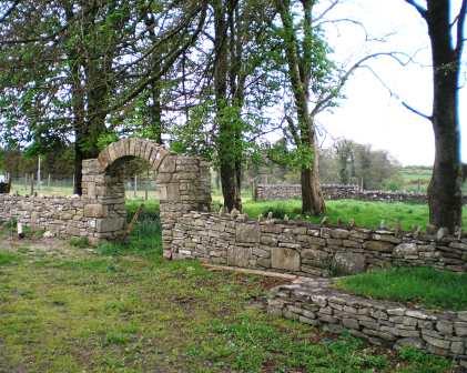
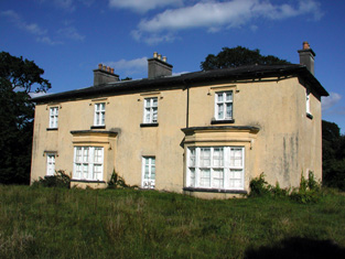
Dunmore Lodge
Houses within 10km of this house
Displaying 12 houses.
Houses within 10km of Dunmore Lodge
Displaying 12 houses.
| House name | Description | |
|---|---|---|
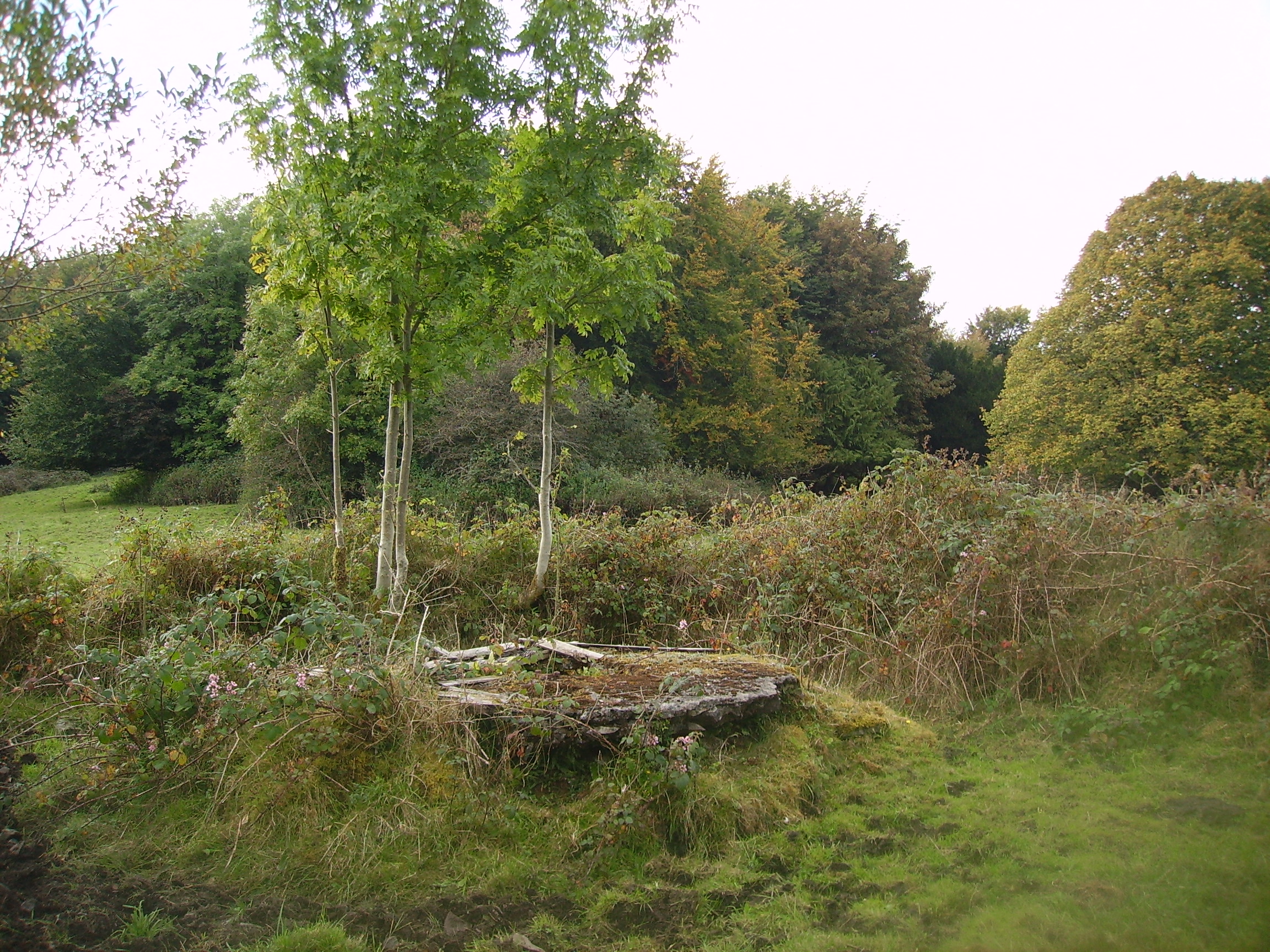
| Lugboy | Home of the Nolan family and the Nolan Ferrall family, this house no longer exists. The only feature still visible is a well in what was once part of the yard. |
|
| Holywell | At th time of Griffith's Valuation, John Burke Jnr. and Gerald Burke were jointly leasing this property from Hugh Burke, when the buildings were valued at £14. In 1786 Wilson refers to Holywell as a seat of Mr. Dillon. Some renovations were made to the house in 2005 by its current owner Eamon Healy. |
|
| Annagh | This townland was in the possession of Thomas Tyrle (Tyrrell) at the time of Griffith's Valuation. No house there has a significant valuation. In 1786 Wilson had noted Annagh as the seat of Mr. Dillon. | |
| Carrolton House | The house known as Beagh Lodge, an O'Carroll house, is shown on the First Edition Ordnance Survey . It is not visible on the 25-inch Ordnance Map of the 1890s. A house on a nearby site is labelled Carrolton House on the latter map. The original house is not extant though there are later buildings. |

|
| Caher | Charles French was leasing the house at Caher, barony of Frenchpark, valued at £16, from Lord de Freyne's estate, at the time of Griffith's Valuation. Lewis also records the house as the residence of C. French in 1837. In the same year the Ordnance Survey Name books record Caher as a "dwelling house of three stories and slated". In the 1749 Census of Elphin F. Elwood was recorded as residing at Caher. By 1894 it was the residence of the Dowager Lady de Freyne. The building is still extant. | |
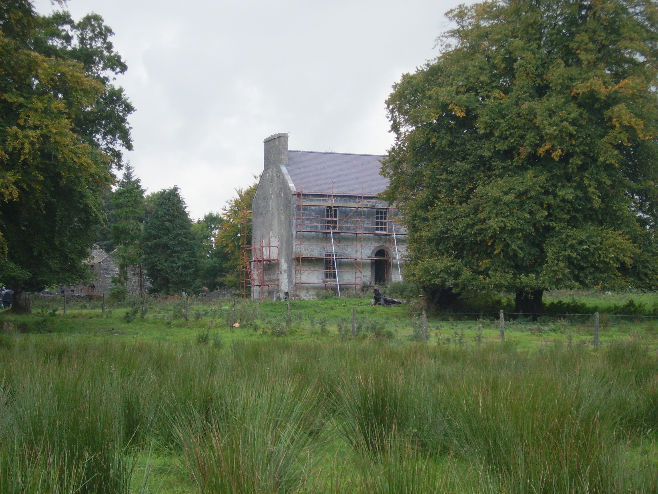
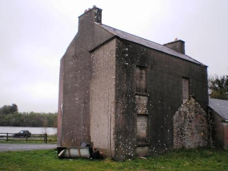
| Errit Lodge | Errit Lodge, valued at £12, was the residence of Fitzstephen French at the time of Griffith's Valuation. It is recorded as Lough Errit by Lewis in 1837 when the Ordnance Survey Name books describe it as " a well built house, two stories high and slated with detached offices". Slater refers to it as the seat of Hon. Charles French in 1894. In 1814 Errit is recorded as the residence of John Barlow. The Census of Elphin in 1749 also records it as a residence of W. Barlow. A modernised and derelict building now occupies the lakeshore site. |
|
| Cloonkeen House | Patrick Sweeney was leasing a house valued at £12 at Cloonkeen, barony of Castlereagh, from the Sandford estate at the time of Griffith's Valuation. It is labelled Cloonkeen House on the 25-inch edition of the Ordnance Survey map. A house is still extant at the site. | |
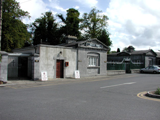
| Castlereagh House | The principal residence of the Sandford estate was at Castlereagh House, barony of Castlereagh. It was valued at £80 at the time of Griffith's Valuation. In 1786 Wilson described it as "a most elegant and capital seat". In 1894 it was the residence of G.R. Wills-Sandford, Castlereagh House has been demolished. Gate lodges, one of which functions as Gaynor's Funeral Home, survive while part of the demesne lands is a public park for Castlerea town. |
|
| Ballinlough | Rev. Robert Blundell was leasing a property valued at £16 at Ballinlough, parish of Kiltullagh, from the Sandford estate at the time of Griffith's Valuation. This appear to be the Glebe House. It is now a ruin. | |
| Willsborough | Henry Sampy was leasing a property valued at £3 10s + 155 acres at Willsborough, barony of Castlereagh, from the Sandford estate at the time of Griffith's Valuation. In 1814 this property was the residence of Walter Jordan. The site of Willsborough House is now occupied by the Community Centre and pitches of Michael Glaveys GAA Club. A memorial stone for a dog owned by Helen Sampey is preserved against the wall of the building. |
|
| Cashlieve House | Lewis describes a house at Cashla in the parish of Kiltullagh as a sporting lodge belonging to W.R. Wills in 1837. In the 1850s William Sandford owned a property valued at £24 at Cashlieve, barony of Castlereagh. The house now known as Cashlieve House was built in the later nineteenth century. |
|
| Lowberry | The Encumbered Estates' Sale notice of May 1856 indicates that the mansion at Lowberry had "formerly" stood in the demesne and recommends it as a "most desirable site for building". It is shown on the First Edition Ordnance Survey map but no buildings are recorded in the townland at the time of Griffith's Valuation. It is labelled "Lowberry House (in ruins)" on the 25-inch map of the 1890s. A portion of these ruins still remain at the site. |