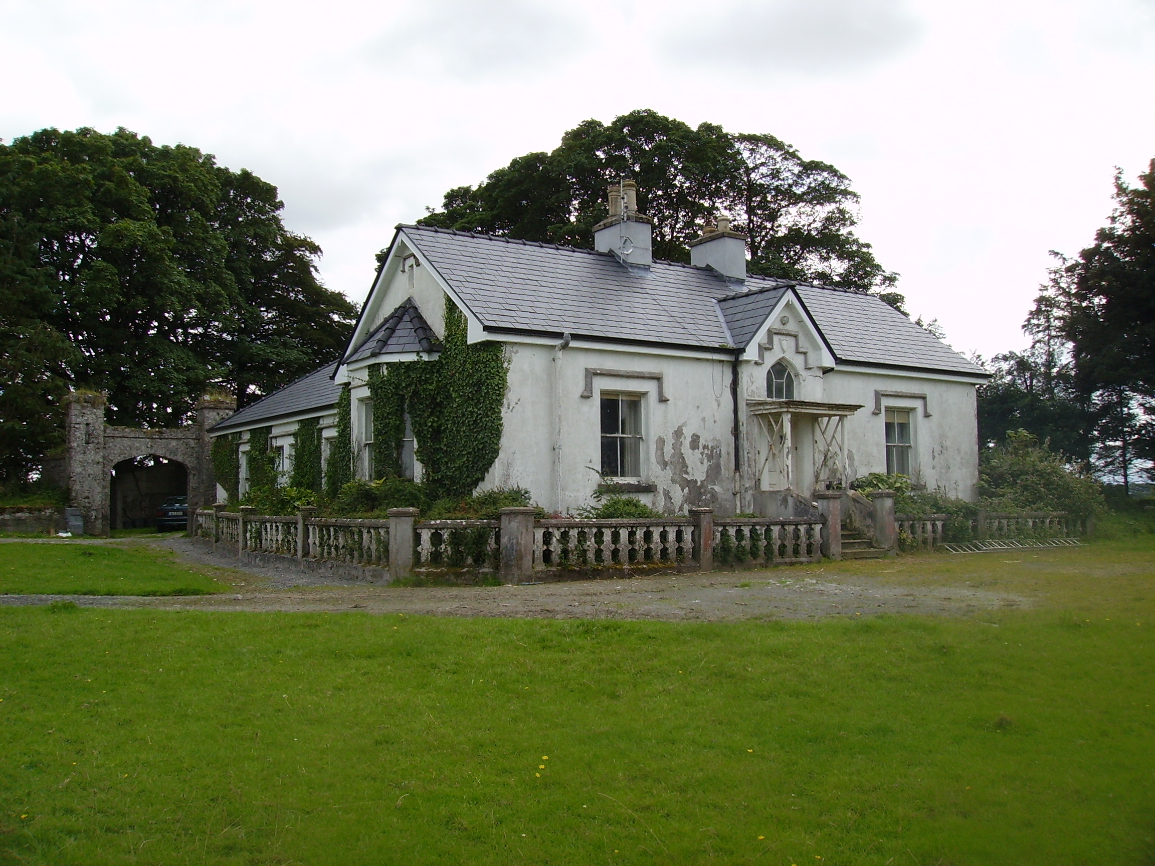
Rockstown
Houses within 10km of this house
Displaying 29 houses.
Houses within 10km of Rockstown
Displaying 29 houses.
| House name | Description | |
|---|---|---|
| Elmhall | Built by Gerald Cuff early in the 18th century, it was let to the Jordans of Murrisk in the 1770s and to a branch of the Browne family of Westport from the 1780s until the early 19th century. In 1786 Wilson refers to it as a seat of the Rt.Hon. James Cuffe. In 1837 the 1st edition Ordnance Survey map notes that it was 'in ruins'. The Irish Tourist Association File states that Elmhall is said to have been burnt in 1798. Only some fragments of walls remain at the site. |
|
| Athavallie | The house at Moat was the main residence of the Lynch Blosses in the 18th and the early 19th century. In 1786 Wilson refers to Moat, the seat of Sir Henry L. Blosse. A fire destroyed the original house in 1808. It was rebuilt and is marked on the first Ordnance Survey map as Attavally. The Lynch Blosse family were absentee landlords for most of the 19th century. In 1894 the house was recorded as the seat of Sir Henry Lynch-Blosse. Later the house became a community school run by the St Louis nuns. It is now known as Balla Secondary Schoool. |

|
| Lagaturrin | The house at Lagaturrin was valued at £6 at the time of Griffith's Valuation, when it was occupied by William Fitzmaurice. William R. Falkiner lived here in the early 1860s. It is no longer extant. | |
| Brownhall | In 1786 Wilson refers to Brownehall as the seat of George Browne. Described in the Ordnance Survey Name Books of the 1830s as "a handsome, commodious building" . It was held in fee by James Browne at the time of Griffith's Valuation, when the house was valued at £25. It is no longer extant. | |
| Carrowgowan | From at least 1814 the house was occupied by the Deanes who held it from Colonel McAlpine, who held from John Knox of Castlereagh. The house was described as in good repair, with offices, orchard and garden. Daniel H. Mellet occupied the house at the time of Griffith's Valuation. It is now demolished. | |
| Thornhill | Home of Charles Burke Jordan in the 19th century. At the time of Griffith's Valuation, he was leasing this property to James Jordan when it was valued at £5. The building labelled Thornhill on the 1st edition Ordnance Survey map is not the same as that on the later 25-inch edition published in the 1890s. The latter is no longer extant but some buildings remain at the original site. | |
| Listrisnan House | This house was described as in 'good repair' at the time of the first Ordnance Survey in the 1830s. At the time of Griffith's Valuation, Joseph Jordan was leasing buildings valued at £2 in the townland of Listrisnan from Myles Jordan. A building still remains at the site. | |
| Bellavary | Charles Goodwin lived in the house in the late 1830s. The Landed Estates' Court rental records that Bellavary House was leased to Standish O'Grady McDermott by William Malley on 10 Feb 1859 for 21 years. It later became a Royal Irish Constabulary barracks and burned down in 1920. | |
| Mount Pleasant | Home of George Mahon in 1814 and of Charles G. Mahon in the 1850s when the house was valued at over £22. It is no longer extant. | |
| Ballinamore | This house was the home of the Ormsby family in the 18th and 19th centuries. It was held in fee by Anthony Ormsby at the time of Griffith's Valuation, when it was valued at £40. In 1786 Wilson refers to it as " the beautiful seat of Thomas Ormsby". In 1938 the Ormsbys sold Ballinamore to a Scottish order of nuns, the Order of St John, who used the house as a school. The building was donated to Western Care in the 1970s. It now functions as a nursing home. |
|
| Oxford | The home of members of the Joyce family in the late 18th and early 19th centuries, later held by the Tuohys in fee. In 1786 Wilson refers to it as the seat of "Mr. Joice". The house and over 740 acres held in fee by Martin Joyes were advertised for sale in the ''The Telegraph'' [Connaught Telegraph] of 13 July 1831. The original house is now a ruin. |
|
| Ballinafad | Bence Jones states that the house was built in 1827 and was sold to the African Missionary Brothers circa 1908 by Lieutenant Colonel Llewellyn Blake of Ballinafad and Cloghballymore, county Galway. It is recorded as his seat in 1894. The Irish Tourist Association File states that the house was donated to the African Missionary Brothers by Colonel Blake and that a new wing was added in 1932. For sale in 2012. |
|
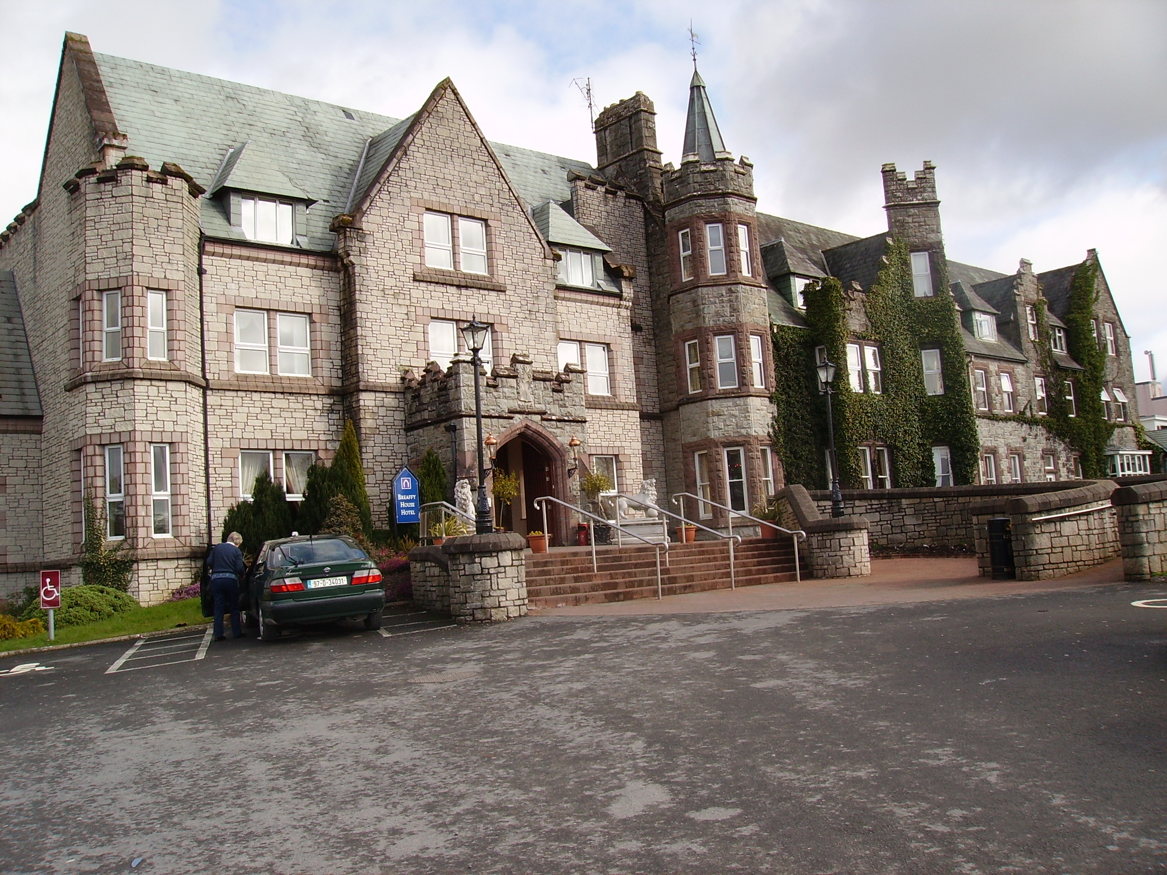
| Breaghwy Lodge | A house known as Breaghwy Lodge was the estate home of the family in the early 19th century. In 1786 Wilson refers to Breafy as the seat of Mr. Browne. This building was later replaced by a large Victorian house which was the residence of D.A Browne in 1894. It now functions as Breaffy House Hotel, |
|
| Bridgemount House (Drum) | The home of the Acton family in the 19th century and the seat of G.H.Acton in 1894. At the time of Griffith's Valuation it was held in fee by George Acton and valued at £10. It was later the home of the Coyne family and is still extant and occupied. |
|
| Castlelucas | A house belonging to the Blakes of Ballinafad, let to Lieutenant Hugh Ryan in 1814 and to Mrs Phibbs in the 1830s who subleased to George Ormsby of the Ballinamore family. At the time of Griffith's Valuation, it was leased by Matthew Phibbs from Mark Blake and valued at £5. It is no longer extant. | |
| Fisherhill | Occupied by Major Blake in the early 19th century. Fisherhill and the lands of Carheens, were leased by Richard D'Arcy of New Forest, county Galway to Edward Cheevers of Killyan, county Galway on 23 Mar 1858. In 1879 Robert Ireland advertised for sale his interest in Cheevers lease. A. C. Larminie lived here in the late 19th century. Now the home of the McGreal family. |
|
| Fortlawn Cottage | William Mulrooney held this property in fee at the time of Griffith's Valuation when it was valued at £5. It is labelled as Fortlawn Cottage on both the 1st and 25-inch edition Ordnance Survey maps. A house is still extant at the site. | |
| Knockmore | Leased by Thomas Ormsby from Lord Kilmaine at the time of Griffith's Valuation, when the property was valued at £13. The ruins of this house were still extant in the 1980s but the house is now demolished and a modern residence erected on the site. The old farm buildings still remain. |
|
| Lakeland | John Ormsby, a younger son of Thomas Ormsby of Ballinamore, lived at Lakeland at the beginning of the 19th century. At the time of Griffith's Valuation, it was leased from Lord Kilmaine by Peter Rutledge Phibbs and valued at £5. It is no longer extant. | |
| Thomastown | Thomastown was originally leased by Christopher Bowen to Francis Lambert in 1777. It was the residence of Thomas Valentine Clendining in the first half of the 19th century. The unoccupied house was held by Charles G. Mahon at the time of Griffith's Valuation when it was valued at £30. Some buildings survive at the site. | |
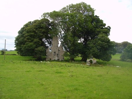
| Charleville | A late 18th century house, the main residence of the family until 1865. Held in fee by Charles L. Fitzgerald at the time of Griffith's Valuation when the buildings were valued at £20. It is now a ruin. | |
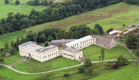
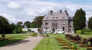
| Turlough Park | Built in 1865 to the design of Sir Thomas Newenham Deane, this Victorian Gothic house was sold to Mayo County Council in 1991 and is now part of the Museum of Country Life. |
|
| Summerhill House (Kilmaine) | The residence of Parsons Persse, agent to Lord Clanmorris, at the time of Griffith's Valuation when the house was valued at £8. Summerhill no longer exists but the yard buildings still remain. |
|
| Curraghleagh Lodge | The O'Moore sales rental of 1852 states that Isidore Bourke held Murneen North by a lease dated 1844, for 500 years. At the time of Griffith's Valuation he was leasing this property from Garret O'Moore when the house was valued at £30. This building is labelled Curraghleagh Lodge on the 25-inch Ordnance Survey map of the 1890s. A building much reduced in size is visible at the site. | |
| Brees/Brize | The original castle was the home of the Moore family in the 17th century. A house was later built which was the home of the Coghlan family in the early 19th century and was occupied by John and Mathew Anderson at the time of Griffith's Valuation, see http://familyhistory.oram.ca/burrishoole/?page_id=1345 . A house is still extant at this site. |
|
| Cloonboy House | The home of John Coghlan at the time of Griffith's Valuation, held from the Lynch Blosse estate when the house was valued at £10. It is still extant. | |
| Cappagh | Cappagh was occupied by James Tighe at the time of Griffith's Valuation when the house, valued at £4, is described as a herd's house. It was built some time before the publication of the 1st edition Ordnance Survey map of 1838 and is still extant and well-maintained. |
|
| Coarsefield | The Grays were in possession of Coarsefield by the late 1830s. The present house was probably built by the Tighe family who bought Coarsefield from the Grays and sold it to the Stephens family in the early 20th century. |
|
| Oory/Coarsefield | It is probable that the townland of Coarsefield was part of Oory in the 18th century and that Oory was divided into two townlands at the time of the first Ordnance Survey. The remains of an old house are still visible at Coarsefield, close to the present house, and it is believed that this was Oory House, home of the Bourkes and later owned by the Nettervilles. In 1814 "Course-field" belonged to James Netterville. The sales rental of the Gray estate of Coarsefield in 1861 refers to one wall remaining of the old Netterville house. |
|