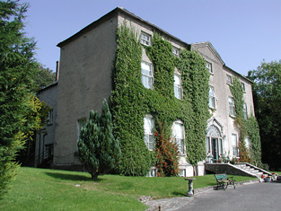
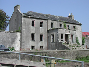
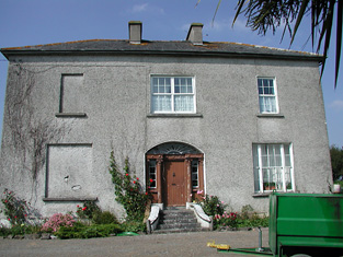
Shanbally
Houses within 5km of this house
Displaying 24 houses.
Houses within 5km of Shanbally
Displaying 24 houses.
| House name | Description | |
|---|---|---|
| Lismore | A house on the Toler estate, occupied by John Pepper and valued at £13+ in the mid 19th century. A building is still located at this site. | |
| Lissanisky | The home of a branch of the Pepper family in the 19th century, occupied by Simon Pepper in 1814, by R. Smithwick in 1837. The Ordnance Survey Name Books refer to it as " a good dwelling house, the residence of Mr. Pepper". It was occupied by Theobald Pepper and Brothers in the early 1850s. This house was held from the Honourable O.F.G. Toler and was valued at £25.10 shillings. It is still extant and occupied. |
|
| Camira | Occupied by the Reverend P. Bolton in 1837 and by William Jackson in the early 1850s, when the house valued at £11.14 shillings was held from Anne Crawford. In the possession of the Cole Bowen family in the later 19th century. This house no longer exists although a building is still located at the site. http://www.askaboutireland.ie/reading-room/history-heritage/big-houses-of-ireland/the-cole-bowen-estate/bowen-family-history/ | |
| Hermitage | This house was occupied by J.A. [John Andrew] Jackson at the time of Griffith's Valuation and held from his father Major Jackson. The house was valued at £20.16 shillings and was located close to the River Ollatrim. This house was renovated in the early 21st century. |
|
| Mount Pleasant | The main home of the Jackson family in the 19th century, occupied by John Short in 1814, by Captain Jackson in the 1830s and by Major Jackson in the early 1850s. The house with 448 acres was held from John Willington. The buildings were valued at £29+. Francis Freeman was the tenant in 1870. This house no longer exists. | |
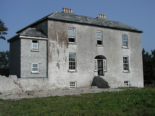
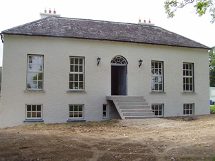
| Castle Willington | Castle Willington was the seat of a junior branch of the Willington family of Killoskehane Castle. In 1786 Wilson refers to it as the seat of Mr. Willington. The Ordnance Survey Name Books note it as the seat of James Willington. Valued at £38+ it was held by James Willington in fee at the time of Griffith's Valuation. Alice C. Langford occupied this house valued at £20 in 1906. She was a daughter of John Willington and had married in 1877 Charles C. Coplen Langford. This house of 3 storys with tower house attached is still a residence. |

|
| Donnybrook | This house was the seat of a branch of the Poe family in the 18th and 19th centuries. William Poe was resident in 1814 and Lewis records him as the proprietor but the house was occupied by a tenant. The Ordnance Survey Name Books mention William Jackson as the occupier and describe the house as "large and commodious". At the time of Griffith's Valuation William Poe held the property in fee, the buildings were valued at £16.14 shillings. Donnybrook is still extant. |
|
| Wilton | This house located close to Donnybrook was vacant at the time of Griffith's Valuation and held by William Poe. It was valued at £10+. Earlier, in 1839, the Ordnance Survey Name books had noted it as the residence of John Poe but "out of repair at present". It no longer exists. | |
| Falleen | The home of the Hawkeshaw family in the 19th century, held from the Bowens of Bowens Court. Benjamin Hawkeshaw is recorded as the occupant in 1814 and in the early 1850s when the house was valued at £13.14 shillings. G. Riall was resident in 1837. The Ordnance Survey Name Books refer to Falleen as the seat of James Bennett in 1839. A house is still extant at the site. | |
| Knockane | Knockane was occupied by Mr William Cooke in 1814. In 1840 the Ordnance Survey Name Books describe it as " a commodious house the property of Mr. Hawkshaw". It was the residence of William Hodgens in the early 1850s, when the buildings were valued at £12.17 shillings and held from Robert Cole Bowen. A possibly later house is located at the site now. | |
| Pallas | The home of the Short family in the first half of the 19th century held from the Bowens of Bowens Court. John Short was resident in 1814 and 1837. The Ordnance Survey Name Books describe it as "a commodious dwelling with pretty demesne". It was occupied by Edmund Short at the time of Griffith's Valuation when the buildings were valued at £10. A farm is located at the site. | |
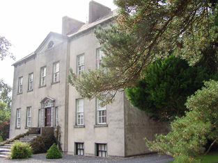
| Bessborough | In 1814 this house was occupied by John Mahon and in 1837 by T. Sadlier junior. The Ordnance Survey Name Books indicate that the proprietor was Mrs. Harding of Dublin and describe Bessborough as " a most beautiful house, occupied by Mr. Cushin, solicitor". By the time of Griffith's Valuation Dr John Armstrong was resident. He held the property from Mrs Harding and the buildings were valued at £20+. Jonathan Harding of Bessborough, Nenagh owned 163 acres in the 1870s. Slater refers to this house as the residence of David E. Young in 1894. It is still in use as a residence. |
|
| Grenanstown | Wilson refers to Grenan's-town as the seat of Mr. Dalton in 1786. In 1837 Lewis describes Grenanstown as the seat of Count D'Alton. The Ordnance Survey Name Books note that James Williams was leasing Grenanstown but that it was occasionally the residence of Count D'Alton. At the time of Griffith's Valuation James Williams occupied Grenanstown. He held the property from Count D'Alton and the buildings were valued at £19.11 shillings. The National Inventory of Architectural Heritage states that Richard Dalton Williams (1822-1862), poet and Young Irelander, lived here as a child. This house was later the property of Henry Eustace, a member of the Robertstown, county Kildare family. It is now a ruin. |
|
| Woodville | Woodville was a home of a branch of the Minchin family from the mid 18th century. The Reverend James Poe was resident at Woodville, Nenagh, in 1814 and Lewis records Humphrey Minchin as the proprietor in 1837. The Ordnance Survey Name Books mention that it had "by far the most beautiful demesne in the parish". He is also recorded as the occupier in Griffith's Valuation when the house was valued at £20.14 shillings and held in fee. When advertised for sale in 1869 James J. Poe was given as the tenant under the Court of Chancery. The house was described as containing a basement story, three large sitting rooms and five principal bedrooms. In 1906 occupied by Alice M.M. Bunbury. George W. Bunbury of Woodville owned 516 acres in the 1870s. |
|
| Ballinamona | A house valued at £11+ on the estate of the Honourable O.F.G. Toler and occupied by Newton Short in the mid 19th century. The Ordnance Survey Name Books refer to it as "a good dwelling house" in 1840. A house is still extant at this location. | |
| Islandbawn | Malachi Ryan held a house, offices, flour mill and 76 acres at Islandbawn from the Honourable O.F.G. Toler at Islandbawn in the mid 19th century. The buildings were valued at £85. |
|
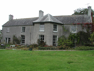
| Rathurles | Rathurles was the home of the Brereton family in the 19th century. Occupied by John Brereton in 1814 and T. Brereton in 1837. In 1840 the Ordnance Survey Name Books refer to it as "a modern building". Thomas Brereton was still resident at the time of Griffith's Valuation holding the property valued at £27.15 shillings from Patrick Kernan. Home of Hugh Finch in the 1870s. This house is still extant and occupied. |
|
| Norwood | In 1841 the Ordnance Survey Name Books described Norwood as "a good dwelling house occupied by a member of the Minchin family" though Simpson Hackett is noted as the proprietor. Captain David Joyce was resident in the mid 19th century when the house was valued at £15+ and held from Thomas Hackett. This house is still extant. |
|
| Ballymackey House | Ballymackey House is described as "in ruins" at the time of the first Ordnance Survey in the 1830s. An earlier tower house is also shown, described as "Ballymackey Castle (in ruins)". Wilson, writing in 1786, refers to "Ballymakey" as the seat of Mr. O'Meara. The Ordnance Survey Name Books describe Ballymackey House as "an old house adjoining the south side of Ballymackey old castle.....now in a state of total ruin". By the time of Griffith's Valuation, this townland was part of the Cole-Bowan estate. Most of the site is now occupied by extensive farm sheds though ruins of the old castle are still visible. | |
| Tiermoyle House | In 1786 Wilson refers to Tiermoyle as the seat of Mr. Crawford. In 1840 the Ordnance Survey Name books refers toTiermoyle as a residence of Cooper Crawford and "about 20 years ago it was then a place of some account but it is now in a state of dilapidation". By the time of Griffith's Valuation, this house was occupied by Mrs. Costelloe, leasing from Countess Norbury's estate and valued at almost £4. A farm is still extant at the site. | |
| Elm Hill House | The Ordnance Survey Name Books record William Middleton as the occupier of Elm Hill House in 1839 and mention the surroundings as "a very pretty demesne situated in a beautiful locality". At the time of Griffith's Valuation, William Middleton was leasing this property from the Poe estate when the house was valued at almost £8. The original house is no longer extant and a modern house has been constructed at the site. | |
| River Lawn | In 1839, he Ordnance Survey Name Books describe River Lawn house as "a commodious house, the property of William Poe, in the occupation of E. Radford esq". At the time of Griffith's Valuation, when it was valued at almost £10 it was leased by Augustus H. Going from William Poe. It is still extant and occupied. |
|
| Mill Grove House | In 1841, the Ordnance Survey Name Books describe Mill Grove House as " a good house with demesne and plantations, the residence of Mr. Kennedy". At the time of Griffith's Valuation, Edward Kennedy was leasing a substantial milling complex and a house at this location from the Stoney estate. The buildings had a value of £46+. It is labelled Millgrove House on the 25-inch map of the 1890s but is no longer extant. | |
| Ballycrenode House | In 1840 the Ordnance Survey Name Books refer to the site of Ballycrenode House in the parish of Kilkeary, stating "only those people who are very old can recollect seeing any part of this house standing". This original Ballycrenode House belonged to the O'Carroll family and the last inhabitant was a Major O'Carroll. The site is marked on the 1st edition Ordnance Survey Map. At that time and in Griffith's Valuation, the townland belonged to the Toler estate. The 25-inch map of the 1890s shows a later Ballycrenode House, located slightly to the north-west of the original site. This property is still extant, part of a large farm. |