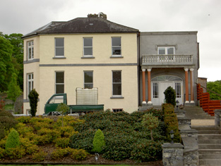
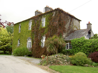
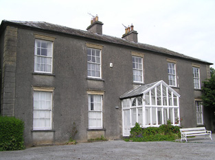
Marlow
Houses within 10km of this house
Displaying 32 houses.
Houses within 10km of Marlow
Displaying 32 houses.
| House name | Description | |
|---|---|---|
| Ardmayle/Clonmore | Ardmayle House in the townland of Clonmore North is marked on the first Ordnance Survey map. The Prices were resident here from at least the 1770s ad Wilson mentions it as the seat of Mr. Price in the 1780s. "Ardmoyle", Cashel, was the residence of Thomas Price in 1814 and in 1837. Richard Price was the occupant in 1850 holding the house valued at £21.17 shillings from John Hyde. The National Inventory of Architectural Heritage states that the present house dates from circa 1870s and was formerly the wing of an 18th century house demolished in 1951. Louis H. Grubb occupied at house at Clonmore North in 1906 valued at £56. This house is now known as Clonmore. |
|
| Fort Edward | Fort Edward was the home of Edward Long from at least the mid 1830s and is referred to as his residence by the Ordnance Survey Name Books in 1840. At the time of Griffith's Valuation he held the property from Charles Bianconi and the buildings were valued at £19+. Still extant and occupied. |
|
| Longfield | The seat of the Long family, occupied by Richard Long in 1814 and in 1837. Bought by Charles Bianconi in the 1840s, he held it in fee in the early 1850s when the house was valued at £27+. By 1906 the house was valued at £37 and was occupied by Mary Anne O'Connell. The house remained in the ownership of Bianconi's descendants until 1968 when it was bequeathed by Mrs Mary O'Connell Bianconi to the Irish Georgian Society. |

|
| Ballinree | Ballinree House was valued at £16+ in 1850 and was occupied by the Reverend William Kirwan and held from Smyth Barry. Arthur H.S. Barry was the occupier in 1906. | |
| Gaile | Gaile was the home of the Phillips family in the 19th century, occupied by S. Phillips in 1837 and by Richard Phillips in 1850. It was held from Benjamin Bunbury with 749 acres and was valued at £37+. The Phillips continued to reside at Gaile until at least the mid 20th century. This house was vacant in the early 21st century. |
|
| Regaile | In 1840 the Ordnance Survey Name Books record Rev. Mr. Joice as the occupant of Regeale. The Reverend Robert Armstrong occupied the house at the time of Griffith's Valuation holding it from Richard Phillips. The buildings were valued at £20.18 shillings.A house is still extant at Regaile. | |
| Graiguenoe | In 1837 Lewis refers to C. Clarke "who has recently erected a spacious and elegant mansion on his estate". In 1850 this mansion was valued at £44.12 shillings and it was held in fee by Charles Clarke. Slater noted it as the seat of James Neville Clarke in 1894 and the Clarkes were still resident at Granguenoe Park in the early 20th century. The house was burnt in 1923. The site is now occupied by a stud farm. | |
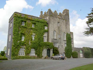
| Killough | A 16th century tower house with a number of additions, Lewis records Killough Castle as the "occasional residence" of the Honourable Mrs Plunkett. In 1850 the Honourable Bowes Daly occupied the castle valued at £22.14 shillings which he held in fee. |
|
| Ballynahinch | A house valued at £14, occupied by Denis Heany and held from Richard B. H. Lowe at the time of Griffith's Valuation. This house is still extant and the centre of a working farm. |

|
| Clonbonane | Edmund Scully of the Silverfort branch of the Scully family lived here in the first half of the 19th century. By the time of Griffith's Valuation Jeremiah Scully held the house valued at £12 from the Earl of Norbury. This house no longer exists. | |
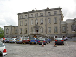
| Dundrum | Dundrum was the seat of the Viscounts Hawarden in county Tipperary in the 18th and 19th centuries. The Ordnance Survey Name Books mention that the demesne was well-planted in 1840. Dundrum was held in fee by Viscount Hawarden and valued at £85 at the time of Griffith's Valuation. The Earl de Montalt was still resident in 1906 when the house was valued at £85. The Irish Tourist Association Survey states that it was bought from the Land Commission in 1908 and became St Michael's Presentation Convent. This early 18th century Palladian house now functions as a hotel located in the grounds of the Tipperary golf club. |
|
| Lackenacoombe | Samuel Cooper held this house in fee at the time of Griffith's Valuation. It was valued at £7.5 shillings. Some buildings remain at this site. | |
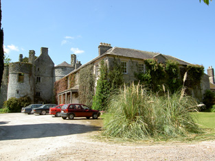
| Killenure Castle | Leet records Samuel Cooper as the proprietor of Killenure in 1814 and Lewis in 1837 as the "seat of William Cooper". At the time of Griffith's Valuation William Cooper held the property in fee and the house was valued at £31.10 shillings. The Coopers were still resident at Killenure in the early 20th century. As its webiste suggests "It has been a fortified home with sturdy towers, a'hunting box', a country house for a large family, a busy productive farm with stables and coach house, a boarding school and even a meditation centre". It will be open to the public from Summer 2012. See htp://killenure.com. |
|
| Ballywalter | F. V. Wayland was resident at Ballywalter in 1837. Francis Wayland of Ballywalter was murdered in 1838 on his way to a fair. William Weyland was living at Ballywalter in the mid 19th century, when the house was held from William Cooper and valued at £12.5 shillings. The Waylands and Coopers were related. This 18th century house is still in use as a family residence. |
|
| Grene Park | This house dates from the mid 19th century and appears to have been built [for Nicholas B. Grene] post the first edition Ordnance survey map as it is not located on exactly the same site as the previous building. Griffith's Valuation records Nicholas B. Greene occupying a house valued at £29.15 shillings, held from the representatives of Robert Usher. This house still functions as a residence. |

|
| Ballymore House | The Murphys were established at Ballymore from the early 18th century. A castle and two houses are located in this townland at the time of Griffith's Valuation, all inhabited by members of the Murphy family. The main residence was Ballymore House, which was occupied by Edmond W. Murphy. He held the house and 423 acres from the Earl of Norbury. The buildings were valued at £24.5 shillings. Daniel Murphy also occupied a house valued at £12.5 shillings (Grid Ref S021 457). Ballymore House is still a family residence. |
|
| Woodford | John Murphy lived at Woodford in 1814 and Edmund Murphy in the mid 19th century when the house was valued at £30.15 shillings and held from Francis Greene. The Ordnance Survey Name Books describe it as "a gentleman's seat situated in a small demesne" in 1841. It is still extant. |
|
| Cappamurragh | The Grene family home occupied by John Grene in the first half of the 19th century. He held the property in fee and the buildings were valued at £24 in the early 1850s. In 1841 the Ordnance Survey Name Books describe it as "a gentleman's seat in a very handsome demesne of considerable extent". It is still extant. |

|
| Castle Fogarty | Lewis writes that Castle Fogarty was "the ancient seat of the O'Fogarty family from whom it descended to the present proprietor J. Lanigan". He describes it as a "square castellated mansion, with embattled towers at the angles". The seat of the Lenigan family in the 18th and 19th centuries [held from the Earls of Portarlington until the fee was purchased in the mid 19th century]. Noted by Slater as the seat of Captain Vivian Ryan-Lanigan in 1894. A ruin since it was burnt in 1922. |
|
| Mountalt | Occupied by Martin Ryan in 1814 and in 1837 and held from J. Lenigan. James Lenigan is recorded as the occupier at the time of Griffith's Valuation, holding the property in fee, when the farm house and offices were valued at £7. | |
| Crossoge | Lewis refers to Prior Lodge as the residence and property of the Reverend Dr Prior. The house in Crossoge is named Prior Lodge on the first edition Ordnance Survey map. This house appears to have been replaced by another building, a short distance to the south, known as Crossoge House sometime in the mid 19th century. Occupied and held in fee with 92 acres by the Reverend John Prior at the time of Griffith's Valuation when the buildings were valued at £25.15 shillings. This house is still in use as a country residence. [This may be the house to which Wilson, writing in 1786, refers to as"Bachelor's Lodge", in this area, which was a seat of Mr. Roe]. |
|
| Ballynera | The residence of Richard Pennefather in 1837 and at the time of Griffith's Valuation when the house was valued at £10 and held in fee. A house is still extant at the site. | |
| Moyaliff | Mealiffe was the residence of the Reverend William Armstrong in 1837 (the Chancellor) and of John Armstrong in the early 1850s. John Armstrong held the property from Colonel Pennefather and the buildings were valued at £29.10 shillings. Moyaliff was the residence of Edward Marcus Armstrong in the 1880s. Mark Armstrong occupied this house in 1906. This house, which incorporates building from the 18th and 19th century, is still a residence. |

|
| Ballycahill | A house at Ballycahill valued at £11+ was occupied by Mrs Mary Cormack at the time of Griffith's Valuation and held from Doctor Wall. | |
| Farney Castle | A seat of a branch of the Armstrong family. Wilson refers to this property as Farney Bridge in 1786, a seat of Mr. Armstrong. It was occupied by Captain Armstrong in 1814 and 1840, when the Ordnance Survey Name Books describe it as "a circular old castle to which a gentleman's residence has been attached". Major William Armstrong was the occupier in the early 1850s. The buildings were then valued at £42.10 shillings and held from the Reverend Garrett Wall. It was still in Armstrong possession in the 1870s. Farney Castle is still extant and occupied. |

|
| Raheen Park | Located south east of Farneybridge this house was occupied by Edward Wilson in the mid 19th century, valued at £34 and held from William B. Armstrong. Raheen Park may have been previously known as Brasfort. Brasfort was the home of the Wilsons in the 1830s. Edward Wilson was Chief Magistrate of Police in county Tipperary in the 1820s. In 1820, his son, Edward Wilson, married Isabella, daughter of Thomas Goodricke Peacock of Fort Etna and they had a son, Thomas Goodricke Wilson, who married Mary Studdert in 1861 and emigrated to Canada. In 1840 the Ordnance Survey Name Books refer to E. Wilson as the proprietor of Raheen Park. Edward Wilson of Raheen Park died at Monkstown, county Dublin in 1880, aged 81, (see D.23260 in the National Archives). | |
| Synone | A house built in the second half of the 19th century, still extant and lived in. |
|
| Gortkelly Castle | The National Inventory of Architectural Heritage dates this house from circa 1800. It is a five-bay house with three storeys. Gortkelly House is marked on the 1st edition Ordnance Survey map as a relatively small house but had increased in size by the end of the 19th century when named Gortkelly Castle. Gortkelly was the home of the Ryan family from the mid 18th century. John Ryan was resident in 1814. In the mid 19th century the house was held from Peter Graham [Grehan] by Andrew Ryan and was valued at £6.5 shillings. It is now a ruin. | |
| Beakstown House | Major Ledwell was resident at Beakstown in 1837 and the Ordnance Survey Name Books also mention it as his residence in 1840. At the time of Griffith's Valuation one house at Beakstown appears to be in use as an auxiliary poorhouse, held by the Reverend George Peacock from the Court of Chancery and valued at £22+. Another property seems to be labelled Abbey View on the 1st Edition Ordnance Survey map but as Beakstown Cottage on the 25-inch map of the 1890s. The OS Name Books refer to this house as the residence of Mr. Mullvany, proprietor of Beakstown Flour Mills nearby. The name Beakstown Cottage had previously belonged to another property in Beakstown which is still extant [S087559]. The original Beakstown House does not appear to be extant. | |
| Holycross House | In 1840 the Ordnance Survey Name Books refer to Holycross House as a gentleman's residence. At the time of Griffith's Valuation, it was owned by Rev. Garret Wall but was unoccupied. The house was valued at almost £24. A house still stands at this site which now appears to be in use as a presbytery. |
|
| Abbeyfield / Gortnagowth | In 1840 the Ordnance Survey Name Books refer to Abbeyfield House as the residence of William Jones. At the time of Griffith's Valuation, Jeremiah O'Brien was leasing this property from the Wall estate when it was valued at £15+ and included a mill. It is labelled Abbeyfield on the 1st edition Ordnance Survey map but as Gortnagowth on the 25-inch map of the 1890s. It is still extant. | |
| Whitefort House | The Ordnance Survey Name Books refer to Whitefort House as a gentleman's residence in 1840. At the time of Griffith's Valuation, this property was leased by John Jones from the Wall estate when it was valued at almost £10. It is still extant. |