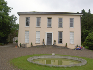
Trantstown
Houses within 5km of this house
Displaying 8 houses.
Houses within 5km of Trantstown
Displaying 8 houses.
| House name | Description | |
|---|---|---|
| Bishop's Island | Grice Richard Smyth held buildings valued at £25 in the townland of Bishop's Island at the time of Griffith's Valuation. ''Burke's Irish Family Records'' refers to his father Henry Mitchell Smyth of Bishop's Island. In 1786 Wilson notes Bishop's Island as the seat of Mr. Mitchell. | |
| Blossomgrove | Blossomgrove was the residence of William Casey in the early 1850s. He held the house valued at £22 and 335 acres from Simon Dring. A house is still extant at the site. | |
| Butlerstown | Nathaniel C. Martin held a house, offices, foreman's house and spade factory valued at £25 from Francis Beamish. The property is labelled Butlerstown House on the 25-inch Ordnance Survey map of the 1890s when the spade factory is no longer visible. There is still an extant house at the site. | |
| Ashton Grove | This house is marked Ashton Grove on the first Ordnance Surve map. John Cotter was the proprietor of Ashton, Cork, in 1814 and T. Cleary of Ballingohig in 1837. Thomas J. Cleary held the property from Henry Braddell at the time of Griffith's Valuation when the buildings were valued at £22. Cleary held a cornmill from Braddell in the townland of Kilrussane. James Fitzgerald held 122 acres of untenanted land and buildings valued at £26+ in 1906. |

|
| Mitchellsfort/Fellfort | This house was the home of Mitchell Esq in the 1770s and 1780s. Occupied by Brooke Brazier in 1814 and by his son Henry B. Mitchell in the early 1850s. Henry B. Mitchell owned the property in fee and the buildings were valued at £52+. Slater noted it as the residence of R.L. Fell in 1894, now demolished. | |
| Hermitage | A house valued at £18, occupied by Eliza Martin and held from Robert Webb at the time of Griffith's Valuation. In the 20th century the home of Edmund Glen Browne. |

|
| Wood View | The home of J. Cremen in 1837 and Jeremiah Crimmin in the early 1850s, when the house was valued at £16 and held from Thomas Wyse. | |
| Sarsfieldscourt [Old] | In 1837 Lewis refers to Sarsfieldscourt as an ancient mansion "formerly belonging to the Sarsfield family but now to Mr Rutland [Putland] of Dublin". On the first Ordnance Survey map one building is marked as "in ruins". Another building also named Sarsfield's Court is marked closer to the Glashaboy River. At the time of Griffith's Valuation Charles Putland junior was recorded as occupier, holding the house valued at £13 from his father Charles Putland. This latter property is labelled Beechmount on the 25-inch Ordnance Survey map of the 1890s. A property labelled Sarsfieldcourt House is also located in the townland on the later map [W723779]. It is no longer extant and St.Stephen's Hospital now occupies the grounds. |

