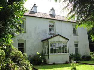
Turret Farm House
Houses within 5km of this house
Displaying 19 houses.
Houses within 5km of Turret Farm House
Displaying 19 houses.
| House name | Description | |
|---|---|---|
| Oriel House | Built in the first decade of the 19th century by the Board of Ordnance. The house was occupied by Charles Wilkes, the superintendant of the gunpowder mills until purchased by the Tobins of Liverpool in the mid 1830s. Mrs Tobin was a painter and their residence became known as Oriel House under Tobin ownership. The house has been a hotel since 1983. |

|
| Woodside | Wilson refers to Wood-side as the seat of Mr. Carleton in 1786. It was occupied by John Carleton in 1814 and by the Reverend E.M. Carleton in 1837. By the early 1850s the house was occupied by Horace Townsend and held by him in fee. It was valued at £40. It had become known as Kilcrenagh by the publication of the 25-inch Ordnance Survey map in the 1890s. Donnelly states that it was burnt in May 1921 during the War of Independence when it was the residence of the family of Ebenezer Pike. The National Inventory of Architectural Heritage notes that it is now in ruins. | |
| Rock Lodge | A house on the Donoughmore estate, occupied by R. Carleton in 1837 and by Henry Osborne Seward at the time of Griffith's Valuation when it was valued at £25. A house is still extant at the site. | |
| Coolyduff House | At the time of Griffith's Valuation this house valued at £16 was occupied by Alfred Parnell and held from Richard Beamish. Labelled as Coolyduff House on the 25-inch Ordnance Survey map of the 1890s. There is still an extant house at the site. | |
| Lackenshoneen | Benjamin Cross occupied this house in the mid 19th century. He held it from Philip Cross and the buildings were valued at £12. The buildings have all but disappeared on the 25-inch edition Ordnance Survey map of the 1890s and nothing remains at the site now. | |
| St Anne's Hill | Richard Barter occupied a house valued at £55 in the townland of Kilnamucky at the time of Griffith's Valuation. St Anne's Hill is marked on the first Ordnance Survey map in this townland. By the 1890s this property had become absorbed into a complex of buildings labelled Hydropathic Establishment. The National Inventory of Architectural Heritage notes that most of the complex is now in ruins though Maranatha House survives as a residence. |

|
| Blarney Castle | The original 15th century castle belonged to the McCarthys of Muskerry. In 1786 Wilson describes Blarney as the "very fine seat, with ample and beautiful demesnes, of Mr. Jeffreys". Lewis wrote in 1837 that Blarney Castle was purchased in 1701 by Sir James Jefferyes, Governor of Cork [from the Hollow Sword Blades Company] who “ soon after erected a large and handsome house in front of it, which was the family residence for many years, but is now a picturesque ruin”. A new house was built in 1874 on the demesne lands by the Colthurst family and is still occupied by them. |

|
| Bawnnafinny | Described at the time of Griffith's Valuation as a caretaker's house, valued at £12 and held by St John Jefferyes in fee. | |
| Cloghroe House | In 1786 Wilson refers to Cloghroe as the seat of Mr. Capel. In the late 18th century this house passed by marriage from the Capel family to the Fitzgerald family. J. C. Fitzgerald was resident at Cloghroe in 1814. The house, valued at £28, was occupied by Thomas Keogh in the early 1850s and held from Thomas Fitzgerald. In 1944 the Irish Tourist Association Survey referred to it as the residence of Major O'Mahony of Blarney Mills. A house is still extant at Cloghroe. | |
| Inchbeg | Located on the Fitzgerald estate, this house was occupied by Henry Young, at the time of Griffith's Valuation. The buildings were valued at £11.15 shillings and he also held a mlll valued at £84. A house is still extant at the site. |
|
| Carrigrohane Castle | A fortified house that came into the possession of the Hoare family through marriage with a member of the Baker family in the 1770s. In 1786 Wilson refers to Carrigrohan as the seat of Mr. Colthurst. Reconstructed in the 1830s by Augustus Robert McSweeny, a corn merchant, who also leased the floor mills nearby. At the time of Griffith's Valuation Jane McSweeny was resident. The Castle later reverted back to the Hoares who owned it until the 1940s. They are mentioned by the Irish Tourist Association survey as resident there. It is still extant. |

|
| Leemount | The residence of John T. Hartnell in 1814 and of Nicholas C. Brabazon at the time of Griffith's Valuation. Brabazon held the house valued at £72 from St John Jeffreys with 118 acres. The 1870s landowners' records indicate it as owned by Henry Lindsey Young and Slater records it as his residence in 1894. Leemount is still extant. |

|
| Mount Desert | The home of the Dunscombe family in the 18th and 19th centuries, it was noted by Wilson as the seat of Mr. Dunscombe in 1786. The house was occupied by George Dunscombe in 1814 and by Nicholas Dunscombe in the early 1850s when it was valued at £55. Still valued at the same amount in 1906 when it was occupied by Robert Dunscombe. The house is no longer extant and the Bon Secours Health Care unit is now located at this site. |
|
| Ballygaggin | Occupied by Edmond Murphy at the time of Griffith's Valuation, valued at £30 and held from the Duke of Devonshire. | |
| Gawsworth | In the mid 19th century this house valued at £19 was occupied by Russell Fitton and held from the representatives of Robert Hedges and Mr Pratt. | |
| Ballycannon | The home of the Spread family in the 18th century, by the time of Griffith's Valuation the buildings were valued at £7 and occupied by Michael and John Daly who held the property from the representatives of William Spread. A building is still extant at this location. | |
| Rosanna | Rosanna was the home of the Webb family in the 19th century, occupied at the time of Griffith's Valuation by Hannah (widow of the Reverend Dr John Webb) valued at £75 and held from St John Jeffreys. A building is still located at this site. | |
| Spud Villa | This house is marked on the first edition Ordnance survey map. Anne and Jane Wise occupied a house in the townland of Mount Desert valued at £38 and held from Thomas Wise in the mid 19th century. | |
| Rathpeacon House | At the time of Griffith's Valuation, Rathpeacon House was occupied by William le Fanu leasing from Richard Thomas when the house was valued at £27. In the 1870s it is recorded as the residence of John Davis. |