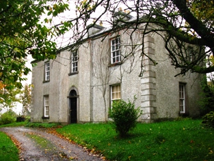
Pheasant Hill
Houses within 5km of this house
Displaying 9 houses.
Houses within 5km of Pheasant Hill
Displaying 9 houses.
| House name | Description | |
|---|---|---|
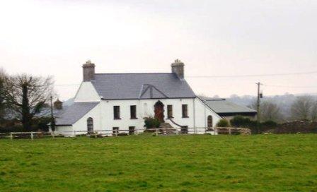
| Greenhills | Greenhills was part of the estate of the Marquess of Sligo until the sale to William Livingstone in 1854 and was let to Joseph Bourke in the early 19th century. It was later occupied by Archibald Stavert who held it from William Livingstone at the time of Griffith's Valuation. It was owned by Matt Fahy in the late 1990s and is still extant. |
|
| Kilboyne | Described at the time of the first Ordnance Survey as a 'good house surrounded by a neat but small demesne'. At the time of Griffith's Valuation it was held in fee by Sir Samuel O'Malley and valued at £12. A modern house exists at the site now. | |
| Kinturk | A residence of the Bourke family in the early 19th century, situated beside Kinturk Castle. In 1786 Wilson refers to it as the seat of Mr. Burke. The townland was in the possession of Rev. H.N. Ormsby at the time of Griffith's Valuation. | |
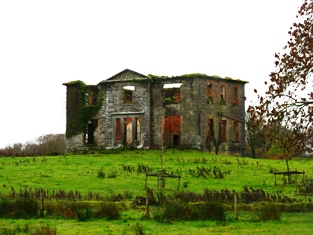
| Raheens | A house south west of Castlebar, noted by Wilson as the seat of A.N. Browne in 1786. Held by the Browne family from their relatives the Lords Kilmaine. At the time of Griffith's Valuation, it was occupied by Henry Browne and valued at over £16. It is now a ruin. |
|
| St Audries | An 18th century house on the shore of Saleens Lake on the outskirts of Castlebar, named after the home of the 1st Countess in Somerset, England. St Audries was leased to Owen Lindsey in 1769 and his family maintained an interest in the property and the farm at Drumsheen until the early 19th century. The Reverend Archdeacon Warburton was living in the house in 1814. By the time of the first Ordnance Survey the house was in ruins. | |
| Snugborough | A property leased from the Brownes of Raheens, the O'Malleys built a house here in 1765, costing £900. It was badly damaged in 1798 and was recorded to be in a dilapidated state in the Ordnance Survey Name Books. It is labelled as Snugborough House on the 1st edition Ordnance Survey map of 1838 but is not labelled on the later 25-inch edition and nothing now remains. | |
| Spencer Park | A house occupied by a junior branch of the Burrishoole family descended from Patrick O'Malley. They held the house during the second half of the 18th century and much of the 19th century from the Earls of Lucan. By the time of Griffith's Valuation it was occupied by John C. Larminie. In 1858 Larminie sold his interest in the O'Malley's lease of Spencer Park, which had been renewed on 7 Oct 1842 for three lives or 31 years. The Freeman's Journal reported that it was purchased in trust by Mr. Jordan. The site is now occupied by modern housing. | |
| Mount Gordon | An 18th century house, occupied in the 1770s by 'Garden' [Gardiner]. Wilson refers to it as the seat of Mr. Garden [Gardiner] in 1786. It was occupied by Mary Boyd at the time of Griffith's Valuation, when the house was valued at £43. It is still extant and occupied. |
|
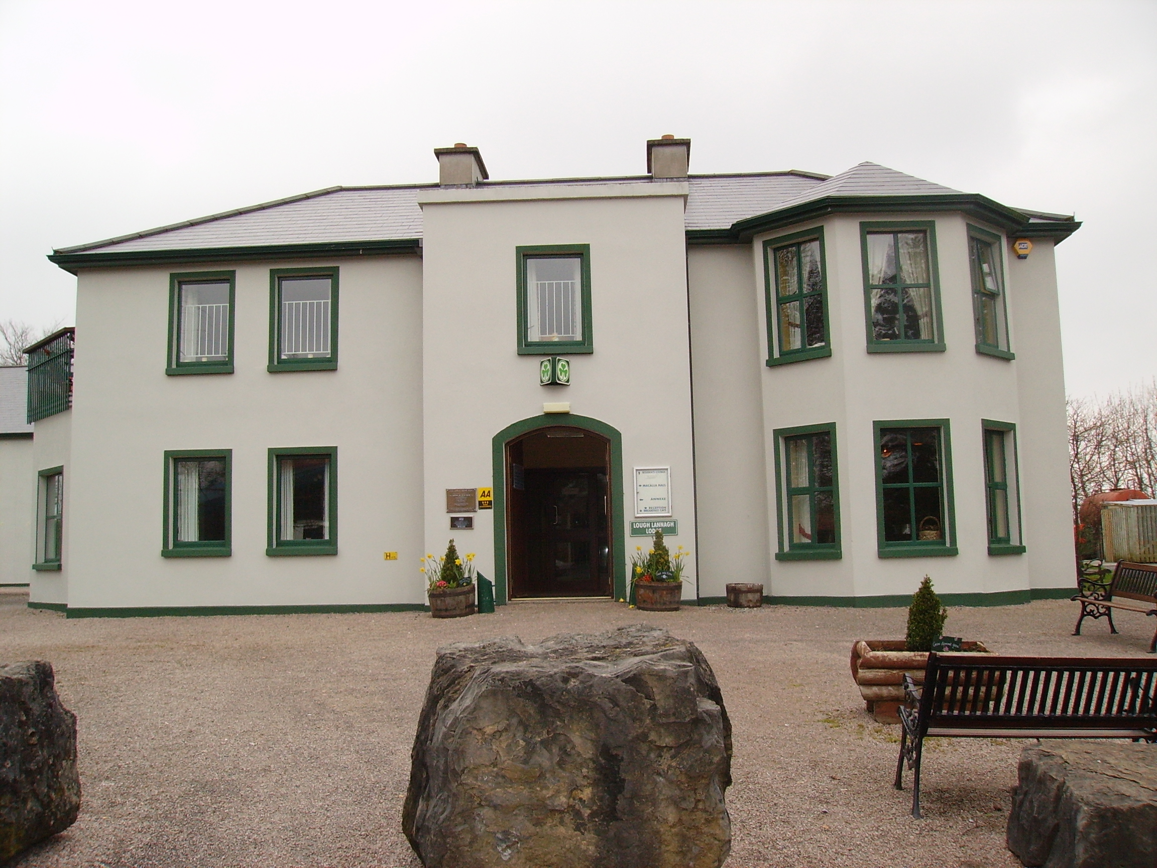
| Creagh's Villa | At the time of Griffith's Valuation, this property appears to be have been leased by Mary Boyd fron the Lucan estate when it was valued at £12. In the 1870s it was the residence of Bernard Peyton. It was destroyed by fire in 1996 and subsequently demolished to make way for the Lough Lannagh holiday complex which includes a building similar to the design of the original house. |
|