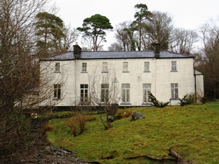
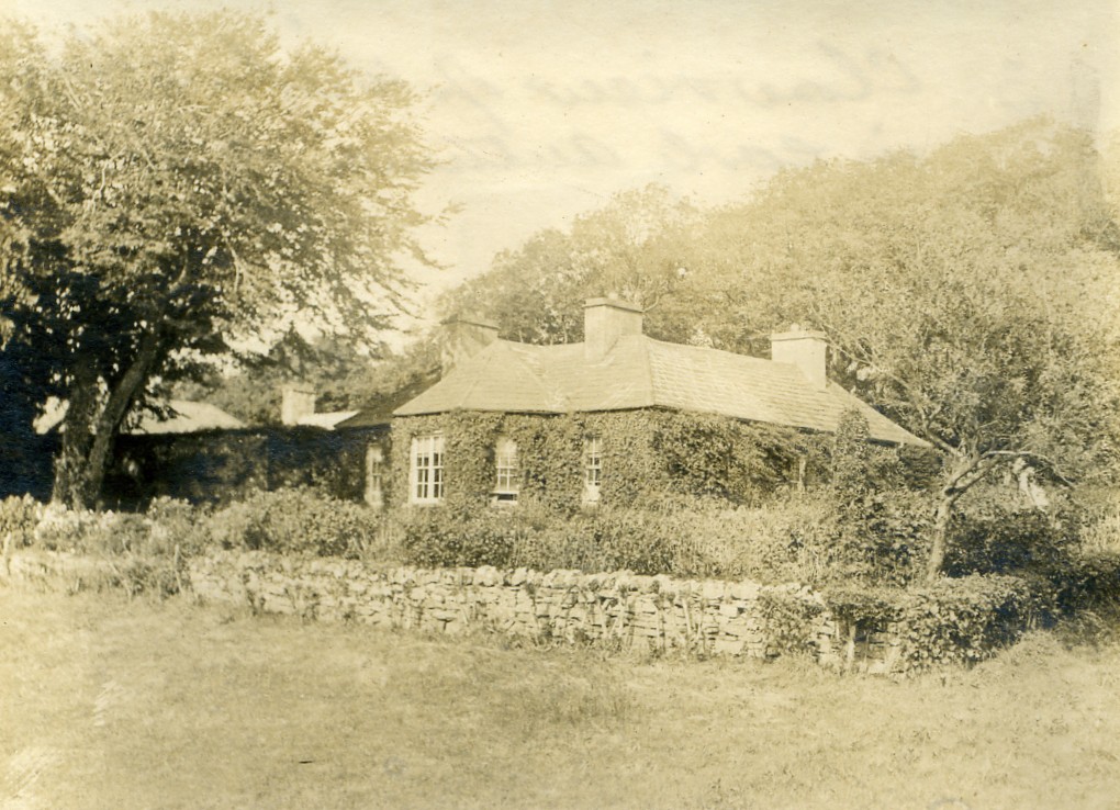
Burrishoole Lodge
Houses within 10km of this house
Displaying 16 houses.
Houses within 10km of Burrishoole Lodge
Displaying 16 houses.
| House name | Description | |
|---|---|---|
| Treanlaur House or Lodge | At the time of Griffith's Valuation the house at Treanlaur was leased by Peter Denis Browne from the Westport estate and valued at almost £9. It was occupied by Charles Henry Laprimaudaye in the 1870s. Treanlaur is still extant. |
|
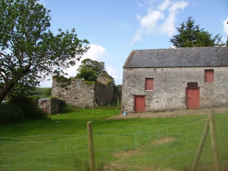
| Newfield House, | Part of the McLoughlin estate and in the second half of the 19th century of the Smith estate. The house appears to have been a ruin by the end of the 19th century. A ruined building is situated near the sea shore with some farm buildings still in use. |
|
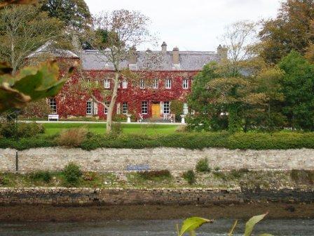
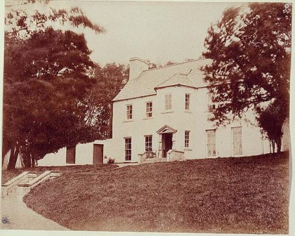
| Newport House | Built in the late 18th century, this house was the main residence of the O'Donels in the 19th century. It now functions as a hotel. |
|
| Ross House | Ross House was built by Lewis O'Donel, a son of Lewis O'Donel of Killeen, Crossmolina, county Mayo and a first cousin of the first Sir Neal O'Donel, baronet. The house was inhabited by Captain and Mrs William Houstoun at the time of Griffith's Valuation. They later moved to Doolough and Delphi in the barony of Murrisk. The house was purchased by Middleton O'Malley about 1880 and Slater records it as his residence in 1894. It is now the home of Mrs Meike Blackwell, whose mother-in-law was an O'Malley. | |
| Raigh Lodge | At the time of Griffith's Valuation the house held by Nathaniel P. Simes in fee, was valued at £6. The premises shown at this site on the 25-inch Ordnance Survey map of the 1890s is labelled Clew Bay Hotel. A house is still extant and occupied here. |
|
| Wilford Lodge | This house may have been named after Lieutenant Colonel Richard R. Wilford who held a lease of the property from the Arbuthnot family in 1786. It was also leased to Reverend George Graydon, Sir Samuel O'Malley and Thomas G. FitzGerald and A. T. Oram, as detailed in the Westport Papers. Charles Pridham was the occupier at the time of Griffith's Valuation. Buildings are still extant at the site. For further information and photographs about the Oram occupation of Wilford see http://familyhistory.oram.ca/burrishoole/ |
|
| Ardagh Lodge | Ruane writes that it was built as a yachting lodge in the 1790s for the Palmer family. It was the residence of the Stuart family during the bathing season in the 1830s. Bought by the Stoney family in 1965. A house is still extant at the site. | |
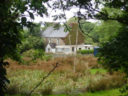
| Milcum House | Ruane states that this house was built in 1754 by the Browne family [of Westport] and that it was first known as 'Seamount'. There was another Milcum house, built in the small townland of Milcum by the Binghams in the early 18th century, which was the house marked 'in ruins' on the first Ordnance Survey map. Seamount was occupied by Connell O'Donel in 1837. At the time of Griffith's Valuation it was unoccupied but in the possession of Nathaniel P. Simes. In the 20th century it was the home of Miss Laprimandaye, Sir Anthony Beever, the Brittains, the Percivals and Mr and Mrs Peter Mullowney. Milcum is still extant and occupied. |
|
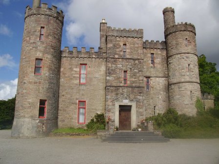
| Rosturk Castle | Enlarged and extended by Robert Vesey Stoney in the latter half of the 19th century. It was noted as his residence by Slater in 1894. The property was sold in the late 1970s to Dr Healy of St Luke's Hospital, Dublin. |
|
| Moyour | This property was held in fee by Martha McDonnell at the time of Griffith's Valuation, when it was valued at almost £5. Described in the sale advertisement of 1870 as a 'commodious thatched house'. It is labelled as "in ruins" on the 25-inch Ordnance Survey map of the 1890s. | |
| Teevmore | A two-storey house occupied by James Stuart in 1837 and owned by Nathaniel P.Simes at the time of Griffith's Valuation but unoccupied. Substantial buildings are shown at the site on the 1st edition Ordnance Survey map but these have all but disappeared by the publication of the 25-inch edition of the 1890s. Some of the old outbuildings have been converted into a house. |
|
| Rosmindle | An O'Malley house occupied by a Mr Garvey in 1814, it was in ruins by the time of the first Ordnance Survey. | |
| Rosehill | Built by Sir Samuel O'Malley in the early 19th century but a ruin by the time of the first Ordnance Survey. Occupied by Mr P.Gibbons in 1814. | |
| Rossyvera | Occupied by William Butler Stoney in the 1850s and held from Captain A.W.Wyndham, who bought Rossyvera from the Marquess of Sligo in 1853. Later the home of Sir Owen O'Malley and in the late 20th century the Irish residence of the former American Ambassador to Ireland Walter Curley. |

|
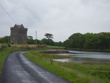
| Rockfleet Castle | An O'Malley castle, owned by the Arbuthnots at the end of the 18th century. By the time of Griffith's Valuation, the townland was in the possession of William B. Stony, leasing from Captain A.W. Wyndham. The castle ruin is still extant. |
|
| Rossanrubble | A small building is shown in this townland at the time of the first Ordnance Survey. Jonathan Pim was the owner of the townland at the time of Griffith's Valuation but there were no buildings with substantial valuation. A house labelled Rosbarnagh Lodge is shown on the 25-inch Ordnance Survey map of the 1890s and this building is still extant. |